Bendoo

Coastal Feature, Headland, Point in Wigtownshire

Scotland

Bendoo

The west shore of The Rhins Bay House in view, just right of centre.
The west shore of The Rhins Credit: David Purchase

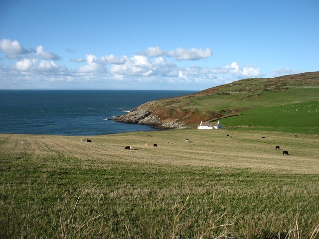
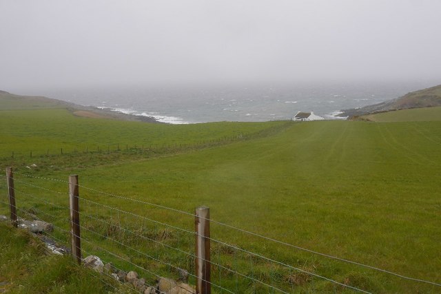
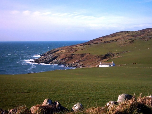
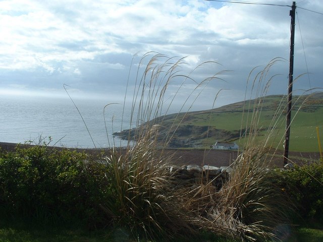
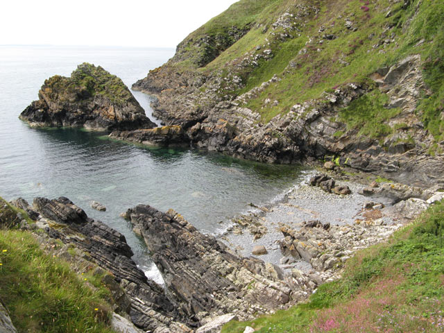
Bendoo is a prominent headland located in Wigtownshire, a coastal region in southwest Scotland. Situated on the western coast, Bendoo juts out into the North Channel of the Irish Sea, offering breathtaking views of the surrounding landscape.

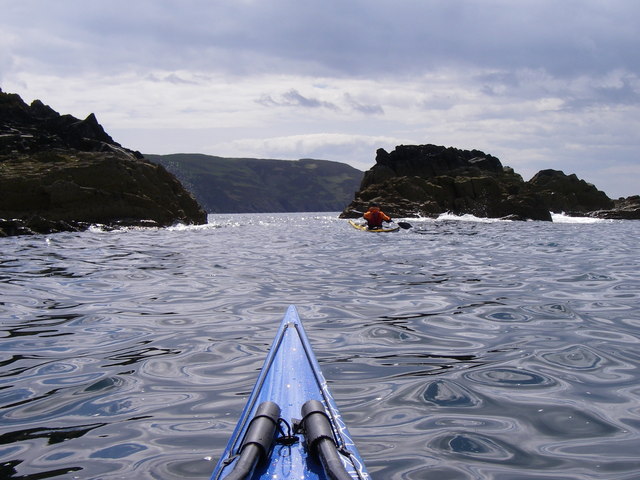
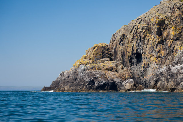
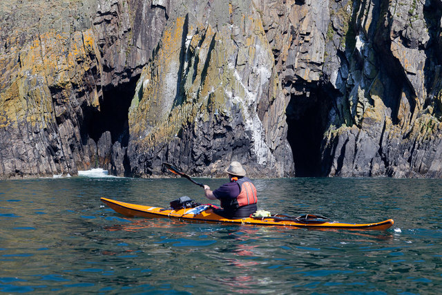
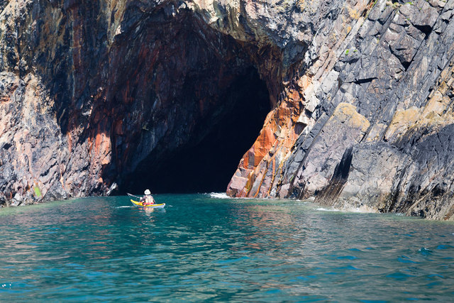
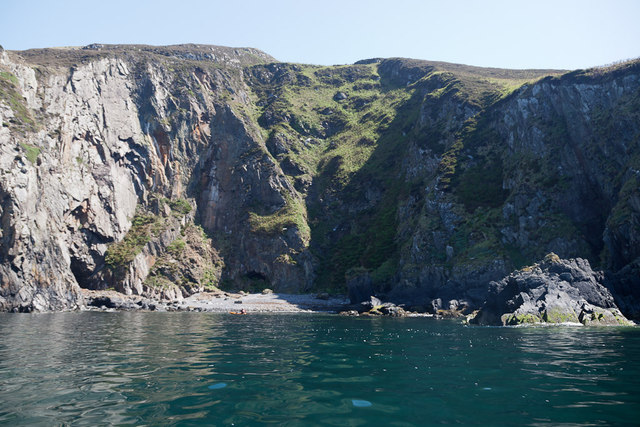
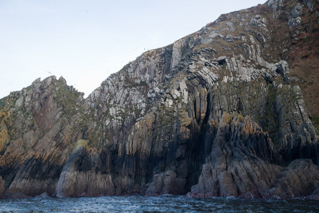
This headland is characterized by its rugged cliffs, which rise steeply from the sea, providing nesting sites for various seabird species such as gulls, razorbills, and guillemots. The cliffs also showcase stunning geological formations, displaying layers of sedimentary rocks that have been shaped by erosion over thousands of years.

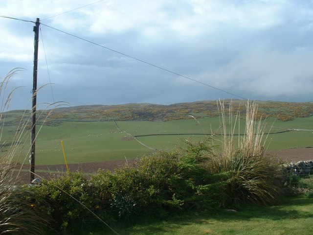
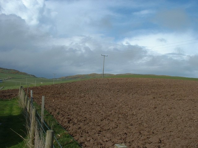
Covered in lush vegetation, Bendoo is home to a variety of plant species, including heather, gorse, and sea thrift, which add vibrant colors to the landscape. The headland is also frequented by small mammals such as rabbits and voles, as well as larger mammals like deer and foxes.

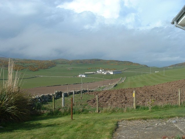
Bendoo serves as a popular destination for outdoor enthusiasts and nature lovers. The headland offers numerous walking trails that allow visitors to explore its rugged terrain and enjoy panoramic views of the sea and surrounding coastline. It is also a favored spot for birdwatching, as the cliffs provide a vantage point to observe the diverse avian population.

In addition to its natural beauty, Bendoo holds historical significance. The headland was once used as a lookout point during World War II, and remnants of old military structures can still be found scattered across the area.

Overall, Bendoo is a stunning coastal feature that showcases the diverse flora, fauna, and geological formations of Wigtownshire. Its breathtaking views and rich history make it a must-visit destination for anyone exploring the region.

If you have any feedback on the listing, please let us know in the comments section below.

Bendoo Images

Images are sourced within 2km of 54.691983/-4.9683783 or Grid Reference NX0837. Thanks to Geograph Open Source API. All images are credited.

The west shore of The Rhins Bay House in view, just right of centre.
The west shore of The Rhins
Bay House in view, just right of centre.
Bay House The bay is Portencorkrie. The west side of the Rhins is wild and there is a gale blowing out to sea.
Bay House
The bay is Portencorkrie. The west side of the Rhins is wild and there is a gale blowing out to sea.
Bay House, Portencorkrie An idyllic traditional Galloway cottage above Portencorkrie Bay.
Bay House, Portencorkrie
An idyllic traditional Galloway cottage above Portencorkrie Bay.
Southbound on the Rhins of Galloway Rockhopping on the way into the mouth of Clanyard bay
Southbound on the Rhins of Galloway
Rockhopping on the way into the mouth of Clanyard bay
North End Portencorkrie Bay The beach side house is now boarded up and abandoned.
North End Portencorkrie Bay
The beach side house is now boarded up and abandoned.
Towards Barncorkrie Moor The gorse on the hillside glows brightly against the new spring grass in the sheep pasture.
Towards Barncorkrie Moor
The gorse on the hillside glows brightly against the new spring grass in the sheep pasture.
Barncorkrie Farm With Barncorkrie Moor behind and the minor road to Inshanks Fell in front.
Barncorkrie Farm
With Barncorkrie Moor behind and the minor road to Inshanks Fell in front.
Fields towards Cairn Fell With Barncorkrie Moor to left.
Fields towards Cairn Fell
With Barncorkrie Moor to left.
Laggantalluch Head Laggantalluch Head from the south, taken on a sea kayak trip from East Tarbet to Port Logan round the Mull of Galloway.
Laggantalluch Head
Laggantalluch Head from the south, taken on a sea kayak trip from East Tarbet to Port Logan round the Mull of Galloway.
Yellow Horse caves, Laggantalluch Head Yellow Horse caves, Laggantalluch Head, taken on a sea kayaking trip from East Tarbet to Port Logan.
Yellow Horse caves, Laggantalluch Head
Yellow Horse caves, Laggantalluch Head, taken on a sea kayaking trip from East Tarbet to Port Logan.
Cave of the Saddle, Gounie Head Cave of the Saddle, Gounie Head, taken on a sea kayaking trip from East Tarbet to Port Logan.
Cave of the Saddle, Gounie Head
Cave of the Saddle, Gounie Head, taken on a sea kayaking trip from East Tarbet to Port Logan.
Breddock Bay Breddock Bay taken on a sea kayak trip from East Tarbet to port Logan
Breddock Bay
Breddock Bay taken on a sea kayak trip from East Tarbet to port Logan
Craig of Dolt Craig of Dolt is composed of vertical and folded strata of greywacke, a sedimentary rock. The photo was taken in the vicinity of a delightfully named Gobawhilkin, while on a sea kayaking trip from East Tarbet to Port Logan.
Craig of Dolt
Craig of Dolt is composed of vertical and folded strata of greywacke, a sedimentary rock. The photo was taken in the vicinity of a delightfully named Gobawhilkin, while on a sea kayaking trip from East Tarbet to Port Logan.
Cairn, Barncorkrie Moor A rather neat cairn on the summit of the moor overlooking Barncorkrie. Another, nearby, is named the Cairn of Dolt, but I didn't go there.
Cairn, Barncorkrie Moor
A rather neat cairn on the summit of the moor overlooking Barncorkrie. Another, nearby, is named the Cairn of Dolt, but I didn't go there.
Granite scenery Portencorkrie gives its name to the intrusion of granodiorite whose outcrops are centred on the bay and nearby headlands. The weathering profile of the granitic rock which is highly jointed and fractured makes a very different local topography. In the background are Bay House and Knockencule.
Granite scenery
Portencorkrie gives its name to the intrusion of granodiorite whose outcrops are centred on the bay and nearby headlands. The weathering profile of the granitic rock which is highly jointed and fractured makes a very different local topography. In the background are Bay House and Knockencule.
Carlin House Bay A small bay eroded along the strike of the rather deformed rocks of the turbiditic greywackes of the Clanyard Bay Formation (Gala Group, Silurian). Much interest attaches to the deformation style and stratigraphy of this area, but I did not climb down from the grassy col between the larger and smaller bays.
Carlin House Bay
A small bay eroded along the strike of the rather deformed rocks of the turbiditic greywackes of the Clanyard Bay Formation (Gala Group, Silurian). Much interest attaches to the deformation style and stratigraphy of this area, but I did not climb down from the grassy col between the larger and smaller bays.
Barncorkrie sheds and house Looking up the farm road past the sheds.
Barncorkrie sheds and house
Looking up the farm road past the sheds.
Farm track Looking up the farm track towards the col of Balloch, with Cairn fell in the right background.
Farm track
Looking up the farm track towards the col of Balloch, with Cairn fell in the right background.
Show me another place!

Bendoo is located at Grid Ref: NX0837 (Lat: 54.691983, Lng: -4.9683783)

Unitary Authority: Dumfries and Galloway

Police Authority: Dumfries and Galloway

What 3 Words

///says.according.hobby. Near Drummore, Dumfries & Galloway

Related Wikis

Port Logan

Port Logan, formerly Port Nessock, is a small village in the parish of Kirkmaiden in the Rhins of Galloway in Wigtownshire. The Gaelic name is Port Neasaig...

Kirkmaiden (village)

Kirkmaiden (sometimes Maidenkirk; Scottish Gaelic: Cill M'Eudan) is a small settlement in Galloway, Scotland, located approximately 17 miles (27 km) south...

Kirkmaiden

Kirkmaiden is a parish in the Rhins of Galloway, the most southerly in Scotland; the present Church of Scotland parish has the same name as and is approximately...

Drummore

Drummore (drum-ORE; (from Gaelic An Druim Mòr meaning "the great ridge") is the southernmost village in Scotland, located at the southern end of the Rhins...

Nearby Amenities

Located within 500m of 54.691983,-4.9683783
Source: PGS
Lat/Long: 54.6942996/-4.9618186
Source: PGS
Lat/Long: 54.6930916/-4.9647486
Source: PGS
Lat/Long: 54.6926605/-4.9650431
Source: PGS
Lat/Long: 54.692661/-4.9654797
Source: PGS
Lat/Long: 54.6922277/-4.9659498
Source: PGS
Lat/Long: 54.6921396/-4.9671955
Source: PGS
Lat/Long: 54.6918153/-4.9682459
Source: PGS
Lat/Long: 54.6916249/-4.9687853
Source: PGS
Lat/Long: 54.6914686/-4.9691935
Source: PGS
Lat/Long: 54.6912866/-4.9696336
Source: PGS
Lat/Long: 54.6911901/-4.9698257
Source: PGS
Lat/Long: 54.6909716/-4.9702342
Source: PGS
Lat/Long: 54.6906394/-4.9710249
Source: PGS
Lat/Long: 54.690158/-4.9723086
Source: PGS
Lat/Long: 54.6897929/-4.9726058
Source: PGS
Lat/Long: 54.6895674/-4.9714821
Source: PGS
Lat/Long: 54.6883702/-4.971976
The data included in this document is from www.openstreetmap.org. The data is made available under ODbL.

Have you been to Bendoo?

Leave your review of Bendoo below (or comments, questions and feedback).