Auld Ship

Coastal Feature, Headland, Point in Wigtownshire

Scotland

Auld Ship

Fields above Knockencule Farm On the west coast of the Rhins.
Fields above Knockencule Farm Credit: David Purchase

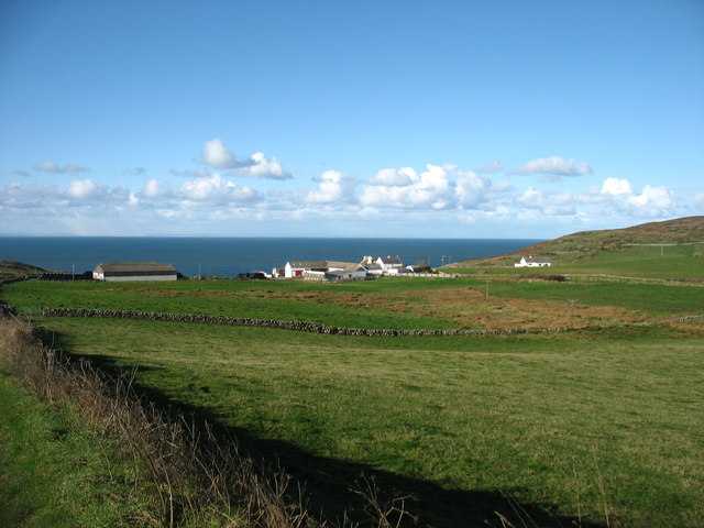
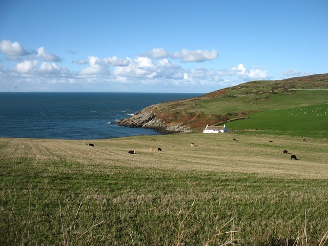
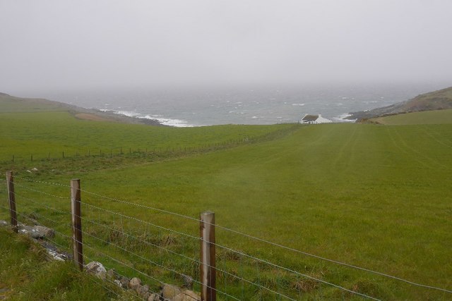
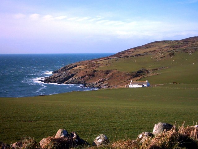
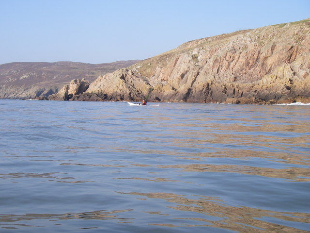
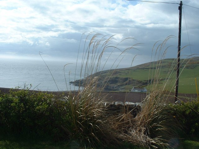
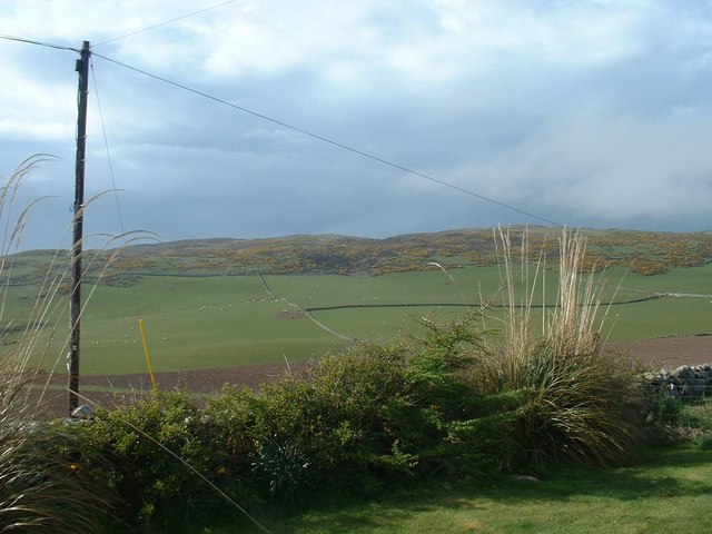
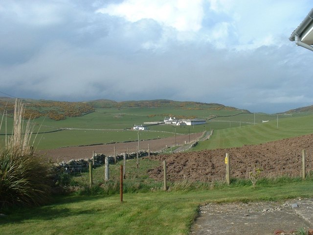
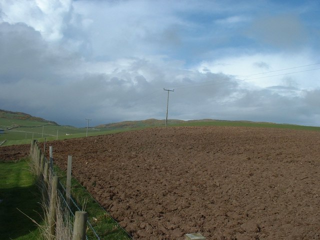
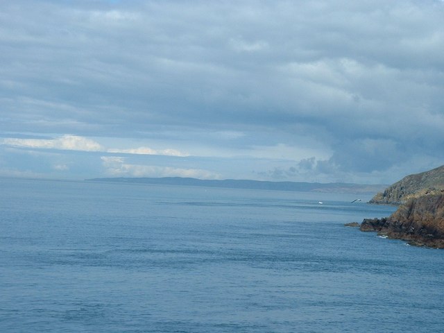
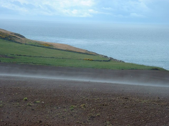
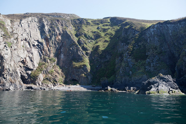
Auld Ship is a prominent coastal feature located in Wigtownshire, Scotland. It is a picturesque headland that juts out into the North Channel, offering stunning panoramic views of the surrounding landscape. The headland is situated at the southernmost point of the Machars Peninsula, which is known for its rugged beauty and diverse wildlife.

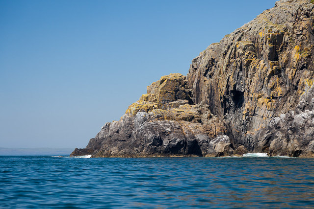
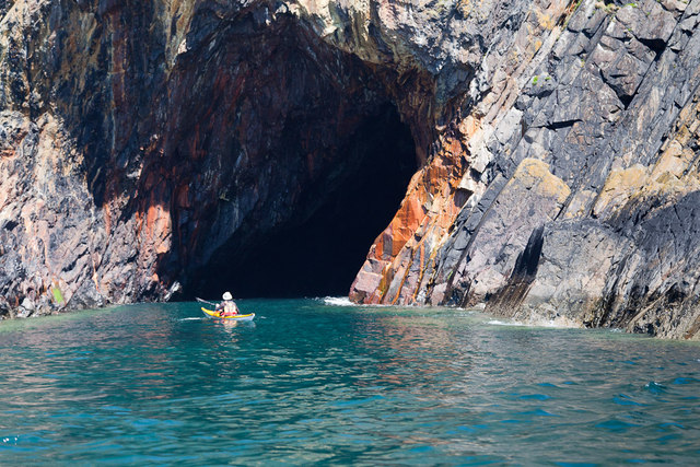
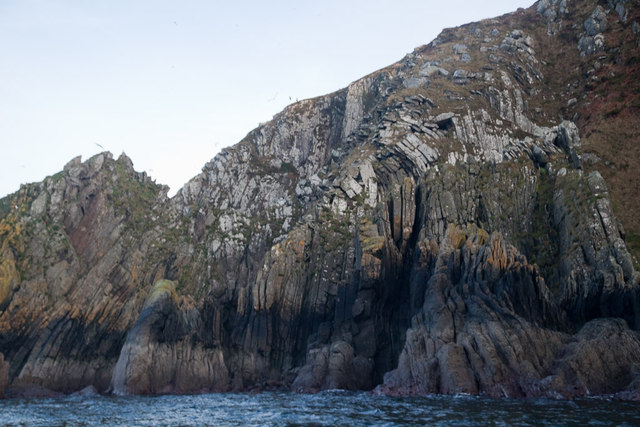
Auld Ship is characterized by its steep cliffs, which rise dramatically from the sea, reaching heights of up to 30 meters. These cliffs are composed of sedimentary rock formations, displaying layers of sandstone, shale, and limestone, providing a fascinating geological history of the area.

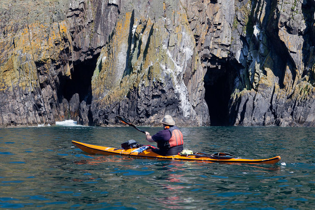
The headland is home to a variety of bird species, making it a popular spot for birdwatching enthusiasts. Visitors can often spot colonies of guillemots, razorbills, kittiwakes, and fulmars nesting along the cliffs. The surrounding waters are also rich in marine life, with seals and dolphins occasionally seen swimming close to the shore.

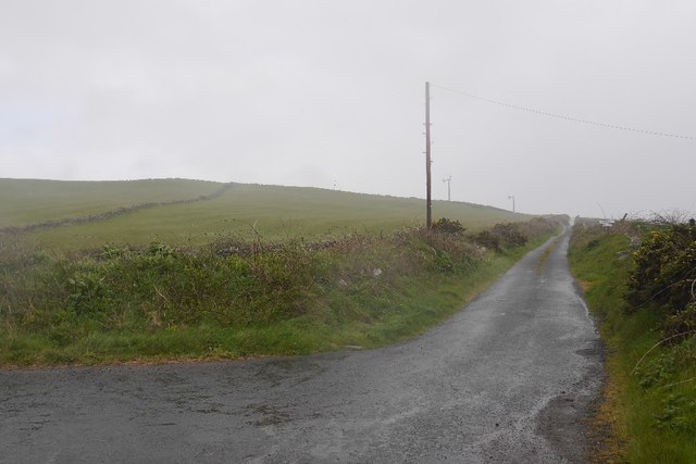
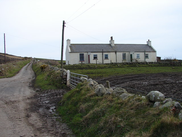
Access to Auld Ship is relatively easy, with a well-maintained footpath leading from the nearby village of Port William. Along the way, visitors can enjoy the beautiful coastal scenery and may even encounter wildflowers and other flora unique to the area.

Overall, Auld Ship is a captivating coastal feature that offers a unique blend of natural beauty, geological interest, and wildlife observation. Whether one is seeking a peaceful stroll, a birdwatching adventure, or simply a place to admire the rugged coastline, Auld Ship is sure to impress.

If you have any feedback on the listing, please let us know in the comments section below.

Auld Ship Images

Images are sourced within 2km of 54.687381/-4.9723719 or Grid Reference NX0836. Thanks to Geograph Open Source API. All images are credited.

Fields above Knockencule Farm On the west coast of the Rhins.
Fields above Knockencule Farm
On the west coast of the Rhins.
The west shore of The Rhins Bay House in view, just right of centre.
The west shore of The Rhins
Bay House in view, just right of centre.
Bay House The bay is Portencorkrie. The west side of the Rhins is wild and there is a gale blowing out to sea.
Bay House
The bay is Portencorkrie. The west side of the Rhins is wild and there is a gale blowing out to sea.
Road to Slockmill Serving scattered dwellings on the exposed west coast of the Rhins of Galloway.
Road to Slockmill
Serving scattered dwellings on the exposed west coast of the Rhins of Galloway.
Bay House, Portencorkrie An idyllic traditional Galloway cottage above Portencorkrie Bay.
Bay House, Portencorkrie
An idyllic traditional Galloway cottage above Portencorkrie Bay.
North of Crammag Head
Knockencule Cottages Farm cottages at Knockencule in the remote south-west corner of South Rhins.
Knockencule Cottages
Farm cottages at Knockencule in the remote south-west corner of South Rhins.
North End Portencorkrie Bay The beach side house is now boarded up and abandoned.
North End Portencorkrie Bay
The beach side house is now boarded up and abandoned.
Towards Barncorkrie Moor The gorse on the hillside glows brightly against the new spring grass in the sheep pasture.
Towards Barncorkrie Moor
The gorse on the hillside glows brightly against the new spring grass in the sheep pasture.
Barncorkrie Farm With Barncorkrie Moor behind and the minor road to Inshanks Fell in front.
Barncorkrie Farm
With Barncorkrie Moor behind and the minor road to Inshanks Fell in front.
Fields towards Cairn Fell With Barncorkrie Moor to left.
Fields towards Cairn Fell
With Barncorkrie Moor to left.
View north from Crammag Head From north side of new lighthouse, with Laggantalluch Head middle right and Black Head, beyond Portpatrick in left far distance.
View north from Crammag Head
From north side of new lighthouse, with Laggantalluch Head middle right and Black Head, beyond Portpatrick in left far distance.
Har forming at Knockencule Har mist forming over freshly planted barley field.
Har forming at Knockencule
Har mist forming over freshly planted barley field.
Laggantalluch Head Laggantalluch Head from the south, taken on a sea kayak trip from East Tarbet to Port Logan round the Mull of Galloway.
Laggantalluch Head
Laggantalluch Head from the south, taken on a sea kayak trip from East Tarbet to Port Logan round the Mull of Galloway.
Yellow Horse caves, Laggantalluch Head Yellow Horse caves, Laggantalluch Head, taken on a sea kayaking trip from East Tarbet to Port Logan.
Yellow Horse caves, Laggantalluch Head
Yellow Horse caves, Laggantalluch Head, taken on a sea kayaking trip from East Tarbet to Port Logan.
Cave of the Saddle, Gounie Head Cave of the Saddle, Gounie Head, taken on a sea kayaking trip from East Tarbet to Port Logan.
Cave of the Saddle, Gounie Head
Cave of the Saddle, Gounie Head, taken on a sea kayaking trip from East Tarbet to Port Logan.
Breddock Bay Breddock Bay taken on a sea kayak trip from East Tarbet to port Logan
Breddock Bay
Breddock Bay taken on a sea kayak trip from East Tarbet to port Logan
Craig of Dolt Craig of Dolt is composed of vertical and folded strata of greywacke, a sedimentary rock. The photo was taken in the vicinity of a delightfully named Gobawhilkin, while on a sea kayaking trip from East Tarbet to Port Logan.
Craig of Dolt
Craig of Dolt is composed of vertical and folded strata of greywacke, a sedimentary rock. The photo was taken in the vicinity of a delightfully named Gobawhilkin, while on a sea kayaking trip from East Tarbet to Port Logan.
Show me another place!

Auld Ship is located at Grid Ref: NX0836 (Lat: 54.687381, Lng: -4.9723719)

Unitary Authority: Dumfries and Galloway

Police Authority: Dumfries and Galloway

What 3 Words

///altering.recently.elevates. Near Drummore, Dumfries & Galloway

Related Wikis

Kirkmaiden (village)

Kirkmaiden (sometimes Maidenkirk; Scottish Gaelic: Cill M'Eudan) is a small settlement in Galloway, Scotland, located approximately 17 miles (27 km) south...

Kirkmaiden

Kirkmaiden is a parish in the Rhins of Galloway, the most southerly in Scotland; the present Church of Scotland parish has the same name as and is approximately...

Port Logan

Port Logan, formerly Port Nessock, is a small village in the parish of Kirkmaiden in the Rhins of Galloway in Wigtownshire. The Gaelic name is Port Neasaig...

Drummore

Drummore (drum-ORE; (from Gaelic An Druim Mòr meaning "the great ridge") is the southernmost village in Scotland, located at the southern end of the Rhins...

Cairngaan

Cairngaan, Wigtownshire, is the southmost settlement in Scotland. The hamlet of Cairngaan lies just north of the Mull of Galloway (which contains Scotland...

Logan Botanic Garden

Logan Botanic Garden is a botanical garden near Port Logan on the Rhins of Galloway, at the south-western tip of Scotland. The Botanic Garden was established...

Doon Castle Broch

Doon Castle Broch is an iron-age broch located in Dumfries and Galloway, Scotland (grid reference NX 06702 44683). == Location == The Broch is located...

Mull of Galloway

The Mull of Galloway (Scottish Gaelic: Maol nan Gall, pronounced [mɯːlˠ̪ nəŋ ˈkaulˠ̪]; grid reference NX158303) is the southernmost point of Scotland....

Nearby Amenities

Located within 500m of 54.687381,-4.9723719
Source: PGS
Lat/Long: 54.6914686/-4.9691935
Source: PGS
Lat/Long: 54.6912866/-4.9696336
Source: PGS
Lat/Long: 54.6911901/-4.9698257
Source: PGS
Lat/Long: 54.6909716/-4.9702342
Source: PGS
Lat/Long: 54.6906394/-4.9710249
Source: PGS
Lat/Long: 54.690158/-4.9723086
Source: PGS
Lat/Long: 54.6897929/-4.9726058
Source: PGS
Lat/Long: 54.6895674/-4.9714821
Source: PGS
Lat/Long: 54.6883702/-4.971976
Source: PGS
Lat/Long: 54.6879046/-4.972215
Source: PGS
Lat/Long: 54.6876081/-4.972855
Source: PGS
Lat/Long: 54.6872086/-4.972896
Source: PGS
Lat/Long: 54.686834/-4.9730156
Source: PGS
Lat/Long: 54.6863024/-4.9730516
Source: PGS
Lat/Long: 54.6860848/-4.9729636
Source: PGS
Lat/Long: 54.6858946/-4.9731366
Source: PGS
Lat/Long: 54.6856389/-4.9736902
Source: PGS
Lat/Long: 54.685159/-4.9744158
Source: PGS
Lat/Long: 54.6847711/-4.9746234
Source: PGS
Lat/Long: 54.6839774/-4.9741102
Source: PGS
Lat/Long: 54.6840784/-4.9739446
Source: PGS
Lat/Long: 54.6839025/-4.9734854
Source: PGS
Lat/Long: 54.6836853/-4.9738273
Source: PGS
Lat/Long: 54.6832502/-4.9734754
Source: PGS
Lat/Long: 54.6829886/-4.9728719
The data included in this document is from www.openstreetmap.org. The data is made available under ODbL.

Have you been to Auld Ship?

Leave your review of Auld Ship below (or comments, questions and feedback).