Creag na h-Iolaire

Coastal Feature, Headland, Point in Argyllshire

Scotland

Creag na h-Iolaire

Stone gate and gatehouse for Strachur House
Stone gate and gatehouse for Strachur House Credit: Steven Brown

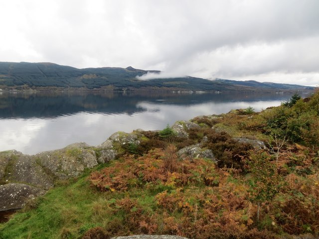
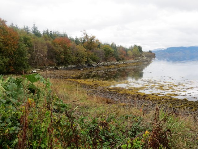
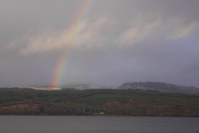
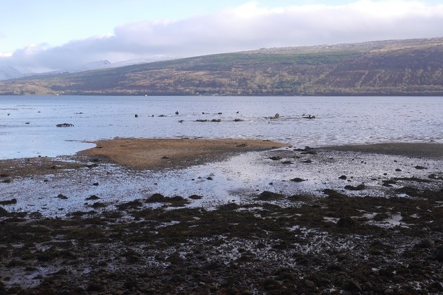
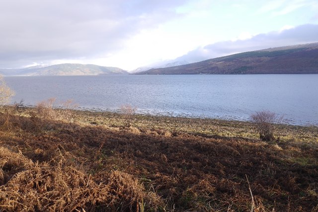
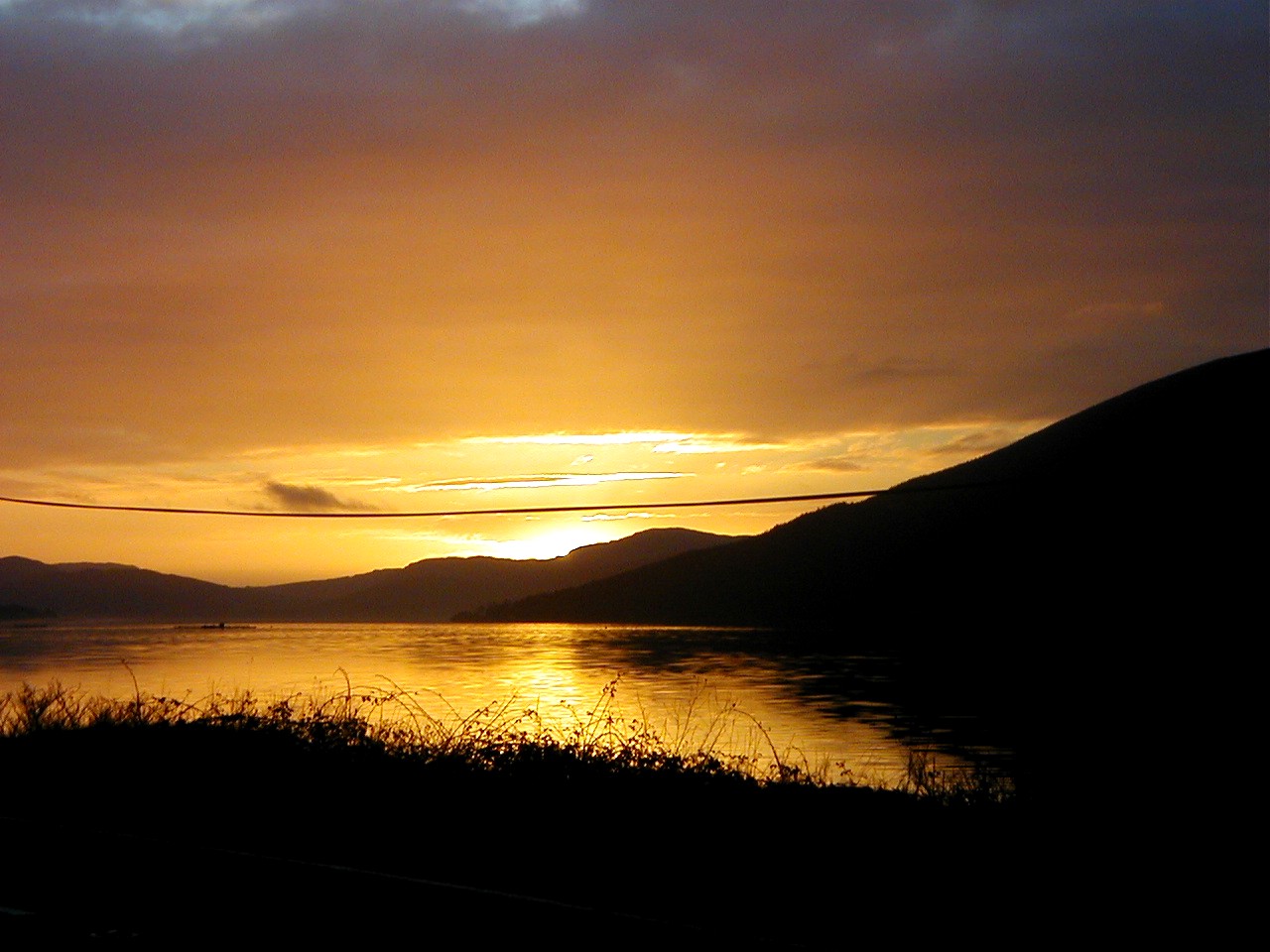
Creag na h-Iolaire, located in Argyllshire, Scotland, is a prominent coastal feature that stands as a magnificent headland and point. Rising majestically from the shores of the Atlantic Ocean, it showcases stunning natural beauty and offers breathtaking views of the surrounding landscape.

The name "Creag na h-Iolaire" translates to "Eagle Rock" in English, paying homage to the presence of eagles that can often be seen soaring above the headland. The area is renowned for its diverse wildlife, with numerous seabirds and marine creatures inhabiting the surrounding waters.

The headland boasts steep cliffs on its seaward side, providing a dramatic backdrop against the crashing waves below. These cliffs are composed of ancient rock formations, displaying a rich geological history that dates back millions of years. Geologists and nature enthusiasts are drawn to Creag na h-Iolaire to study the unique rock formations and the fossils they contain.

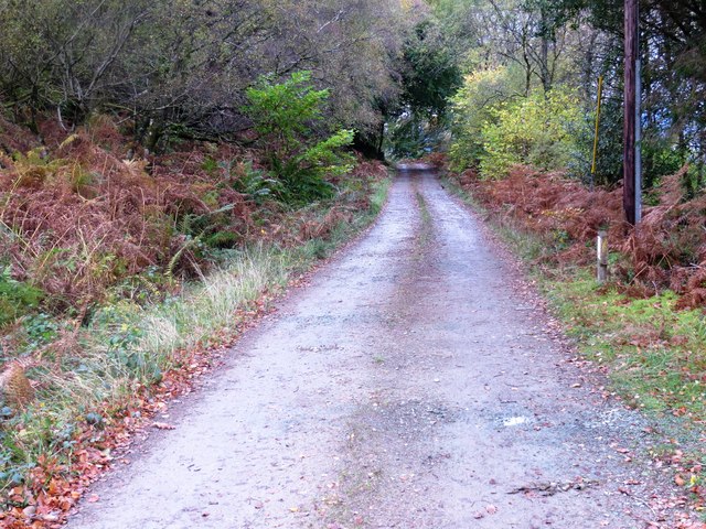
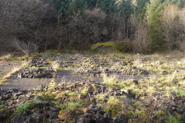
Hikers and outdoor enthusiasts are also drawn to this coastal feature due to its excellent walking trails and breathtaking views. The headland offers panoramic vistas of the rugged coastline, the vast ocean, and the distant mountains, creating an awe-inspiring experience. The trails winding through the area showcase the diverse flora and fauna, including heather, wildflowers, and various species of seabirds.

Creag na h-Iolaire is a true gem of Argyllshire, combining natural beauty, geological significance, and a sense of adventure. Whether exploring the cliffs, observing wildlife, or simply admiring the stunning vistas, visitors to this coastal feature are sure to be captivated by its unique charm.

If you have any feedback on the listing, please let us know in the comments section below.

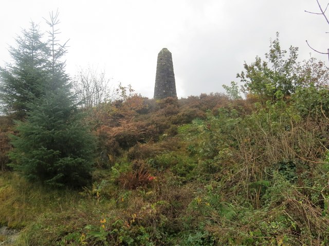
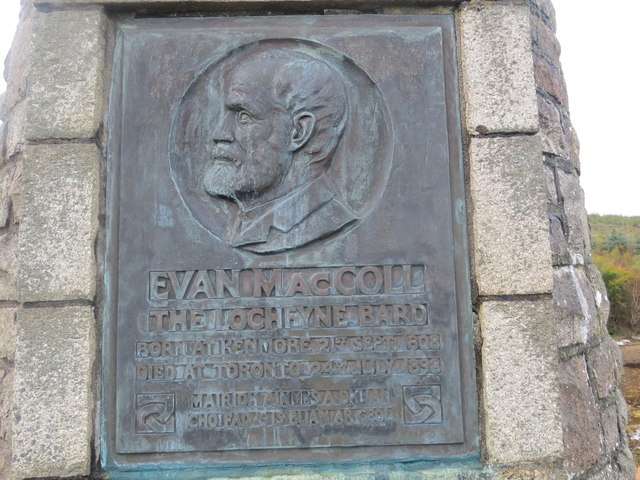
Creag na h-Iolaire Images

Images are sourced within 2km of 56.180411/-5.1085736 or Grid Reference NN0702. Thanks to Geograph Open Source API. All images are credited.

Stone gate and gatehouse for Strachur House
A815 at Creggans
A815 at Creggans
A815 north of Creggans
Rocky coastline below the village of Kenmore Loch Fyne
Rocky coastline below the village of Kenmore
Loch Fyne
Monument on the rocks above the village of Kenmore
Inscription on the monument at the village of Kenmore
Bay in Loch Fyne at the village of Kenmore
Track from Kenmore near Creag na h-Iolaire
Creggans Cottage,near Kenmore
Loch Fyne shoreline looking towards the holiday park
Creggans Inn Hotel on the shores of Loch Fyne.
Creggans Inn
Hotel on the shores of Loch Fyne.
Rainbow, Kenmore A view over Loch Fyne from Creggans
Rainbow, Kenmore
A view over Loch Fyne from Creggans
Allt Bealachuisge Burn flowing into Loch Fyne.
Allt Bealachuisge
Burn flowing into Loch Fyne.
A815 Heading for Strachur.
A815
Heading for Strachur.
Beside the Douglas Water An exception to the usually wooded land found along this bit of Loch Fyne.
Beside the Douglas Water
An exception to the usually wooded land found along this bit of Loch Fyne.
Outflow of the Douglas Water And view across Loch Fyne.
Outflow of the Douglas Water
And view across Loch Fyne.
Hard standing beside Loch Fyne Probably a relic from the World War II naval training base, HMS Quebec where training on opposed landings took place.

The combinedops website has an anonymous poem from the base which strikes me as a possible inspiration for John Cooper Clarke's Chickentown.

"Ode to Inveraray
This bloody place is a bloody cuss 
No bloody tram, no bloody bus 
And do they care for bloody us? 
In bloody Inveraray

The bloody films are bloody old 
The bloody seats are bloody sold 
Can't get in for bloody gold 
In bloody Inveraray

It bloody pours, it bloody rains 
No bloody kerbs, no bloody drains 
Ain't no-one got no brains 
In bloody Inveraray?

Everything's so bloody dear
A bloody bob for a bloody beer 
And is it good? no bloody fear 
In bloody Inveraray

All bloody work no bloody games 
No bloody fun with bloody dames
Wouldn't even tell their names 
In bloody Inveraray

Enough of this ere bloody rhyme 
Everything's just a waste of time 
Next week'll be just "T" sime 
In bloody Inveraray."
Hard standing beside Loch Fyne
Probably a relic from the World War II naval training base, HMS Quebec where training on opposed landings took place. The combinedops website has an anonymous poem from the base which strikes me as a possible inspiration for John Cooper Clarke's Chickentown. "Ode to Inveraray This bloody place is a bloody cuss No bloody tram, no bloody bus And do they care for bloody us? In bloody Inveraray The bloody films are bloody old The bloody seats are bloody sold Can't get in for bloody gold In bloody Inveraray It bloody pours, it bloody rains No bloody kerbs, no bloody drains Ain't no-one got no brains In bloody Inveraray? Everything's so bloody dear A bloody bob for a bloody beer And is it good? no bloody fear In bloody Inveraray All bloody work no bloody games No bloody fun with bloody dames Wouldn't even tell their names In bloody Inveraray Enough of this ere bloody rhyme Everything's just a waste of time Next week'll be just "T" sime In bloody Inveraray."
Beach, Loch Fyne
Beach, Loch Fyne
Show me another place!

Creag na h-Iolaire is located at Grid Ref: NN0702 (Lat: 56.180411, Lng: -5.1085736)

Unitary Authority: Argyll and Bute

Police Authority: Argyll and West Dunbartonshire

What 3 Words

///outlawing.gratitude.back. Near Inveraray, Argyll & Bute

Nearby Locations

Creag na h-Iolaire

Related Wikis

Loch Fyne

Loch Fyne (Scottish Gaelic: Loch Fìne, pronounced [l̪ˠɔx ˈfiːnə]; meaning "Loch of the Vine/Wine"), is a sea loch off the Firth of Clyde and forms part...

Strachur Bay

Strachur Bay is a coastal embayment, on a 114° orientation, on the eastern coast of the longest sea loch in Scotland, Loch Fyne located in Argyll and Bute...
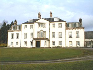
Strachur House

Strachur House is a Category B listed building in Strachur, Argyll and Bute, Scotland. It dates from around 1770, and is a three-storey building, built...

Combined Operations Training Centre

The Combined Operations Training Centre, also known as No.1 Combined Training Centre, Inveraray was a military installation on the banks of Loch Fyne near...

Strachur

Strachur (Scottish Gaelic: Srath Chura) and Strathlachlan (Scottish Gaelic: Srath Lachlainn) are united parishes located on the Cowal peninsula, in Argyll...

Auchindrain

Auchindrain (Scottish Gaelic: Achadh an Droighinn: 'thorn field') lies on the A83, 6 miles (10 km) south of Inveraray in Argyll and Bute, Scotland. It...

Douglas Water, Loch Fyne

The Douglas Water (Scottish Gaelic: Dùghlas) is a river in Argyll in the southwest Scottish Highlands. It emerges from the northeastern end of the diminutive...

Furnace, Argyll

Furnace (Scottish Gaelic: An Fhùirneis) (formerly Inverleacainn (Scottish Gaelic: Inbhir Leacainn)) is a village in Argyll and Bute, on the west coast...

Nearby Amenities

Located within 500m of 56.180411,-5.1085736
Created By: dmgroom_coastlines
Source: PGS
Lat/Long: 56.176638/-5.112952
Created By: dmgroom_coastlines
Source: PGS
Lat/Long: 56.177405/-5.112994
Created By: dmgroom_coastlines
Source: PGS
Lat/Long: 56.177421/-5.112076
Created By: dmgroom_coastlines
Source: PGS
Lat/Long: 56.178189/-5.112118
Created By: dmgroom_coastlines
Source: PGS
Lat/Long: 56.178332/-5.111208
Created By: dmgroom_coastlines
Source: PGS
Lat/Long: 56.178464/-5.110986
Created By: dmgroom_coastlines
Source: PGS
Lat/Long: 56.17898/-5.110784
Created By: dmgroom_coastlines
Source: PGS
Lat/Long: 56.178996/-5.109867
Created By: dmgroom_coastlines
Source: PGS
Lat/Long: 56.179507/-5.109895
Created By: dmgroom_coastlines
Source: PGS
Lat/Long: 56.17965/-5.108984
Created By: dmgroom_coastlines
Source: PGS
Lat/Long: 56.179783/-5.108763
Created By: dmgroom_coastlines
Source: PGS
Lat/Long: 56.179914/-5.10854
Created By: dmgroom_coastlines
Source: PGS
Lat/Long: 56.180046/-5.108318
Created By: dmgroom_coastlines
Source: PGS
Lat/Long: 56.180822/-5.107901
Created By: dmgroom_coastlines
Source: PGS
Lat/Long: 56.181598/-5.107485
Created By: dmgroom_coastlines
Source: PGS
Lat/Long: 56.182373/-5.107068
Created By: dmgroom_coastlines
Source: PGS
Lat/Long: 56.183404/-5.106665
Created By: dmgroom_coastlines
Source: PGS
Lat/Long: 56.18366/-5.106679
Created By: dmgroom_coastlines
Source: PGS
Lat/Long: 56.184172/-5.106707
Created By: dmgroom_coastlines
Source: PGS
Lat/Long: 56.184684/-5.106735
The data included in this document is from www.openstreetmap.org. The data is made available under ODbL.

Have you been to Creag na h-Iolaire?

Leave your review of Creag na h-Iolaire below (or comments, questions and feedback).