Fishing Point

Coastal Feature, Headland, Point in Cornwall

England

Fishing Point

Par beach
Par beach Credit: Alex McGregor

Fishing Point is a prominent and picturesque headland located along the rugged coastline of Cornwall, England. Situated on the southeastern tip of the county, this coastal feature is known for its stunning natural beauty and rich maritime heritage.

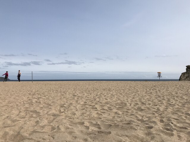
The headland juts out into the Atlantic Ocean, providing breathtaking panoramic views of the surrounding coastline and the open sea. The rugged cliffs, composed of slate and granite, add to the dramatic charm of Fishing Point. The coastline is dotted with small sandy coves and rock pools, making it a popular destination for beachcombing and exploring nature.

Historically, Fishing Point has played a significant role in the fishing industry of Cornwall. The headland's strategic location and deep waters have made it an ideal spot for fishermen to cast their nets and catch a variety of fish species. Today, Fishing Point continues to attract anglers and fishing enthusiasts from near and far, who come to try their luck in the abundant waters.

In addition to its natural beauty, Fishing Point is also home to a diverse range of wildlife. It serves as a nesting site for various seabirds, including gulls, puffins, and razorbills, making it a paradise for birdwatchers. Dolphins and seals are often spotted frolicking in the waters surrounding the headland, adding to the area's allure.

With its breathtaking scenery, rich fishing history, and abundant wildlife, Fishing Point is a must-visit destination for nature lovers, photographers, and those seeking a tranquil and awe-inspiring coastal experience in Cornwall.

If you have any feedback on the listing, please let us know in the comments section below.

Fishing Point Images

Images are sourced within 2km of 50.337824/-4.7176228 or Grid Reference SX0652. Thanks to Geograph Open Source API. All images are credited.
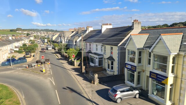
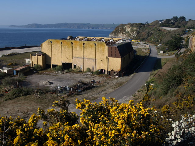
Par beach
Par beach
Par beach
Par beach
Par Beach cafe
Par Beach cafe
Moorlands Road, Par
Moorlands Road, Par
Dog walking at Par
Dog walking at Par
Par Green
Par Green
Par Sands Dog walkers and kite surfers at Par Sands
Par Sands
Dog walkers and kite surfers at Par Sands
Holmbush Road (A390) The A390  runs for 60 miles between Tavistock and a roundabout with the A30 at Three Burrows, 5 miles north west of the city of Truro in Cornwall, via Lostwithiel, St Blazey, and St Austell. It is an important road as it forms part of the main route (the Truro to Dobwalls section) from Truro to Plymouth. It can be used to travel along the spine of Cornwall as a more leisurely drive instead of using the A30.
Holmbush Road (A390)
The A390 runs for 60 miles between Tavistock and a roundabout with the A30 at Three Burrows, 5 miles north west of the city of Truro in Cornwall, via Lostwithiel, St Blazey, and St Austell. It is an important road as it forms part of the main route (the Truro to Dobwalls section) from Truro to Plymouth. It can be used to travel along the spine of Cornwall as a more leisurely drive instead of using the A30.
Bus Stop near Doubletrees School The A390  runs for 60 miles between Tavistock and a roundabout with the A30 at Three Burrows, 5 miles north west of the city of Truro in Cornwall, via Lostwithiel, St Blazey, and St Austell. It is an important road as it forms part of the main route (the Truro to Dobwalls section) from Truro to Plymouth. It can be used to travel along the spine of Cornwall as a more leisurely drive instead of using the A30.
Bus Stop near Doubletrees School
The A390 runs for 60 miles between Tavistock and a roundabout with the A30 at Three Burrows, 5 miles north west of the city of Truro in Cornwall, via Lostwithiel, St Blazey, and St Austell. It is an important road as it forms part of the main route (the Truro to Dobwalls section) from Truro to Plymouth. It can be used to travel along the spine of Cornwall as a more leisurely drive instead of using the A30.
The Four Lords, St Austell Rd Pub/restaurant on the A390 at St Blazey Gate.
The Four Lords, St Austell Rd
Pub/restaurant on the A390 at St Blazey Gate.
A390, St Austell Road, St Blazey Gate The A390  runs for 60 miles between Tavistock and a roundabout with the A30 at Three Burrows, 5 miles north west of the city of Truro in Cornwall, via Lostwithiel, St Blazey, and St Austell. It is an important road as it forms part of the main route (the Truro to Dobwalls section) from Truro to Plymouth. It can be used to travel along the spine of Cornwall as a more leisurely drive instead of using the A30.
A390, St Austell Road, St Blazey Gate
The A390 runs for 60 miles between Tavistock and a roundabout with the A30 at Three Burrows, 5 miles north west of the city of Truro in Cornwall, via Lostwithiel, St Blazey, and St Austell. It is an important road as it forms part of the main route (the Truro to Dobwalls section) from Truro to Plymouth. It can be used to travel along the spine of Cornwall as a more leisurely drive instead of using the A30.
Rose Hill, St Blazey St Blazey (Cornish: Lanndreth) is a small town in Cornwall, 3 miles (4.8 km) east of St Austell. The town takes its name from the Armenian Saint Blaise who, in Christian tradition, is believed to have "cure[d] toothache, sore throats and cattle diseases".

The local mining industries once dominated the town; historically copper and tin were mined in and around the parish, whilst more recently china clay has been the principal commodity mined. <a href="https://www.geograph.org.uk/photo/1701065">SX0554 : The Eden Project</a> is located about a mile and a half (2 km) from the centre of the town and the large number of visitors this attracts has led to the development of tourism in the town.
St Blazey. (2022, April 23). In Wikipedia. <span class="nowrap"><a title="https://en.wikipedia.org/wiki/St_Blazey" rel="nofollow ugc noopener" href="https://en.wikipedia.org/wiki/St_Blazey">Link</a><img style="margin-left:2px;" alt="External link" title="External link - shift click to open in new window" src="https://s1.geograph.org.uk/img/external.png" width="10" height="10"/></span>
Rose Hill, St Blazey
St Blazey (Cornish: Lanndreth) is a small town in Cornwall, 3 miles (4.8 km) east of St Austell. The town takes its name from the Armenian Saint Blaise who, in Christian tradition, is believed to have "cure[d] toothache, sore throats and cattle diseases". The local mining industries once dominated the town; historically copper and tin were mined in and around the parish, whilst more recently china clay has been the principal commodity mined. SX0554 : The Eden Project is located about a mile and a half (2 km) from the centre of the town and the large number of visitors this attracts has led to the development of tourism in the town. St Blazey. (2022, April 23). In Wikipedia. LinkExternal link
St Mary's Church
St Mary's Church
Carlyon Bay beach
Carlyon Bay beach
Rainbow over Par Moor Road
Pinetum Gardens
Pinetum Gardens
Treffry Way, St Blazey Gate
Trenython Road St Blazey Gate
Show me another place!

Fishing Point is located at Grid Ref: SX0652 (Lat: 50.337824, Lng: -4.7176228)

Unitary Authority: Cornwall

Police Authority: Devon and Cornwall

What 3 Words

///following.shoppers.intruding. Near Par, Cornwall

Related Wikis

Cornwall Coliseum

Cornwall Coliseum was a sport and entertainment venue located at Carlyon Bay near St Austell, Cornwall, England. It hosted exhibitions, tennis tournaments...

Carlyon Bay

Carlyon Bay (Cornish: Caryones, meaning forts) is a bay and a set of three beaches (Crinnis, Shorthorn and Polgaver) near St Austell on the south coast...

Par Docks

Par Docks is an Imerys-owned harbour in the village of Par, Cornwall, England, United Kingdom, which was used for the export of china clay from the numerous...

Par River, Cornwall

The Par River (Cornish: Dowr Gwernan, meaning alder tree river), also known as the Luxulyan River is a river draining the area north of St Blazey in Cornwall...

Nearby Amenities

Located within 500m of 50.337824,-4.7176228
Source: PGS
Lat/Long: 50.3378338/-4.7208003
Source: PGS
Lat/Long: 50.3380812/-4.7183987
Source: PGS
Lat/Long: 50.3378299/-4.7177732
Source: PGS
Lat/Long: 50.3380772/-4.7182629
Golf: pin
Lat/Long: 50.339808/-4.7203493
Golf: pin
Lat/Long: 50.3403044/-4.7155964
Golf: pin
Lat/Long: 50.339679/-4.7194105
Golf: pin
Lat/Long: 50.339528/-4.7151752
Golf: pin
Lat/Long: 50.3400898/-4.7149195
Golf: pin
Lat/Long: 50.340399/-4.7214896
WW2 Pillbox
Building: bunker
Bunker Type: pillbox
Military: bunker
Lat/Long: 50.3384755/-4.7180317
Addr Housename: Merthen Farm
Lat/Long: 50.3412303/-4.7201161
The data included in this document is from www.openstreetmap.org. The data is made available under ODbL.

Have you been to Fishing Point?

Leave your review of Fishing Point below (or comments, questions and feedback).