Tòrr Garbh

Coastal Feature, Headland, Point in Cromartyshire

Scotland

Tòrr Garbh

Ardessie Falls
Ardessie Falls Credit: Matthew Chadwick

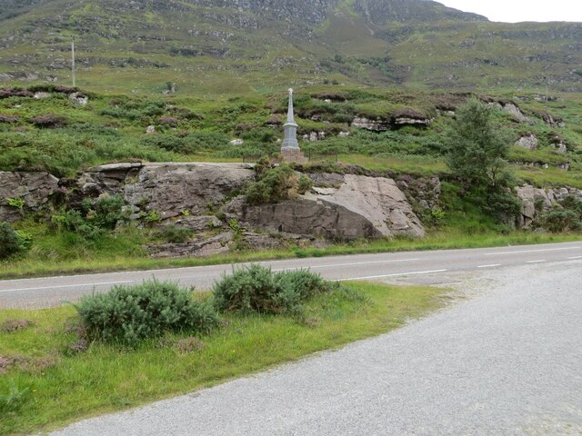
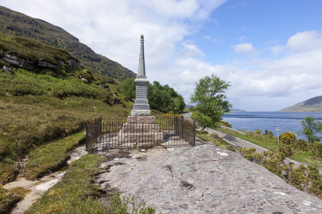
Tòrr Garbh is a prominent coastal feature located in Cromartyshire, a county in the Highlands region of Scotland. It is a headland that juts out into the North Sea, forming a distinctive point along the coastline. The name "Tòrr Garbh" translates to "rough tower" in Gaelic, alluding to the rugged and imposing nature of the headland.

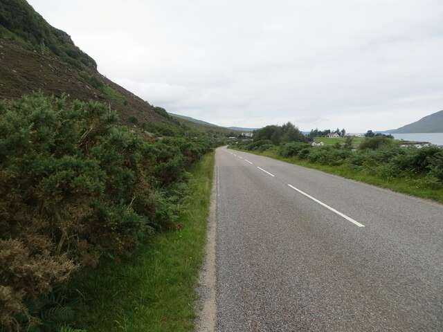
This coastal feature is characterized by its steep cliffs and rocky terrain, which provide a dramatic backdrop against the crashing waves of the North Sea. It offers breathtaking views of the surrounding landscape, with panoramic vistas of the coastline and the vast expanse of the sea.

Tòrr Garbh is known for its diverse wildlife, making it a popular destination for nature enthusiasts. The headland is home to a variety of seabirds, including gulls, kittiwakes, and fulmars, which nest on the cliffs. Visitors can often spot seals basking on nearby rocks and, if lucky, catch a glimpse of dolphins or porpoises swimming offshore.

The headland is also of historical significance, with remnants of ancient settlements and archaeological sites scattered along its rugged coastline. These include Iron Age forts and burial mounds, providing insights into the area's rich cultural heritage.

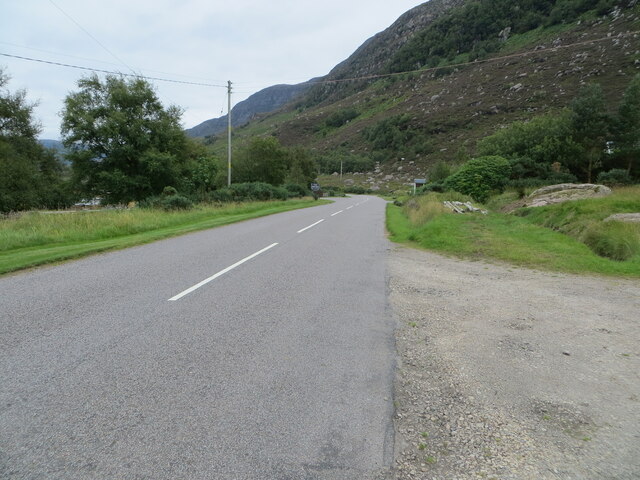
Accessible by foot, Tòrr Garbh offers a unique opportunity for hikers and walkers to explore the natural beauty of the Highlands. Its picturesque landscapes, abundant wildlife, and historical significance make it a must-visit destination for those seeking an authentic Scottish coastal experience.

If you have any feedback on the listing, please let us know in the comments section below.
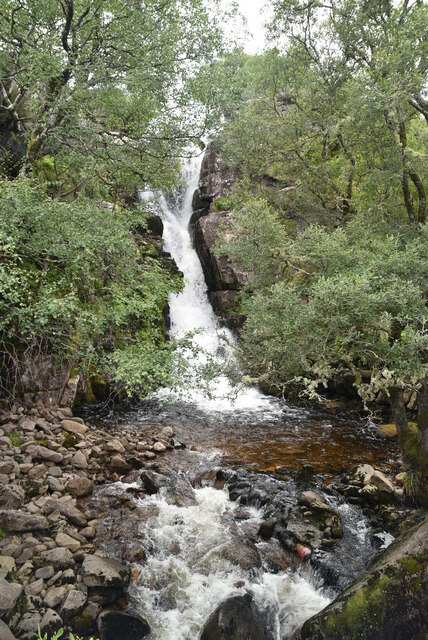
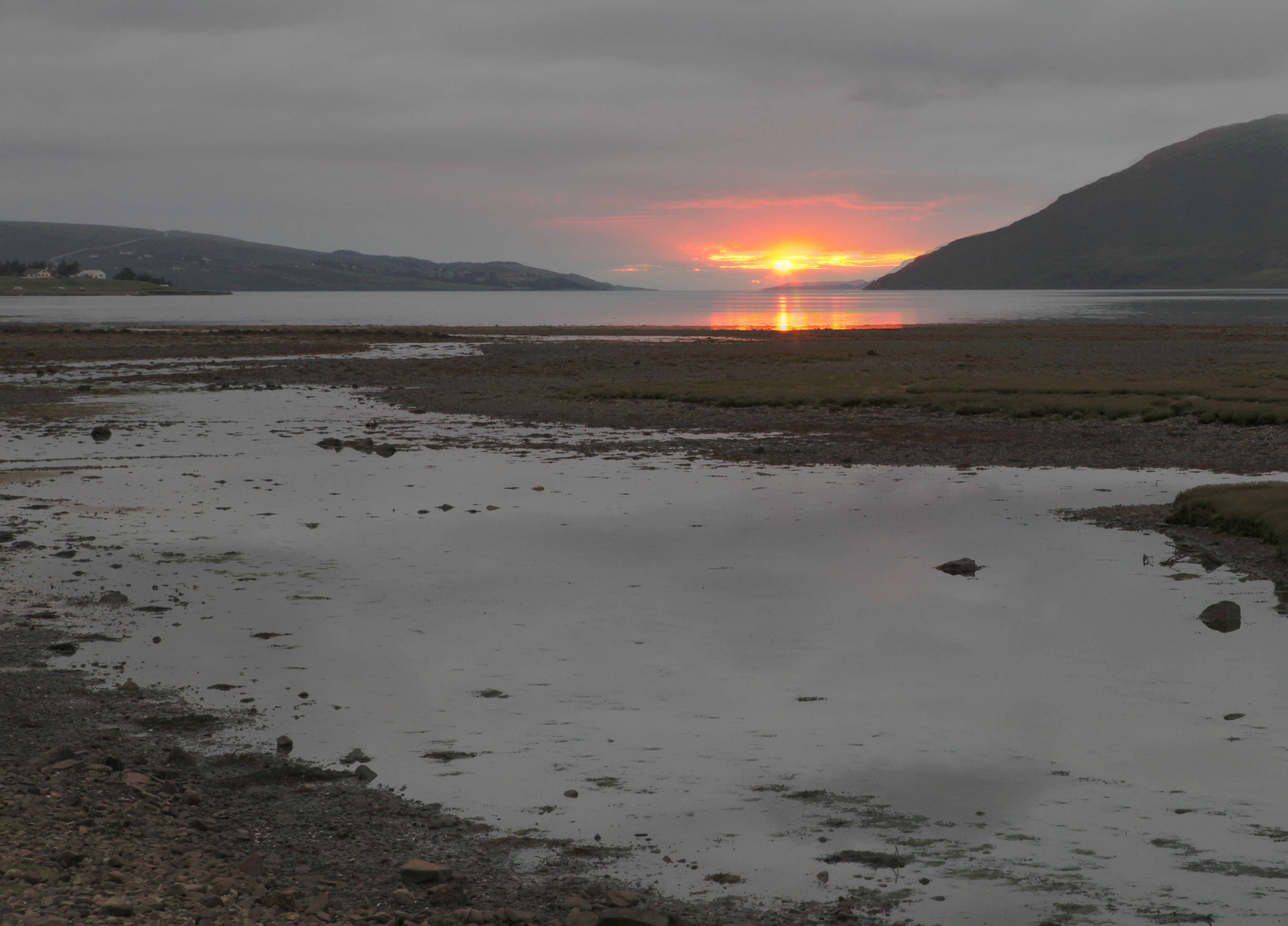
Tòrr Garbh Images

Images are sourced within 2km of 57.846128/-5.2622059 or Grid Reference NH0688. Thanks to Geograph Open Source API. All images are credited.

Ardessie Falls
Ardessie Falls
Road (A832) and War memorial near Dundonnell Looking south-westward from the roadside parking area.
Road (A832) and War memorial near Dundonnell
Looking south-westward from the roadside parking area.
Road (A832) sandwiched between Torr Garbh and Little Loch Broom Looking north-westward.
Road (A832) sandwiched between Torr Garbh and Little Loch Broom
Looking north-westward.
Road (A832) at Camusnagaul Looking south-eastward.
Road (A832) at Camusnagaul
Looking south-eastward.
Road (A832) near to Ardessie Looking south-eastward.
Road (A832) near to Ardessie
Looking south-eastward.
Ordnance Survey Flush Bracket G1950 This partly buried bracket can be found on the wall of a disused boathouse beside the A832 near to Dundonnell.
The recorded details give a height of 4.3553 metres above sea level.
For more details see : <span class="nowrap"><a title="https://www.bench-marks.org.uk/bm11724" rel="nofollow ugc noopener" href="https://www.bench-marks.org.uk/bm11724">Link</a><img style="margin-left:2px;" alt="External link" title="External link - shift click to open in new window" src="https://s1.geograph.org.uk/img/external.png" width="10" height="10"/></span>
Ordnance Survey Flush Bracket G1950
This partly buried bracket can be found on the wall of a disused boathouse beside the A832 near to Dundonnell. The recorded details give a height of 4.3553 metres above sea level. For more details see : LinkExternal link
War memorial above Little Loch Broom The obelisk-like memorial is dedicated to the 'Men of the District' which is of course the Dundonnell area. It's perched on a low rock plinth above the A832 and is accessed from the west by a stone-chipped path.
War memorial above Little Loch Broom
The obelisk-like memorial is dedicated to the 'Men of the District' which is of course the Dundonnell area. It's perched on a low rock plinth above the A832 and is accessed from the west by a stone-chipped path.
Building by A832 The A832 runs 127 miles from the Black Isle to Braemore Junction <a href="https://www.geograph.org.uk/photo/7232275">NH2077 : Braemore Junction</a>.
<span class="nowrap"><a title="https://www.sabre-roads.org.uk/wiki/index.php?title=A832" rel="nofollow ugc noopener" href="https://www.sabre-roads.org.uk/wiki/index.php?title=A832">Link</a><img style="margin-left:2px;" alt="External link" title="External link - shift click to open in new window" src="https://s1.geograph.org.uk/img/external.png" width="10" height="10"/></span>
Building by A832
The A832 runs 127 miles from the Black Isle to Braemore Junction NH2077 : Braemore Junction. LinkExternal link
Badcal Water Treatment Works
Track, Ardessie
Track, Ardessie
Ardessie Falls
Ardessie Falls
Ardessie Falls
Ardessie Falls
Allt Airdeasaidh
Allt Airdeasaidh
Ardessie Falls
Ardessie Falls
Ardessie Falls
Ardessie Falls
Interesting location!
View to Loch Broom
View to Loch Broom
Allt Airdeasaidh
Allt Airdeasaidh
Show me another place!

Tòrr Garbh is located at Grid Ref: NH0688 (Lat: 57.846128, Lng: -5.2622059)

Unitary Authority: Highland

Police Authority: Highlands and Islands

What 3 Words

///suitably.freshen.ombudsman. Near Ullapool, Highland

Nearby Locations

Tòrr Garbh

Related Wikis

Camusnagaul

Camusnagaul (Scottish Gaelic: Camas nan Gall) is a village on the south shore of the sea loch, Little Loch Broom in Wester Ross, Scottish Highlands and...

Ardessie

Ardessie (Scottish Gaelic: Àird Easaidh) is a small hamlet on the south western shore of Little Loch Broom 2 miles northwest of Dundonnell, in Garve, Ross...

Dundonnell

Dundonnell (Gaelic: Achadh Dà Dhòmhnaill) is a village in Ross and Cromarty, Scotland, on the south side of Little Loch Broom and at the foot of An Teallach...

Badrallach

Badrallach (Scottish Gaelic: Am Bad Ràilleach or Am Bad Tràilleach) is a village on the north shore of Little Loch Broom in Wester Ross, in the Highland...

Nearby Amenities

Located within 500m of 57.846128,-5.2622059
Source: PGS
Lat/Long: 57.8491722/-5.2568024
Source: PGS
Lat/Long: 57.8491549/-5.2570814
Source: PGS
Lat/Long: 57.8492289/-5.2577358
Source: PGS
Lat/Long: 57.8494474/-5.2586424
Source: PGS
Lat/Long: 57.8498487/-5.2599618
Source: PGS
Lat/Long: 57.8502651/-5.2600479
Power: pole
Lat/Long: 57.8503494/-5.2649265
Power: pole
Lat/Long: 57.8500925/-5.2639219
Power: pole
Lat/Long: 57.8496989/-5.2623704
Power: pole
Lat/Long: 57.8493166/-5.2607283
Power: pole
Lat/Long: 57.8489519/-5.2589996
Power: pole
Lat/Long: 57.8485904/-5.2573254
Power: pole
Lat/Long: 57.8482195/-5.2561263
Power: pole
Lat/Long: 57.8478859/-5.2545767
The data included in this document is from www.openstreetmap.org. The data is made available under ODbL.

Have you been to Tòrr Garbh?

Leave your review of Tòrr Garbh below (or comments, questions and feedback).