An Dùnan

Coastal Feature, Headland, Point in Inverness-shire

Scotland

An Dùnan

A82, North Ballachulish
A82, North Ballachulish Credit: Steven Brown

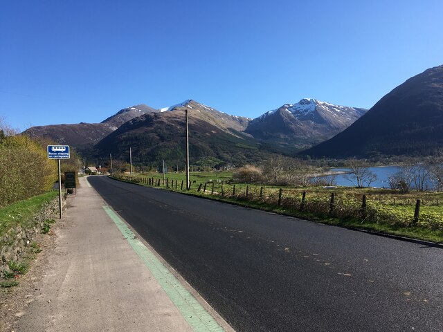
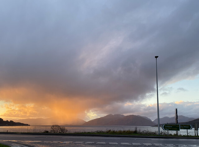
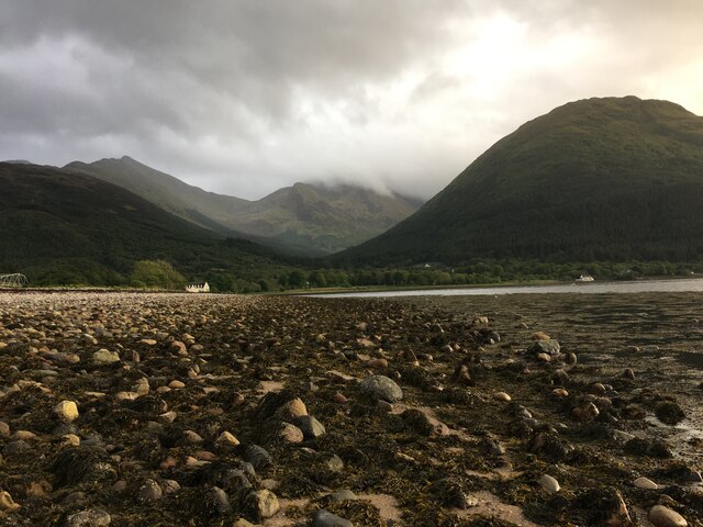
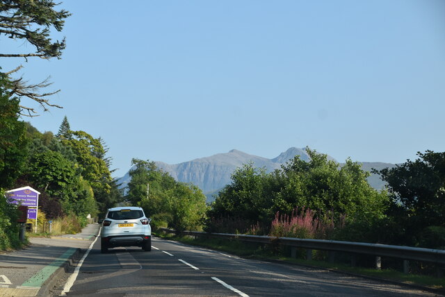
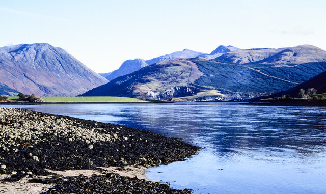
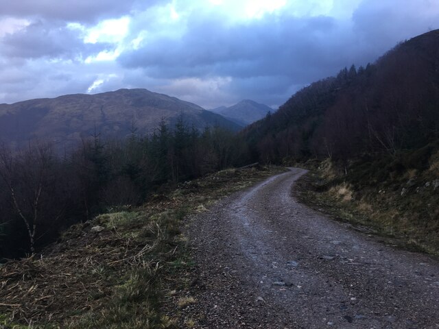
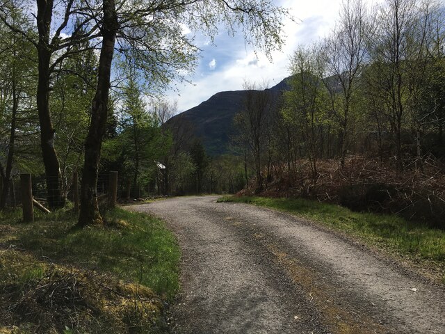
An Dùnan is a prominent coastal feature located in Inverness-shire, Scotland. It is a headland that juts out into the North Atlantic Ocean, forming a point that offers stunning views of the surrounding landscape.

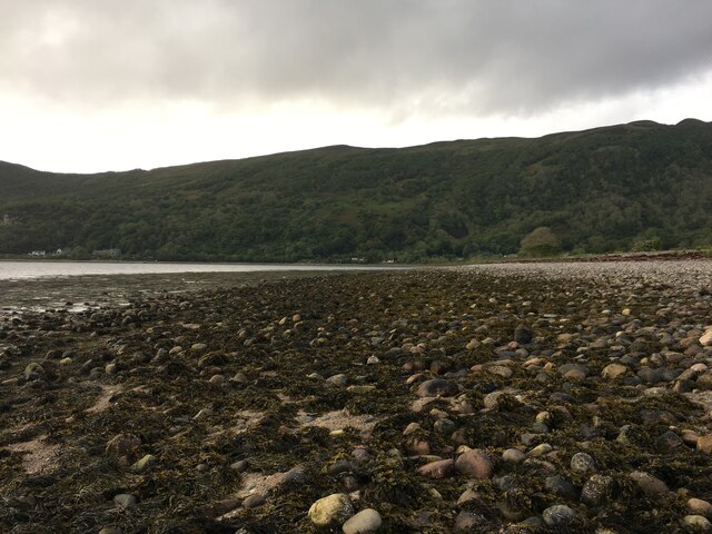
The headland is characterized by its rugged and rocky terrain, with cliffs that rise dramatically from the sea. These cliffs are mainly composed of sandstone, which has been eroded over time by the crashing waves and strong winds. As a result, the headland boasts several sea caves and natural arches, which add to its visual appeal.

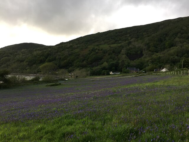
An Dùnan is known for its rich biodiversity, with a variety of plant and animal species making their home in the area. The headland is particularly famous for its birdlife, attracting birdwatchers from all over the world. Visitors can spot species such as puffins, guillemots, and razorbills, as well as the occasional seal basking on the rocks.

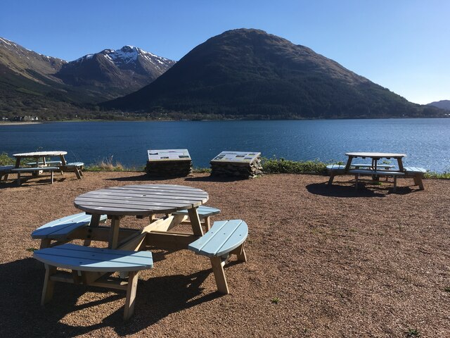
Due to its picturesque setting, An Dùnan is a popular destination for hikers and nature enthusiasts. Several walking trails traverse the headland, offering visitors the opportunity to explore its fascinating geological formations and enjoy panoramic views of the ocean. The headland is also a great spot for photography, especially during sunrise and sunset when the golden light casts a magical glow over the landscape.

In conclusion, An Dùnan is a captivating coastal feature in Inverness-shire, Scotland. With its stunning cliffs, sea caves, and diverse wildlife, it provides a memorable experience for anyone seeking natural beauty and outdoor adventure.

If you have any feedback on the listing, please let us know in the comments section below.
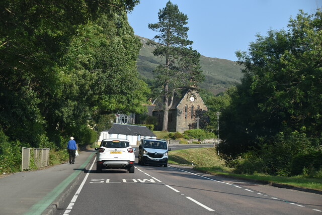
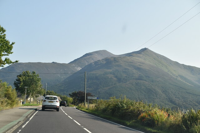
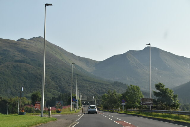
An Dùnan Images

Images are sourced within 2km of 56.690838/-5.1725567 or Grid Reference NN0559. Thanks to Geograph Open Source API. All images are credited.

A82, North Ballachulish
Picnic benches adjactent to Onich Filling Station
Road junction North Ballachulish
Shoreline at North Ballachulish
Bluebell laden fields, North Ballachulish
A82 The A82 is a trunk road in Scotland. It is the principal route from Lowland Scotland to the western Scottish Highlands, running from Glasgow to Inverness, going by Loch Lomond, Glen Coe, Fort William and the Great Glen. It is 167 miles long.
<span class="nowrap"><a title="https://www.sabre-roads.org.uk/wiki/index.php?title=A82" rel="nofollow ugc noopener" href="https://www.sabre-roads.org.uk/wiki/index.php?title=A82">Link</a><img style="margin-left:2px;" alt="External link" title="External link - shift click to open in new window" src="https://s1.geograph.org.uk/img/external.png" width="10" height="10"/></span>
A82
The A82 is a trunk road in Scotland. It is the principal route from Lowland Scotland to the western Scottish Highlands, running from Glasgow to Inverness, going by Loch Lomond, Glen Coe, Fort William and the Great Glen. It is 167 miles long. LinkExternal link
A82, Onich Services The A82 is a trunk road in Scotland. It is the principal route from Lowland Scotland to the western Scottish Highlands, running from Glasgow to Inverness, going by Loch Lomond, Glen Coe, Fort William and the Great Glen. It is 167 miles long.
<span class="nowrap"><a title="https://www.sabre-roads.org.uk/wiki/index.php?title=A82" rel="nofollow ugc noopener" href="https://www.sabre-roads.org.uk/wiki/index.php?title=A82">Link</a><img style="margin-left:2px;" alt="External link" title="External link - shift click to open in new window" src="https://s1.geograph.org.uk/img/external.png" width="10" height="10"/></span>
A82, Onich Services
The A82 is a trunk road in Scotland. It is the principal route from Lowland Scotland to the western Scottish Highlands, running from Glasgow to Inverness, going by Loch Lomond, Glen Coe, Fort William and the Great Glen. It is 167 miles long. LinkExternal link
A82 The A82 is a trunk road in Scotland. It is the principal route from Lowland Scotland to the western Scottish Highlands, running from Glasgow to Inverness, going by Loch Lomond, Glen Coe, Fort William and the Great Glen. It is 167 miles long.
<span class="nowrap"><a title="https://www.sabre-roads.org.uk/wiki/index.php?title=A82" rel="nofollow ugc noopener" href="https://www.sabre-roads.org.uk/wiki/index.php?title=A82">Link</a><img style="margin-left:2px;" alt="External link" title="External link - shift click to open in new window" src="https://s1.geograph.org.uk/img/external.png" width="10" height="10"/></span>
A82
The A82 is a trunk road in Scotland. It is the principal route from Lowland Scotland to the western Scottish Highlands, running from Glasgow to Inverness, going by Loch Lomond, Glen Coe, Fort William and the Great Glen. It is 167 miles long. LinkExternal link
A82, North Ballachulish The A82 is a trunk road in Scotland. It is the principal route from Lowland Scotland to the western Scottish Highlands, running from Glasgow to Inverness, going by Loch Lomond, Glen Coe, Fort William and the Great Glen. It is 167 miles long.
<span class="nowrap"><a title="https://www.sabre-roads.org.uk/wiki/index.php?title=A82" rel="nofollow ugc noopener" href="https://www.sabre-roads.org.uk/wiki/index.php?title=A82">Link</a><img style="margin-left:2px;" alt="External link" title="External link - shift click to open in new window" src="https://s1.geograph.org.uk/img/external.png" width="10" height="10"/></span>
A82, North Ballachulish
The A82 is a trunk road in Scotland. It is the principal route from Lowland Scotland to the western Scottish Highlands, running from Glasgow to Inverness, going by Loch Lomond, Glen Coe, Fort William and the Great Glen. It is 167 miles long. LinkExternal link
A82 The A82 is a trunk road in Scotland. It is the principal route from Lowland Scotland to the western Scottish Highlands, running from Glasgow to Inverness, going by Loch Lomond, Glen Coe, Fort William and the Great Glen. It is 167 miles long.
<span class="nowrap"><a title="https://www.sabre-roads.org.uk/wiki/index.php?title=A82" rel="nofollow ugc noopener" href="https://www.sabre-roads.org.uk/wiki/index.php?title=A82">Link</a><img style="margin-left:2px;" alt="External link" title="External link - shift click to open in new window" src="https://s1.geograph.org.uk/img/external.png" width="10" height="10"/></span>
A82
The A82 is a trunk road in Scotland. It is the principal route from Lowland Scotland to the western Scottish Highlands, running from Glasgow to Inverness, going by Loch Lomond, Glen Coe, Fort William and the Great Glen. It is 167 miles long. LinkExternal link
Stones on shore of Loch Leven The stones with seaweed are on and alongside the slipway at North Ballachulish which was the northern landing for the vehicle ferry service which operated prior to the opening of the Ballachulish Bridge.
The view beyond is to the east where the Glen Coe peaks rise, Sgorr nam Fiannaidh being at the left side of the image.
Stones on shore of Loch Leven
The stones with seaweed are on and alongside the slipway at North Ballachulish which was the northern landing for the vehicle ferry service which operated prior to the opening of the Ballachulish Bridge. The view beyond is to the east where the Glen Coe peaks rise, Sgorr nam Fiannaidh being at the left side of the image.
Forestry road above Glenachulish
Bridge over river in Glenachulish
Cameron mausoleum near Callart
Stained glass windows in Cameron mausoleum
Private road to Carness
A82 approaching Ballachulish Bridge The A82 is a trunk road in Scotland. It is the principal route from Lowland Scotland to the western Scottish Highlands, running from Glasgow to Inverness, going by Loch Lomond, Glen Coe, Fort William and the Great Glen. It is 167 miles long.
<span class="nowrap"><a title="https://www.sabre-roads.org.uk/wiki/index.php?title=A82" rel="nofollow ugc noopener" href="https://www.sabre-roads.org.uk/wiki/index.php?title=A82">Link</a><img style="margin-left:2px;" alt="External link" title="External link - shift click to open in new window" src="https://s1.geograph.org.uk/img/external.png" width="10" height="10"/></span>
A82 approaching Ballachulish Bridge
The A82 is a trunk road in Scotland. It is the principal route from Lowland Scotland to the western Scottish Highlands, running from Glasgow to Inverness, going by Loch Lomond, Glen Coe, Fort William and the Great Glen. It is 167 miles long. LinkExternal link
Show me another place!

An Dùnan is located at Grid Ref: NN0559 (Lat: 56.690838, Lng: -5.1725567)

Unitary Authority: Highland

Police Authority: Highlands and Islands

What 3 Words

///button.spells.objective. Near Glencoe, Highland

Related Wikis

Nether Lochaber

Nether Lochaber ( NEDH-ər lokh-AH-bər) in Lochaber, Highland, Scotland, is the modern (1950s) name for the Parish of Ballachulish and Onich. This Parish...

Ballachulish Ferry railway station

Ballachulish Ferry was a railway station on the south shore at the narrows of Loch Leven at South Ballachulish in Highland region, Scotland. It was on...

Ballachulish House

Ballachulish House is a restaurant located in Ballachulish, Highland, Scotland. As of 2008, the restaurant holds one star in the Michelin Guide. ��2�...

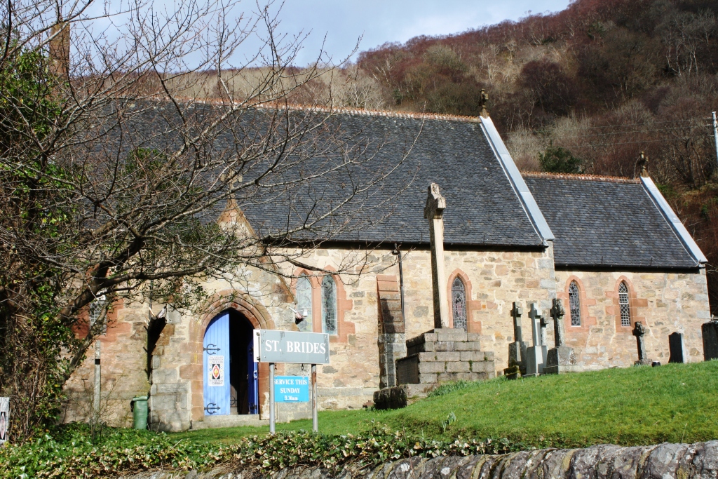
St Bride's Church, Onich

St Bride's Church (alternatively, Saint Brigid of Kildare Church) is an Episcopal parish church in North Ballachulish in the Scottish Highlands, within...

Glenachulish

Glenachulish (Scottish Gaelic: Gleann a' Chaolais: valley of the narrows; pronounced Glen – ah – hoolish) is a hamlet and glen which lie close to the village...

St John's Church, Ballachulish (former)

St John's Church is a former church building in Ballachulish, Highland, Scotland. It dates to 1842, replacing an earlier Episcopal church, and was designed...

Eilean Munde

Eilean Munde is a small uninhabited island in Loch Leven, close to Ballachulish. It is the site of a chapel built by St. Fintan Mundus (also known as Saint...

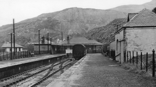
Ballachulish railway station

Ballachulish was a railway station at Ballachulish on the southern shore of Loch Leven at East Laroch (south Ballachulish) in Highland. It was the terminus...

Nearby Amenities

Located within 500m of 56.690838,-5.1725567
Source: PGS
Lat/Long: 56.6892184/-5.1784395
Source: PGS
Lat/Long: 56.6893383/-5.1779262
Source: PGS
Lat/Long: 56.6896617/-5.1775118
Source: PGS
Lat/Long: 56.690385/-5.1769423
Source: PGS
Lat/Long: 56.6908382/-5.1765563
Source: PGS
Lat/Long: 56.6911519/-5.1761569
Source: PGS
Lat/Long: 56.6913104/-5.1740681
Source: PGS
Lat/Long: 56.6912567/-5.1737282
Source: PGS
Lat/Long: 56.6911622/-5.1732895
Source: PGS
Lat/Long: 56.6906775/-5.1727684
Source: PGS
Lat/Long: 56.6913056/-5.1732232
Source: PGS
Lat/Long: 56.6917187/-5.1732359
Source: PGS
Lat/Long: 56.6919759/-5.1731897
Source: PGS
Lat/Long: 56.692151/-5.1728041
Source: PGS
Lat/Long: 56.6924305/-5.1725459
Source: PGS
Lat/Long: 56.6925253/-5.1715809
Source: PGS
Lat/Long: 56.6926018/-5.171223
Created By: dmgroom_coastlines
Source: PGS
Lat/Long: 56.692624/-5.170637
Source: PGS
Lat/Long: 56.6926233/-5.1703296
Source: PGS
Lat/Long: 56.6926279/-5.1682266
Source: PGS
Lat/Long: 56.6925077/-5.1672403
Created By: dmgroom_coastlines
Source: PGS
Lat/Long: 56.691862/-5.167961
Source: PGS
Lat/Long: 56.6917153/-5.1691984
Source: PGS
Lat/Long: 56.6915482/-5.1695342
Source: PGS
Lat/Long: 56.6913062/-5.1695552
Source: PGS
Lat/Long: 56.6910353/-5.1692824
Source: PGS
Lat/Long: 56.6908163/-5.169125
Source: PGS
Lat/Long: 56.6905685/-5.1692719
Source: PGS
Lat/Long: 56.6903495/-5.1686737
Source: PGS
Lat/Long: 56.6900671/-5.1685163
Source: PGS
Lat/Long: 56.690021/-5.1681385
Source: PGS
Lat/Long: 56.6903399/-5.1679095
Source: PGS
Lat/Long: 56.6906581/-5.168167
Source: PGS
Lat/Long: 56.6908466/-5.1677593
Source: PGS
Lat/Long: 56.691214/-5.1678132
Source: PGS
Lat/Long: 56.6916144/-5.1671114
Source: PGS
Lat/Long: 56.6911141/-5.1674881
Source: PGS
Lat/Long: 56.6907066/-5.1662445
Source: PGS
Lat/Long: 56.6906308/-5.1658395
Source: PGS
Lat/Long: 56.6896514/-5.1660446
Source: PGS
Lat/Long: 56.6892191/-5.1658323
Leisure: slipway
Lat/Long: 56.6892983/-5.1798635
Benvoulin
Place: locality
Lat/Long: 56.6922274/-5.1800867
Bishop's Bay
Natural: bay
Seamark Type: anchorage
Lat/Long: 56.6916613/-5.1710276
Source: PGS
Lat/Long: 56.6919139/-5.1672641
Generator Method: photovoltaic
Generator Output Electricity: yes
Generator Source: solar
Generator Type: solar_photovoltaic_panel
Location: roof
Power: generator
Lat/Long: 56.6916723/-5.1803137
Generator Method: photovoltaic
Generator Output Electricity: yes
Generator Source: solar
Generator Type: solar_photovoltaic_panel
Location: roof
Power: generator
Lat/Long: 56.6905659/-5.1795749
Generator Method: photovoltaic
Generator Output Electricity: yes
Generator Source: solar
Generator Type: solar_photovoltaic_panel
Location: roof
Power: generator
Lat/Long: 56.690303/-5.1804855
Power: pole
Lat/Long: 56.6942044/-5.1766356
Power: pole
Lat/Long: 56.6951835/-5.1714406
Power: pole
Lat/Long: 56.694889/-5.1703362
Power: pole
Lat/Long: 56.6944453/-5.1688808
Power: pole
Lat/Long: 56.6941119/-5.167559
Power: pole
Lat/Long: 56.693898/-5.1667761
Power: pole
Lat/Long: 56.6928522/-5.1656388
Power: pole
Lat/Long: 56.6926189/-5.1655233
The data included in this document is from www.openstreetmap.org. The data is made available under ODbL.

Have you been to An Dùnan?

Leave your review of An Dùnan below (or comments, questions and feedback).