Burnfoot

Coastal Feature, Headland, Point in Wigtownshire

Scotland

Burnfoot

Ailsa Craig view This view looks towards the high cliffs on the south side of the island.
Ailsa Craig view Credit: Mary and Angus Hogg

Burnfoot is a picturesque coastal headland located in Wigtownshire, a region in the southwest of Scotland. Situated on the western coast of the Rhins of Galloway Peninsula, Burnfoot is a prominent point that juts out into the North Channel of the Irish Sea.

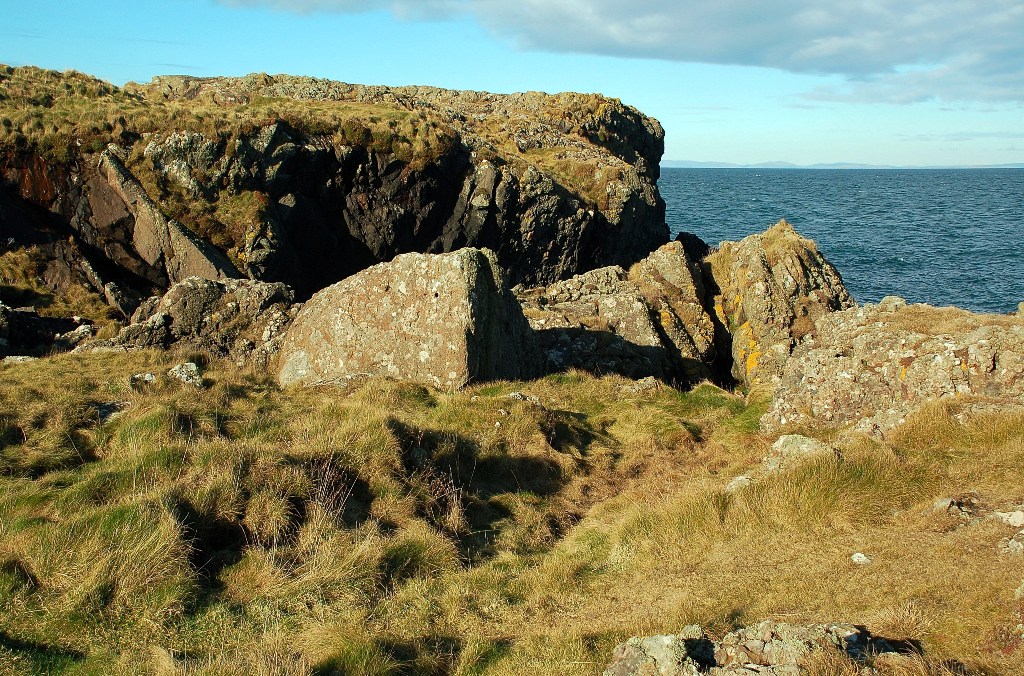
The headland is characterized by its stunning natural beauty and rugged landscape. It is known for its towering cliffs, which provide breathtaking views of the surrounding sea and coastline. The cliffs are made up of various rock types, including sandstone and granite, creating a diverse and visually striking geological formation.

At the tip of Burnfoot, there is a small sandy beach, offering visitors a tranquil spot to relax and enjoy the coastal scenery. The beach is often visited by locals and tourists alike, who can take leisurely walks along the shoreline or explore the rock pools that are exposed during low tide.

The headland is also home to a variety of wildlife, making it a popular spot for nature enthusiasts. Seabirds such as gulls, puffins, and cormorants can be spotted nesting on the cliffs, while seals and dolphins can sometimes be seen swimming in the waters below.

Due to its location on the coast, Burnfoot is subject to the elements, with strong winds and rough seas being a common occurrence. This, however, adds to its charm and allure, attracting visitors who appreciate the raw power and beauty of nature.

Overall, Burnfoot is a captivating headland that showcases the rugged and mesmerizing coastal landscape of Wigtownshire. Its dramatic cliffs, sandy beach, and diverse wildlife make it a must-visit destination for nature lovers and those seeking a peaceful retreat by the sea.

If you have any feedback on the listing, please let us know in the comments section below.

Burnfoot Images

Images are sourced within 2km of 55.01156/-5.1243562 or Grid Reference NX0073. Thanks to Geograph Open Source API. All images are credited.

Ailsa Craig view This view looks towards the high cliffs on the south side of the island.
Ailsa Craig view
This view looks towards the high cliffs on the south side of the island.
Balscalloch Radio Mast Located on Craignawachel at the northern tip of the North Rhins.
Balscalloch Radio Mast
Located on Craignawachel at the northern tip of the North Rhins.
Milleur Point With navigation buoy and Craignawachel communications mast.
Milleur Point
With navigation buoy and Craignawachel communications mast.
Corsewall Lighthouse
Damhouse Farm, The Rhins
Pigs and Arks Barnhills Farm.
Pigs and Arks
Barnhills Farm.
Remains of Corsewall Castle Picturesque 15th century ruin.
Remains of Corsewall Castle
Picturesque 15th century ruin.
HSS leaving Lochryan Taken from Corsewall Point
HSS leaving Lochryan
Taken from Corsewall Point
Port Mullin View This small bay lies to the east of Corsewall Point. The farmland had been cut up by cattle when this shot was taken in mid-February.
Port Mullin View
This small bay lies to the east of Corsewall Point. The farmland had been cut up by cattle when this shot was taken in mid-February.
Ochley Point View Looking towards Ochley Point, in the same square, from the rocks near Corsewall Point on a fine February morning.
Ochley Point View
Looking towards Ochley Point, in the same square, from the rocks near Corsewall Point on a fine February morning.
Towards Well Isle Looking out to sea across the rocks near Corsewall Point at the northern end of the Rhins of Galloway.
Towards Well Isle
Looking out to sea across the rocks near Corsewall Point at the northern end of the Rhins of Galloway.
St Columba's Well? The Explorer map shows St Columba's Well here, which I think could be this very wet patch in the tiny burn that flows into Port Mullin, near Corsewall Point. Viewed in mid-February, in winter colours.
St Columba's Well?
The Explorer map shows St Columba's Well here, which I think could be this very wet patch in the tiny burn that flows into Port Mullin, near Corsewall Point. Viewed in mid-February, in winter colours.
Winter Cattle These cattle were wintering in the fields near Corsewall Point.  Wet weather had led to very muddy conditions here and in many other nearby fields.
Winter Cattle
These cattle were wintering in the fields near Corsewall Point. Wet weather had led to very muddy conditions here and in many other nearby fields.
Corsewall Castle This 15th century tower was recorded as a ruin in 1684. It had been a substantial house in its day.  (Source: "The Castles of South-West Scotland", by Mike Salter).  Three roe deer are grazing on the winter barley to the left of the castle.
Corsewall Castle
This 15th century tower was recorded as a ruin in 1684. It had been a substantial house in its day. (Source: "The Castles of South-West Scotland", by Mike Salter). Three roe deer are grazing on the winter barley to the left of the castle.
Corsewall Point Road This is on the way back from the point, just beside the road to North Park.
Corsewall Point Road
This is on the way back from the point, just beside the road to North Park.
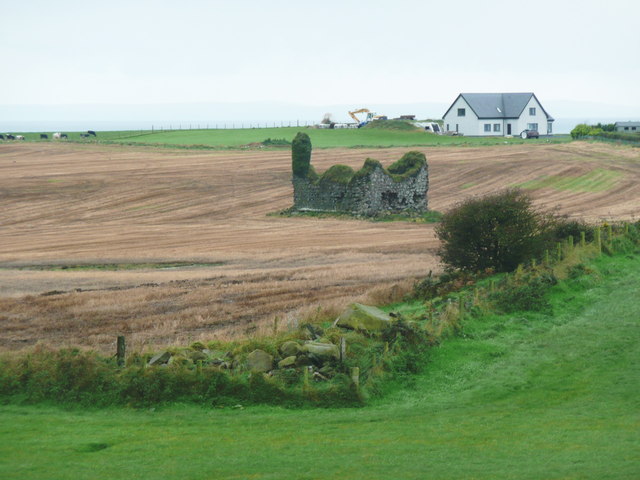
Corsewall Castle Unfortunately I ran out of time and was unable to find a suitable parking spot, so this was the closest I got to the ruins of Corsewall Castle. The zoom lens makes it look very close to the modern house at Old Blackhills, but it is in fact several hundred metres away.
Corsewall Castle
Unfortunately I ran out of time and was unable to find a suitable parking spot, so this was the closest I got to the ruins of Corsewall Castle. The zoom lens makes it look very close to the modern house at Old Blackhills, but it is in fact several hundred metres away.
Corsewall Castle A Ruined 15C tower house.
Corsewall Castle
A Ruined 15C tower house.
Show me another place!

Burnfoot is located at Grid Ref: NX0073 (Lat: 55.01156, Lng: -5.1243562)

Unitary Authority: Dumfries and Galloway

Police Authority: Dumfries and Galloway

What 3 Words

///grandest.full.skews. Near Cairnryan, Dumfries & Galloway

Related Wikis

Corsewall Point

Corsewall Point, or Corsill Point, is a headland on the northwest coast of Wigtownshire, Kirkcolm near Stranraer, Dumfries and Galloway, Scotland. A lighthouse...

Kirkcolm

Kirkcolm (Scots: Kirkcoam) is a village and civil parish on the northern tip of the Rhinns of Galloway peninsula, south-west Scotland. It is in Dumfries...

Ervie

Ervie is a small village in Dumfries and Galloway, Scotland, in the Rhins of Galloway, just outside Stranraer.

RAF Wig Bay

Royal Air Force Wig Bay, or more simply RAF Wig Bay, is a former Royal Air Force station near Stranraer, Dumfries and Galloway, Scotland The following...

Loch Ryan

Loch Ryan (Scottish Gaelic: Loch Rìoghaine, pronounced [l̪ˠɔx ˈrˠiː.ɛɲə]) is a Scottish sea loch that acts as an important natural harbour for shipping...

Cairnryan Harbour

Cairnryan Harbour is a roll-on ferry terminal on Loch Ryan in south west Scotland north of Stranraer. In World War II it was developed as an emergency...

Cairnryan

Cairnryan (Scots: The Cairn; Scottish Gaelic: Càrn Rìoghain or Machair an Sgithich) is a village in the historical county of Wigtownshire, Dumfries and...

Leswalt

Leswalt (Scottish Gaelic: Lios Uillt) is a village and civil parish in Dumfries and Galloway, south-west Scotland. It lies between Portpatrick and Stranraer...

Nearby Amenities

Located within 500m of 55.01156,-5.1243562
Created By: dmgroom_coastlines
Source: PGS
Lat/Long: 55.014133/-5.118235
Created By: dmgroom_coastlines
Source: PGS
Lat/Long: 55.014238/-5.119578
Created By: dmgroom_coastlines
Source: PGS
Lat/Long: 55.014358/-5.12003
Created By: dmgroom_coastlines
Source: PGS
Lat/Long: 55.013591/-5.11999
Created By: dmgroom_coastlines
Source: PGS
Lat/Long: 55.013695/-5.121332
Created By: dmgroom_coastlines
Source: PGS
Lat/Long: 55.013687/-5.121778
Created By: dmgroom_coastlines
Source: PGS
Lat/Long: 55.013544/-5.122662
Created By: dmgroom_coastlines
Source: PGS
Lat/Long: 55.013036/-5.122413
Created By: dmgroom_coastlines
Source: PGS
Lat/Long: 55.012911/-5.122183
Created By: dmgroom_coastlines
Source: PGS
Lat/Long: 55.012788/-5.121954
Created By: dmgroom_coastlines
Source: PGS
Lat/Long: 55.012532/-5.12194
Created By: dmgroom_coastlines
Source: PGS
Lat/Long: 55.012268/-5.122372
Created By: dmgroom_coastlines
Source: PGS
Lat/Long: 55.011748/-5.122791
Created By: dmgroom_coastlines
Source: PGS
Lat/Long: 55.010977/-5.122972
Created By: dmgroom_coastlines
Source: PGS
Lat/Long: 55.011097/-5.123424
Created By: dmgroom_coastlines
Source: PGS
Lat/Long: 55.011081/-5.124315
Created By: dmgroom_coastlines
Source: PGS
Lat/Long: 55.010794/-5.126083
Created By: dmgroom_coastlines
Source: PGS
Lat/Long: 55.010522/-5.12696
Created By: dmgroom_coastlines
Source: PGS
Lat/Long: 55.01034/-5.13007
Created By: dmgroom_coastlines
Source: PGS
Lat/Long: 55.009829/-5.130043
Created By: dmgroom_coastlines
Source: PGS
Lat/Long: 55.009933/-5.131386
The data included in this document is from www.openstreetmap.org. The data is made available under ODbL.

Have you been to Burnfoot?

Leave your review of Burnfoot below (or comments, questions and feedback).