Blackhead Rock

Coastal Feature, Headland, Point in Wigtownshire

Scotland

Blackhead Rock

Corsewall Lighthouse Copious amounts of Sea Thrift (Armeria maritima) grow here.
Corsewall Lighthouse Credit: Jon Alexander

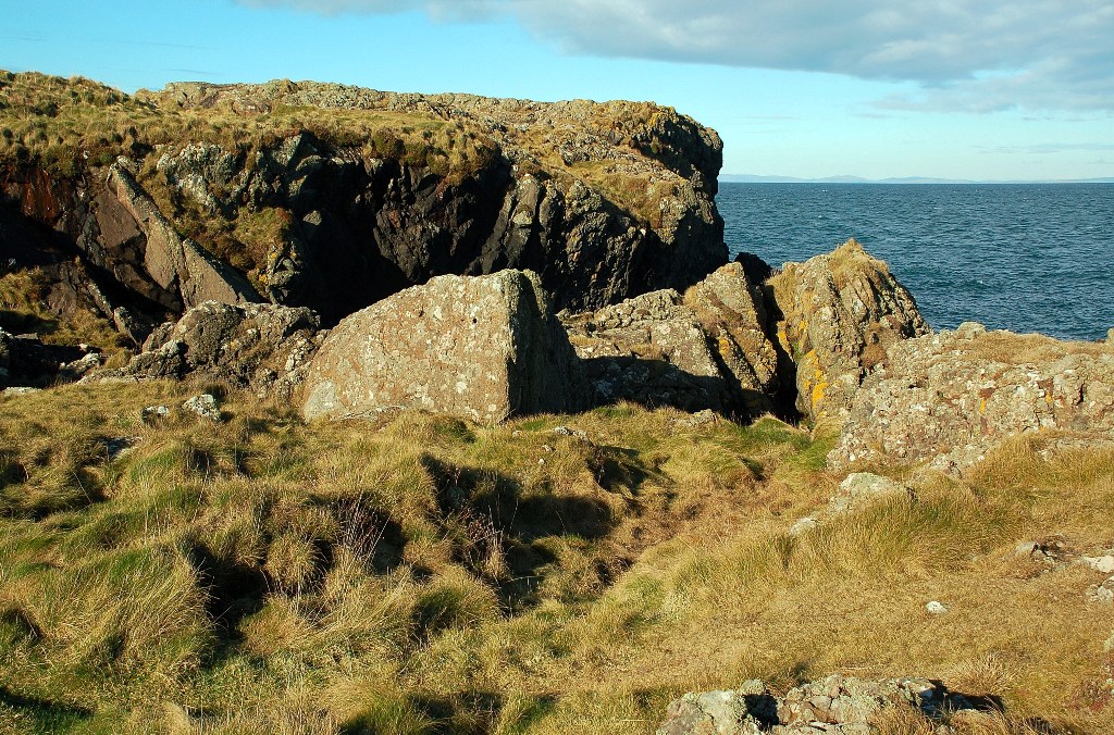
Blackhead Rock is a prominent coastal feature located in Wigtownshire, situated in the southwest region of Scotland. It is a striking headland that juts out into the North Channel, a body of water separating Scotland and Northern Ireland. The rock is positioned near the town of Portpatrick, a popular tourist destination known for its picturesque coastal views.

Blackhead Rock is characterized by its rugged cliffs and steep slopes, which are often covered in lush vegetation. The headland is composed of igneous rock formations, primarily basalt, which have been shaped by the relentless force of the sea over thousands of years. This geological feature is a testament to the power of erosion and showcases the dramatic beauty of the Scottish coastline.

Visitors to Blackhead Rock can enjoy breathtaking panoramic views of the North Channel and the surrounding coastal landscape. On a clear day, the distant shores of Northern Ireland can be seen, adding to the allure of this natural wonder.

The headland is also known for its diverse wildlife, providing a habitat for numerous bird species, including fulmars, gulls, and cormorants. Marine life such as seals and dolphins can often be spotted swimming in the waters around Blackhead Rock.

For outdoor enthusiasts and nature lovers, Blackhead Rock offers an array of opportunities for exploration and adventure. Hiking trails wind their way along the cliffs, providing breathtaking vistas and a chance to observe the coastal ecosystem up close.

Overall, Blackhead Rock stands as a magnificent coastal feature, captivating visitors with its striking geological formations, stunning views, and abundant wildlife.

If you have any feedback on the listing, please let us know in the comments section below.

Blackhead Rock Images

Images are sourced within 2km of 55.007912/-5.1548741 or Grid Reference NW9872. Thanks to Geograph Open Source API. All images are credited.

Corsewall Lighthouse Copious amounts of Sea Thrift (Armeria maritima) grow here.
Corsewall Lighthouse
Copious amounts of Sea Thrift (Armeria maritima) grow here.
Rock Art Somebody has a sense of humour!
Rock Art
Somebody has a sense of humour!
Meadow Pipit (Anthus pratensis) It was very tame and just waited for me to move away from its dinner.
Meadow Pipit (Anthus pratensis)
It was very tame and just waited for me to move away from its dinner.
Leaving Loch Ryan Stena Superfast VIII heading from Cairnryan to Belfast, passing through NX9873 off Corsewall Point.
Leaving Loch Ryan
Stena Superfast VIII heading from Cairnryan to Belfast, passing through NX9873 off Corsewall Point.
Corsewall Point lighthouse After being automated, the lighthouse buildings are now used for a hotel and restaurant.
Corsewall Point lighthouse
After being automated, the lighthouse buildings are now used for a hotel and restaurant.
Ailsa Craig view This view looks towards the high cliffs on the south side of the island.
Ailsa Craig view
This view looks towards the high cliffs on the south side of the island.
Corsewall Point lighthouse From the ferry to Larne.
Corsewall Point lighthouse
From the ferry to Larne.
Stena Line Ferry passing the Corsewall Lighthouse Viewed from the P&O European Causeway ferry headed for Cairnryan.
Stena Line Ferry passing the Corsewall Lighthouse
Viewed from the P&O European Causeway ferry headed for Cairnryan.
Corsewall Lighthouse
Corsewall Lighthouse from Cairnside Farm View from Cairnside Farm to Corsewall Lighthouse.
Corsewall Lighthouse from Cairnside Farm
View from Cairnside Farm to Corsewall Lighthouse.
Corsewall Lighthouse View of Corsewall Lighthouse from a passing Larne to Cairnrayn ferry
Corsewall Lighthouse
View of Corsewall Lighthouse from a passing Larne to Cairnrayn ferry
Corsewall Lighthouse Corsewall Lighthouse, image made from an inbound ferry approaching Loch Ryan.
Corsewall Lighthouse
Corsewall Lighthouse, image made from an inbound ferry approaching Loch Ryan.
Damhouse Farm, The Rhins
Pigs and Arks Barnhills Farm.
Pigs and Arks
Barnhills Farm.
Corsewall Hotel, The Rhins As you can see formerly a lighthouse.
Corsewall Hotel, The Rhins
As you can see formerly a lighthouse.
Remains of Corsewall Castle Picturesque 15th century ruin.
Remains of Corsewall Castle
Picturesque 15th century ruin.
HSS leaving Lochryan Taken from Corsewall Point
HSS leaving Lochryan
Taken from Corsewall Point
Show me another place!

Blackhead Rock is located at Grid Ref: NW9872 (Lat: 55.007912, Lng: -5.1548741)

Unitary Authority: Dumfries and Galloway

Police Authority: Dumfries and Galloway

What 3 Words

///stumps.holdings.delays. Near Cairnryan, Dumfries & Galloway

Related Wikis

Corsewall Point

Corsewall Point, or Corsill Point, is a headland at the northern end of the Rhins of Galloway in Scotland. A lighthouse, Corsewall Lighthouse, was placed...

Ervie

Ervie is a small village in Dumfries and Galloway, Scotland, in the Rhins of Galloway, just outside Stranraer.

Kirkcolm

Kirkcolm (Scots: Kirkcoam) is a village and civil parish on the northern tip of the Rhinns of Galloway peninsula, south-west Scotland. It is in Dumfries...

RAF Wig Bay

Royal Air Force Wig Bay, or more simply RAF Wig Bay, is a former Royal Air Force station near Stranraer, Dumfries and Galloway, Scotland The following...

Nearby Amenities

Located within 500m of 55.007912,-5.1548741
Created By: dmgroom_coastlines
Source: PGS
Lat/Long: 55.007843/-5.148213
Created By: dmgroom_coastlines
Source: PGS
Lat/Long: 55.007579/-5.148644
Source: PGS
Lat/Long: 55.0075514/-5.1501854
Created By: dmgroom_coastlines
Source: PGS
Lat/Long: 55.007933/-5.150446
Source: PGS
Lat/Long: 55.008207/-5.1510007
Source: PGS
Lat/Long: 55.0083517/-5.1522909
Source: PGS
Lat/Long: 55.0086698/-5.1521512
Source: PGS
Lat/Long: 55.0081791/-5.1529641
Source: PGS
Lat/Long: 55.0083557/-5.1535593
Source: PGS
Lat/Long: 55.0083723/-5.1541277
Source: PGS
Lat/Long: 55.0081926/-5.1549403
Source: PGS
Lat/Long: 55.0080862/-5.1550644
Source: PGS
Lat/Long: 55.0082225/-5.1553126
Created By: dmgroom_coastlines
Source: PGS
Lat/Long: 55.00835/-5.155817
Source: PGS
Lat/Long: 55.0082407/-5.1563633
Source: PGS
Lat/Long: 55.0078023/-5.1567514
Created By: dmgroom_coastlines
Source: PGS
Lat/Long: 55.007806/-5.157571
Source: PGS
Lat/Long: 55.007517/-5.1583318
Source: PGS
Lat/Long: 55.0073416/-5.1594089
Created By: dmgroom_coastlines
Source: PGS
Lat/Long: 55.006991/-5.160201
Source: PGS
Lat/Long: 55.0065393/-5.1601117
Source: PGS
Lat/Long: 55.00594/-5.1608273
Source: PGS
Lat/Long: 55.0057204/-5.1613358
Corsewall Lighthouse Hotel
Addr City: Kirkcolm
Addr Housename: Lighthouse Hotel
Addr Postcode: DG9 0QG
Addr Street: Corsewall Point
Check Date: 2023-08-12
Email: info@lighthousehotel.co.uk
Fax: +44 1776 854231
Fhrs Id: 876494
Phone: +44 1776 853220
Reservation: required
Rooms: 11
Source: https://en.wikipedia.org/wiki/Corsewall_Lighthouse
Start Date: ~1994
Tourism: hotel
Website: https://www.lighthousehotel.co.uk/
Lat/Long: 55.0069692/-5.1593019
Corsewall Lighthouse
Seamark Light 1 Character: Fl
Seamark Light 1 Colour: white
Seamark Light 1 Group: 5
Seamark Light 1 Height: 34
Seamark Light 1 Period: 30
Seamark Light 1 Range: 22
Seamark Light 1 Sector End: 257
Seamark Light 1 Sector Start: 27
Seamark Light Reference: A 4604
Seamark Name: Corsewall
Seamark Radio Station Category: ais
Seamark Radio Station Mmsi: 992351018
Seamark Type: light_major
Wikidata: Q5173151
Wikipedia: en:Corsewall Lighthouse
Lat/Long: 55.0070771/-5.1594749
Power: pole
Lat/Long: 55.0045555/-5.1505271
Power: pole
Lat/Long: 55.0048369/-5.1516187
Power: pole
Lat/Long: 55.0050995/-5.1526329
Power: pole
Lat/Long: 55.0052153/-5.1537785
Power: pole
Lat/Long: 55.0053122/-5.154788
Power: pole
Lat/Long: 55.0054414/-5.1560581
Power: pole
Lat/Long: 55.0059329/-5.156976
Power: pole
Lat/Long: 55.0064943/-5.1579737
Corsewall Lighthouse
Man Made: lighthouse
Start Date: ~1817
Wikidata: Q5173151
Wikipedia: en:Corsewall Lighthouse
Lat/Long: 55.0070797/-5.1595018
The data included in this document is from www.openstreetmap.org. The data is made available under ODbL.

Have you been to Blackhead Rock?

Leave your review of Blackhead Rock below (or comments, questions and feedback).