Bere Holm

Coastal Feature, Headland, Point in Wigtownshire

Scotland

Bere Holm

Lighthouse on Black Head, Wigtonshire Seen from the cliff top path of the Southern Upland Way from Portpatrick heading North.
Lighthouse on Black Head, Wigtonshire Credit: Uncredited

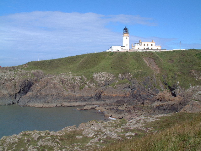
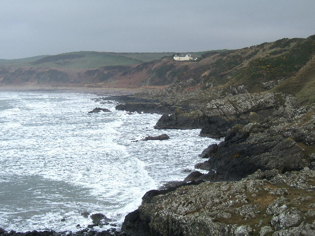
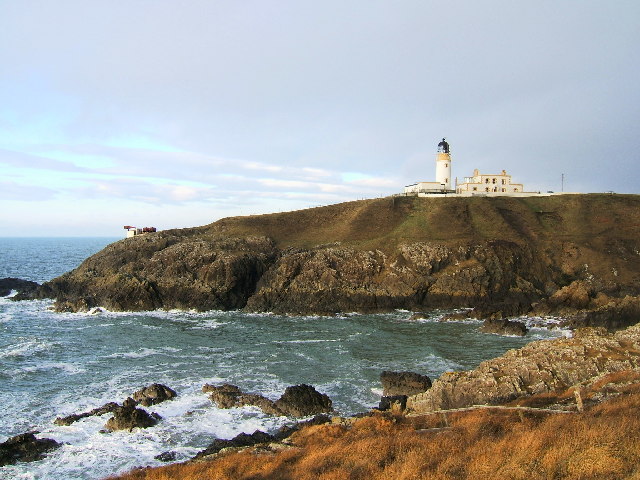
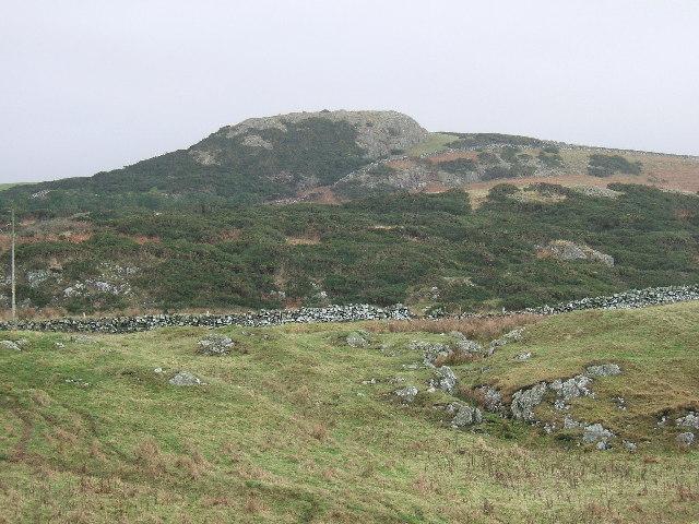
Bere Holm is a prominent headland located in Wigtownshire, Scotland. Situated along the coastline, it is a notable coastal feature that offers breathtaking views of the surrounding area. With its rugged cliffs and picturesque scenery, Bere Holm attracts both locals and tourists alike.

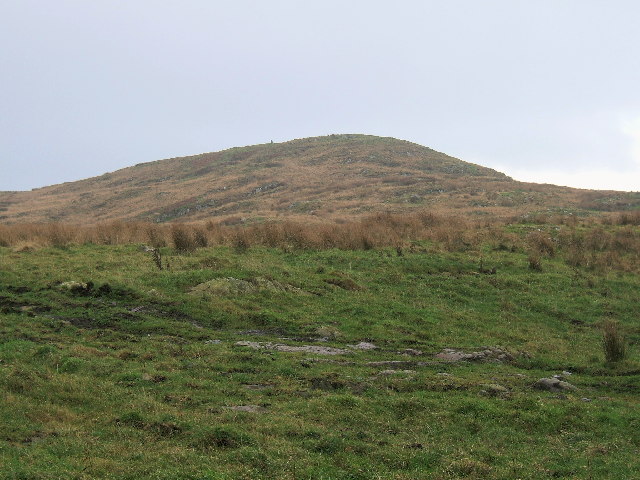
The headland is characterized by its rocky terrain and steep slopes, which provide a dramatic backdrop against the crashing waves of the sea. The cliffs are home to a diverse range of coastal vegetation, adding to the natural beauty of the area. Visitors can explore the numerous walking trails that wind their way along the coastline, providing opportunities for hiking and birdwatching.

Bere Holm is also known for its historical significance. The headland was once an important lookout point during times of war, offering a strategic vantage point for monitoring any approaching vessels. Today, remnants of these military installations can still be seen, serving as a reminder of the area's past.

In addition to its natural and historical features, Bere Holm is also a popular spot for fishing enthusiasts. The surrounding waters are abundant with various species of fish, making it an ideal location for angling.

Overall, Bere Holm is a captivating coastal feature that showcases the beauty and diversity of Wigtownshire. Its rugged cliffs, stunning views, and rich history make it a must-visit destination for anyone exploring the region.

If you have any feedback on the listing, please let us know in the comments section below.

Bere Holm Images

Images are sourced within 2km of 54.876593/-5.1492912 or Grid Reference NW9858. Thanks to Geograph Open Source API. All images are credited.

Lighthouse on Black Head, Wigtonshire Seen from the cliff top path of the Southern Upland Way from Portpatrick heading North.
Lighthouse on Black Head, Wigtonshire
Seen from the cliff top path of the Southern Upland Way from Portpatrick heading North.
Killantringan Bay, Wigtonshire Seen from the Southern Upland Way heading North from Portpatrick.
Killantringan Bay, Wigtonshire
Seen from the Southern Upland Way heading North from Portpatrick.
Killantringan Fell near Portpatrick The small hill Killantringan Fell (464 feet) situated south of the Southern Upland Way road to Killantringan Lighthouse.
Killantringan Fell near Portpatrick
The small hill Killantringan Fell (464 feet) situated south of the Southern Upland Way road to Killantringan Lighthouse.
Killantringan Bay, Knock Bay and House of Knock, near Portpatrick In the foreground you see Killantringan Bay. The large white house on the cliff top is House of Knock and below it is Knock Bay. Basically, it is all the same bay, but split into two halves and with different names.
Killantringan Bay, Knock Bay and House of Knock, near Portpatrick
In the foreground you see Killantringan Bay. The large white house on the cliff top is House of Knock and below it is Knock Bay. Basically, it is all the same bay, but split into two halves and with different names.
Killantringan Lighthouse and foghorn, Black Head near Portpatrick This photo is almost the same as the one already submitted, but taken on a stormy winter day. This photo also shows the foghorn. The bay in front of the lighthouse is called Portamaggie where a cargo ship named "Craiganlet" was grounded on rocks and shipwrecked in 1982. The remains can still be seen protruding from the sea.
Killantringan Lighthouse and foghorn, Black Head near Portpatrick
This photo is almost the same as the one already submitted, but taken on a stormy winter day. This photo also shows the foghorn. The bay in front of the lighthouse is called Portamaggie where a cargo ship named "Craiganlet" was grounded on rocks and shipwrecked in 1982. The remains can still be seen protruding from the sea.
Craig Anthony (90 metres) near Killantringan lighthouse. A steep rocky crag named Craig Anthony near Killantringan lighthouse, South West Scotland.
Craig Anthony (90 metres) near Killantringan lighthouse.
A steep rocky crag named Craig Anthony near Killantringan lighthouse, South West Scotland.
Portslogan, North Rhins On the B738
Portslogan, North Rhins
On the B738
House at Knock, North Rhins On the B738. There are a number of windfarms in the area, but there is no suggestion that the windmill in this garden is generating any electricity!
House at Knock, North Rhins
On the B738. There are a number of windfarms in the area, but there is no suggestion that the windmill in this garden is generating any electricity!
Standing stone at Knock and Maize One of many megaliths in Wigtownshire. For more photos see <span class="nowrap"><a title="http://www.megalithic.co.uk/article.php?sid=6575" rel="nofollow ugc noopener" href="http://www.megalithic.co.uk/article.php?sid=6575">Link</a><img style="margin-left:2px;" alt="External link" title="External link - shift click to open in new window" src="https://s1.geograph.org.uk/img/external.png" width="10" height="10"/></span>
Standing stone at Knock and Maize
One of many megaliths in Wigtownshire. For more photos see LinkExternal link
Field at Knock and Maize
Killantringan Lighthouse, near Portpatrick Fantastic views, especially over to Ireland and the Mountains of Mourne. The lightkeepers cottage is available as holiday cottage.
Killantringan Lighthouse, near Portpatrick
Fantastic views, especially over to Ireland and the Mountains of Mourne. The lightkeepers cottage is available as holiday cottage.
Beach Lodge, Labrax Bay This is a Victorian Hunting lodge which belonged to the nearby Lochnaw Castle. It is surrounded on 3 sides by hills and yet, immediately behind the photographer's position , is the beach. It is now a holiday cottage.
Beach Lodge, Labrax Bay
This is a Victorian Hunting lodge which belonged to the nearby Lochnaw Castle. It is surrounded on 3 sides by hills and yet, immediately behind the photographer's position , is the beach. It is now a holiday cottage.
Site of hill fort, Broadsea Bay This Iron Age hill fort site lies to the right of the hills surrounding Beach Lodge which can just be seen behind some rocks.
Site of hill fort, Broadsea Bay
This Iron Age hill fort site lies to the right of the hills surrounding Beach Lodge which can just be seen behind some rocks.
Cliff path, Black Head This is on a clifftop walk below Killantringan lighthouse, looking down into Portamaggie. The shipwreck is that of the Craigantlet who went aground on 26.2.1982. She was sailing from Belfast to Liverpool and managed to wreck herself NORTH of her starting point - -she should have sailed south! The wreck is still visible today, over 20 years later.
Cliff path, Black Head
This is on a clifftop walk below Killantringan lighthouse, looking down into Portamaggie. The shipwreck is that of the Craigantlet who went aground on 26.2.1982. She was sailing from Belfast to Liverpool and managed to wreck herself NORTH of her starting point - -she should have sailed south! The wreck is still visible today, over 20 years later.
Fog horn The fog horn at Killantringan lighthouse.
Fog horn
The fog horn at Killantringan lighthouse.
Knock Bay from the North End at High Tide
Walkers on the Southern Upland Way The Southern Upland Way 
<span class="nowrap"><a title="http://www.dumgal.gov.uk/dumgal/miniweb.aspx?id=137" rel="nofollow ugc noopener" href="http://www.dumgal.gov.uk/dumgal/miniweb.aspx?id=137">Link</a><img style="margin-left:2px;" alt="External link" title="External link - shift click to open in new window" src="https://s1.geograph.org.uk/img/external.png" width="10" height="10"/></span> is one of Scotland's official long distance paths and runs for 340 km from Portpatrick in the west to Cockburnspath in the east. Here seen near the western end on the road to Black Head. The walkers are walking east to west in the opposite direction to normal.
Walkers on the Southern Upland Way
The Southern Upland Way LinkExternal link is one of Scotland's official long distance paths and runs for 340 km from Portpatrick in the west to Cockburnspath in the east. Here seen near the western end on the road to Black Head. The walkers are walking east to west in the opposite direction to normal.
Glaik Farm & Core Hill of Glaik This shot was taken from Glenstockadale looking towards Glaik Farm on the left of the shot and Core Hill of Glaik.
Glaik Farm & Core Hill of Glaik
This shot was taken from Glenstockadale looking towards Glaik Farm on the left of the shot and Core Hill of Glaik.
Show me another place!

Bere Holm is located at Grid Ref: NW9858 (Lat: 54.876593, Lng: -5.1492912)

Unitary Authority: Dumfries and Galloway

Police Authority: Dumfries and Galloway

What 3 Words

///unlocking.acre.eternity. Near Stranraer, Dumfries & Galloway

Related Wikis

Killantringan Lighthouse

Killantringan Lighthouse is a lighthouse located near Portpatrick in Dumfries and Galloway, south-west Scotland. The light came into operation in 1900...

MV Craigantlet

MV Craigantlet was a German-owned, Cyprus-registered container ship operated on time-charter by Cawoods Containers Ltd of Belfast. She ran aground on 26...

Portpatrick

Portpatrick is a village and civil parish in the historical county of Wigtownshire, Dumfries and Galloway, Scotland. It is located on the west coast of...

Portpatrick railway station

Portpatrick railway station was a railway station serving the village of Portpatrick, Dumfries & Galloway, Scotland. Opened in 1862 the station served...

Related Videos

KILLANTRINGAN SNIPPETS

Hello Jamie here and with another video. After Castle Kennedy and Leswalt, I thought that would be it, but we went to Killintringan, ...

OFF GRID - WILD CAMPING at Killantringan Lighthouse - DJI Mavic PRO

During our UK 2023 Tour, we managed to find some spectacular places to stay OFF GRID which allowed us to WILD CAMP.

Dunskey Estate Wedding Film || It Is Done || Chris : Todd

Follow us on Social Instagram : https://cmfilm.co.uk/ig Website : https://cmfilm.co.uk/cinematefilms Facebook ...

Have you been to Bere Holm?

Leave your review of Bere Holm below (or comments, questions and feedback).