Black Rock

Coastal Feature, Headland, Point in Cornwall

England

Black Rock

Gell Point
Gell Point Credit: don cload

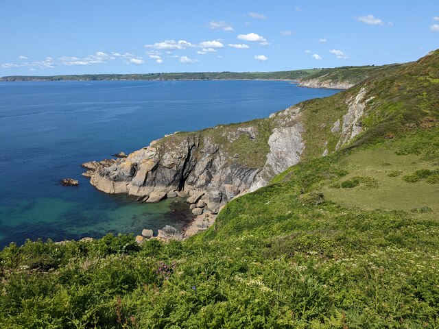
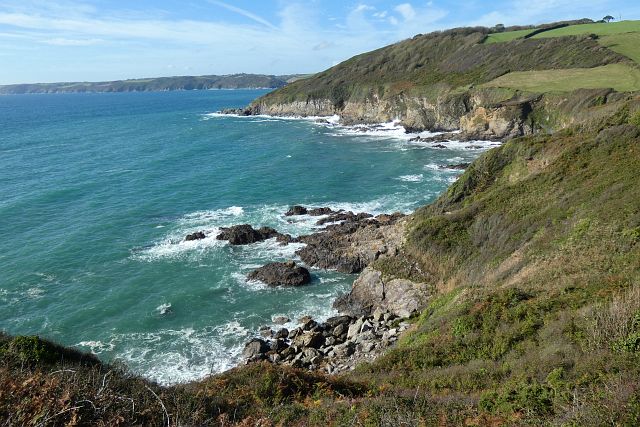
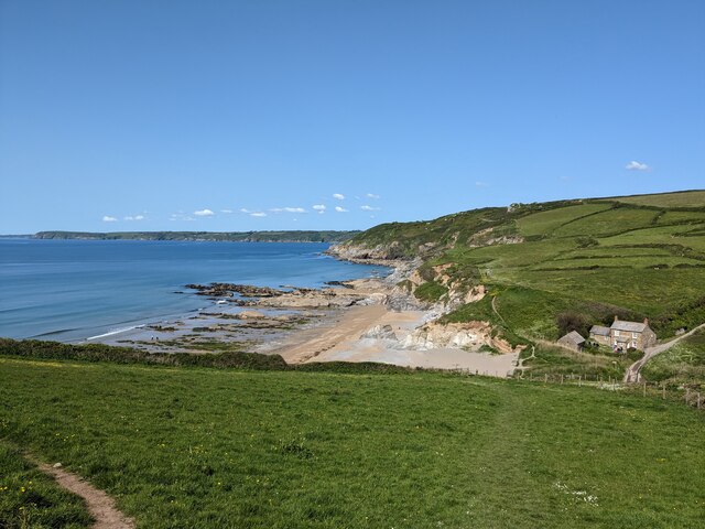
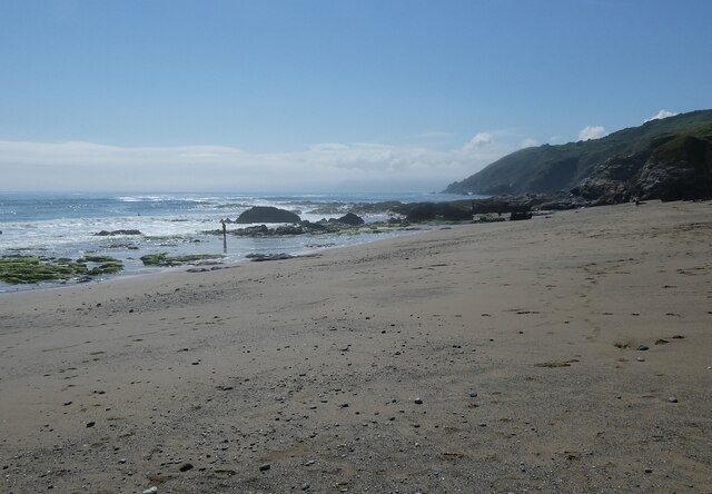
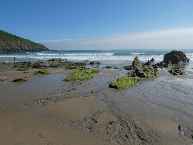
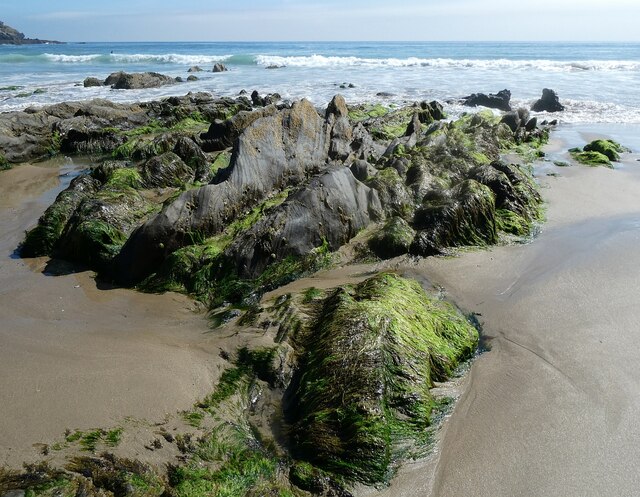
Black Rock is a prominent coastal feature located in Cornwall, England. Situated on the rugged southwestern coast of the county, it is a captivating headland that juts out into the Atlantic Ocean. The area is known for its dramatic cliffs, rocky shorelines, and picturesque views.

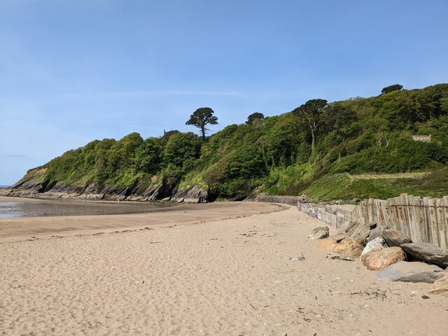
Black Rock is characterized by its towering cliffs that rise steeply from the sea, providing a stunning backdrop to the surrounding landscape. These cliffs are primarily composed of dark, weathered rocks, lending the headland its name. The area is rich in geological diversity, with layers of slate, granite, and other sedimentary formations visible along its coastline.

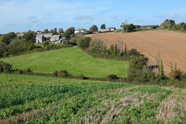
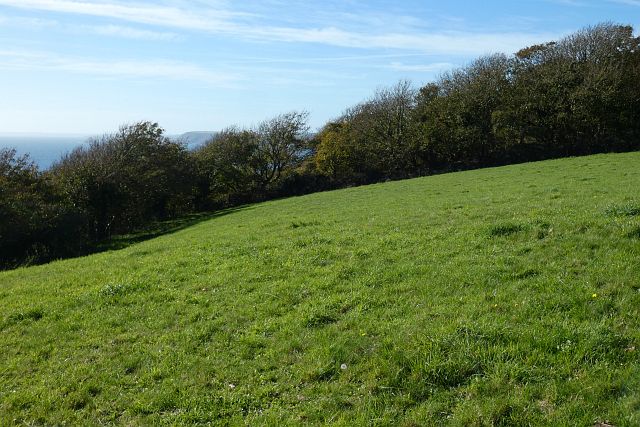
The headland offers visitors a wealth of natural beauty and outdoor recreational opportunities. Hikers and nature enthusiasts are drawn to the area for its scenic coastal paths, which provide stunning vistas of the ocean and the surrounding countryside. The rugged terrain and crashing waves create a sense of wildness and tranquility that is unparalleled.

Black Rock also serves as a vital habitat for a variety of plant and animal species. The cliffs provide nesting sites for seabirds such as gulls, cormorants, and fulmars. In addition, the rocky shores and pools are home to a diverse array of marine life, including sea anemones, crabs, and small fish.

Due to its striking beauty and ecological importance, Black Rock is a popular destination for tourists and locals alike. Whether it be for a leisurely stroll along the cliffs, birdwatching, or simply enjoying the breathtaking views, the headland offers a captivating and memorable experience for all who visit.

If you have any feedback on the listing, please let us know in the comments section below.

Black Rock Images

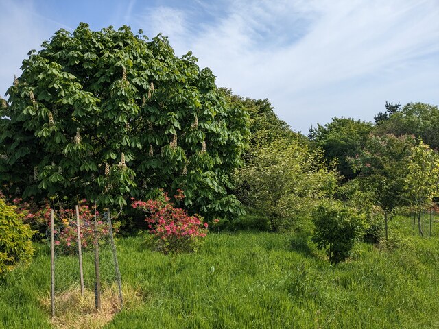
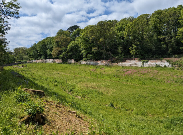
Images are sourced within 2km of 50.232005/-4.8375723 or Grid Reference SW9740. Thanks to Geograph Open Source API. All images are credited.

Gell Point
Gell Point
Gell Point One of several jagged headlands and line of rocks that align south-southwest on the west side of Dodman Point. Seen from the South West Coast Path.
Gell Point
One of several jagged headlands and line of rocks that align south-southwest on the west side of Dodman Point. Seen from the South West Coast Path.
Farmland, St Goran The hamlet of Rescassa is seen from the footpath north of Treveor.
Farmland, St Goran
The hamlet of Rescassa is seen from the footpath north of Treveor.
Pasture and woodland, St Goran The coast path follows the edge of the field before entering the wood and descending steeply to Porthluney Cove.
Pasture and woodland, St Goran
The coast path follows the edge of the field before entering the wood and descending steeply to Porthluney Cove.
Coastline, St Goran Looking across Lambsowden Cove from the coast path above Greeb Point.
Coastline, St Goran
Looking across Lambsowden Cove from the coast path above Greeb Point.
Boswinger Methodist Church
St Michael's Church
St Michael's Church
Former East Portholland Wesleyan Methodist Chapel
Former Bible Christian chapel
Hemmick Beach
Hemmick Beach
Porthluney Cove
Porthluney Cove
The Upper Garden at Caerhays
The Kitchen Walled Garden
Hemmick Beach - western end Looking across the sand and occasional shingle of Hemmick Beach to the rocks meeting the sea at its western end.
Cf. <a href="https://www.geograph.org.uk/photo/7511603">SW9940 : Hemmick Beach - eastern end</a>
See also 
<a href="https://www.geograph.org.uk/photo/7511732">SW9940 : Hemmick Beach - Seaweed-covered rocks</a>
<a href="https://www.geograph.org.uk/photo/7511733">SW9940 : Hemmick Beach - Rocks at the water's edge</a>
Hemmick Beach information: <span class="nowrap"><a title="http://www.cornwallbeaches.org.uk/South-Coast-Central-Cornwall/Hemmick-Percunning-Cove.pdf" rel="nofollow ugc noopener" href="http://www.cornwallbeaches.org.uk/South-Coast-Central-Cornwall/Hemmick-Percunning-Cove.pdf">Link</a><img style="margin-left:2px;" alt="External link" title="External link - shift click to open in new window" src="https://s1.geograph.org.uk/img/external.png" width="10" height="10"/></span>
Hemmick Beach - western end
Looking across the sand and occasional shingle of Hemmick Beach to the rocks meeting the sea at its western end. Cf. SW9940 : Hemmick Beach - eastern end See also SW9940 : Hemmick Beach - Seaweed-covered rocks SW9940 : Hemmick Beach - Rocks at the water's edge Hemmick Beach information: LinkExternal link
Hemmick Beach - eastern end The sands of Hemmick Beach meet the sea with numerous clumps of seaweed-covered rocks. Cf. <a href="https://www.geograph.org.uk/photo/7511593">SW9940 : Hemmick Beach - western end</a>
See also 
<a href="https://www.geograph.org.uk/photo/7511732">SW9940 : Hemmick Beach - Seaweed-covered rocks</a>
<a href="https://www.geograph.org.uk/photo/7511733">SW9940 : Hemmick Beach - Rocks at the water's edge</a>
Hemmick Beach information: <span class="nowrap"><a title="http://www.cornwallbeaches.org.uk/South-Coast-Central-Cornwall/Hemmick-Percunning-Cove.pdf" rel="nofollow ugc noopener" href="http://www.cornwallbeaches.org.uk/South-Coast-Central-Cornwall/Hemmick-Percunning-Cove.pdf">Link</a><img style="margin-left:2px;" alt="External link" title="External link - shift click to open in new window" src="https://s1.geograph.org.uk/img/external.png" width="10" height="10"/></span>
Hemmick Beach - eastern end
The sands of Hemmick Beach meet the sea with numerous clumps of seaweed-covered rocks. Cf. SW9940 : Hemmick Beach - western end See also SW9940 : Hemmick Beach - Seaweed-covered rocks SW9940 : Hemmick Beach - Rocks at the water's edge Hemmick Beach information: LinkExternal link
Hemmick Beach - Seaweed-covered rocks The rocks at the water's edge, which will be inundated at high tide, have a luxuriant coating of seaweed.
See also <a href="https://www.geograph.org.uk/photo/7511733">SW9940 : Hemmick Beach - Rocks at the water's edge</a>
Hemmick Beach information: <span class="nowrap"><a title="http://www.cornwallbeaches.org.uk/South-Coast-Central-Cornwall/Hemmick-Percunning-Cove.pdf" rel="nofollow ugc noopener" href="http://www.cornwallbeaches.org.uk/South-Coast-Central-Cornwall/Hemmick-Percunning-Cove.pdf">Link</a><img style="margin-left:2px;" alt="External link" title="External link - shift click to open in new window" src="https://s1.geograph.org.uk/img/external.png" width="10" height="10"/></span>
Hemmick Beach - Seaweed-covered rocks
The rocks at the water's edge, which will be inundated at high tide, have a luxuriant coating of seaweed. See also SW9940 : Hemmick Beach - Rocks at the water's edge Hemmick Beach information: LinkExternal link
Hemmick Beach - Rocks at the water's edge Looking inland from the sea's edge on Hemmick Beach. These seaweed covered, slippery rocks will be covered at high tide.
See also <a href="https://www.geograph.org.uk/photo/7511732">SW9940 : Hemmick Beach - Seaweed-covered rocks</a>
Hemmick Beach information: <span class="nowrap"><a title="http://www.cornwallbeaches.org.uk/South-Coast-Central-Cornwall/Hemmick-Percunning-Cove.pdf" rel="nofollow ugc noopener" href="http://www.cornwallbeaches.org.uk/South-Coast-Central-Cornwall/Hemmick-Percunning-Cove.pdf">Link</a><img style="margin-left:2px;" alt="External link" title="External link - shift click to open in new window" src="https://s1.geograph.org.uk/img/external.png" width="10" height="10"/></span>
Hemmick Beach - Rocks at the water's edge
Looking inland from the sea's edge on Hemmick Beach. These seaweed covered, slippery rocks will be covered at high tide. See also SW9940 : Hemmick Beach - Seaweed-covered rocks Hemmick Beach information: LinkExternal link
Porthluney Cove A panoramic view of Porthluney Cove immediately to the south of Caerhays Castle.
Write-up on Cornwallbeaches.org.uk <span class="nowrap"><a title="http://www.cornwallbeaches.org.uk/South-Coast-Central-Cornwall/Porthluney-Cove.pdf" rel="nofollow ugc noopener" href="http://www.cornwallbeaches.org.uk/South-Coast-Central-Cornwall/Porthluney-Cove.pdf">Link</a><img style="margin-left:2px;" alt="External link" title="External link - shift click to open in new window" src="https://s1.geograph.org.uk/img/external.png" width="10" height="10"/></span>
Porthluney Cove
A panoramic view of Porthluney Cove immediately to the south of Caerhays Castle. Write-up on Cornwallbeaches.org.uk LinkExternal link
Show me another place!

Black Rock is located at Grid Ref: SW9740 (Lat: 50.232005, Lng: -4.8375723)

Unitary Authority: Cornwall

Police Authority: Devon and Cornwall

What 3 Words

///design.enjoyable.bulbs. Near Mevagissey, Cornwall

Related Wikis

Cuckoo Rock to Turbot Point

Cuckoo Rock to Turbot Point is a coastal Geological Conservation Review site and Site of Special Scientific Interest (SSSI) in Cornwall, England, UK, noted...

Boswinger

Boswinger is a village in south Cornwall, England, two miles south of Mevagissey (where the 2011 Census population is included). There is a youth hostel...

Hemmick Beach

Hemmick Beach is a west-facing beach on the south coast of Cornwall, England. It is situated at the east end of Veryan Bay, on the west side of the Dodman...

Rescassa

Rescassa is a hamlet near Mevagissey in Cornwall, England. == References ==

Nearby Amenities

Located within 500m of 50.232005,-4.8375723
Source: PGS
Lat/Long: 50.2348864/-4.8400538
Source: PGS
Lat/Long: 50.2349245/-4.840458
Source: PGS
Lat/Long: 50.2350501/-4.8410309
Source: PGS
Lat/Long: 50.2351814/-4.8406701
Source: PGS
Lat/Long: 50.2343201/-4.8397564
Source: PGS
Lat/Long: 50.2322127/-4.8368197
Source: PGS
Lat/Long: 50.2323356/-4.8365149
Source: PGS
Lat/Long: 50.2324359/-4.8362735
Source: PGS
Lat/Long: 50.2324573/-4.8361006
Source: PGS
Lat/Long: 50.2325719/-4.8359516
Source: PGS
Lat/Long: 50.2330041/-4.8324012
Source: PGS
Lat/Long: 50.2332113/-4.8323092
Source: PGS
Lat/Long: 50.2328223/-4.8321433
Source: PGS
Lat/Long: 50.2326276/-4.8319336
Source: PGS
Lat/Long: 50.231796/-4.8306824
Source: PGS
Lat/Long: 50.2311192/-4.8308102
Barrier: kissing_gate
Lat/Long: 50.2340313/-4.8336943
Bench
Backrest: yes
Check Date: 2023-03-26
Lat/Long: 50.2351154/-4.8389592
Barrier: stile
Foot: yes
Step Count: 1
Stile: stepover
Wheelchair: no
Lat/Long: 50.2335966/-4.8322302
Barrier: kissing_gate
Foot: yes
Image: https://archive.org/details/porthluney-photos/Porthluney%20to%20Hemmick%20Beach%202020-08-26/DSCN1757.JPG
Wheelchair: no
Lat/Long: 50.2339193/-4.8328691
Barrier: kissing_gate
Foot: yes
Image: https://archive.org/details/porthluney-photos/Porthluney%20to%20Hemmick%20Beach%202020-08-26/DSCN1754.JPG
Lat/Long: 50.2338821/-4.8343203
Barrier: kissing_gate
Foot: yes
Image: https://archive.org/details/porthluney-photos/Porthluney%20to%20Hemmick%20Beach%202020-08-26/DSCN1747.JPG
Lat/Long: 50.2336794/-4.8366869
Barrier: kissing_gate
Foot: yes
Image: https://archive.org/details/porthluney-photos/Porthluney%20to%20Hemmick%20Beach%202020-08-26/DSCN1724.JPG
Wheelchair: no
Lat/Long: 50.2352643/-4.8388867
Image: https://archive.org/details/porthluney-photos/Porthluney%20to%20Hemmick%20Beach%202020-08-26/DSCN1719.JPG
Natural: stone
Lat/Long: 50.2355692/-4.8388056
The data included in this document is from www.openstreetmap.org. The data is made available under ODbL.

Have you been to Black Rock?

Leave your review of Black Rock below (or comments, questions and feedback).