An Cnapach

Coastal Feature, Headland, Point in Ross-shire

Scotland

An Cnapach

Am Fraoch-eilean in Loch Duich I believe you can walk to this islet at low tide.
Am Fraoch-eilean in Loch Duich Credit: Julian Paren

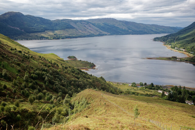
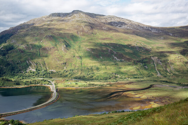
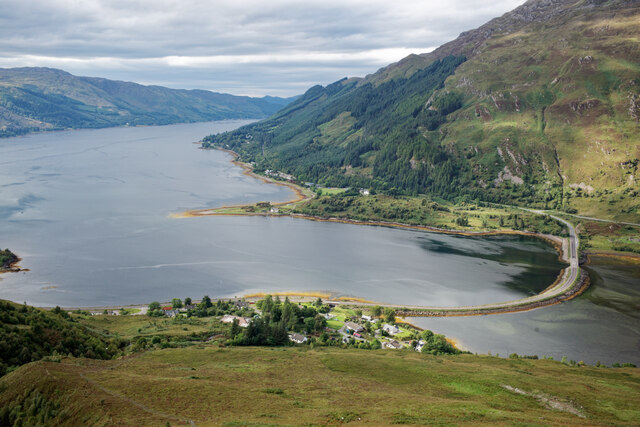
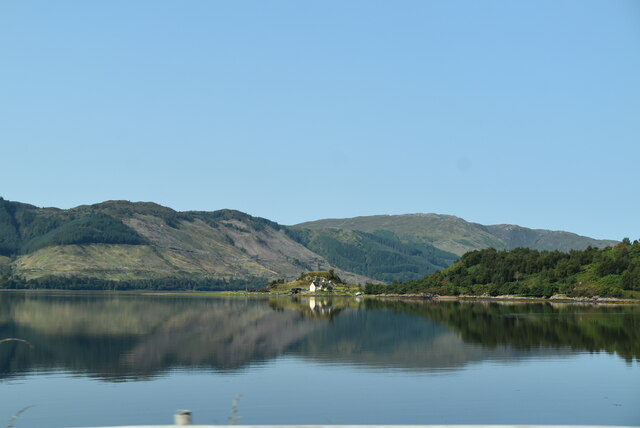
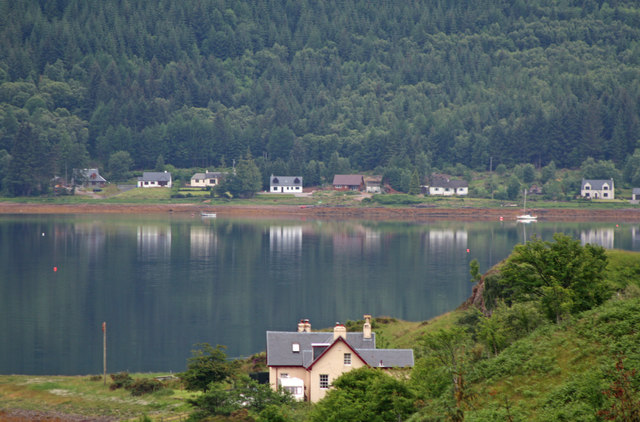
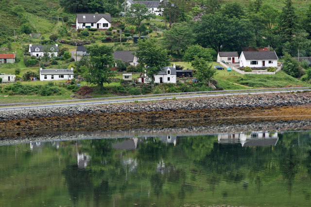
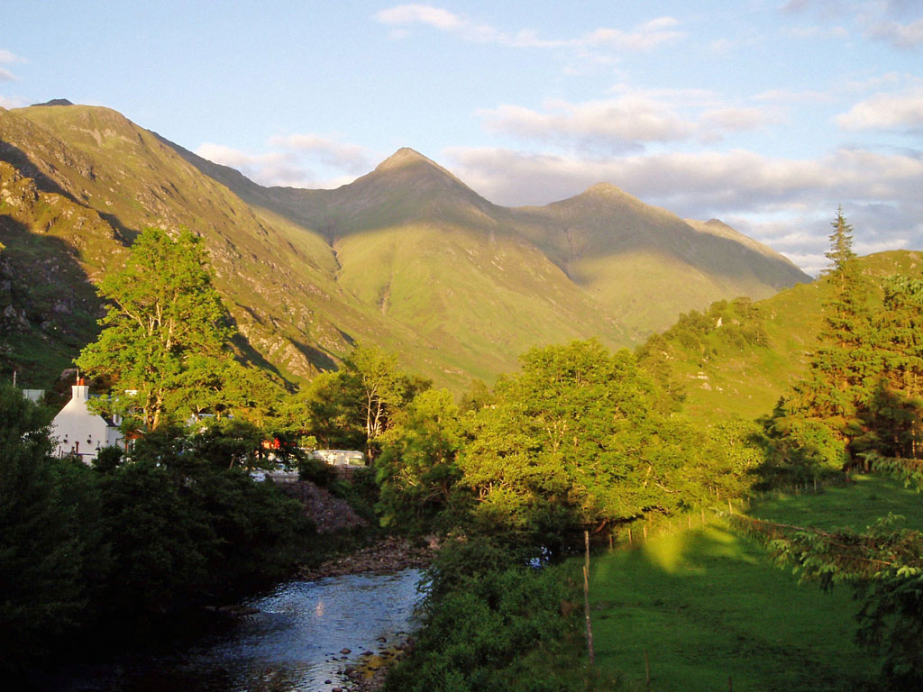
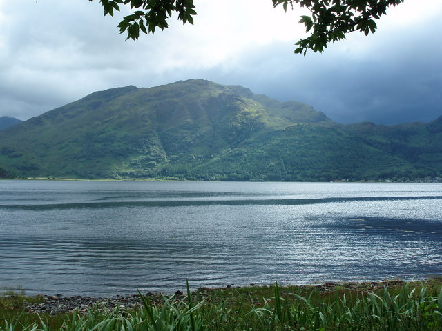
An Cnapach is a prominent headland located in Ross-shire, Scotland. Situated on the northern coast, it juts out into the North Sea, offering breathtaking views of the surrounding landscape. The name "An Cnapach" translates to "the knoll" in Gaelic, which aptly describes the distinct topography of this coastal feature.

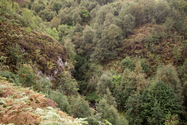
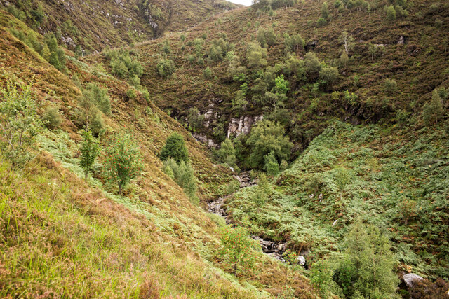
This headland is characterized by its rugged cliffs, which rise steeply from the sea, creating a dramatic and picturesque scenery. The cliffs are composed of sedimentary rocks, displaying layers of different colors and textures, hinting at the geological history of the area. The constant battering of the waves against the base of the cliffs has resulted in the formation of sea caves and natural arches, adding to the charm and intrigue of An Cnapach.

The headland is a haven for various bird species, including gulls, fulmars, and puffins. Their presence adds a lively element to the otherwise serene surroundings. Birdwatchers and nature enthusiasts are often drawn to An Cnapach to observe these fascinating creatures in their natural habitat.

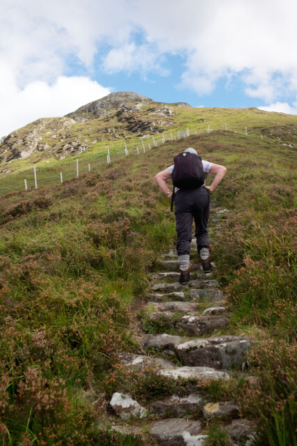
Visitors to An Cnapach can enjoy a multitude of outdoor activities, such as hiking along the cliff-top trails, taking in the panoramic views, and exploring the intricate rock formations. For those seeking a more adventurous experience, the headland offers opportunities for rock climbing and abseiling.

An Cnapach is a captivating coastal feature that showcases the beauty and diversity of Scotland's coastline. Its stunning landscapes, rich biodiversity, and recreational opportunities make it a must-visit destination for nature lovers and outdoor enthusiasts alike.

If you have any feedback on the listing, please let us know in the comments section below.

An Cnapach Images

Images are sourced within 2km of 57.216133/-5.4191508 or Grid Reference NG9319. Thanks to Geograph Open Source API. All images are credited.

Am Fraoch-eilean in Loch Duich I believe you can walk to this islet at low tide.
Am Fraoch-eilean in Loch Duich
I believe you can walk to this islet at low tide.
Bay by the A87 in Kintail Looking to the eastern limb of Loch Duich.
Bay by the A87 in Kintail
Looking to the eastern limb of Loch Duich.
The steep valley of the Allt a' Chruinn, Kintail A stalkers' path follows the valley to the Five Sisters ridge.
The steep valley of the Allt a' Chruinn, Kintail
A stalkers' path follows the valley to the Five Sisters ridge.
The steep valley of the Allt a' Chruinn, Kintail The burn cuts a sharp defile on the steep slope.
The steep valley of the Allt a' Chruinn, Kintail
The burn cuts a sharp defile on the steep slope.
Staircase of the NTS path beside the Allt a' Chruinn Much care has been spent creating this path which follows a different route to the current (2021) OS mapping.
Staircase of the NTS path beside the Allt a' Chruinn
Much care has been spent creating this path which follows a different route to the current (2021) OS mapping.
Loch Duich from the hill path leaving  Allt a' Chruinn The village of Allt a' Chruinn is visible below.
Loch Duich from the hill path leaving Allt a' Chruinn
The village of Allt a' Chruinn is visible below.
The head of Loch Duich As seen from the hill path leaving Allt a' Chruinn.
The head of Loch Duich
As seen from the hill path leaving Allt a' Chruinn.
The village of Allt a' Chruinn at the head of Loch Duich This is a view after a rather steep section of the hill path beside the Allt a' Chruinn. The causeway that shortens the original A87 is clearly visible at the head of Loch Duich.
The village of Allt a' Chruinn at the head of Loch Duich
This is a view after a rather steep section of the hill path beside the Allt a' Chruinn. The causeway that shortens the original A87 is clearly visible at the head of Loch Duich.
The A87 at  Ault a' Chruinn The village of Ault a'Chruinn is at the head of Loch Doich.
The A87 at Ault a' Chruinn
The village of Ault a'Chruinn is at the head of Loch Doich.
Ault a' Chruinn The village of Ault a'Chruinn is at the head of Loch Doich.
Ault a' Chruinn
The village of Ault a'Chruinn is at the head of Loch Doich.
Motorcyclists on the A87 Causeway near Ault a' Chruinn Crossing the causeway over the Croe estuary at the head of Loch Doich.
Motorcyclists on the A87 Causeway near Ault a' Chruinn
Crossing the causeway over the Croe estuary at the head of Loch Doich.
A87 at Inverinate
A87 at Inverinate
A87 near Allt a’ Chruinn
A87, Allt a' Chruinn The A87 runs 99 miles from Invergarry to Uig on the Isle of Skye <a href="https://www.geograph.org.uk/photo/7374675">NG3863 : End of the A87, Uig</a>.
<span class="nowrap"><a title="https://www.sabre-roads.org.uk/wiki/index.php?title=A87" rel="nofollow ugc noopener" href="https://www.sabre-roads.org.uk/wiki/index.php?title=A87">Link</a><img style="margin-left:2px;" alt="External link" title="External link - shift click to open in new window" src="https://s1.geograph.org.uk/img/external.png" width="10" height="10"/></span>
A87, Allt a' Chruinn
The A87 runs 99 miles from Invergarry to Uig on the Isle of Skye NG3863 : End of the A87, Uig. LinkExternal link
Loch Duich
Loch Duich
Jac-O-Bite Restaurant at Ault a' Chruinn
Tigh-a-mholain with Ratagan over Loch Duich from Macrae War Memorial
Allt a' Chruinn from Macrae War Memorial The name Ault-a-chrinn does not appear on the 1st edition 1874 OS map, although it is used in the 1861 census. Roy's survey of around 1750 does not record a township here and it seems that this may be a settlement that developed during the 19th century following the displacement of cottars and crofters when sheep farming was introduced.
Allt a' Chruinn from Macrae War Memorial
The name Ault-a-chrinn does not appear on the 1st edition 1874 OS map, although it is used in the 1861 census. Roy's survey of around 1750 does not record a township here and it seems that this may be a settlement that developed during the 19th century following the displacement of cottars and crofters when sheep farming was introduced.
Show me another place!

An Cnapach is located at Grid Ref: NG9319 (Lat: 57.216133, Lng: -5.4191508)

Unitary Authority: Highland

Police Authority: Highlands and Islands

What 3 Words

///layers.vacancies.crunchy. Near Glenelg, Highland

Nearby Locations

Invershiel An Cnapach

Related Wikis

Shiel Bridge

Shiel Bridge is a hamlet on the south east shore of Loch Duich at the foot of Glen Shiel, in the Lochalsh area of the Scottish Highlands. It is in the...

Glen Shiel

Glen Shiel (Scottish Gaelic: Gleann Seile; also known as Glenshiel) is a glen in the Northwest Highlands of Scotland. The glen runs approximately 9 miles...

Ratagan

Ratagan (Ràtagan in Scottish Gaelic) is a small hamlet on the southwestern shore of the sea loch, Loch Duich in Lochalsh, Scottish Highlands and is in...

Sgùrr Mhic Bharraich

Sgurr Mhic Bharraich (779 m) is a mountain in the Northwest Highlands, Scotland, at the head of Loch Duich in Ross-shire. The mountain is the last peak...

Nearby Amenities

Located within 500m of 57.216133,-5.4191508
Created By: Merkaartor 0.11
Lat/Long: 57.2127907/-5.4139154
Created By: Merkaartor 0.11
Lat/Long: 57.2128193/-5.4160765
Created By: Merkaartor 0.11
Lat/Long: 57.2128933/-5.4179868
Created By: Merkaartor 0.11
Lat/Long: 57.2136799/-5.4191978
Created By: Merkaartor 0.11
Lat/Long: 57.2138835/-5.4202382
Created By: Merkaartor 0.11
Lat/Long: 57.213902/-5.4212958
Created By: Merkaartor 0.11
Lat/Long: 57.2138373/-5.4223703
Created By: Merkaartor 0.11
Lat/Long: 57.2138666/-5.4242585
Created By: Merkaartor 0.11
Lat/Long: 57.2127174/-5.4172534
Post Box
Collection Times: Mo-Sa 13:45
Operator: Royal Mail
Operator Wikidata: Q638098
Post Box Type: lamp
Ref: IV40 18
Royal Cypher: scottish_crown
Source: survey
Lat/Long: 57.2143425/-5.4206443
Telephone
Booth: K6
Covered: booth
Source: survey
Lat/Long: 57.2143354/-5.4205967
Bus Stop
Junction
Bench: no
Bin: no
Direction: E
Lit: yes
Long Name: Shiel Bridge, opposite Junction
Naptan AtcoCode: 670086538
Naptan Bearing: SE
Naptan CommonName: Junction
Naptan Indicator: opp
Naptan Landmark: Shiel Bridge
Naptan NaptanCode: 45323785
Naptan Street: A87
Naptan Verified: no
Shelter: yes
Source: naptan_import
Tactile Paving: no
Lat/Long: 57.2142797/-5.4203435
Bus Stop
Junction
Bench: no
Bin: no
Lit: no
Local Ref: AT
Naptan AtcoCode: 670086538A
Naptan Bearing: NW
Naptan CommonName: Junction
Naptan Indicator: at
Naptan Landmark: Shiel Bridge
Naptan NaptanCode: 45324682
Naptan Street: A87
Naptan Verified: no
Shelter: yes
Source: naptan_import
Tactile Paving: no
Lat/Long: 57.2141243/-5.4201212
Cafe
The Wee Bun House
Phone: +44 1599 511275
Website: https://kintaillodgehotel.co.uk/wee-bun-house/
Lat/Long: 57.2201999/-5.4175244
Shiel Bridge
Name Gd: Drochaid Sheile
Place: hamlet
Wikidata: Q2672608
Wikipedia: en:Shiel Bridge
Lat/Long: 57.2132875/-5.4195561
Bus Stop
Shiel Bridge
Bench: no
Bin: no
Lit: no
Shelter: no
Tactile Paving: no
Lat/Long: 57.2141943/-5.4205298
Cill Fhearchair
Archaeological Site: megalith
Heritage: yes
Historic: archaeological_site
Wikidata: Q56661398
Lat/Long: 57.2133286/-5.4151239
Power: pole
Lat/Long: 57.2140258/-5.4245449
Power: pole
Lat/Long: 57.2131665/-5.4252233
Power: pole
Lat/Long: 57.2199409/-5.4163661
Power: pole
Lat/Long: 57.2190253/-5.4171825
Power: pole
Lat/Long: 57.2180612/-5.4177712
Power: pole
Lat/Long: 57.2186817/-5.417604
Power: pole
Lat/Long: 57.2190122/-5.4174005
Power: pole
Lat/Long: 57.2193624/-5.4171825
Power: pole
Lat/Long: 57.2197874/-5.4168991
Power: pole
Lat/Long: 57.2199579/-5.4167852
Power: pole
Lat/Long: 57.2176598/-5.4180789
Power: pole
Lat/Long: 57.2142331/-5.4232343
Power: pole
Lat/Long: 57.2144141/-5.4244069
Power: pole
Lat/Long: 57.2150569/-5.4247654
Power: pole
Lat/Long: 57.2157679/-5.4251845
Power: pole
Lat/Long: 57.2163071/-5.4238085
Power: pole
Lat/Long: 57.2167045/-5.4227837
Power: pole
Lat/Long: 57.2170928/-5.4218073
Material: wood
Power: pole
Lat/Long: 57.2175559/-5.4206009
Power: pole
Lat/Long: 57.2181343/-5.4191715
Power: pole
Lat/Long: 57.2140769/-5.4221271
The data included in this document is from www.openstreetmap.org. The data is made available under ODbL.

Have you been to An Cnapach?

Leave your review of An Cnapach below (or comments, questions and feedback).