Angle Point

Coastal Feature, Headland, Point in Pembrokeshire

Wales

Angle Point

Angle Point View from Angle Point looking east towards the Texaco refinery
Angle Point Credit: John Smitten

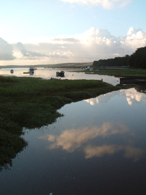
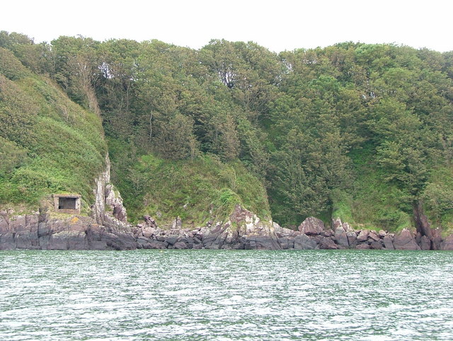
Angle Point is a prominent headland located in Pembrokeshire, Wales. Situated along the rugged coastline, this coastal feature offers stunning views of the surrounding cliffs, beaches, and sea. The point juts out into the Irish Sea, providing a strategic vantage point for observing marine life and maritime activity.

The geology of Angle Point is characterized by steep cliffs composed of sedimentary rocks, which have been shaped by centuries of erosion from the crashing waves of the sea. The headland is home to a variety of plant and animal species, including seabirds such as gulls and puffins.

Visitors to Angle Point can enjoy hiking along the coastal paths, taking in the breathtaking scenery and fresh sea air. The area is also popular for fishing and birdwatching, with opportunities to spot dolphins and seals in the waters below.

Overall, Angle Point is a picturesque and diverse coastal feature that offers a glimpse into the natural beauty and wildlife of Pembrokeshire. Its rugged charm and panoramic views make it a must-visit destination for nature lovers and outdoor enthusiasts.

If you have any feedback on the listing, please let us know in the comments section below.
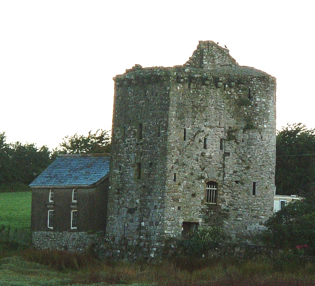
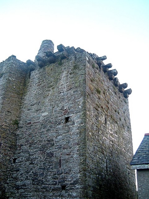
Angle Point Images

Images are sourced within 2km of 51.687433/-5.0750798 or Grid Reference SM8703. Thanks to Geograph Open Source API. All images are credited.

Angle Point View from Angle Point looking east towards the Texaco refinery
Angle Point
View from Angle Point looking east towards the Texaco refinery
Angle Bay An inlet of Angle Bay near the village of Angle.
Angle Bay
An inlet of Angle Bay near the village of Angle.
Jetty The jetty and pipelines at SM 874 052.
Jetty
The jetty and pipelines at SM 874 052.
Stack Rock Skerry occupied by a fort/gun emplacement defending Milford Haven. Completed in 1871 replacing an older emplacement built after the defeat of the original Napoleon.
Stack Rock
Skerry occupied by a fort/gun emplacement defending Milford Haven. Completed in 1871 replacing an older emplacement built after the defeat of the original Napoleon.
Former refinery pier, Milford Haven Pier that supplied the closed Exxon refinery. Much activity here now, including work on pipes. Unsure if demolition work or that the pier is now used by another enterprise. Stack Rock fort in the distance.
Former refinery pier, Milford Haven
Pier that supplied the closed Exxon refinery. Much activity here now, including work on pipes. Unsure if demolition work or that the pier is now used by another enterprise. Stack Rock fort in the distance.
Pier, Exxon refinery The refinery has closed and been dismantled, only two Milford Haven refineries remain. There is a lot of activity on the pier, possibly demolition work. If so, this square could soon be "all at sea" again.
Pier, Exxon refinery
The refinery has closed and been dismantled, only two Milford Haven refineries remain. There is a lot of activity on the pier, possibly demolition work. If so, this square could soon be "all at sea" again.
Old refinery pier Pipe sections on the old Exxon refinery pier. There is a lot of work going on here, floating cranes, hard hats swarming over the remains of the loading pier. Not sure if it's being demolished, or used for another purpose.  My guess is that these sections are awaiting offloading.
Milford Haven is a very fine deepwater harbour, hence the oil industry. A pier like this could find new uses, but as there is nearly 3km of it, upkeep could be a problem without the backing of "Big Oil".
Old refinery pier
Pipe sections on the old Exxon refinery pier. There is a lot of work going on here, floating cranes, hard hats swarming over the remains of the loading pier. Not sure if it's being demolished, or used for another purpose. My guess is that these sections are awaiting offloading. Milford Haven is a very fine deepwater harbour, hence the oil industry. A pier like this could find new uses, but as there is nearly 3km of it, upkeep could be a problem without the backing of "Big Oil".
Tanker, Popton point Smallish tanker, probably loading with refined products from the Texaco refinery
Tanker, Popton point
Smallish tanker, probably loading with refined products from the Texaco refinery
Oil jetty Loading/unloading for the Total refinery, Milford Haven
Oil jetty
Loading/unloading for the Total refinery, Milford Haven
Angle Church
Angle Church
Seals on rocks at Stackrock Fort Seals regularly bask here
Seals on rocks at Stackrock Fort
Seals regularly bask here
Floating cranes constructing LNG jetty Huge floating cranes constructing new jetty at the LNG (liquefied natural gas ) terminal.
Floating cranes constructing LNG jetty
Huge floating cranes constructing new jetty at the LNG (liquefied natural gas ) terminal.
RNLI Lifeboat house at Angle The present lifeboat here (may 2007) is an all weather "Tyne" class boat , "The Lady Rank"
RNLI Lifeboat house at Angle
The present lifeboat here (may 2007) is an all weather "Tyne" class boat , "The Lady Rank"
Old lifeboat house at Angle Situated just to the west of the new station
Old lifeboat house at Angle
Situated just to the west of the new station
Angle Lifeboat in Chapel Bay "The Lady Rank" Angle Tyne Class lifeboat on call 5th May 2007, in Chapel Bay having just been slipway launched .
Angle Lifeboat in Chapel Bay
"The Lady Rank" Angle Tyne Class lifeboat on call 5th May 2007, in Chapel Bay having just been slipway launched .
Ancient Tower, Angle This ancient tower is next to Castle Farm on a track to the rear of the village of Angle. It is a few years now since I visited it. It is (or at least was) open to the public and I was able to look around inside including climbing stairs to an upper floor and there are some informative plaques. Despite this I have been able to find nothing about it on the web.
The tower is just north of the gridline and the photo was taken from practically astride it by my estimation.
See also a close-up of the tower here <a href="https://www.geograph.org.uk/photo/478401">SM8603 : The Tower, Angle</a>
Ancient Tower, Angle
This ancient tower is next to Castle Farm on a track to the rear of the village of Angle. It is a few years now since I visited it. It is (or at least was) open to the public and I was able to look around inside including climbing stairs to an upper floor and there are some informative plaques. Despite this I have been able to find nothing about it on the web. The tower is just north of the gridline and the photo was taken from practically astride it by my estimation. See also a close-up of the tower here SM8603 : The Tower, Angle
The Tower, Angle A close-up picture of the <a href="https://www.geograph.org.uk/photo/478398">SM8603 : Ancient Tower, Angle</a>. The tower is on a track that runs roughly parallel and to the north of the main lane through the village of Angle. It is situated next to Castle Farm, though I think this structure was never more than a fortified house as opposed to a castle.
The Tower, Angle
A close-up picture of the SM8603 : Ancient Tower, Angle. The tower is on a track that runs roughly parallel and to the north of the main lane through the village of Angle. It is situated next to Castle Farm, though I think this structure was never more than a fortified house as opposed to a castle.
Chapel Bay Bay below Chapel Bay Fort with remains of WWII pillbox and landing jetty
Chapel Bay
Bay below Chapel Bay Fort with remains of WWII pillbox and landing jetty
Show me another place!

Angle Point is located at Grid Ref: SM8703 (Lat: 51.687433, Lng: -5.0750798)

Unitary Authority: Pembrokeshire

Police Authority: Dyfed Powys

What 3 Words

///brands.glance.went. Near Milford Haven, Pembrokeshire

Nearby Locations

Angle Point

Related Wikis

Angle Lifeboat Station

Angle Lifeboat Station, Angle, Pembrokeshire, Wales, first opened in 1868 after a request from the local Coastguard for a lifeboat station to be opened...

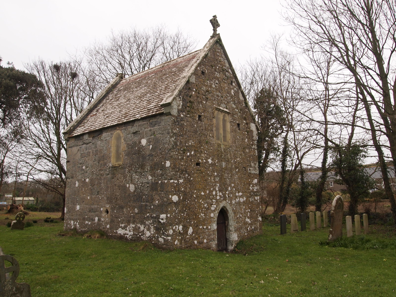
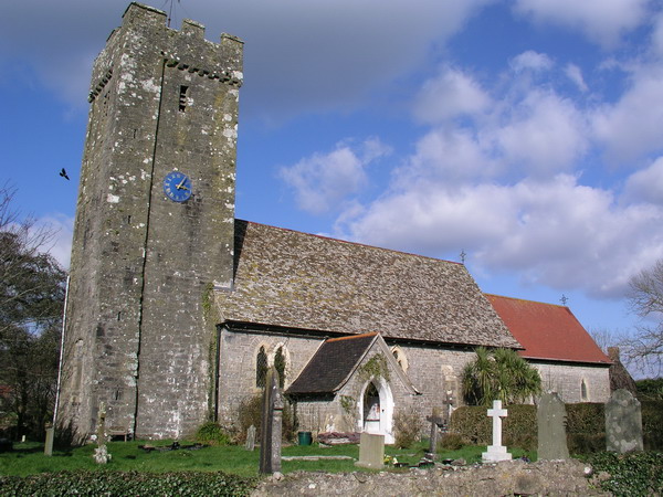
Sailors' Chapel, Angle

Sailors' Chapel, Seamen's Chapel or Fishermen's Chapel is a Grade I listed building in Angle, Pembrokeshire, Wales. The chapel, which is dedicated to St...

Angle, Pembrokeshire

Angle (Welsh: Angl) is a village, parish and community on the southern side of the entrance to the Milford Haven Waterway in Pembrokeshire, Wales. The...

Chapel Bay Fort

Chapel Bay Fort is located on the southern shore of the Milford Haven Waterway, Pembrokeshire, Wales. The fort is approximately 1 mile (1.6 km) from the...

Nearby Amenities

Located within 500m of 51.687433,-5.0750798
Angle Point
Place: locality
Lat/Long: 51.6875905/-5.0753155
The data included in this document is from www.openstreetmap.org. The data is made available under ODbL.

Have you been to Angle Point?

Leave your review of Angle Point below (or comments, questions and feedback).