An Leacach

Coastal Feature, Headland, Point in Ross-shire

Scotland

An Leacach

View toward Loch Thunaig
View toward Loch Thunaig Credit: N Chadwick

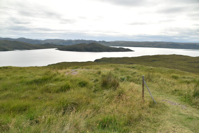
An Leacach is a prominent coastal feature located in Ross-shire, Scotland. It is a headland that juts out into the North Atlantic Ocean, creating a striking and dramatic point along the coastline. Situated near the village of Aultbea, An Leacach offers breathtaking views of the surrounding landscape and the vast expanse of the ocean.

The headland is characterized by its rugged cliffs, which reach heights of up to 150 meters in some areas. These sheer cliffs are composed of ancient rock formations, including sandstone and gneiss, showcasing the geological history of the region. Visitors to An Leacach can witness the powerful forces of erosion at work as the waves crash against the cliffs, shaping and reshaping the coastline over time.

An Leacach is also known for its diverse wildlife. The surrounding waters are home to a variety of marine species, including seals, dolphins, and various species of seabirds. Birdwatchers flock to the headland to catch glimpses of puffins, gannets, and guillemots, among others. The area is also a popular spot for fishing, attracting anglers in search of salmon and sea trout.

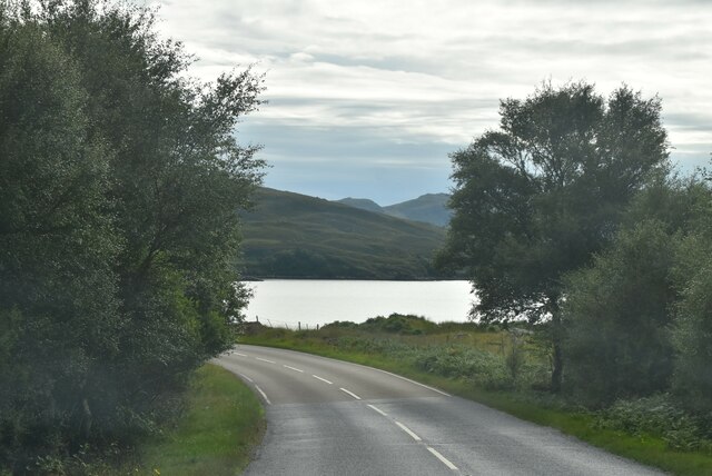
For those who enjoy outdoor activities, An Leacach offers opportunities for hiking and exploring. There are a number of trails that wind along the headland, providing stunning views and a chance to immerse oneself in the natural beauty of the Scottish coastline. The headland is easily accessible by road, with parking available near the village of Aultbea.

Overall, An Leacach is a captivating coastal feature that combines breathtaking landscapes, diverse wildlife, and outdoor recreation. It is a must-visit destination for nature enthusiasts and those seeking to experience the raw power and beauty of Scotland's coastal environments.

If you have any feedback on the listing, please let us know in the comments section below.

An Leacach Images

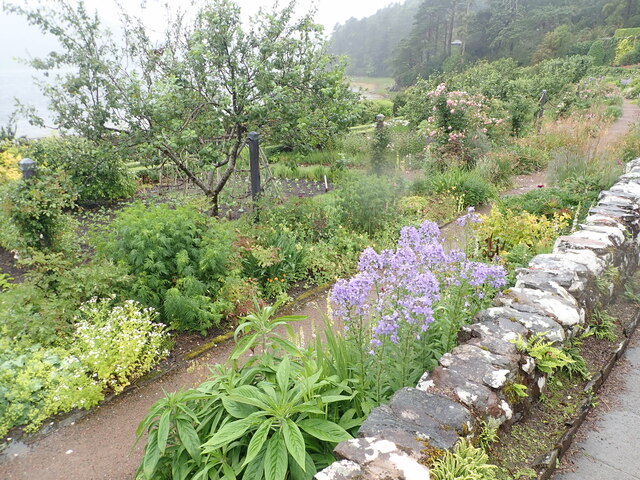
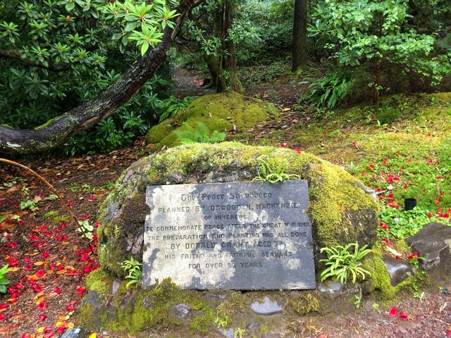
Images are sourced within 2km of 57.784923/-5.598151 or Grid Reference NG8682. Thanks to Geograph Open Source API. All images are credited.

View toward Loch Thunaig
Loch Thunaig
Loch Thunaig
A832 The A832 runs 127 miles from the Black Isle to Braemore Junction <a href="https://www.geograph.org.uk/photo/7232275">NH2077 : Braemore Junction</a>.
<span class="nowrap"><a title="https://www.sabre-roads.org.uk/wiki/index.php?title=A832" rel="nofollow ugc noopener" href="https://www.sabre-roads.org.uk/wiki/index.php?title=A832">Link</a><img style="margin-left:2px;" alt="External link" title="External link - shift click to open in new window" src="https://s1.geograph.org.uk/img/external.png" width="10" height="10"/></span>
A832
The A832 runs 127 miles from the Black Isle to Braemore Junction NH2077 : Braemore Junction. LinkExternal link
Entrance to Inverewe Gardens Inverewe is situated at a latitude of 57.8 degrees which is further north than Moscow and about the same as Hudson's Bay in Canada. However its situation on the west coast of Scotland with the influence of the Gulf Stream is such that extremes of temperature are rare.

It was created in the late 19th century by Osgood Mackenzie, the son of Sir Francis Mackenzie, laird of Gairloch. He established shelter belts of pines and a walled garden to give protection from the strong winds and salt spray.

It contains one of the finest collections in Scotland of temperate plants from both Northern and Southern hemispheres.

Now in the care of National Trust for Scotland, it attracts many thousands of visitors each year.

The information board at the entrance says:
"An oasis of exotic plantings in a wild and timeless landscape.

Inverewe Garden is a haven of tranquility on a rocky, windswept headland. First planted in the 1860s, this once barren landscape has grown into a unique and beautiful garden where plants from around the world thrive.

Inverewe Garden is an experience for all the senses. It is a fascinating and inspiring place to visit, in any season.

Take a walk around the sheltered Walled Garden on the shores of Loch Ewe – enjoy the brilliant borders and the views from the lawn of Inverewe House. A series of winding paths lead you into the woodland garden where native and exotic plants release alluring scents and provide explosions of colour. Viewpoints offer breathtaking vistas of the surrounding mountains."
Entrance to Inverewe Gardens
Inverewe is situated at a latitude of 57.8 degrees which is further north than Moscow and about the same as Hudson's Bay in Canada. However its situation on the west coast of Scotland with the influence of the Gulf Stream is such that extremes of temperature are rare. It was created in the late 19th century by Osgood Mackenzie, the son of Sir Francis Mackenzie, laird of Gairloch. He established shelter belts of pines and a walled garden to give protection from the strong winds and salt spray. It contains one of the finest collections in Scotland of temperate plants from both Northern and Southern hemispheres. Now in the care of National Trust for Scotland, it attracts many thousands of visitors each year. The information board at the entrance says: "An oasis of exotic plantings in a wild and timeless landscape. Inverewe Garden is a haven of tranquility on a rocky, windswept headland. First planted in the 1860s, this once barren landscape has grown into a unique and beautiful garden where plants from around the world thrive. Inverewe Garden is an experience for all the senses. It is a fascinating and inspiring place to visit, in any season. Take a walk around the sheltered Walled Garden on the shores of Loch Ewe – enjoy the brilliant borders and the views from the lawn of Inverewe House. A series of winding paths lead you into the woodland garden where native and exotic plants release alluring scents and provide explosions of colour. Viewpoints offer breathtaking vistas of the surrounding mountains."
A832 nearing Tournaig
Loch nan Dilthean
Loch nan Dilthean
Outcrops on Druim Lochan na Ba Caoile
Field at Inverewe Look closely and you will find a stag in it
Field at Inverewe
Look closely and you will find a stag in it
Loch Ewe Inverewe Gardens on the peninsula
Loch Ewe
Inverewe Gardens on the peninsula
National Trust gardens at Inverewe Well worth a visit even on a soaking wet day for the exotic plants which thrive here
National Trust gardens at Inverewe
Well worth a visit even on a soaking wet day for the exotic plants which thrive here
Walled garden at Inverewe
Roses in the walled garden at Inverewe  Inverewe is situated at a latitude of 57.8 degrees which is further north than Moscow and about the same as Hudson's Bay in Canada. However its situation on the west coast of Scotland with the influence of the Gulf Stream is such that extremes of temperature are rare.

It was created in the late 19th century by Osgood Mackenzie, the son of Sir Francis Mackenzie, laird of Gairloch. He established shelter belts of pines and a walled garden to give protection from the strong winds and salt spray.

It contains one of the finest collections in Scotland of temperate plants from both Northern and Southern hemispheres.

Now in the care of National Trust for Scotland, it attracts many thousands of visitors each year.

The information board at the entrance says:
"An oasis of exotic plantings in a wild and timeless landscape.

Inverewe Garden is a haven of tranquility on a rocky, windswept headland. First planted in the 1860s, this once barren landscape has grown into a unique and beautiful garden where plants from around the world thrive.

Inverewe Garden is an experience for all the senses. It is a fascinating and inspiring place to visit, in any season.

Take a walk around the sheltered Walled Garden on the shores of Loch Ewe – enjoy the brilliant borders and the views from the lawn of Inverewe House. A series of winding paths lead you into the woodland garden where native and exotic plants release alluring scents and provide explosions of colour. Viewpoints offer breathtaking vistas of the surrounding mountains."
Roses in the walled garden at Inverewe
Inverewe is situated at a latitude of 57.8 degrees which is further north than Moscow and about the same as Hudson's Bay in Canada. However its situation on the west coast of Scotland with the influence of the Gulf Stream is such that extremes of temperature are rare. It was created in the late 19th century by Osgood Mackenzie, the son of Sir Francis Mackenzie, laird of Gairloch. He established shelter belts of pines and a walled garden to give protection from the strong winds and salt spray. It contains one of the finest collections in Scotland of temperate plants from both Northern and Southern hemispheres. Now in the care of National Trust for Scotland, it attracts many thousands of visitors each year. The information board at the entrance says: "An oasis of exotic plantings in a wild and timeless landscape. Inverewe Garden is a haven of tranquility on a rocky, windswept headland. First planted in the 1860s, this once barren landscape has grown into a unique and beautiful garden where plants from around the world thrive. Inverewe Garden is an experience for all the senses. It is a fascinating and inspiring place to visit, in any season. Take a walk around the sheltered Walled Garden on the shores of Loch Ewe – enjoy the brilliant borders and the views from the lawn of Inverewe House. A series of winding paths lead you into the woodland garden where native and exotic plants release alluring scents and provide explosions of colour. Viewpoints offer breathtaking vistas of the surrounding mountains."
Overview of the formal gardens at Inverewe
Peace Shrubbery plaque The shrubbery was planned by Osgooth MacKenzie to commemorate peace after WW1. Donald Grant, aged 77, planted it
Peace Shrubbery plaque
The shrubbery was planned by Osgooth MacKenzie to commemorate peace after WW1. Donald Grant, aged 77, planted it
Mature trees in Inverewe woodland
Path in Inverewe woodland Inverewe is situated at a latitude of 57.8 degrees which is further north than Moscow and about the same as Hudson's Bay in Canada. However its situation on the west coast of Scotland with the influence of the Gulf Stream is such that extremes of temperature are rare.

It was created in the late 19th century by Osgood Mackenzie, the son of Sir Francis Mackenzie, laird of Gairloch. He established shelter belts of pines and a walled garden to give protection from the strong winds and salt spray.

It contains one of the finest collections in Scotland of temperate plants from both Northern and Southern hemispheres.

Now in the care of National Trust for Scotland, it attracts many thousands of visitors each year.

The information board at the entrance says:
"An oasis of exotic plantings in a wild and timeless landscape.

Inverewe Garden is a haven of tranquility on a rocky, windswept headland. First planted in the 1860s, this once barren landscape has grown into a unique and beautiful garden where plants from around the world thrive.

Inverewe Garden is an experience for all the senses. It is a fascinating and inspiring place to visit, in any season.

Take a walk around the sheltered Walled Garden on the shores of Loch Ewe – enjoy the brilliant borders and the views from the lawn of Inverewe House. A series of winding paths lead you into the woodland garden where native and exotic plants release alluring scents and provide explosions of colour. Viewpoints offer breathtaking vistas of the surrounding mountains."
Path in Inverewe woodland
Inverewe is situated at a latitude of 57.8 degrees which is further north than Moscow and about the same as Hudson's Bay in Canada. However its situation on the west coast of Scotland with the influence of the Gulf Stream is such that extremes of temperature are rare. It was created in the late 19th century by Osgood Mackenzie, the son of Sir Francis Mackenzie, laird of Gairloch. He established shelter belts of pines and a walled garden to give protection from the strong winds and salt spray. It contains one of the finest collections in Scotland of temperate plants from both Northern and Southern hemispheres. Now in the care of National Trust for Scotland, it attracts many thousands of visitors each year. The information board at the entrance says: "An oasis of exotic plantings in a wild and timeless landscape. Inverewe Garden is a haven of tranquility on a rocky, windswept headland. First planted in the 1860s, this once barren landscape has grown into a unique and beautiful garden where plants from around the world thrive. Inverewe Garden is an experience for all the senses. It is a fascinating and inspiring place to visit, in any season. Take a walk around the sheltered Walled Garden on the shores of Loch Ewe – enjoy the brilliant borders and the views from the lawn of Inverewe House. A series of winding paths lead you into the woodland garden where native and exotic plants release alluring scents and provide explosions of colour. Viewpoints offer breathtaking vistas of the surrounding mountains."
Show me another place!

An Leacach is located at Grid Ref: NG8682 (Lat: 57.784923, Lng: -5.598151)

Unitary Authority: Highland

Police Authority: Highlands and Islands

What 3 Words

///improve.disco.struts. Near Gairloch, Highland

Related Wikis

Inverewe Garden

Inverewe Garden (Scottish Gaelic: Gàradh Inbhir Iù) is a botanical garden in Wester Ross in the Scottish Highlands. It is located just to the north of...

Londubh

Londubh (Scottish Gaelic: An Lòn Dubh) is a village on the south shore of Loch Ewe in Poolewe, Ross-shire, Scottish Highlands and is in the Scottish council...

Tournaig

Tournaig is a remote scattered crofting and fishing hamlet, that sits on the confluence of the sea loch, Loch Thùrnaig to the west, and Loch Nan Dailthean...

Poolewe Stone

The Poolewe Stone is a Class-I Pictish stone discovered in 1992 in the cemetery at Poolewe (Poll Iùbh) in Wester Ross. The stone carries the common Pictish...

Nearby Amenities

Located within 500m of 57.784923,-5.598151
Source: PGS
Lat/Long: 57.7887155/-5.5945363
Created By: almien_coastlines
Source: PGS
Lat/Long: 57.787528/-5.594648
Source: PGS
Lat/Long: 57.7871519/-5.5958687
Created By: almien_coastlines
Source: PGS
Lat/Long: 57.787243/-5.596066
Source: PGS
Lat/Long: 57.7881029/-5.5964519
Source: PGS
Lat/Long: 57.7886579/-5.5970104
Source: PGS
Lat/Long: 57.788771/-5.5973554
Source: PGS
Lat/Long: 57.7883257/-5.5994697
Source: PGS
Lat/Long: 57.7881669/-5.5996182
Source: PGS
Lat/Long: 57.7880287/-5.5997559
Source: PGS
Lat/Long: 57.7879355/-5.6003233
Source: PGS
Lat/Long: 57.7879871/-5.6010172
Source: PGS
Lat/Long: 57.7878362/-5.6014962
Source: PGS
Lat/Long: 57.7874731/-5.6027079
Source: PGS
Lat/Long: 57.7873016/-5.6033748
Created By: almien_coastlines
Source: PGS
Lat/Long: 57.787204/-5.604215
Created By: almien_coastlines
Source: PGS
Lat/Long: 57.787066/-5.604685
Òb na Bà Ruaidhe
Natural: bay
Lat/Long: 57.7883187/-5.6028517
The data included in this document is from www.openstreetmap.org. The data is made available under ODbL.

Have you been to An Leacach?

Leave your review of An Leacach below (or comments, questions and feedback).