Leacan Bàna

Coastal Feature, Headland, Point in Ross-shire

Scotland

Leacan Bàna

Lochan Dubh Lovely little Lochan Dubh on the very rough path between Diabaig and Alligin Shuas. Little peak in centre is unnamed on maps while to the right is Ben Shieldaig.
Lochan Dubh Credit: Adam Ward

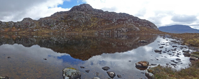
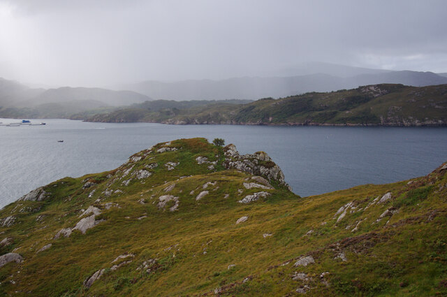
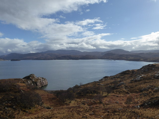
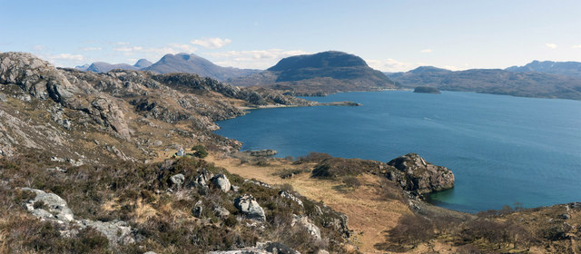
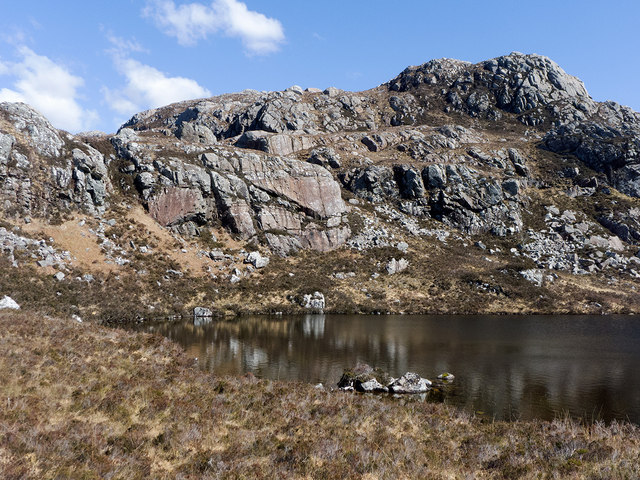
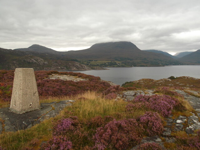
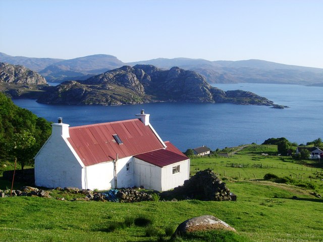
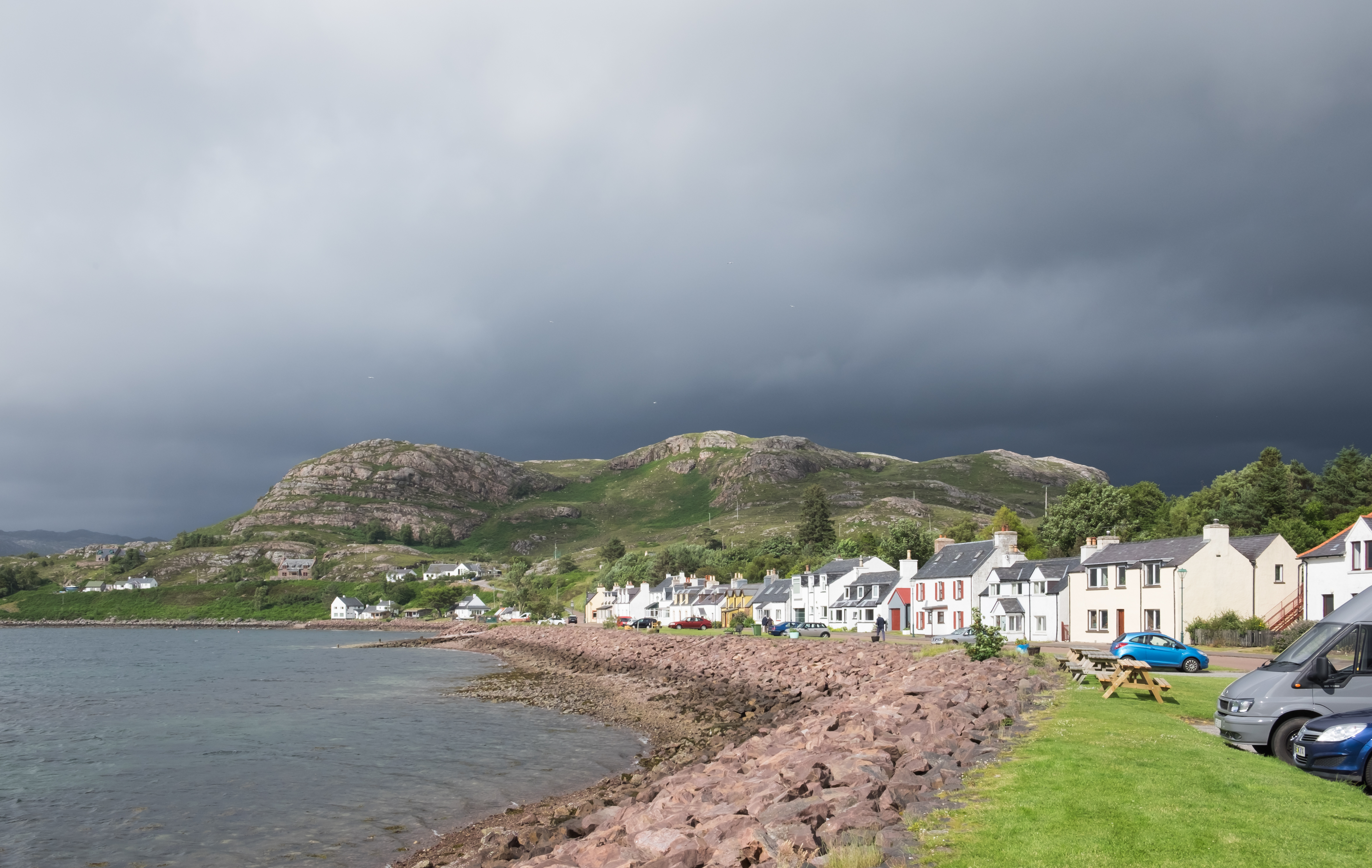
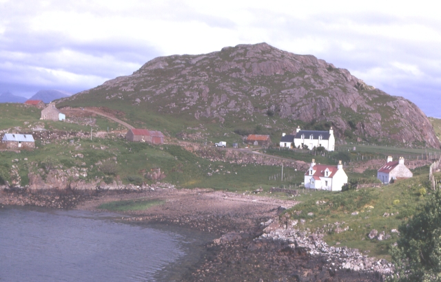
Leacan Bàna is a prominent coastal feature located in Ross-shire, Scotland. It is a headland or point that juts out into the North Atlantic Ocean, offering stunning views of the surrounding landscape. The name Leacan Bàna translates to "white slope" in Gaelic, which accurately describes the appearance of the headland.

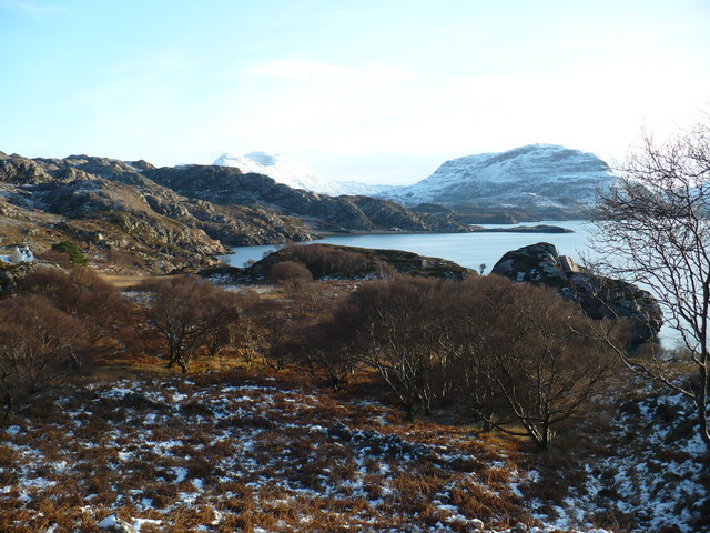
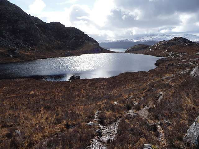
The headland is characterized by its rugged and rocky terrain, with steep cliffs that drop dramatically into the sea below. These cliffs are composed of various types of rock, including sandstone and granite, creating a visually striking contrast against the deep blue waters. The headland itself is covered in a layer of white grass, which gives it its distinctive name.

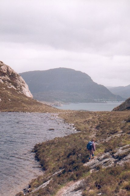
Leacan Bàna is a popular destination for nature enthusiasts and hikers due to its breathtaking scenery and abundant wildlife. The headland provides a habitat for a variety of bird species, including gannets, fulmars, and puffins, making it a haven for birdwatchers. Visitors may also spot seals and dolphins swimming in the surrounding waters.

In addition to its natural beauty, Leacan Bàna has historical significance. It is believed to have been inhabited by ancient civilizations, with evidence of prehistoric settlements and burial grounds in the area. The headland also played a role in more recent history, serving as a lookout point during World War II.

Overall, Leacan Bàna is a captivating coastal feature in Ross-shire, offering a stunning combination of natural beauty, wildlife, and historical significance. It is a must-visit destination for those seeking to explore Scotland's rugged and picturesque coastline.

If you have any feedback on the listing, please let us know in the comments section below.

Leacan Bàna Images

Images are sourced within 2km of 57.552034/-5.6537301 or Grid Reference NG8157. Thanks to Geograph Open Source API. All images are credited.

Lochan Dubh Lovely little Lochan Dubh on the very rough path between Diabaig and Alligin Shuas. Little peak in centre is unnamed on maps while to the right is Ben Shieldaig.
Lochan Dubh
Lovely little Lochan Dubh on the very rough path between Diabaig and Alligin Shuas. Little peak in centre is unnamed on maps while to the right is Ben Shieldaig.
Lochan Dubh On the coastal path between Diabaig and Inveralligin. Loch Shieldaig is in the distance.
Lochan Dubh
On the coastal path between Diabaig and Inveralligin. Loch Shieldaig is in the distance.
Lochan Dubh On the coastal path between Diabaig and Inveralligin.
Lochan Dubh
On the coastal path between Diabaig and Inveralligin.
Above Port Laire Looking across Loch Torridon from the headland above Port Laire.
Above Port Laire
Looking across Loch Torridon from the headland above Port Laire.
Old settlement, Port Laire
Loch Shieldaig from above Port Laire A fine viewpoint from beside the Diabaig to  Inveralligin footpath.  Port Laire is the small bay in the immediate foreground.  Ben Shieldaig is the hill in the very centre of the view. The major Torridon mountains are not seen from here. An isolated cottage lies below - accessible only by a part of this footpath or by sea.
Loch Shieldaig from above Port Laire
A fine viewpoint from beside the Diabaig to Inveralligin footpath. Port Laire is the small bay in the immediate foreground. Ben Shieldaig is the hill in the very centre of the view. The major Torridon mountains are not seen from here. An isolated cottage lies below - accessible only by a part of this footpath or by sea.
Lochan Dubh Immediately beside the Diabaig to Inveralligin footpath.
Lochan Dubh
Immediately beside the Diabaig to Inveralligin footpath.
Lochan Dubh The stony outflow from Lochan Dubh. Just visible in the distance across Loch Shieldaig is Shieldaig Island and (very hard to discern) Shieldaig itself.
Lochan Dubh
The stony outflow from Lochan Dubh. Just visible in the distance across Loch Shieldaig is Shieldaig Island and (very hard to discern) Shieldaig itself.
Walking the coast path at Lochan Dubh An interesting and exciting little path winds around the rocky coast from Lower Diabaig to Inveralligin on the north shore of Loch Torridon.
Walking the coast path at Lochan Dubh
An interesting and exciting little path winds around the rocky coast from Lower Diabaig to Inveralligin on the north shore of Loch Torridon.
Winter coastline near Diabaig Looking across Loch Shieldaig to Ben Shieldaig on the first day of 2010. The ground is completely frozen and very icy. At the far left can be seen a cottage accessible only by path or boat.
Winter coastline near Diabaig
Looking across Loch Shieldaig to Ben Shieldaig on the first day of 2010. The ground is completely frozen and very icy. At the far left can be seen a cottage accessible only by path or boat.
Lochan Dubh The black lochan, beside the path that joins Diabaig and Alligin Shuas.
Lochan Dubh
The black lochan, beside the path that joins Diabaig and Alligin Shuas.
Above Port Laire Looking towards Loch Torridon from the Diabaig coastal path.
Above Port Laire
Looking towards Loch Torridon from the Diabaig coastal path.
Moorland on the Shieldaig peninsula Sheep and salmon
Moorland on the Shieldaig peninsula
Sheep and salmon
Fishing store at the end of the Shieldaig peninsula
Camas Ruadh Trig Point
The road to Canapress
The road to Diabeg
The road to Diabeg
Sit A While Not a bad place to sit and eat lunch and ponder. Liathach appears to be making smoke signals while to the right is Upper Loch Torridon.
Sit A While
Not a bad place to sit and eat lunch and ponder. Liathach appears to be making smoke signals while to the right is Upper Loch Torridon.
Show me another place!

Leacan Bàna is located at Grid Ref: NG8157 (Lat: 57.552034, Lng: -5.6537301)

Unitary Authority: Highland

Police Authority: Highlands and Islands

What 3 Words

///televise.thrilled.onlookers. Near Lochcarron, Highland

Related Wikis

Inveralligin

Inveralligin (Scottish Gaelic: Inbhir Àiliginn) is a remote crofting township which lies on the north shore of Loch Torridon in Wester Ross and is in the...

Diabaig

Diabaig (Scottish Gaelic: Dìobaig) is a remote coastal fishing and crofting township in Wester Ross, in the Northwest Highlands of Scotland. Diabaig lies...

Shieldaig

Shieldaig (Scottish Gaelic: Sìldeag; Old Norse: síld-vík, lit. 'herring bay') is a village in Wester Ross in the Northwest Highlands, in the Scottish council...

Ardheslaig

Ardheslaig (Scottish Gaelic: Àird Heisleag) is a crofting settlement at the northern end of the Applecross peninsula in the Scottish Highlands. It is 3...

Nearby Amenities

Located within 500m of 57.552034,-5.6537301
Source: PGS
Lat/Long: 57.5485568/-5.6586036
Source: PGS
Lat/Long: 57.5487835/-5.6576442
Source: PGS
Lat/Long: 57.5490714/-5.6573162
Source: PGS
Lat/Long: 57.5493685/-5.6570551
Created By: almien_coastlines
Source: PGS
Lat/Long: 57.549581/-5.657022
Source: PGS
Lat/Long: 57.549745/-5.6569478
Source: PGS
Lat/Long: 57.5499193/-5.6564924
Source: PGS
Lat/Long: 57.5503196/-5.6553046
Source: PGS
Lat/Long: 57.550483/-5.6544942
Source: PGS
Lat/Long: 57.5508482/-5.6539445
Source: PGS
Lat/Long: 57.5513359/-5.6534833
Source: PGS
Lat/Long: 57.5516798/-5.6528159
Created By: almien_coastlines
Source: PGS
Lat/Long: 57.551849/-5.65266
Source: PGS
Lat/Long: 57.5520928/-5.6521201
Source: PGS
Lat/Long: 57.5523048/-5.6517342
Source: PGS
Lat/Long: 57.5524994/-5.6504458
Source: PGS
Lat/Long: 57.5521591/-5.6492129
Source: PGS
Lat/Long: 57.5520548/-5.6486777
Source: PGS
Lat/Long: 57.55198/-5.6467536
Source: PGS
Lat/Long: 57.5517255/-5.6457041
Puffin Rock
Natural: cave_entrance
Lat/Long: 57.5486764/-5.6580974
The data included in this document is from www.openstreetmap.org. The data is made available under ODbL.

Have you been to Leacan Bàna?

Leave your review of Leacan Bàna below (or comments, questions and feedback).