Na Garbh-Chrìochan

Coastal Feature, Headland, Point in Ross-shire

Scotland

Na Garbh-Chrìochan

Bridge at Balmacara Lovely old bridge carrying the minor road over the Balmacara Burn near Balmacara Square. Taken on a wet summer's day
Bridge at Balmacara Credit: Adam Ward

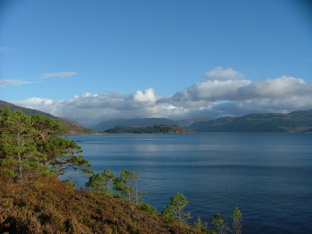
Na Garbh-Chrìochan is a prominent coastal feature located in Ross-shire, Scotland. It is a headland that juts out into the sea, forming a distinct point along the rugged coastline. The name "Na Garbh-Chrìochan" translates to "the rough boundaries" in Gaelic, which aptly describes the wild and untamed nature of this area.

The headland is characterized by its towering cliffs, which stand tall against the crashing waves below. These cliffs are composed mainly of ancient rock formations, including sandstone and limestone, which have been weathered over thousands of years. The exposed nature of the headland makes it susceptible to erosion from the relentless force of the sea.

Na Garbh-Chrìochan offers breathtaking panoramic views of the surrounding seascape. On a clear day, one can see the vast expanse of the North Atlantic Ocean, with its ever-changing hues of blue and green. Seabirds, such as gannets and puffins, can often be spotted soaring above the water, adding to the natural beauty of the area.

The headland is also home to a diverse range of flora and fauna. Hardy plants, such as heather and gorse, thrive in the harsh coastal conditions, providing a burst of color against the rugged landscape. The rocky shoreline is home to various marine creatures, including seals and dolphins, which can sometimes be spotted swimming near the point.

Na Garbh-Chrìochan is a popular destination for outdoor enthusiasts and nature lovers. Its dramatic cliffs, stunning views, and abundant wildlife make it an ideal spot for hiking, birdwatching, and photography. However, caution is advised when exploring the area, as the terrain can be challenging and the weather conditions unpredictable.

If you have any feedback on the listing, please let us know in the comments section below.

Na Garbh-Chrìochan Images

Images are sourced within 2km of 57.283077/-5.6315211 or Grid Reference NG8127. Thanks to Geograph Open Source API. All images are credited.

Bridge at Balmacara Lovely old bridge carrying the minor road over the Balmacara Burn near Balmacara Square. Taken on a wet summer's day
Bridge at Balmacara
Lovely old bridge carrying the minor road over the Balmacara Burn near Balmacara Square. Taken on a wet summer's day
Lichens on Old Oak In amongst the small pocket of Atlantic Oakwoods above Reraig and this old dead oak has an array of lichens - probably Beard or Horsehair Lichen - growing on it.
A lovely walk to do on a wet summer's day. Some information here:-
<span class="nowrap"><a title="https://forestryandland.gov.scot/visit/balmacara-woods" rel="nofollow ugc noopener" href="https://forestryandland.gov.scot/visit/balmacara-woods">Link</a><img style="margin-left:2px;" alt="External link" title="External link - shift click to open in new window" src="https://s1.geograph.org.uk/img/external.png" width="10" height="10"/></span>
Lichens on Old Oak
In amongst the small pocket of Atlantic Oakwoods above Reraig and this old dead oak has an array of lichens - probably Beard or Horsehair Lichen - growing on it. A lovely walk to do on a wet summer's day. Some information here:- LinkExternal link
Mighty Larch Trunks These big mature Larch Trees are at the bottom of one of the woodland walks above Reraig and Balmacara. You can see evidence of the damage from last winter's storms.
Mighty Larch Trunks
These big mature Larch Trees are at the bottom of one of the woodland walks above Reraig and Balmacara. You can see evidence of the damage from last winter's storms.
Before the 'Throw-Up' Kinlochshiel and Glengarry 2nd teams just before the 'Throw-Up' to start a North Division 1 shinty match at Reraig in the west highlands. An improvised shelter for spectators made from old shipping containers can be seen behind the teams.
Kinlochshiel - in red - went on to win narrowly 3-2. I left after the first goal as I was getting eaten alive by midges and it had started raining. The things you do to pass the time on a wet summer's day in the Scottish Highlands!
Before the 'Throw-Up'
Kinlochshiel and Glengarry 2nd teams just before the 'Throw-Up' to start a North Division 1 shinty match at Reraig in the west highlands. An improvised shelter for spectators made from old shipping containers can be seen behind the teams. Kinlochshiel - in red - went on to win narrowly 3-2. I left after the first goal as I was getting eaten alive by midges and it had started raining. The things you do to pass the time on a wet summer's day in the Scottish Highlands!
A87 at Reraig
A87 at Reraig
A Traffic Queue near to Balmacara Roadworks on the A87 have caused a build-up of traffic heading towards Kyle of Lochalsh and the Isle of Skye.
A Traffic Queue near to Balmacara
Roadworks on the A87 have caused a build-up of traffic heading towards Kyle of Lochalsh and the Isle of Skye.
Reraig, A87
Reraig, A87
Eastbound A87 near Kirkton The A87 is a primary route  in the Highland region of Scotland. It runs west for 99 miles from its junction with the A82 at Invergarry, along the north shores of Loch Garry and Loch Cluanie, then through Glen Shiel and along Loch Duich to Kyle of Lochalsh before crossing the Skye Bridge to Kyleakin, Broadford, and Portree, before terminating at Uig in the north of the Isle of Skye.
Eastbound A87 near Kirkton
The A87 is a primary route in the Highland region of Scotland. It runs west for 99 miles from its junction with the A82 at Invergarry, along the north shores of Loch Garry and Loch Cluanie, then through Glen Shiel and along Loch Duich to Kyle of Lochalsh before crossing the Skye Bridge to Kyleakin, Broadford, and Portree, before terminating at Uig in the north of the Isle of Skye.
The car park at Lochalsh Woodland Walks
A87 near Reraig
A87 near Reraig
A87 at Reraig
A87 at Reraig
Reservoir (disused) Believed to be the reservoir that supplied the WWII gun emplacement/camp above Reraig in the area of the view point shown on the OS map (NG810276).
When the "Red Trail" was constructed it was filled in by the Forestry Commission.
Reservoir (disused)
Believed to be the reservoir that supplied the WWII gun emplacement/camp above Reraig in the area of the view point shown on the OS map (NG810276). When the "Red Trail" was constructed it was filled in by the Forestry Commission.
Hamlet of Glaik A small hamlet on north side of Lochalsh.  Location of "Woodland Walks" on the NT for Scotland property.
Hamlet of Glaik
A small hamlet on north side of Lochalsh. Location of "Woodland Walks" on the NT for Scotland property.
Village of Reraig Reraig, on the shore of Lochalsh, in centre of picture.  The Isle of Skye and the Sound of Sleat beyond
Village of Reraig
Reraig, on the shore of Lochalsh, in centre of picture. The Isle of Skye and the Sound of Sleat beyond
Westward on Loch Alsh at Balmacara, to Skye On A87, by the Donald Merchison Monument, about two miles from the Kyle of Lochalsh, showing the piers already erected of the Skye Bridge at Kyleakin, which was opened on 16/10/95.
Westward on Loch Alsh at Balmacara, to Skye
On A87, by the Donald Merchison Monument, about two miles from the Kyle of Lochalsh, showing the piers already erected of the Skye Bridge at Kyleakin, which was opened on 16/10/95.
Dun NW of Kirkton, Lochalsh "A kind of hill fort and also a kind of Atlantic roundhouse."
In this case all that remains are a moss covered circle of stones.
See also <span class="nowrap"><a title="http://canmore.org.uk/site/11859/kirkton" rel="nofollow ugc noopener" href="http://canmore.org.uk/site/11859/kirkton">Link</a><img style="margin-left:2px;" alt="External link" title="External link - shift click to open in new window" src="https://s1.geograph.org.uk/img/external.png" width="10" height="10"/></span>
Dun NW of Kirkton, Lochalsh
"A kind of hill fort and also a kind of Atlantic roundhouse." In this case all that remains are a moss covered circle of stones. See also LinkExternal link
Footpath - the Red Trail Part of the Forestry Commission walks network starting from Balmacara Square.
This is the steep(-er than it looks) section in the oak wood above the path between Reraig and Kirkton.
Footpath - the Red Trail
Part of the Forestry Commission walks network starting from Balmacara Square. This is the steep(-er than it looks) section in the oak wood above the path between Reraig and Kirkton.
Old outbuilding at Balmacara
Show me another place!

Na Garbh-Chrìochan is located at Grid Ref: NG8127 (Lat: 57.283077, Lng: -5.6315211)

Unitary Authority: Highland

Police Authority: Highlands and Islands

What 3 Words

///torches.commenced.radio. Near Kyleakin, Highland

Nearby Locations

Reraig Na Garbh-Chrìochan

Related Wikis

Balmacara Square

Balmacara Square (Scottish Gaelic: Ceàrnag Bhaile Mac Carra) is a small village, close to Balmacara, in Lochlash, Scottish Highlands and is in the council...

Balmacara

Balmacara (Scottish Gaelic: Baile Mac Ara) is a scattered village on the north shore of Loch Alsh near Kyle of Lochalsh, Ross-shire, Highland and is in...

Balmacara Bay

Balmacara Bay is a remote wide mouthed embayment on a 193° orientation, located on the north shore of the Lochalsh peninsula, on the north coast of sea...

Loch Alsh

Loch Alsh (from the Scottish Gaelic Loch Aillse, "foaming lake") is a sea inlet between the isle of Skye in the Inner Hebrides and the Northwest Highlands...

Nearby Amenities

Located within 500m of 57.283077,-5.6315211
Source: PGS
Lat/Long: 57.2839991/-5.6393391
Created By: almien_coastlines
Source: PGS
Lat/Long: 57.283588/-5.638997
Created By: almien_coastlines
Source: PGS
Lat/Long: 57.283076/-5.63896
Created By: almien_coastlines
Source: PGS
Lat/Long: 57.282309/-5.638906
Created By: almien_coastlines
Source: PGS
Lat/Long: 57.282446/-5.638442
Created By: almien_coastlines
Source: PGS
Lat/Long: 57.282595/-5.637507
Created By: almien_coastlines
Source: PGS
Lat/Long: 57.283106/-5.637544
Created By: almien_coastlines
Source: PGS
Lat/Long: 57.282998/-5.63659
Created By: almien_coastlines
Source: PGS
Lat/Long: 57.282771/-5.635155
Created By: almien_coastlines
Source: PGS
Lat/Long: 57.282536/-5.634192
Created By: almien_coastlines
Source: PGS
Lat/Long: 57.282555/-5.633248
Source: PGS
Lat/Long: 57.2824111/-5.6317086
Source: PGS
Lat/Long: 57.2822427/-5.6313051
Source: PGS
Lat/Long: 57.2822868/-5.6304979
Source: PGS
Lat/Long: 57.2821966/-5.6292565
Source: PGS
Lat/Long: 57.2821984/-5.6288485
Source: PGS
Lat/Long: 57.2822006/-5.6285652
Source: PGS
Lat/Long: 57.2822764/-5.6280586
Source: PGS
Lat/Long: 57.2822753/-5.6274376
Source: PGS
Lat/Long: 57.282111/-5.6269854
Source: PGS
Lat/Long: 57.2817228/-5.6265557
Source: PGS
Lat/Long: 57.2813368/-5.6253421
Source: PGS
Lat/Long: 57.2807521/-5.6247064
Source: PGS
Lat/Long: 57.280411/-5.6251994
Recycling
Created By: Merkaartor 0.12
Source: survey
Lat/Long: 57.2833366/-5.6382854
Created By: Merkaartor 0.12
Lat/Long: 57.2846577/-5.6392899
Created By: Merkaartor 0.12
Lat/Long: 57.2844374/-5.6390859
Created By: Merkaartor 0.12
Lat/Long: 57.2842958/-5.6391248
Bus Stop
Balmacara Hotel
Direction: E
Long Name: Reraig, Balmacara Hotel
Naptan AtcoCode: 6700712415
Naptan Bearing: E
Naptan CommonName: Balmacara Hotel
Naptan Indicator: o/s
Naptan Landmark: Balmacara Hotel
Naptan NaptanCode: 45323765
Naptan Street: A87
Naptan Verified: no
Source: naptan_import
Lat/Long: 57.2825759/-5.627266
Bus Stop
Balmacara Hotel
Naptan AtcoCode: 6700712415A
Naptan Bearing: W
Naptan CommonName: Balmacara Hotel
Naptan Indicator: opp Hotel
Naptan Landmark: Balmacara Hotel
Naptan NaptanCode: 45324689
Naptan Street: A87
Naptan Verified: no
Source: naptan_import
Lat/Long: 57.2824049/-5.6262369
Reraig War Memorial
Historic: memorial
Lat/Long: 57.2833306/-5.6362273
Parking
Source: survey
Lat/Long: 57.2824095/-5.6290074
Leisure: slipway
Source: survey
Lat/Long: 57.2823497/-5.6292496
Post Box
Ref: IV40 22
Source: survey
Lat/Long: 57.2826414/-5.6283374
Post Office
Balmacara Post Office
Brand: Post Office
Brand Wikidata: Q1783168
Check Date: 2023-09-27
Operator: Spar
Ref Pol Id: 4136
Source: OS_OpenData_StreetView
Lat/Long: 57.282721/-5.6283188
Leisure: slipway
Source: survey
Lat/Long: 57.2821816/-5.6298417
Balmacara Hotel
Addr City: Kyle of Lochalsh
Addr Housename: Balmacara Hotel
Addr Postcode: IV40 8DH
Addr Street: Reraig
Source: survey
Tourism: hotel
Lat/Long: 57.2826944/-5.6273459
Reraig
Name En: Reraig
Name Gd: Rèaraig
Place: hamlet
Lat/Long: 57.2829404/-5.6277709
Ceol Na Mara B&B
Tourism: guest_house
Lat/Long: 57.2826046/-5.6297799
Power: pole
Lat/Long: 57.2822961/-5.6249549
Power: pole
Lat/Long: 57.2826499/-5.6251975
Power: pole
Lat/Long: 57.2865579/-5.6362645
Power: pole
Lat/Long: 57.2841344/-5.6377092
Power: pole
Lat/Long: 57.2848586/-5.6390492
Power: pole
Lat/Long: 57.2868805/-5.6321175
Power: pole
Lat/Long: 57.2874642/-5.6330839
Power: pole
Lat/Long: 57.2861025/-5.6308566
Power: pole
Lat/Long: 57.2856142/-5.6300404
Power: pole
Lat/Long: 57.2850567/-5.6291145
Power: pole
Lat/Long: 57.2844982/-5.628215
Power: pole
Lat/Long: 57.2832098/-5.6261095
Spar
Brand: Spar
Brand Wikidata: Q610492
Opening Hours: Mo-Sa 07:30-21:00; Su 10:00 - 20:00
Shop: convenience
Lat/Long: 57.2827141/-5.6283626
Power: pole
Lat/Long: 57.2840544/-5.6274898
Power: pole
Lat/Long: 57.2830658/-5.6279937
The data included in this document is from www.openstreetmap.org. The data is made available under ODbL.

Have you been to Na Garbh-Chrìochan?

Leave your review of Na Garbh-Chrìochan below (or comments, questions and feedback).