Long Marston

Settlement in Hertfordshire Dacorum

England

Long Marston

Cheddington Lane, Long Marston
Cheddington Lane, Long Marston Credit: David Howard

Long Marston is a small village located in the county of Hertfordshire, England. Situated approximately 6 miles east of Tring and 10 miles southwest of Hemel Hempstead, it is nestled in the picturesque Chiltern Hills. The village has a population of around 700 residents and is known for its tranquil and idyllic surroundings.

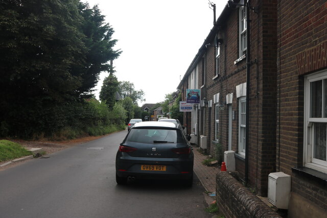
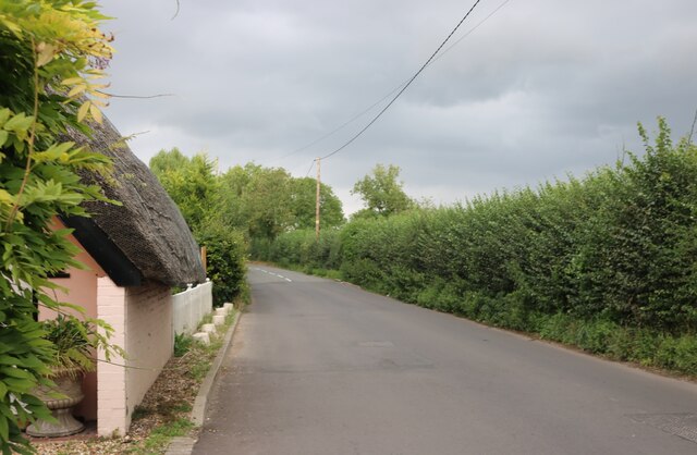
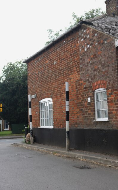
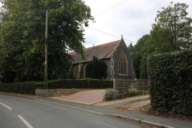
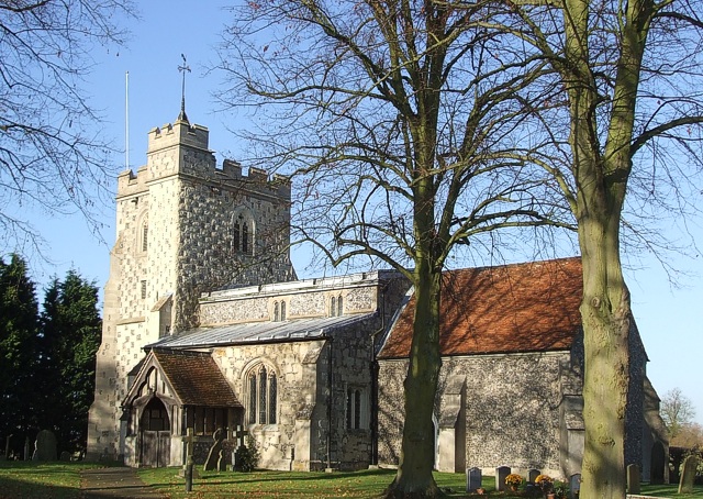
The village of Long Marston dates back to medieval times and still retains much of its historic charm. It features a mix of traditional thatched cottages and more modern houses, giving it a unique character. The heart of the village is dominated by the 12th-century St. Mary's Church, which is a notable architectural landmark.

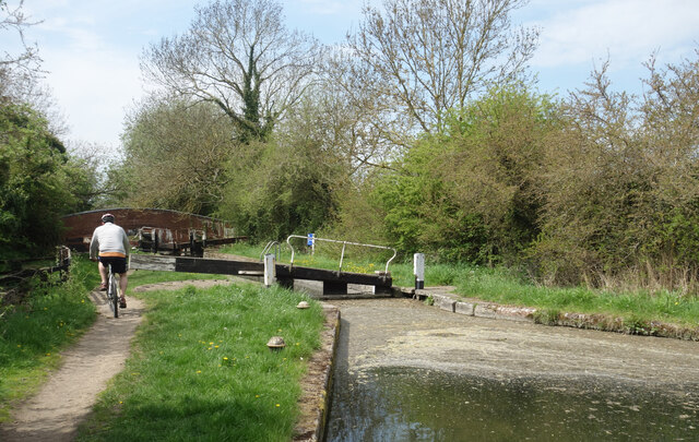
The surrounding countryside offers stunning views and ample opportunities for outdoor activities. The Chiltern Hills provide numerous walking and cycling trails, allowing visitors to explore the natural beauty of the area. Long Marston also benefits from its proximity to the Ashridge Estate, a vast area of woodlands and meadows managed by the National Trust.

Although relatively small, Long Marston has a strong sense of community. It has a village hall that hosts various events and social gatherings, bringing residents together. The village also has a primary school, providing education for local children.

In terms of amenities, Long Marston has a pub, The Queens Head, which serves as a hub for socializing and enjoying traditional British cuisine. However, for more extensive shopping and entertainment options, residents often travel to nearby towns and cities such as Tring or Hemel Hempstead.

Overall, Long Marston is a charming and peaceful village that offers a perfect mix of rural tranquility and access to larger urban centers.

If you have any feedback on the listing, please let us know in the comments section below.

Long Marston Images

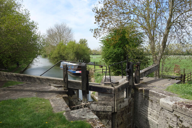
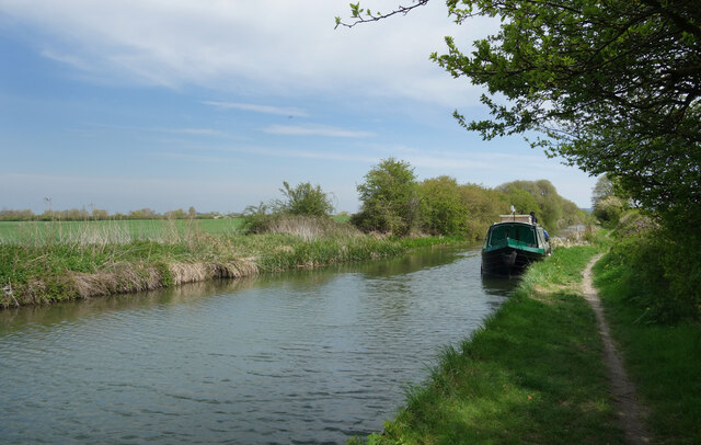
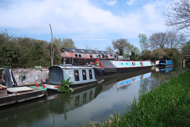
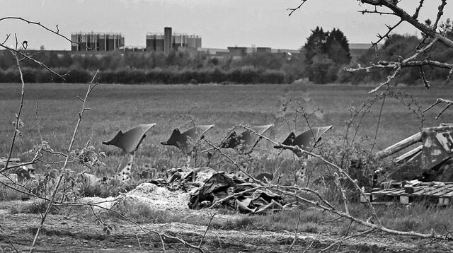
Images are sourced within 2km of 51.833156/-0.702524 or Grid Reference SP8915. Thanks to Geograph Open Source API. All images are credited.

Cheddington Lane, Long Marston
Cheddington Lane, Long Marston This is the last house in the small village
Cheddington Lane, Long Marston
This is the last house in the small village
Stripy poles on Cheddington Lane, Long Marston These are on both sides of the roads to protect the buildings from traffic. They clearly work well as none have been damaged.
Stripy poles on Cheddington Lane, Long Marston
These are on both sides of the roads to protect the buildings from traffic. They clearly work well as none have been damaged.
Tring Road, Long Marston
All Saints' Church, Long Marston
Pylon on Station Road, Long Marston
Station Road south of Wingrave
Field entrance on Station Road
Station Road south of Wingrave
Lock No. 10, Aylesbury Canal It looks really flat around here but the canal locks are not far apart, so there is quite a slope down into the Vale of Aylesbury.
Lock No. 10, Aylesbury Canal
It looks really flat around here but the canal locks are not far apart, so there is quite a slope down into the Vale of Aylesbury.
A Quiet Mooring In fact the whole canal is very quiet.
A Quiet Mooring
In fact the whole canal is very quiet.
Awaiting Restoration at Bates Boatyard Bates Boatyard specialises in restoring traditional and vintage canal boats. Some of the ones moored here look to be in a very challenging state. The little boat "Bosley"  could do with some weeding to start with. The writing on the side says
"Victorian Iron Icebreaker. Gorton Works, Manchester 1860"
Awaiting Restoration at Bates Boatyard
Bates Boatyard specialises in restoring traditional and vintage canal boats. Some of the ones moored here look to be in a very challenging state. The little boat "Bosley" could do with some weeding to start with. The writing on the side says "Victorian Iron Icebreaker. Gorton Works, Manchester 1860"
Bates Boatyard, Puttenham Bates Boatyard specialises in the restoration of vintage canal boats.
Bates Boatyard, Puttenham
Bates Boatyard specialises in the restoration of vintage canal boats.
Flying Ploughshares In a yard amongst other old farm junk these ploughshares on their side seem to resemble some sort of creatures flying or maybe swimming.
In the background is Kingspan's glass fibre factory.
Flying Ploughshares
In a yard amongst other old farm junk these ploughshares on their side seem to resemble some sort of creatures flying or maybe swimming. In the background is Kingspan's glass fibre factory.
Cheddington Lane
Cheddington Lane
Cheddington Lane Heading towards Long Marston
Cheddington Lane
Heading towards Long Marston
Coronation Pump by the Bus Stop Tring Road, Wilstone. With King Charles's Royal Coronation only a couple of days away, a small flag decorates an old water pump. A few other flags can be seen along the street.
Coronation Pump by the Bus Stop
Tring Road, Wilstone. With King Charles's Royal Coronation only a couple of days away, a small flag decorates an old water pump. A few other flags can be seen along the street.
Cyclist at Lock 9 The canal towpath is generally ok for cycling but you need to watch out for mud, old bricks and bits of subsidence from time to time.
The water looks messy but it's only stuff off the trees which gets blown along onto the lock gate. East wind today, obviously.
Cyclist at Lock 9
The canal towpath is generally ok for cycling but you need to watch out for mud, old bricks and bits of subsidence from time to time. The water looks messy but it's only stuff off the trees which gets blown along onto the lock gate. East wind today, obviously.
Show me another place!

Long Marston is located at Grid Ref: SP8915 (Lat: 51.833156, Lng: -0.702524)

Administrative County: Hertfordshire

District: Dacorum

Police Authority: Hertfordshire

What 3 Words

///cloud.dustbin.existence. Near Cheddington, Buckinghamshire

Related Wikis

Tring Rural

Tring Rural is a civil parish in Hertfordshire, England. It includes the villages of Long Marston, Wilstone, Puttenham, and the hamlets of Gubblecote and...

Long Marston, Hertfordshire

Long Marston is a small village to the north of Tring in Hertfordshire, in the Tring Rural parish council area. It is in the Borough of Dacorum, Tring...

Astrope

Astrope is a village in Hertfordshire, England. It is in the civil parish of Tring Rural. == External links == Media related to Astrope at Wikimedia Commons

Marston Gate railway station

Marston Gate Railway station was a station on the London and North Western Railway - Aylesbury Branch serving the nearby village of Long Marston, Hertfordshire...

Puttenham, Hertfordshire

Puttenham is a village and former civil parish, now in the parish of Tring Rural, in the Dacorum district, in north west Hertfordshire, England. In 1961...

RAF Cheddington

Royal Air Force Cheddington or more simply RAF Cheddington (also known as RAF Marsworth) is a former Royal Air Force station located 1 mile (1.6 km) south...
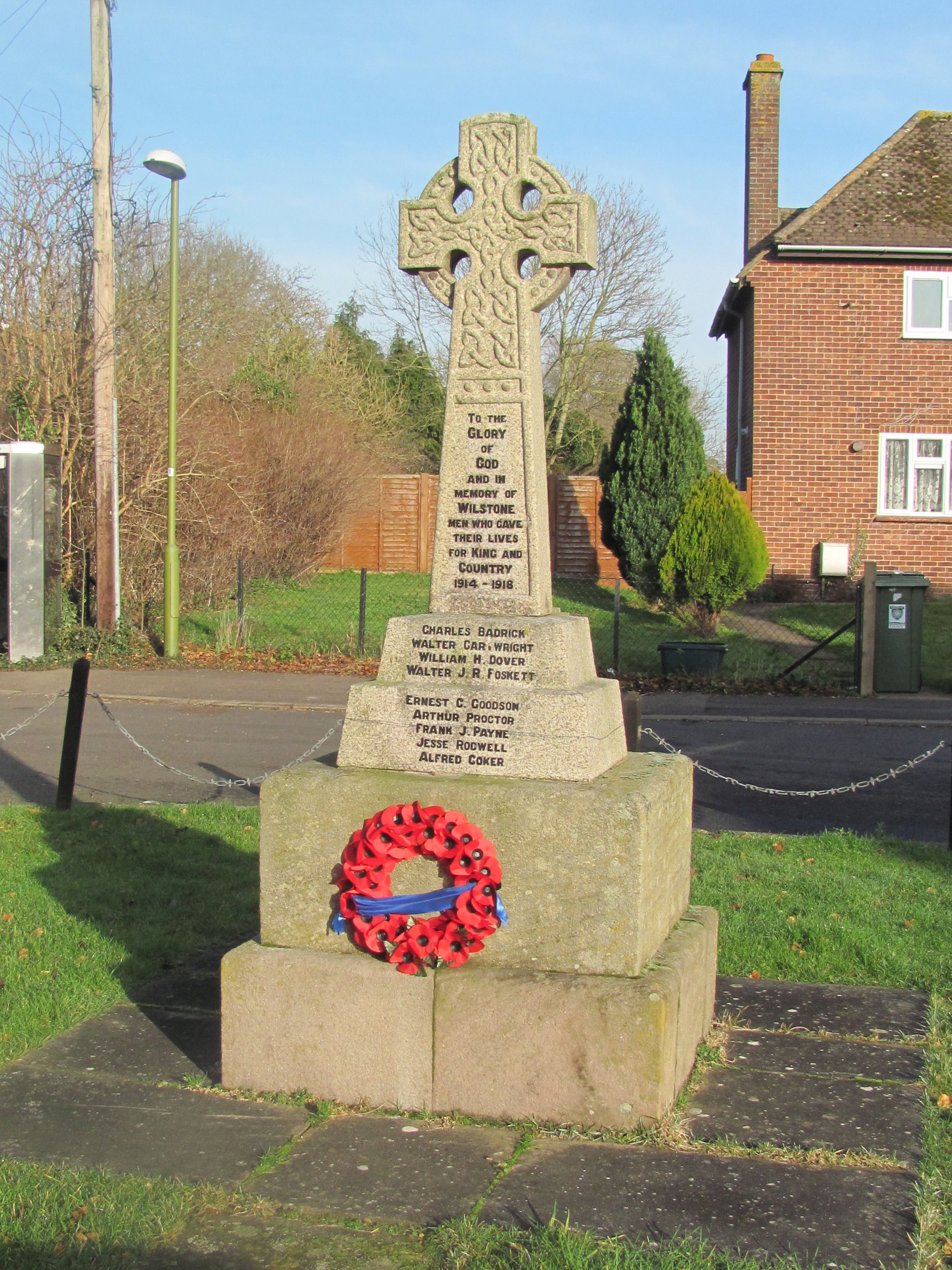
Wilstone

Wilstone is the name of an English village and a reservoir approximately two miles north-west of Tring, Hertfordshire. The village lies within the civil...

Thistle Brook

Thistle Brook is a short, minor river (brook) in Buckinghamshire, England that is a tributary to the River Thame.Located entirely in the Aylesbury Vale...

Nearby Amenities

Located within 500m of 51.833156,-0.702524
Long Marston
Place: village
Wikidata: Q3836636
Wikipedia: en:Long Marston, Hertfordshire
Lat/Long: 51.8320612/-0.6979292
Barrier: stile
Bicycle: no
Foot: yes
Horse: no
Motor Vehicle: no
Lat/Long: 51.8353457/-0.696403
Chapel of Ease
Historic: ruins
Lat/Long: 51.8319995/-0.7037278
Fixme: ?building?
Source: npe
Lat/Long: 51.8291423/-0.7021856
Ravens Court
Naptan AtcoCode: 210021424740
Naptan Bearing: SE
Naptan BusStopType: CUS
Naptan CommonName: Ravens Court
Naptan Crossing: Wheelers Yard
Naptan Indicator: opp
Naptan Landmark: Wheelers Yard
Naptan NaptanCode: hrtdawat
Naptan ShortCommonName: NA
Naptan Street: Tring Road
Naptan Verified: no
Source: naptan_import
Lat/Long: 51.8312812/-0.6969828
Bus Stop
Ravens Court
Bus: yes
Local Ref: NR
Naptan AtcoCode: 210021426100
Naptan Bearing: NW
Naptan CommonName: Ravens Court
Naptan Crossing: The Old Forge
Naptan Indicator: nr
Naptan Landmark: The Old Forge
Naptan NaptanCode: hrtdatpd
Naptan ShortCommonName: NA
Naptan Street: Tring Road
Naptan Verified: no
Public Transport: platform
Source: naptan_import
Lat/Long: 51.8315514/-0.6973528
Bromley
Local Ref: NR
Naptan AtcoCode: 210021426105
Naptan Bearing: W
Naptan BusStopType: CUS
Naptan CommonName: Bromley
Naptan Crossing: Bromley
Naptan Indicator: nr
Naptan Landmark: Bromley
Naptan NaptanCode: hrtdatgd
Naptan ShortCommonName: NA
Naptan Street: Station Road
Naptan Verified: no
Source: naptan_import
Lat/Long: 51.833882/-0.7048327
Chapel Lane
Naptan AtcoCode: 210021426130
Naptan Bearing: NW
Naptan BusStopType: CUS
Naptan CommonName: Chapel Lane
Naptan Crossing: War Memorial
Naptan Indicator: adj
Naptan Landmark: War Memorial
Naptan NaptanCode: hrtgtgaj
Naptan ShortCommonName: NA
Naptan Street: Station Road
Naptan Verified: no
Source: naptan_import
Lat/Long: 51.832803/-0.7014794
Line Management: transition
Power: tower
Lat/Long: 51.8350526/-0.7034935
Power: tower
Lat/Long: 51.8342419/-0.7078989
Power: tower
Ref: PDG 123
Lat/Long: 51.8346292/-0.7058072
Barrier: stile
Lat/Long: 51.8356938/-0.6996538
Barrier: stile
Lat/Long: 51.8337605/-0.6954385
Barrier: stile
Lat/Long: 51.8316085/-0.7026793
Post Box
Collection Times: Mo-Fr 18:00; Sa 09:00
Operator: Royal Mail
Post Box Type: lamp
Ref: HP23 124
Royal Cypher: EIIR
Royal Cypher Wikidata: Q33102113
Source: survey
Lat/Long: 51.8326387/-0.698987
Historic: memorial
Lat/Long: 51.832873/-0.701132
Power: portal
Lat/Long: 51.8340769/-0.7077444
Power: pole
Lat/Long: 51.8306518/-0.7047544
Power: pole
Lat/Long: 51.83006/-0.7034978
Power: pole
Lat/Long: 51.8295263/-0.7023525
Power: pole
Lat/Long: 51.8292776/-0.7018523
Power: pole
Lat/Long: 51.8288632/-0.7009819
Fixme: Check location. Should be pretty close, based on preliminary survey.
Power: pole
Lat/Long: 51.8327707/-0.7055076
Fixme: Check location. Should be pretty close, based on preliminary survey.
Power: pole
Lat/Long: 51.8321221/-0.7062046
Power: pole
Lat/Long: 51.8321742/-0.7060888
Power: pole
Lat/Long: 51.8331323/-0.706872
Power: pole
Lat/Long: 51.8328107/-0.7090688
Power: pole
Lat/Long: 51.8319405/-0.7081836
Power: pole
Lat/Long: 51.8310944/-0.7073137
Power: pole
Lat/Long: 51.8301421/-0.7056731
Power: pole
Lat/Long: 51.8295404/-0.7046244
Power: pole
Lat/Long: 51.8289519/-0.7036561
Power: pole
Lat/Long: 51.828758/-0.703302
Parking
Lat/Long: 51.8322137/-0.6973213
Access: no
Barrier: stile
Foot: yes
Lat/Long: 51.8335353/-0.6973901
Public Bookcase
Bardaid Box Library
Booth: K6
Disused Amenity: telephone
Man Made: telephone_box
Public Bookcase Type: phone_box
Lat/Long: 51.8320633/-0.6983024
Bicycle Parking
Access: yes
Bicycle Parking: staple
Capacity: 3
Covered: no
Fee: no
Lat/Long: 51.8328264/-0.7012473
The data included in this document is from www.openstreetmap.org. The data is made available under ODbL.

Have you been to Long Marston?

Leave your review of Long Marston below (or comments, questions and feedback).