An Cnap

Coastal Feature, Headland, Point in Inverness-shire

Scotland

An Cnap

Rough ford at the mouth of the Abhainn Inbhir Ghuiserein, Inverguseran, Knoydart This is the crossing point of the Abhainn Inbhir Ghuiserein at Inverguseran.  The ford is rough and you would need to remove boots to cross it even in favourable conditions.
Rough ford at the mouth of the Abhainn Inbhir Ghuiserein, Inverguseran, Knoydart Credit: Colin Park

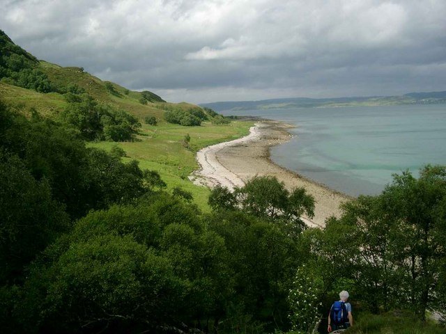
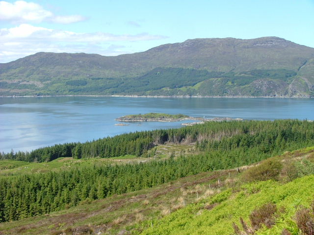
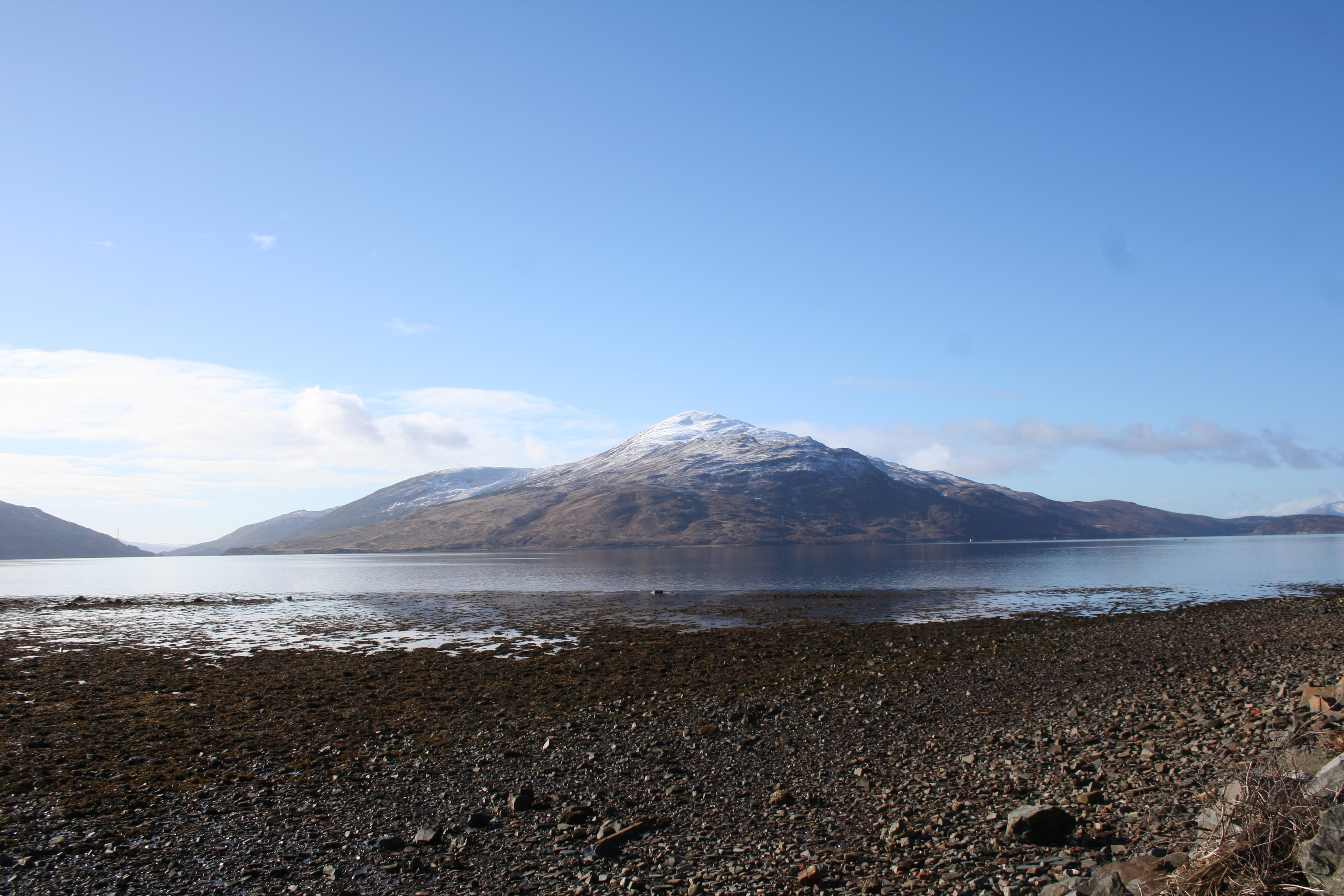
An Cnap is a prominent headland located in Inverness-shire, Scotland. Situated along the rugged coastline, An Cnap offers stunning views of the surrounding landscape and the vast expanse of the North Sea. The headland is characterized by its rocky cliffs, grassy fields, and diverse wildlife, making it a popular destination for nature lovers and outdoor enthusiasts.

An Cnap is a significant coastal feature due to its strategic location and unique geological formations. The headland serves as a natural barrier protecting the coastline from erosion and strong ocean currents. Its rocky outcrops provide a habitat for various seabirds and marine life, making it a hotspot for birdwatching and marine wildlife spotting.

Visitors to An Cnap can enjoy hiking along the rugged coastal trails, taking in the panoramic views of the sea and surrounding countryside. The headland is also a great spot for picnicking, photography, and simply soaking in the peaceful atmosphere of the Scottish coast.

Overall, An Cnap is a must-visit destination in Inverness-shire for those seeking natural beauty, outdoor adventure, and a glimpse into the diverse ecosystems of the Scottish coast.

If you have any feedback on the listing, please let us know in the comments section below.

An Cnap Images

Images are sourced within 2km of 57.114668/-5.7231006 or Grid Reference NG7408. Thanks to Geograph Open Source API. All images are credited.

Rough ford at the mouth of the Abhainn Inbhir Ghuiserein, Inverguseran, Knoydart This is the crossing point of the Abhainn Inbhir Ghuiserein at Inverguseran.  The ford is rough and you would need to remove boots to cross it even in favourable conditions.
Rough ford at the mouth of the Abhainn Inbhir Ghuiserein, Inverguseran, Knoydart
This is the crossing point of the Abhainn Inbhir Ghuiserein at Inverguseran. The ford is rough and you would need to remove boots to cross it even in favourable conditions.
The mouth of the Abhainn Inbhir Ghuiserein, Inverguseran, Knoydart
Sheep grazing at Inverguseran Knoydart lamb.
Sheep grazing at Inverguseran
Knoydart lamb.
Trees at Rubha Camas an t-Salainn
Descending towards the shore at Slisneach
Flag iris on the shore at Slisneach
Rubha ard Slisneach Isle of Skye in the distance.
Rubha ard Slisneach
Isle of Skye in the distance.
Slisneach
Slisneach
The bay at Camas Garbh On the horizon, Skye can be seen to the right and, faintly, on the central horizon, the isle of Eigg.
The bay at Camas Garbh
On the horizon, Skye can be seen to the right and, faintly, on the central horizon, the isle of Eigg.
Natural rock sculpture at Inverguseran
The Guseran track
The Guseran track
Rock Stack, Inverguseran
Camas Garbh Beautiful bay in a remote corner of Knoydart.
Camas Garbh
Beautiful bay in a remote corner of Knoydart.
Rubha Ard Slisneach Beautiful, wild promontory.
Rubha Ard Slisneach
Beautiful, wild promontory.
Rubha Ard Slisneach A remote promontory on west Knoydart.
Rubha Ard Slisneach
A remote promontory on west Knoydart.
Unspoilt Coastline The trees make an interesting contrast to sea and hill.
Unspoilt Coastline
The trees make an interesting contrast to sea and hill.
Rubha Camas an t-Salainn Wooded little area near Cnoc Gorm.
Rubha Camas an t-Salainn
Wooded little area near Cnoc Gorm.
Loch Coire na Circe Ascending the south slopes a lovely scene of the south western side of the loch presents itself.
Loch Coire na Circe
Ascending the south slopes a lovely scene of the south western side of the loch presents itself.
Show me another place!

An Cnap is located at Grid Ref: NG7408 (Lat: 57.114668, Lng: -5.7231006)

Unitary Authority: Highland

Police Authority: Highlands and Islands

What 3 Words

///packets.freshen.bandwagon. Near Armadale, Highland

Related Wikis

Sound of Sleat

The Sound of Sleat is a narrow sea channel off the western coast of Scotland. It divides the Sleat peninsula on the south-east side of the Isle of Skye...

Airor

Airor is a hamlet in the peninsula of Knoydart, Lochaber, Highland, on the west coast of Scotland. It is situated on the north-west coast of Knoydart,...

Ornsay

Ornsay is a small tidal island to the east of the Sleat peninsula on the Isle of Skye in the Inner Hebrides of Scotland. == Description == The island provides...

Beinn na Caillich (Knoydart)

Beinn na Caillich (Scottish Gaelic for 'mountain of the old woman or Cailleach') is a mountain with a height of 732 metres (2,402 ft) in Knoydart, in the...

Nearby Amenities

Located within 500m of 57.114668,-5.7231006
Source: PGS
Lat/Long: 57.1183487/-5.7185449
Source: PGS
Lat/Long: 57.118327/-5.7193046
Source: PGS
Lat/Long: 57.1182238/-5.7197531
Source: PGS
Lat/Long: 57.1180465/-5.7205644
Source: PGS
Lat/Long: 57.1181412/-5.721494
Created By: almien_coastlines
Source: PGS
Lat/Long: 57.117886/-5.722073
Created By: almien_coastlines
Source: PGS
Lat/Long: 57.11763/-5.722054
Source: PGS
Lat/Long: 57.1170617/-5.7220067
Source: PGS
Lat/Long: 57.1167255/-5.7215288
Source: PGS
Lat/Long: 57.1153802/-5.7215859
Source: PGS
Lat/Long: 57.1149349/-5.7225436
Created By: almien_coastlines
Source: PGS
Lat/Long: 57.115303/-5.72306
Source: PGS
Lat/Long: 57.1149707/-5.7246503
Created By: almien_coastlines
Source: PGS
Lat/Long: 57.1145/-5.724649
Source: PGS
Lat/Long: 57.1141916/-5.723762
Source: PGS
Lat/Long: 57.113219/-5.7233782
Source: PGS
Lat/Long: 57.111843/-5.7238602
Source: PGS
Lat/Long: 57.1115121/-5.7246555
Source: PGS
Lat/Long: 57.1111833/-5.7250484
Source: PGS
Lat/Long: 57.1105977/-5.7253239
Ford: yes
Lat/Long: 57.1171056/-5.7207493
Slisneach
Locality: abandoned_place
Place: locality
Lat/Long: 57.1147963/-5.7175633
The data included in this document is from www.openstreetmap.org. The data is made available under ODbL.

Have you been to An Cnap?

Leave your review of An Cnap below (or comments, questions and feedback).