Long John's Hill

Settlement in Norfolk Norwich

England

Long John's Hill

Church of St John and All Saints, Norwich <span class="nowrap"><a title="https://historicengland.org.uk/listing/the-list/list-entry/1372796?section=official-list-entry" rel="nofollow ugc noopener" href="https://historicengland.org.uk/listing/the-list/list-entry/1372796?section=official-list-entry">Link</a><img style="margin-left:2px;" alt="External link" title="External link - shift click to open in new window" src="https://s1.geograph.org.uk/img/external.png" width="10" height="10"/></span>
Church of St John and All Saints, Norwich Credit: Sandy Gerrard

Long John's Hill is a picturesque village located in the county of Norfolk, England. Situated in the South Norfolk district, this rural settlement is nestled amidst rolling hills and beautiful countryside, offering a tranquil and idyllic setting.

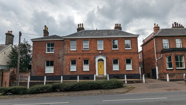
The village is known for its historic charm and traditional architecture, with many buildings dating back several centuries. The focal point of Long John's Hill is its namesake, a long and winding road that cuts through the heart of the village. Lined with quaint cottages and old-fashioned lampposts, this road exudes a sense of old-world charm and serves as a reminder of the village's rich history.

Surrounded by stunning natural beauty, Long John's Hill boasts an abundance of outdoor activities for nature enthusiasts. The village is surrounded by lush green fields, providing ample opportunities for scenic walks, hiking, and cycling. In addition, the nearby River Waveney offers fishing and boating opportunities for those seeking a more leisurely way to enjoy the countryside.

Long John's Hill is also home to a close-knit community, with a small number of local amenities. These include a village pub, which serves as a gathering place for residents and visitors alike, fostering a sense of community spirit.

Overall, Long John's Hill is a charming and picturesque village, offering a peaceful retreat from the hustle and bustle of modern life. With its rich history, stunning natural surroundings, and welcoming community, it is a hidden gem in the Norfolk countryside.

If you have any feedback on the listing, please let us know in the comments section below.

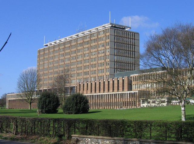
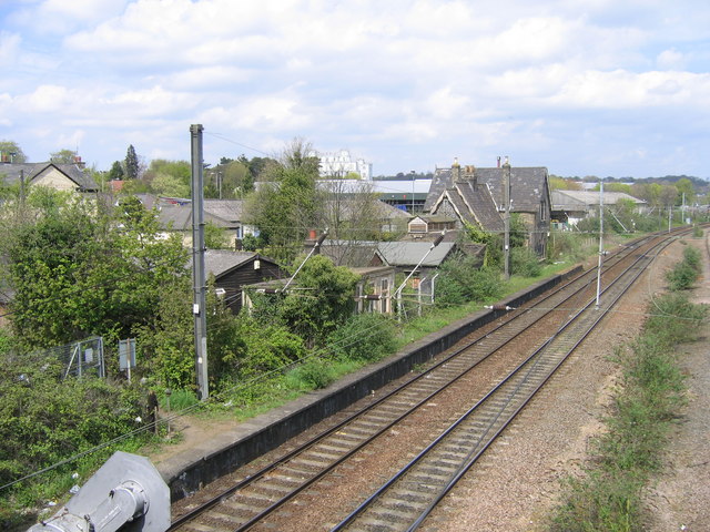
Long John's Hill Images

Images are sourced within 2km of 52.612497/1.302227 or Grid Reference TG2306. Thanks to Geograph Open Source API. All images are credited.

Church of St John and All Saints, Norwich <span class="nowrap"><a title="https://historicengland.org.uk/listing/the-list/list-entry/1372796?section=official-list-entry" rel="nofollow ugc noopener" href="https://historicengland.org.uk/listing/the-list/list-entry/1372796?section=official-list-entry">Link</a><img style="margin-left:2px;" alt="External link" title="External link - shift click to open in new window" src="https://s1.geograph.org.uk/img/external.png" width="10" height="10"/></span>
Church of St John and All Saints, Norwich
Church of St. Andrew, Trowse with Newton <span class="nowrap"><a title="https://historicengland.org.uk/listing/the-list/list-entry/1050444?section=official-list-entry" rel="nofollow ugc noopener" href="https://historicengland.org.uk/listing/the-list/list-entry/1050444?section=official-list-entry">Link</a><img style="margin-left:2px;" alt="External link" title="External link - shift click to open in new window" src="https://s1.geograph.org.uk/img/external.png" width="10" height="10"/></span>
Church of St. Andrew, Trowse with Newton
72, 72A and 72B, Bracondale, Norwich <span class="nowrap"><a title="https://historicengland.org.uk/listing/the-list/list-entry/1372766?section=official-list-entry" rel="nofollow ugc noopener" href="https://historicengland.org.uk/listing/the-list/list-entry/1372766?section=official-list-entry">Link</a><img style="margin-left:2px;" alt="External link" title="External link - shift click to open in new window" src="https://s1.geograph.org.uk/img/external.png" width="10" height="10"/></span>
72, 72A and 72B, Bracondale, Norwich
Church of St Mark, Norwich <span class="nowrap"><a title="https://historicengland.org.uk/listing/the-list/list-entry/1280305?section=official-list-entry" rel="nofollow ugc noopener" href="https://historicengland.org.uk/listing/the-list/list-entry/1280305?section=official-list-entry">Link</a><img style="margin-left:2px;" alt="External link" title="External link - shift click to open in new window" src="https://s1.geograph.org.uk/img/external.png" width="10" height="10"/></span>
Church of St Mark, Norwich
Town Crier in the Royal Arcade A colourful scene in the splendid Victorian shopping arcade.
Town Crier in the Royal Arcade
A colourful scene in the splendid Victorian shopping arcade.
Crane at the Castle Norwich castle keep is closed just now while work goes on inside.
Crane at the Castle
Norwich castle keep is closed just now while work goes on inside.
Norwich - Castle housing museum and art gallery Norwich Castle is a huge imposing edifice which, situated on its mound (or motte) towers over the city. This is a view of its western façade taken from Castle Meadow (a street that curves around the castle to the west and north).

 Dating originally from the C12th (estimated to have been built between 1094 and 1121) it was refaced in fine ashlar stone in the 1830s which accounts for its very 'clean' appearance. It was converted to a museum and art gallery in the 1880s.
For far more detailed information about the castle and its scheduled area see EH listings linked below:
Scheduled Ancient Monument listing: <span class="nowrap"><a title="https://historicengland.org.uk/listing/the-list/list-entry/1004054" rel="nofollow ugc noopener" href="https://historicengland.org.uk/listing/the-list/list-entry/1004054">Link</a><img style="margin-left:2px;" alt="External link" title="External link - shift click to open in new window" src="https://s1.geograph.org.uk/img/external.png" width="10" height="10"/></span>
Castle Grade I listing: <span class="nowrap"><a title="https://historicengland.org.uk/listing/the-list/list-entry/1372724" rel="nofollow ugc noopener" href="https://historicengland.org.uk/listing/the-list/list-entry/1372724">Link</a><img style="margin-left:2px;" alt="External link" title="External link - shift click to open in new window" src="https://s1.geograph.org.uk/img/external.png" width="10" height="10"/></span>
The castle is currently undergoing a £13.5m restoration [2021] which means that the castle itself is not open to the public, though its extensive museum and art gallery remain open.
Castle Museum & Art Gallery website: <span class="nowrap"><a title="https://www.museums.norfolk.gov.uk/norwich-castle/plan-your-visit/admission-prices" rel="nofollow ugc noopener" href="https://www.museums.norfolk.gov.uk/norwich-castle/plan-your-visit/admission-prices">Link</a><img style="margin-left:2px;" alt="External link" title="External link - shift click to open in new window" src="https://s1.geograph.org.uk/img/external.png" width="10" height="10"/></span>
See also <a href="https://www.geograph.org.uk/photo/6949278">TG2308 : Norwich - Castle eastern façade with crane</a>
Norwich - Castle housing museum and art gallery
Norwich Castle is a huge imposing edifice which, situated on its mound (or motte) towers over the city. This is a view of its western façade taken from Castle Meadow (a street that curves around the castle to the west and north). Dating originally from the C12th (estimated to have been built between 1094 and 1121) it was refaced in fine ashlar stone in the 1830s which accounts for its very 'clean' appearance. It was converted to a museum and art gallery in the 1880s. For far more detailed information about the castle and its scheduled area see EH listings linked below: Scheduled Ancient Monument listing: LinkExternal link Castle Grade I listing: LinkExternal link The castle is currently undergoing a £13.5m restoration [2021] which means that the castle itself is not open to the public, though its extensive museum and art gallery remain open. Castle Museum & Art Gallery website: LinkExternal link See also TG2308 : Norwich - Castle eastern façade with crane
Norwich - Castle eastern façade with crane Norwich Castle is currently undergoing a £13.5 million refurbishment - which accounts for the presence of the crane in this photograph. Although it dates originally from the C12th or even the early C11th, the fine quality of the stonework is due to the fact that it was refaced in the 1830s.
The restoration means that at the moment [2021] the castle itself is not open to the public, though its extensive museum and art gallery remain open.
For far more detailed information about the castle and its scheduled area see EH listings linked below:
Scheduled Ancient Monument listing: <span class="nowrap"><a title="https://historicengland.org.uk/listing/the-list/list-entry/1004054" rel="nofollow ugc noopener" href="https://historicengland.org.uk/listing/the-list/list-entry/1004054">Link</a><img style="margin-left:2px;" alt="External link" title="External link - shift click to open in new window" src="https://s1.geograph.org.uk/img/external.png" width="10" height="10"/></span>
Castle Grade I listing: <span class="nowrap"><a title="https://historicengland.org.uk/listing/the-list/list-entry/1372724" rel="nofollow ugc noopener" href="https://historicengland.org.uk/listing/the-list/list-entry/1372724">Link</a><img style="margin-left:2px;" alt="External link" title="External link - shift click to open in new window" src="https://s1.geograph.org.uk/img/external.png" width="10" height="10"/></span>
Castle Museum & Art Gallery website: <span class="nowrap"><a title="https://www.museums.norfolk.gov.uk/norwich-castle/plan-your-visit/admission-prices" rel="nofollow ugc noopener" href="https://www.museums.norfolk.gov.uk/norwich-castle/plan-your-visit/admission-prices">Link</a><img style="margin-left:2px;" alt="External link" title="External link - shift click to open in new window" src="https://s1.geograph.org.uk/img/external.png" width="10" height="10"/></span>
See also <a href="https://www.geograph.org.uk/photo/6949270">TG2308 : Norwich - Castle housing museum and art gallery</a>
Norwich - Castle eastern façade with crane
Norwich Castle is currently undergoing a £13.5 million refurbishment - which accounts for the presence of the crane in this photograph. Although it dates originally from the C12th or even the early C11th, the fine quality of the stonework is due to the fact that it was refaced in the 1830s. The restoration means that at the moment [2021] the castle itself is not open to the public, though its extensive museum and art gallery remain open. For far more detailed information about the castle and its scheduled area see EH listings linked below: Scheduled Ancient Monument listing: LinkExternal link Castle Grade I listing: LinkExternal link Castle Museum & Art Gallery website: LinkExternal link See also TG2308 : Norwich - Castle housing museum and art gallery
Demolition of Cathedral Infirmary, Norwich by John Crome I would not normally submit a photograph of a painting in a gallery to Geograph, because that isn't really what this site is about - however I have added this image for two reasons.
Firstly it is an example of one of the many paintings in the Art Gallery within Norwich Castle by the Norwich artist John Crome (22 December 1768 – 22 April 1821 - Wikipedia <span class="nowrap"><a title="https://en.wikipedia.org/wiki/John_Crome" rel="nofollow ugc noopener" href="https://en.wikipedia.org/wiki/John_Crome">Link</a><img style="margin-left:2px;" alt="External link" title="External link - shift click to open in new window" src="https://s1.geograph.org.uk/img/external.png" width="10" height="10"/></span> ), an influential and respected artist of the late C18th and early C19th. This art gallery probably has the finest collection of his paintings anywhere but also features many paintings by other local artists such as John Sell Cotman. There are also paintings by such famous artists as JMW Turner. It is an extensive and impressive collection, particularly of the local "Norwich School of Painters" see Wikipedia <span class="nowrap"><a title="https://en.wikipedia.org/wiki/Norwich_School_of_painters" rel="nofollow ugc noopener" href="https://en.wikipedia.org/wiki/Norwich_School_of_painters">Link</a><img style="margin-left:2px;" alt="External link" title="External link - shift click to open in new window" src="https://s1.geograph.org.uk/img/external.png" width="10" height="10"/></span>
The second reason for its inclusion is to give an indication of what <a href="https://www.geograph.org.uk/photo/6949351">TG2308 : Norwich - Remains of the Monastic Infirmary</a> looked like prior to its demolition in 1804.
The painting itself is watercolour on paper and although undated is almost certainly contemporaneous with the infirmary's demolition or a year or so later. It was long attributed to fellow artist Charles Hodgson who made many similar paintings, but it is now considered to be by Crome. It is thought though, that the man in the foreground with a sheet of paper might be Hodgson.
Demolition of Cathedral Infirmary, Norwich by John Crome
I would not normally submit a photograph of a painting in a gallery to Geograph, because that isn't really what this site is about - however I have added this image for two reasons. Firstly it is an example of one of the many paintings in the Art Gallery within Norwich Castle by the Norwich artist John Crome (22 December 1768 – 22 April 1821 - Wikipedia LinkExternal link ), an influential and respected artist of the late C18th and early C19th. This art gallery probably has the finest collection of his paintings anywhere but also features many paintings by other local artists such as John Sell Cotman. There are also paintings by such famous artists as JMW Turner. It is an extensive and impressive collection, particularly of the local "Norwich School of Painters" see Wikipedia LinkExternal link The second reason for its inclusion is to give an indication of what TG2308 : Norwich - Remains of the Monastic Infirmary looked like prior to its demolition in 1804. The painting itself is watercolour on paper and although undated is almost certainly contemporaneous with the infirmary's demolition or a year or so later. It was long attributed to fellow artist Charles Hodgson who made many similar paintings, but it is now considered to be by Crome. It is thought though, that the man in the foreground with a sheet of paper might be Hodgson.
River Wensum with Boat and Pub A river cruiser moored outside a pub. A frequent sight on the waterways.
River Wensum with Boat and Pub
A river cruiser moored outside a pub. A frequent sight on the waterways.
Kings on the Corner Kings & Co, estate agents, occupy the ground floor of one of the new buildings which have replaced old industrial premises along here.
Kings on the Corner
Kings & Co, estate agents, occupy the ground floor of one of the new buildings which have replaced old industrial premises along here.
Old and New by the River The River Wensum heads out of Norwich through a former industrial area. On this side, an extensive redevelopment zone is full of new building, but on the other side is the old Colmans Mustard factory where mustard was made for 160 years before production stopped in 2020. 
Colmans Mustard is now made outside the city in a new mill.
Old and New by the River
The River Wensum heads out of Norwich through a former industrial area. On this side, an extensive redevelopment zone is full of new building, but on the other side is the old Colmans Mustard factory where mustard was made for 160 years before production stopped in 2020. Colmans Mustard is now made outside the city in a new mill.
Stadium Car Park Outside Norwich City's Carrow Road Football Ground.
Stadium Car Park
Outside Norwich City's Carrow Road Football Ground.
New Buildings, Geoffrey Watling Way A large area of old industrial buildings is being redeveloped.
Geoffrey Watling was a Norwich businessman and philanthropist, and also former president and chairman of Norwich City football club, whose stadium is a short way behind me.
New Buildings, Geoffrey Watling Way
A large area of old industrial buildings is being redeveloped. Geoffrey Watling was a Norwich businessman and philanthropist, and also former president and chairman of Norwich City football club, whose stadium is a short way behind me.
Building Site, Geoffrey Watling Way Redevelopment of former industrial land near the river.
Building Site, Geoffrey Watling Way
Redevelopment of former industrial land near the river.
Old Factory by the River Industrial buildings by the River Wensum.
Colman's Mustard was made here for 160 years up to 2020 when production moved to a new out of town site.
Old Factory by the River
Industrial buildings by the River Wensum. Colman's Mustard was made here for 160 years up to 2020 when production moved to a new out of town site.
Fireworks and Creamery, Trafalgar Street There can't be many of these side by side. An all year round fireworks shop, and next door an ice cream factory and shop in what looks like a converted suburban house.
Fireworks and Creamery, Trafalgar Street
There can't be many of these side by side. An all year round fireworks shop, and next door an ice cream factory and shop in what looks like a converted suburban house.
River Wensum from the Novi Sad Bridge Some of the new riverside housing which has been built in a former run down industrial area.
River Wensum from the Novi Sad Bridge
Some of the new riverside housing which has been built in a former run down industrial area.
Show me another place!

Long John's Hill is located at Grid Ref: TG2306 (Lat: 52.612497, Lng: 1.302227)

Administrative County: Norfolk

District: Norwich

Police Authority: Norfolk

What 3 Words

///save.regime.plank. Near Norwich, Norfolk

Related Wikis

Nearby Amenities

Located within 500m of 52.612497,1.302227
Crossing
Crossing: uncontrolled
Tactile Paving: no
Lat/Long: 52.6113589/1.3056378
Power: pole
Lat/Long: 52.610944/1.306799
Power: pole
Lat/Long: 52.610942/1.306673
Material: wood
Power: pole
Lat/Long: 52.609624/1.307054
Material: wood
Power: pole
Lat/Long: 52.609618/1.306933
Post Box
Collection Times: Mo-Fr 09:00, Sa 07:00
Operator: Royal Mail
Post Box Type: pillar
Ref: NR1 114D
Royal Cypher: GR
Royal Cypher Wikidata: Q33102273
Lat/Long: 52.6147447/1.2993103
Post Box
Brand: Royal Mail
Brand Wikidata: Q638098
Collection Times: Mo-Fr 09:00; Sa 07:00
Operator: Royal Mail
Operator Wikidata: Q638098
Post Box Type: lamp
Ref: NR1 111
Lat/Long: 52.6118687/1.2953889
Post Box
Collection Times: Mo-Fr 09:00, Sa 07:00
Operator: Royal Mail
Post Box Type: pillar
Ref: NR1 117
Royal Cypher: EIIR
Royal Cypher Wikidata: Q33102113
Lat/Long: 52.6103268/1.3015383
Traffic Signals
Lat/Long: 52.6092382/1.297263
Check Date: 2021-05-27
Traffic Calming: hump
Lat/Long: 52.6113314/1.2954466
Check Date: 2021-05-03
Traffic Calming: cushion
Lat/Long: 52.6096897/1.2971064
Traffic Calming: table
Lat/Long: 52.6106048/1.2990425
Check Date: 2021-05-27
Surface: brick
Traffic Calming: table
Lat/Long: 52.6110413/1.2968135
Traffic Calming: table
Lat/Long: 52.6107628/1.2984121
Traffic Calming: table
Lat/Long: 52.6108882/1.2976879
Check Date: 2021-05-03
Traffic Calming: cushion
Lat/Long: 52.6108934/1.2964674
Check Date: 2021-05-03
Traffic Calming: cushion
Lat/Long: 52.6101845/1.2968724
Check Date: 2021-05-03
Traffic Calming: cushion
Lat/Long: 52.6116329/1.2957724
Crossing
Crossing: unmarked
Lat/Long: 52.6125343/1.3054749
Noexit: yes
Lat/Long: 52.6114096/1.3052215
Turning Circle
Lat/Long: 52.6121167/1.3039566
Crossing
Lat/Long: 52.6161407/1.3058012
Barrier: kerb
Kerb: normal
Lat/Long: 52.6164309/1.3007855
Crossing
Crossing: uncontrolled
Crossing Island: no
Crossing Ref: zebra
Tactile Paving: yes
Lat/Long: 52.6164137/1.2993057
Priority: equal
Lat/Long: 52.6122434/1.2981626
Check Date: 2021-05-27
Traffic Calming: cushion
Lat/Long: 52.6143355/1.2956623
Turning Circle
Lat/Long: 52.6132107/1.2976289
Give Way
Lat/Long: 52.6144691/1.2957091
Turning Circle
Lat/Long: 52.6144645/1.296339
Check Date: 2021-05-27
Traffic Calming: hump
Lat/Long: 52.6137145/1.2956559
Crossing
Crossing: unmarked
Crossing Island: yes
Tactile Paving: no
Lat/Long: 52.6139107/1.2992749
Give Way
Lat/Long: 52.6136108/1.2994794
Mini Roundabout
Direction: clockwise
Lat/Long: 52.6103927/1.3008973
Lakenham
Place: suburb
Lat/Long: 52.6153383/1.3021692
Crossing
Crossing: unmarked
Crossing Island: yes
Tactile Paving: no
Lat/Long: 52.6106951/1.3032131
Crossing
Crossing: unmarked
Crossing Island: yes
Tactile Paving: no
Lat/Long: 52.6104275/1.3022637
Crossing
Crossing: uncontrolled
Tactile Paving: no
Lat/Long: 52.6113911/1.3055105
Traffic Signals
Lat/Long: 52.6116491/1.3066656
Traffic Signals
Lat/Long: 52.6118916/1.3062536
Traffic Signals
Lat/Long: 52.6120354/1.3067592
Traffic Signals
Lat/Long: 52.6120032/1.3070283
Bus Stop
Long John Hill, S-bound
Bench: no
Bus: yes
Naptan AtcoCode: 2900N12211
Naptan Bearing: E
Naptan CommonName: Long John Hill
Naptan Indicator: S-bound
Naptan Locality: Lakenham
Naptan NaptanCode: nfodjawm
Naptan PlusbusZoneRef: NRCH
Naptan Street: Cavell Road
Naptan Verified: no
Public Transport: platform
Shelter: no
Source: naptan_import
Tactile Paving: yes
Lat/Long: 52.6104732/1.3005007
Bus Stop
Cavell Road, opp
Bench: no
Bin: no
Bus: yes
Lit: yes
Naptan AtcoCode: 2900N12212
Naptan Bearing: S
Naptan CommonName: Cavell Road
Naptan Indicator: opp
Naptan Locality: Lakenham
Naptan NaptanCode: nfodjawp
Naptan PlusbusZoneRef: NRCH
Naptan Street: Long John Hill
Naptan Verified: no
Public Transport: platform
Shelter: no
Source: naptan_import
Tactile Paving: no
Lat/Long: 52.6108293/1.300956
Cavell Road, adj
Naptan AtcoCode: 2900N12213
Naptan Bearing: N
Naptan BusStopType: CUS
Naptan CommonName: Cavell Road
Naptan Indicator: adj
Naptan Locality: Lakenham
Naptan NaptanCode: nfodjawt
Naptan PlusbusZoneRef: NRCH
Naptan Street: Long John Hill
Naptan Verified: no
Source: naptan_import
Lat/Long: 52.6106616/1.3008399
Bus Stop
Long John Hill, N-bound
Bench: no
Bus: yes
Naptan AtcoCode: 2900N1234
Naptan Bearing: NW
Naptan CommonName: Long John Hill
Naptan Indicator: N-bound
Naptan Locality: Lakenham
Naptan NaptanCode: nfodjmpw
Naptan PlusbusZoneRef: NRCH
Naptan Street: Cavell Road
Naptan Verified: no
Public Transport: platform
Shelter: no
Source: naptan_import
Tactile Paving: no
Lat/Long: 52.6103708/1.300626
Bus Stop
Bus Shelter, Stand A
Local Ref: A
Naptan AtcoCode: 2900N1236
Naptan Bearing: SW
Naptan CommonName: Bus Shelter
Naptan Indicator: Stand A
Naptan Locality: County Hall
Naptan NaptanCode: nfodjpaw
Naptan PlusbusZoneRef: NRCH
Naptan Street: Lower Car Park
Shelter: yes
Source: naptan_import
Lat/Long: 52.6152545/1.3072751
Bus Stop
Bus Shelter, Stand B
Local Ref: B
Naptan AtcoCode: 2900N1237
Naptan Bearing: SW
Naptan CommonName: Bus Shelter
Naptan Indicator: Stand B
Naptan Locality: County Hall
Naptan NaptanCode: nfogmptw
Naptan PlusbusZoneRef: NRCH
Naptan Street: Lower Car Park
Shelter: yes
Source: naptan_import
Lat/Long: 52.6153536/1.3073845
Hospital Lane, adj
Naptan AtcoCode: 2900N12448
Naptan Bearing: N
Naptan BusStopType: CUS
Naptan CommonName: Hospital Lane
Naptan Indicator: adj
Naptan Landmark: Hospital Lane
Naptan Locality: Norwich
Naptan NaptanCode: nfodjtwt
Naptan PlusbusZoneRef: NRCH
Naptan Street: City Road
Naptan Verified: no
Source: naptan_import
Lat/Long: 52.6166209/1.2992892
Bus Stop
Stratford Drive, opp
Bench: no
Bin: yes
Bus: yes
Lit: yes
Naptan AtcoCode: 2900N12450
Naptan Bearing: N
Naptan BusStopType: CUS
Naptan CommonName: Stratford Drive
Naptan Indicator: opp
Naptan Landmark: opp Stratford Drive
Naptan Locality: Norwich
Naptan NaptanCode: nfodjwag
Naptan PlusbusZoneRef: NRCH
Naptan Street: City Road
Naptan Verified: no
Public Transport: platform
Shelter: no
Source: naptan_import
Source Position: survey
Tactile Paving: no
Lat/Long: 52.6148962/1.2990778
Stratford Drive, adj
Naptan AtcoCode: 2900N12451
Naptan Bearing: S
Naptan BusStopType: CUS
Naptan CommonName: Stratford Drive
Naptan Indicator: adj
Naptan Landmark: opp Old Cricketers Arms
Naptan Locality: Norwich
Naptan NaptanCode: nfodjwaj
Naptan PlusbusZoneRef: NRCH
Naptan Street: City Road
Naptan Verified: no
Source: naptan_import
Lat/Long: 52.6151582/1.2992428
Bus Stop
Coke Road, adj
Bench: no
Bin: no
Bus: yes
Lit: yes
Naptan AtcoCode: 2900N12452
Naptan Bearing: NE
Naptan CommonName: Coke Road
Naptan Indicator: adj
Naptan Landmark: Coke Road
Naptan Locality: Lakenham
Naptan NaptanCode: nfodjwam
Naptan PlusbusZoneRef: NRCH
Naptan Street: Barrett Road
Naptan Verified: no
Public Transport: platform
Shelter: no
Source: naptan_import
Tactile Paving: yes
Lat/Long: 52.609435/1.2980587
Springbank, S-bound
Naptan AtcoCode: 2900N12453
Naptan Bearing: SE
Naptan BusStopType: CUS
Naptan CommonName: Springbank
Naptan Indicator: S-bound
Naptan Locality: Norwich
Naptan NaptanCode: nfodjwap
Naptan PlusbusZoneRef: NRCH
Naptan Street: Long John Hill
Naptan Verified: no
Source: naptan_import
Lat/Long: 52.6133744/1.29967
Bus Stop
No 7, opp
Bench: no
Bus: yes
Naptan AtcoCode: 2900N12458
Naptan Bearing: W
Naptan CommonName: No 7
Naptan Indicator: opp
Naptan Locality: Norwich
Naptan NaptanCode: nfodjwdj
Naptan PlusbusZoneRef: NRCH
Naptan Street: Cavell Road
Naptan Verified: no
Public Transport: platform
Shelter: no
Source: naptan_import
Tactile Paving: yes
Lat/Long: 52.6110292/1.2970113
Bus Stop
No 7, adj
Bench: no
Bus: yes
Naptan AtcoCode: 2900N12459
Naptan Bearing: E
Naptan CommonName: No 7
Naptan Indicator: adj
Naptan Landmark: Cavell Road
Naptan Locality: Norwich
Naptan NaptanCode: nfodjwdm
Naptan PlusbusZoneRef: NRCH
Naptan Street: Mansfield Lane
Naptan Verified: no
Public Transport: platform
Shelter: no
Source: naptan_import
Tactile Paving: yes
Lat/Long: 52.6111418/1.2968425
Bus Stop
Keyes Road, opp
Bench: no
Bus: yes
Naptan AtcoCode: 2900N12460
Naptan Bearing: N
Naptan CommonName: Keyes Road
Naptan Indicator: opp
Naptan Locality: Norwich
Naptan NaptanCode: nfodjwdp
Naptan PlusbusZoneRef: NRCH
Naptan Street: Mansfield Lane
Naptan Verified: no
Public Transport: platform
Shelter: no
Source: naptan_import
Tactile Paving: yes
Lat/Long: 52.6138032/1.2955798
Bus Stop
Keyes Road, adj
Bench: no
Bus: yes
Naptan AtcoCode: 2900N12461
Naptan Bearing: S
Naptan CommonName: Keyes Road
Naptan Indicator: adj
Naptan Locality: Norwich
Naptan NaptanCode: nfodjwdt
Naptan PlusbusZoneRef: NRCH
Naptan Street: Mansfield Lane
Naptan Verified: no
Public Transport: platform
Shelter: no
Source: naptan_import
Tactile Paving: yes
Lat/Long: 52.6141867/1.2956973
The Cock, opp
Naptan AtcoCode: 2900N12588
Naptan Bearing: N
Naptan BusStopType: CUS
Naptan CommonName: The Cock
Naptan Indicator: opp
Naptan Landmark: Cock Public House
Naptan Locality: Lakenham
Naptan NaptanCode: nfodmdwm
Naptan PlusbusZoneRef: NRCH
Naptan Street: Long John Hill
Naptan Verified: no
Source: naptan_import
Lat/Long: 52.6081347/1.300827
Springbank, N-bound
Naptan AtcoCode: 2900N12632
Naptan Bearing: NW
Naptan BusStopType: CUS
Naptan CommonName: Springbank
Naptan Indicator: N-bound
Naptan Locality: Norwich
Naptan NaptanCode: nfodmgwd
Naptan PlusbusZoneRef: NRCH
Naptan Street: Long John Hill
Naptan Verified: no
Source: naptan_import
Lat/Long: 52.6135173/1.2993852
Traffic Signals
Button Operated: yes
Crossing: traffic_signals
Tactile Paving: yes
Traffic Signals Sound: no
Traffic Signals Vibration: yes
Lat/Long: 52.6118119/1.3063073
Traffic Signals
Lat/Long: 52.6117328/1.3067893
Crossing
Button Operated: yes
Crossing: traffic_signals
Crossing Island: no
Crossing Ref: pelican
Tactile Paving: yes
Traffic Signals Sound: no
Traffic Signals Vibration: yes
Lat/Long: 52.6093691/1.2972418
Crossing
Button Operated: yes
Crossing: traffic_signals
Crossing Island: yes
Crossing Ref: pelican
Tactile Paving: yes
Traffic Signals Sound: no
Traffic Signals Vibration: yes
Lat/Long: 52.609254/1.2974631
Crossing
Crossing: unmarked
Crossing Island: yes
Tactile Paving: no
Lat/Long: 52.6096226/1.2991202
Crossing
Crossing: unmarked
Crossing Island: yes
Tactile Paving: no
Lat/Long: 52.6095012/1.2986018
Crossing
Crossing: unmarked
Crossing Island: yes
Tactile Paving: no
Lat/Long: 52.6098254/1.2999563
Crossing
Button Operated: yes
Crossing: traffic_signals
Tactile Paving: yes
Traffic Signals Sound: no
Traffic Signals Vibration: yes
Lat/Long: 52.610008/1.3009139
Crossing
Button Operated: yes
Crossing: traffic_signals
Tactile Paving: yes
Traffic Signals Sound: no
Traffic Signals Vibration: yes
Lat/Long: 52.6100999/1.3009471
Traffic Signals
Lat/Long: 52.6101996/1.301315
Crossing
Crossing: uncontrolled
Crossing Island: no
Tactile Paving: yes
Lat/Long: 52.6099958/1.301195
Crossing
Button Operated: yes
Crossing: traffic_signals
Tactile Paving: yes
Traffic Signals Sound: no
Traffic Signals Vibration: yes
Lat/Long: 52.6102101/1.3010522
Crossing
Button Operated: yes
Crossing: traffic_signals
Tactile Paving: yes
Traffic Signals Sound: no
Traffic Signals Vibration: yes
Lat/Long: 52.6102715/1.3011394
Crossing
Button Operated: yes
Crossing: traffic_signals
Crossing Island: yes
Tactile Paving: yes
Traffic Signals Sound: no
Traffic Signals Vibration: yes
Lat/Long: 52.6101372/1.3013621
Turning Circle
Lat/Long: 52.6106316/1.2972693
Crossing
Crossing: unmarked
Lat/Long: 52.6111083/1.2985875
Entrance: yes
Lat/Long: 52.6117296/1.2987467
Crossing
Crossing: uncontrolled
Crossing Island: no
Tactile Paving: no
Lat/Long: 52.609532/1.2971816
Check Date: 2021-05-27
Traffic Calming: cushion
Lat/Long: 52.6129724/1.2956062
Check Date: 2021-05-27
Traffic Calming: cushion
Lat/Long: 52.6123088/1.2955093
Entrance: yes
Lat/Long: 52.6117548/1.2990661
Entrance: yes
Lat/Long: 52.6130473/1.3085571
Entrance: yes
Lat/Long: 52.6149142/1.3071633
Crossing
Crossing: uncontrolled
Crossing Ref: zebra
Tactile Paving: no
Lat/Long: 52.6152074/1.3070421
Barrier: cycle_barrier
Lat/Long: 52.6124201/1.3029094
Barrier: bollard
Lat/Long: 52.6104261/1.3019736
Crossing
Crossing: uncontrolled
Tactile Paving: no
Lat/Long: 52.6126913/1.3075713
Atm
Check Date: 2021-05-01
Lat/Long: 52.6127616/1.307995
Crossing
Crossing: uncontrolled
Tactile Paving: no
Lat/Long: 52.6131508/1.3080979
Welcome to Norwich / A Fine City
Colour: white
Inscription: UNESCO World City of Literature / Twinned with Rouen, Koblenz, Novi Sad and El Viejo
Material: metal
Traffic Sign: city_limit
Lat/Long: 52.6115783/1.3067539
Crossing
Crossing: unmarked
Crossing Island: yes
Tactile Paving: no
Lat/Long: 52.6109172/1.3040093
Barrier: bollard
Lat/Long: 52.6114296/1.3053667
Crossing
Button Operated: yes
Crossing: traffic_signals
Crossing Ref: pelican
Tactile Paving: yes
Traffic Signals Sound: no
Traffic Signals Vibration: yes
Lat/Long: 52.6116536/1.3065917
Crossing
Button Operated: yes
Crossing: traffic_signals
Crossing Ref: pelican
Tactile Paving: yes
Traffic Signals Sound: no
Traffic Signals Vibration: yes
Lat/Long: 52.6117552/1.3067472
Crossing
Button Operated: no
Crossing: traffic_signals
Crossing Ref: pelican
Tactile Paving: yes
Traffic Signals Sound: no
Traffic Signals Vibration: yes
Lat/Long: 52.6117586/1.3063931
Crossing
Button Operated: yes
Crossing: traffic_signals
Crossing Ref: pelican
Tactile Paving: yes
Traffic Signals Sound: no
Traffic Signals Vibration: yes
Lat/Long: 52.6118373/1.3063455
Crossing
Button Operated: yes
Crossing: traffic_signals
Crossing Ref: pelican
Tactile Paving: yes
Traffic Signals Sound: no
Traffic Signals Vibration: yes
Lat/Long: 52.6118528/1.3067974
Crossing
Button Operated: yes
Crossing: traffic_signals
Crossing Ref: pelican
Tactile Paving: yes
Traffic Signals Sound: no
Traffic Signals Vibration: yes
Lat/Long: 52.6119192/1.3062926
Crossing
Button Operated: yes
Crossing: traffic_signals
Crossing Ref: pelican
Tactile Paving: yes
Traffic Signals Sound: no
Traffic Signals Vibration: yes
Lat/Long: 52.6119702/1.3070266
Barrier: kerb
Kerb: flush
Tactile Paving: yes
Lat/Long: 52.6091011/1.2973646
Barrier: kerb
Kerb: flush
Tactile Paving: yes
Lat/Long: 52.6093637/1.297163
Barrier: kerb
Kerb: flush
Tactile Paving: yes
Lat/Long: 52.6093721/1.297304
Barrier: kerb
Kerb: flush
Tactile Paving: yes
Lat/Long: 52.6099861/1.3009281
Barrier: kerb
Kerb: flush
Tactile Paving: yes
Lat/Long: 52.6099915/1.3011757
Barrier: kerb
Kerb: flush
Tactile Paving: yes
Lat/Long: 52.6101895/1.3009226
Barrier: kerb
Kerb: flush
Tactile Paving: yes
Lat/Long: 52.6119681/1.3070821
Passing Place
Lat/Long: 52.6150434/1.3028738
Post Box
Collection Times: Mo-Fr 17:45; Sa 13:15
Operator: Royal Mail
Post Box Mounting: brick_pillar
Post Box Type: wall
Ref: NR1 157
Royal Cypher: EIIR
Royal Cypher Wikidata: Q33102113
Lat/Long: 52.6151908/1.3072699
Letter Box
Colour: yellow
Description: Yellow box in a brick pillar for incoming mail to Norfolk County Council.
Letter Box Mounting: brick_pillar
Operator: Norfolk County Council
Lat/Long: 52.6152063/1.3072858
Elevator
Lat/Long: 52.6150899/1.3070793
Barrier: bollard
Lat/Long: 52.6114207/1.3050891
Turning Loop
Lat/Long: 52.6145997/1.3029581
Give Way
Lat/Long: 52.6103941/1.3009553
Crossing
Crossing: uncontrolled
Kerb: raised
Lat/Long: 52.616596/1.3013957
Barrier: bollard
Bollard: fixed
Material: wood
Motor Vehicle: no
Lat/Long: 52.6164354/1.3009695
Noexit: yes
Lat/Long: 52.6157443/1.303164
Waste Basket
Lat/Long: 52.6148863/1.2990569
Toilets
Access: yes
Female: yes
Operator: Norwich City Council
Lat/Long: 52.6161306/1.2991592
Give Way
Lat/Long: 52.6081604/1.3010423
Crossing: uncontrolled
Railway: level_crossing
Supervised: no
Lat/Long: 52.6118241/1.3081446
Crossing: uncontrolled
Railway: level_crossing
Supervised: no
Lat/Long: 52.6118018/1.3081786
Entrance: yes
Lat/Long: 52.6124477/1.2996323
Entrance: yes
Lat/Long: 52.6122265/1.2997093
Entrance: yes
Lat/Long: 52.6120583/1.2996448
Entrance: yes
Lat/Long: 52.6119052/1.299485
Barrier: cycle_barrier
Cycle Barrier: double
Lat/Long: 52.609263/1.3009732
Power: transformer
Transformer: distribution
Lat/Long: 52.6093738/1.301217
Barrier: cycle_barrier
Bicycle: no
Lat/Long: 52.6133409/1.304607
Bench
Backrest: no
Lat/Long: 52.6137491/1.2973682
Door: sliding
Entrance: staircase
Lat/Long: 52.6149453/1.3064897
Restaurant
The Kitchen County Hall
Access: private
Addr City: Norwich
Addr Housename: County Hall
Addr Postcode: NR1 2HU
Addr Street: Martineau Lane
Fhrs Id: 45197
Lat/Long: 52.6147259/1.3063375
Defibrillator
Defibrillator Location: Inside County Hall, attached to a pillar by main reception desk on the ground floor.
Emergency: defibrillator
Indoor: yes
Lat/Long: 52.6148879/1.3072349
Simon O'Rourke
Artwork Type: statue
Material: wood
Tourism: artwork
Lat/Long: 52.6164408/1.3022463
Railway: buffer_stop
Lat/Long: 52.6119466/1.3080463
Railway: buffer_stop
Lat/Long: 52.6119255/1.3080769
Railway: buffer_stop
Lat/Long: 52.6113155/1.3068956
Railway: buffer_stop
Lat/Long: 52.6118855/1.3081418
Railway: buffer_stop
Lat/Long: 52.6119063/1.3081079
Bicycle Rental
Norfolk County Council
Capacity: 10
Email: support@beryl.cc
Fee: yes
Name Signed: no
Network: Beryl - Norwich
Official Name: Norfolk County Council
Operator: Beryl
Operator Wikidata: Q106575369
Payment App: yes
Payment App Android: cc.beryl.basis
Payment App Ios: 1386768364
Payment Cash: no
Payment Credit Cards: no
Payment Cryptocurrencies: no
Payment Debit Cards: no
Payment Electronic Purses: no
Phone: +44 20 3003 5044
Ref Gbfs: beryl_norwich:1882
Rental: city_bike;ebike;escooter
Website: https://beryl.cc/scheme/norwich
Lat/Long: 52.6152115/1.3071899
Bicycle Rental
Barrett Road
Capacity: 10
Email: support@beryl.cc
Fee: yes
Name Signed: no
Network: Beryl - Norwich
Official Name: Barrett Road
Operator: Beryl
Operator Wikidata: Q106575369
Payment App: yes
Payment App Android: cc.beryl.basis
Payment App Ios: 1386768364
Payment Cash: no
Payment Credit Cards: no
Payment Cryptocurrencies: no
Payment Debit Cards: no
Payment Electronic Purses: no
Phone: +44 20 3003 5044
Ref Gbfs: beryl_norwich:1799
Rental: city_bike;ebike;escooter
Website: https://beryl.cc/scheme/norwich
Lat/Long: 52.6103477/1.301584
Power: transformer
Lat/Long: 52.6116148/1.2974769
Waste Basket
Lat/Long: 52.6159257/1.2989411
Waste Basket
Lat/Long: 52.6161988/1.2990967
Waste Basket
Lat/Long: 52.6160322/1.2987855
Waste Basket
Colour: green
Material: plastic
Lat/Long: 52.6104152/1.3015092
Waste Basket
Colour: green
Material: plastic
Lat/Long: 52.6161454/1.2992861
Waste Basket
Colour: green
Material: plastic
Lat/Long: 52.6146611/1.2990887
Waste Basket
Lat/Long: 52.6138497/1.2970462
Waste Basket
Lat/Long: 52.6163793/1.2991078
Waste Basket
Colour: green
Material: plastic
Lat/Long: 52.6103399/1.3006235
Waste Basket
Lat/Long: 52.6124531/1.3020942
Waste Basket
Lat/Long: 52.6141682/1.2978713
Waste Basket
Lat/Long: 52.61402/1.2984048
Waste Basket
Colour: green
Material: plastic
Lat/Long: 52.615049/1.29911
Waste Basket
Colour: green
Material: plastic
Lat/Long: 52.6135405/1.2953367
Give Way
Lat/Long: 52.611296/1.2961982
Give Way
Lat/Long: 52.611072/1.2963928
Barrier: cycle_barrier
Bicycle: yes
Lat/Long: 52.6120269/1.3054311
Give Way
Lat/Long: 52.6130012/1.3040726
Give Way
Lat/Long: 52.613808/1.2992413
Give Way
Lat/Long: 52.614004/1.2993177
Natural: shrub
Lat/Long: 52.6138359/1.3011349
Give Way
Lat/Long: 52.6126172/1.3036381
Priority: equal
Lat/Long: 52.6104858/1.2982564
Give Way
Lat/Long: 52.6162477/1.3062304
Give Way
Lat/Long: 52.6161248/1.3062071
Norwich Archive Centre Registration Office
Government: register_office
Office: government
Opening Hours: Mo-Fr 09:30-16:30; Sa-Su closed
Website: https://www.norfolk.gov.uk/births-ceremonies-and-deaths/registration-offices/norwich-registration-office
Wheelchair: yes
Lat/Long: 52.6148635/1.306504
Power: transformer
Lat/Long: 52.6129533/1.2988858
Communication Mobile Phone: yes
Layer: 1
Man Made: mast
Material: metal
Operator: Three UK;EE
Tower Construction: guyed_tube
Tower Type: communication
Lat/Long: 52.6145703/1.3070606
Crossing
Crossing: uncontrolled
Crossing Island: no
Tactile Paving: yes
Lat/Long: 52.6100157/1.301257
The data included in this document is from www.openstreetmap.org. The data is made available under ODbL.

Have you been to Long John's Hill?

Leave your review of Long John's Hill below (or comments, questions and feedback).