Aird Ghlas

Coastal Feature, Headland, Point in Ross-shire

Scotland

Aird Ghlas

B8021 at Melvaig
B8021 at Melvaig Credit: Chris Morgan

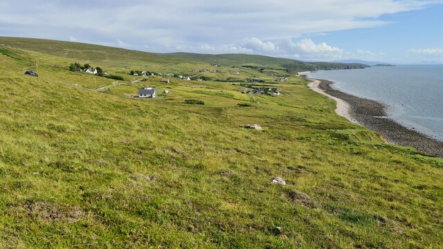
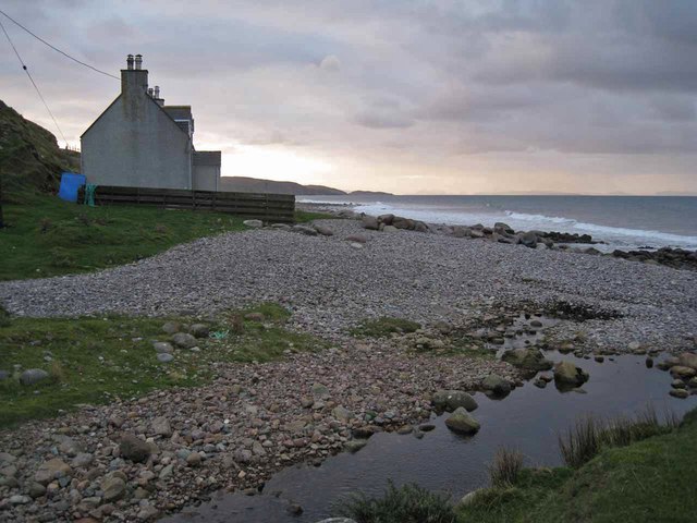
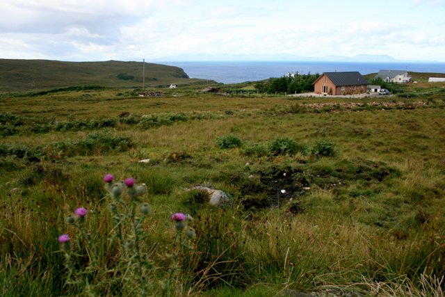
Aird Ghlas is a prominent coastal feature located in Ross-shire, Scotland. It is an impressive headland that juts out into the North Atlantic Ocean, forming a distinct point along the coastline. With its rugged cliffs and stunning views, Aird Ghlas is a popular destination for nature enthusiasts and those seeking a peaceful retreat.

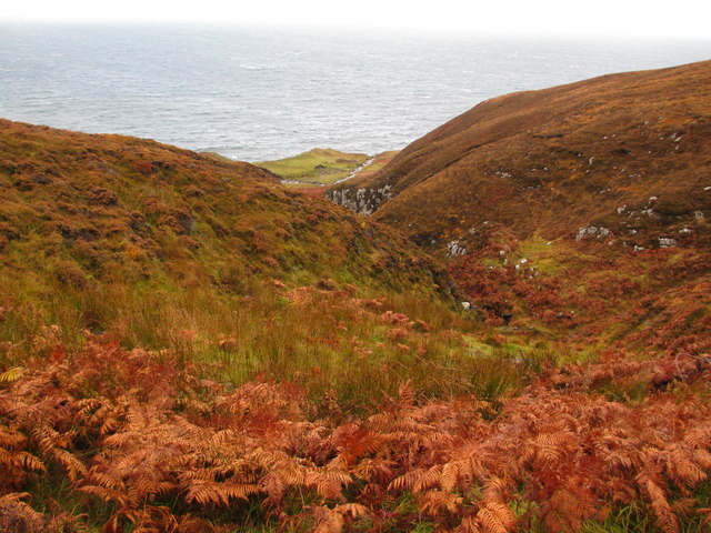
The headland is characterized by its steep cliffs, which reach heights of up to 100 meters in some areas. These cliffs provide a nesting site for various seabird species, including gulls, kittiwakes, and fulmars. The bird colonies add to the charm of the area, attracting birdwatchers from far and wide.

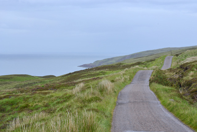
Aird Ghlas is also known for its breathtaking views. From the headland, visitors can enjoy panoramic vistas of the surrounding sea, with the Isle of Skye visible on clear days. The crashing waves against the cliffs create a dramatic backdrop, adding to the allure of the place.

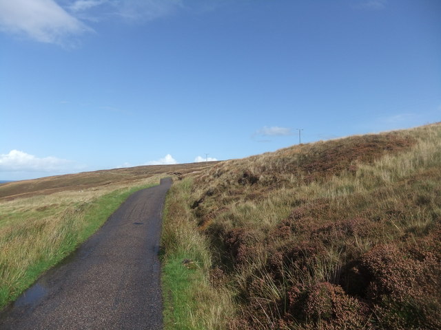
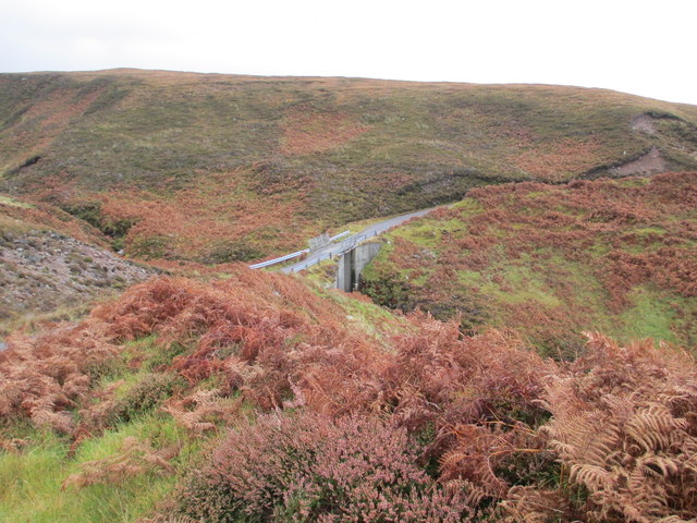
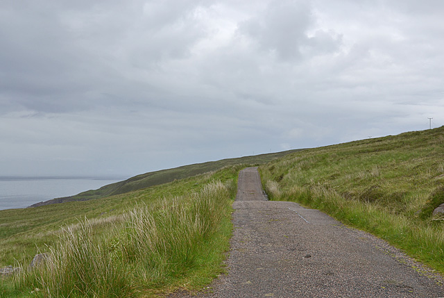
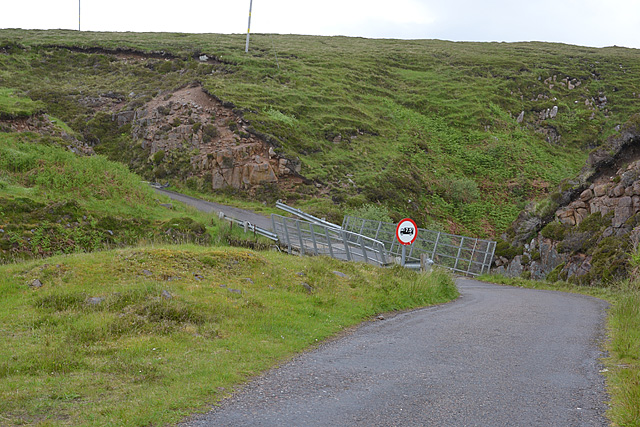
Access to Aird Ghlas is possible via a coastal path that runs along the edge of the headland. The path offers a scenic walk, allowing visitors to explore the rugged coastline and discover hidden coves and rock formations. It is advisable to wear appropriate footwear and take caution while walking near the cliffs, as they can be unstable in some areas.

Overall, Aird Ghlas is a captivating coastal feature that showcases the natural beauty of Ross-shire. Its impressive cliffs, diverse birdlife, and stunning views make it a must-visit destination for nature lovers and outdoor enthusiasts.

If you have any feedback on the listing, please let us know in the comments section below.

Aird Ghlas Images

Images are sourced within 2km of 57.817244/-5.8128538 or Grid Reference NG7387. Thanks to Geograph Open Source API. All images are credited.

B8021 at Melvaig
B8021 at Melvaig
Ruined croft at Melvaig
Coast at Melvaig
Coast at Melvaig
Road to the lighthouse
Car park on the road from Melvaig
Allt Grisionn
Allt Grisionn
Allt Grisionn
Allt Grisionn
Houses at Melvaig
Houses at Melvaig
Grazing land with a view
Allt a' Bhùtha
Allt a' Bhùtha
Bridge over Allt a' Bhùtha
House on the beach This house stands just above the shingle beach at Melvaig. The Allt Melvaig flows into the sea at the photographer's feet.
House on the beach
This house stands just above the shingle beach at Melvaig. The Allt Melvaig flows into the sea at the photographer's feet.
Bridge over Allt Melvaig The bridge carries the unclassified single track road which serves the small settlement of Melvaig.
Bridge over Allt Melvaig
The bridge carries the unclassified single track road which serves the small settlement of Melvaig.
Track heading for the shore With Skye in the distance.
Track heading for the shore
With Skye in the distance.
Melvaig Looking over the southern part of the scattered community.
Melvaig
Looking over the southern part of the scattered community.
The Rubha Rèidh road
Bridge over the Allt a' Bhùtha Not the most confidence-inducing structure.
Bridge over the Allt a' Bhùtha
Not the most confidence-inducing structure.
The Rubha Rèidh road heading north An up and down affair, which may create problems with some vehicles.

In recent years there have been conflicts with the owner of the accomodation at the lighthouse, who has attempted to stop public use of the road. However, the land here is owned by the Inverasdale Estate, and the road is owned by the Northern Lighthouse Board, neither of whom object to the public driving the road. Highland Council, which is responsible for designating the status of roads, has declared the road as "a private road open for all public access". All of which means the driving this road is legitimate. The views are worth it.
The Rubha Rèidh road heading north
An up and down affair, which may create problems with some vehicles. In recent years there have been conflicts with the owner of the accomodation at the lighthouse, who has attempted to stop public use of the road. However, the land here is owned by the Inverasdale Estate, and the road is owned by the Northern Lighthouse Board, neither of whom object to the public driving the road. Highland Council, which is responsible for designating the status of roads, has declared the road as "a private road open for all public access". All of which means the driving this road is legitimate. The views are worth it.
Show me another place!

Aird Ghlas is located at Grid Ref: NG7387 (Lat: 57.817244, Lng: -5.8128538)

Unitary Authority: Highland

Police Authority: Highlands and Islands

What 3 Words

///remake.dripped.customers. Near Gairloch, Highland

Related Wikis

Melvaig

Melvaig is a remote village on the coast of western Ross-shire, Scottish Highlands and is in the Scottish council area of Highland. It is a cliff top...

Aultgrishan

Aultgrishan (Gaelic: ) is a small crofting community near Gairloch, Ross-shire. It adjoins Melvaig, within Highland region and is in the Scottish council...

Rua Reidh Lighthouse

Rua Reidh Lighthouse stands close to the entrance to Loch Ewe in Wester Ross, Scotland. == History == The name "Rua Reidh" is a semi-anglicisation of...

North Erradale

North Erradale is a remote coastal crofting village on the western coast of Ross-shire, Scottish Highlands and is in the Scottish council area of Highland...

Nearby Amenities

Located within 500m of 57.817244,-5.8128538
Source: PGS
Lat/Long: 57.8213147/-5.8129699
Source: PGS
Lat/Long: 57.8212122/-5.8129565
Source: PGS
Lat/Long: 57.8206612/-5.8126651
Source: PGS
Lat/Long: 57.8202207/-5.8129632
Source: PGS
Lat/Long: 57.8201233/-5.8123919
Source: PGS
Lat/Long: 57.8190022/-5.8123027
Source: PGS
Lat/Long: 57.8188589/-5.8125938
Source: PGS
Lat/Long: 57.8186844/-5.8126808
Source: PGS
Lat/Long: 57.818414/-5.8131232
Source: PGS
Lat/Long: 57.8183945/-5.8132602
Source: PGS
Lat/Long: 57.8175514/-5.8131864
Created By: almien_coastlines
Source: PGS
Lat/Long: 57.816929/-5.813215
Source: PGS
Lat/Long: 57.8165365/-5.8112844
Source: PGS
Lat/Long: 57.8160368/-5.8108466
Source: PGS
Lat/Long: 57.8157296/-5.8106069
Source: PGS
Lat/Long: 57.8153368/-5.8103753
Source: PGS
Lat/Long: 57.8149696/-5.8100711
Source: PGS
Lat/Long: 57.814586/-5.8097748
Source: PGS
Lat/Long: 57.8143055/-5.8095246
Source: PGS
Lat/Long: 57.8137573/-5.809103
Cafe
Honesty Cafe and Gallery
Opening Hours: 24/7
Sustenance: self service
Website: https://www.mandyerush.me/
Lat/Long: 57.8162599/-5.80746
Turning Circle
Lat/Long: 57.8162423/-5.8060893
Power: pole
Lat/Long: 57.8174645/-5.8046326
Power: pole
Lat/Long: 57.8181147/-5.8048476
Power: pole
Lat/Long: 57.8186153/-5.8058894
Power: pole
Lat/Long: 57.8191408/-5.8069587
Power: pole
Lat/Long: 57.81962/-5.8079591
Power: pole
Lat/Long: 57.8203737/-5.8079798
Power: pole
Lat/Long: 57.8165676/-5.8049882
Power: pole
Lat/Long: 57.8164531/-5.8057846
Power: pole
Lat/Long: 57.8163459/-5.8066555
The data included in this document is from www.openstreetmap.org. The data is made available under ODbL.

Have you been to Aird Ghlas?

Leave your review of Aird Ghlas below (or comments, questions and feedback).