An Tarbh

Coastal Feature, Headland, Point in Ross-shire

Scotland

An Tarbh

The Allt a' Choire Chruim The Allt a' Choire Chruim passing through sand dunes about to reach the sea near Red Point.
The Allt a' Choire Chruim Credit: Trevor Littlewood

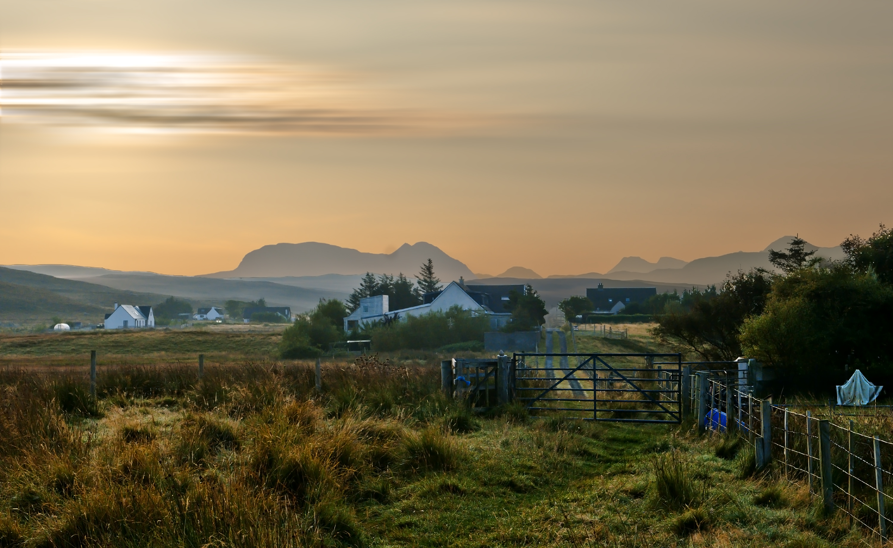
An Tarbh is a prominent headland located in Ross-shire, Scotland. Situated on the coast, this coastal feature offers stunning views of the surrounding area and is a popular destination for nature enthusiasts and hikers.

The headland is characterized by its rocky cliffs and rugged terrain, which provide a dramatic backdrop against the crashing waves of the North Sea. The cliffs are composed of sedimentary rock formations, displaying layers of different colors and textures that have been shaped by years of erosion.

At the highest point of An Tarbh, visitors can enjoy panoramic views of the coastline and the vast expanse of the sea. On clear days, it is possible to see the distant mountains of the Scottish Highlands in the inland direction. The headland is also known for its diverse wildlife, with seabirds nesting on the cliffs and occasional sightings of seals and dolphins in the waters below.

Access to An Tarbh is relatively easy, with a well-maintained hiking trail leading from the nearby village. The trail offers a moderate level of difficulty, but the scenic views along the way make it a worthwhile journey. There are also informational signs and viewpoints along the trail that provide insights into the geological and ecological significance of the area.

Overall, An Tarbh is a captivating coastal feature that showcases the natural beauty of Ross-shire. Its rugged cliffs, breathtaking views, and abundant wildlife make it a must-visit destination for anyone seeking to immerse themselves in the stunning Scottish landscape.

If you have any feedback on the listing, please let us know in the comments section below.

An Tarbh Images

Images are sourced within 2km of 57.665906/-5.8044025 or Grid Reference NG7370. Thanks to Geograph Open Source API. All images are credited.

The Allt a' Choire Chruim The Allt a' Choire Chruim passing through sand dunes about to reach the sea near Red Point.
The Allt a' Choire Chruim
The Allt a' Choire Chruim passing through sand dunes about to reach the sea near Red Point.
Ruined building on croft at Red Point Red Point is a crofting community beside the B8056, south-west of Badachro.
Ruined building on croft at Red Point
Red Point is a crofting community beside the B8056, south-west of Badachro.
Croft land at Red Point Red Point is a crofting community astride the B8056 south-west of Badachro. There are ruined buildings but some crofts are still worked as can be seen by the cutting in these fields of what presumably was an early hay crop.
Croft land at Red Point
Red Point is a crofting community astride the B8056 south-west of Badachro. There are ruined buildings but some crofts are still worked as can be seen by the cutting in these fields of what presumably was an early hay crop.
Redpoint viewpoint
Redpoint viewpoint
Croft land at Redpoint
Entrance to Redpoint Farm
Red Point beach
Red Point beach
Red Point viewpoint
Red Point viewpoint
Viewpoint and view, Redpoint The view is over the beach and dunes at Redpoint and then over the sea to the Isle of Skye.
Viewpoint and view, Redpoint
The view is over the beach and dunes at Redpoint and then over the sea to the Isle of Skye.
Seldom used seat A short path leads from a small car park to the viewpoint at Redpoint. This seat stands alongside the path, but only in rarely experienced idyllic weather conditions is it likely that anyone would want to sit on it for long.
Seldom used seat
A short path leads from a small car park to the viewpoint at Redpoint. This seat stands alongside the path, but only in rarely experienced idyllic weather conditions is it likely that anyone would want to sit on it for long.
Allt a' Choire Chruim This small river drains from the nearby moorland, and finds its way to the sea through the sand dunes at the southern end of Redpoint beach.
Allt a' Choire Chruim
This small river drains from the nearby moorland, and finds its way to the sea through the sand dunes at the southern end of Redpoint beach.
No sand castles today My dog loved the firm sand of the beach at Redpoint, but I managed to get this image of the undisturbed beach before he raced about all over it.
No sand castles today
My dog loved the firm sand of the beach at Redpoint, but I managed to get this image of the undisturbed beach before he raced about all over it.
Stones in the sand The wind has sculpted little sand dunes around these large pebbles on the beach at Redpoint.
Stones in the sand
The wind has sculpted little sand dunes around these large pebbles on the beach at Redpoint.
Pebbles and dunes A river of pebbles flows from among the sand dunes above the beach at Redpoint.
Pebbles and dunes
A river of pebbles flows from among the sand dunes above the beach at Redpoint.
B8056 Glac nan Cuile The phone box seems to have gone now and in a picture I have from the other side it already had the door missing by this date.
B8056 Glac nan Cuile
The phone box seems to have gone now and in a picture I have from the other side it already had the door missing by this date.
Rocks in the dunes at Red Point Beach
Gate at Red Point Farm
A moorland scene at Redpoint Beinn Alligin on the horizon
A moorland scene at Redpoint
Beinn Alligin on the horizon
Show me another place!

An Tarbh is located at Grid Ref: NG7370 (Lat: 57.665906, Lng: -5.8044025)

Unitary Authority: Highland

Police Authority: Highlands and Islands

What 3 Words

///highlighted.magnitude.scatter. Near Gairloch, Highland

Related Wikis

Redpoint

Redpoint (Scottish Gaelic: An Rubha Dearg) is a small settlement in the north west of Highland, Scotland. It takes its name from Red Point, a low promontory...

South Erradale

South Erradale is a small hamlet, situated on the coastline and to the southwest of Gairloch in Ross and Cromarty, Scottish Highlands and is in the Scottish...

Opinan, Gairloch

Opinan (Scottish Gaelic: Na h-Òbaidhnean) is a fishing village on the west coast of Scotland in Gairloch, Ross-shire, Scottish Highlands and is in the...

Port Henderson

Port Henderson (Scottish Gaelic: Portaigil) is a fishing village on the south west shore of the Gair Loch near the village of Gairloch, Ross-shire, Scottish...

Badachro

Badachro (Scottish Gaelic: Bad a' Chrò) is a former fishing village, in the northwest Highlands of Scotland. == Geography == Badachro sits about 3 km south...

Loch Bràigh Horrisdale

Loch Bràigh Horrisdale is a small, irregular shaped, freshwater loch in Wester Ross, in the north west of Scotland. The loch lies approximately 2 mi (3...

Eilean Horrisdale

Eilean Horrisdale is an uninhabited island in Loch Gairloch in Wester Ross, Scotland. == Geography == Eilean Horrisdale is the largest island in Loch Gairloch...

Gair Loch

The Gair Loch is a sea loch on the North West coast of Highland, Scotland. In Scottish Gaelic it is an Geàrr Loch meaning 'the short loch'. Around 6 miles...

Nearby Amenities

Located within 500m of 57.665906,-5.8044025
Source: PGS
Lat/Long: 57.6701478/-5.8018866
Source: PGS
Lat/Long: 57.6696862/-5.8025971
Source: PGS
Lat/Long: 57.6688291/-5.8033372
Created By: almien_coastlines
Source: PGS
Lat/Long: 57.668591/-5.803385
Source: PGS
Lat/Long: 57.6681927/-5.8040899
Source: PGS
Lat/Long: 57.6666604/-5.8051206
Source: PGS
Lat/Long: 57.666753/-5.8052462
Created By: almien_coastlines
Source: PGS
Lat/Long: 57.666754/-5.805393
Source: PGS
Lat/Long: 57.6660229/-5.8059132
Source: PGS
Lat/Long: 57.6658577/-5.8061377
Source: PGS
Lat/Long: 57.6651074/-5.8069306
Source: PGS
Lat/Long: 57.6648356/-5.8073085
Source: PGS
Lat/Long: 57.6647885/-5.8077299
Source: PGS
Lat/Long: 57.6646652/-5.8078588
Source: PGS
Lat/Long: 57.6636445/-5.8084092
Source: PGS
Lat/Long: 57.6631219/-5.8090186
Source: PGS
Lat/Long: 57.6631794/-5.80947
Source: PGS
Lat/Long: 57.6628627/-5.8099158
Power: pole
Lat/Long: 57.6683593/-5.7984469
Power: pole
Lat/Long: 57.6678417/-5.7989432
Power: pole
Lat/Long: 57.6673262/-5.7994452
Power: pole
Lat/Long: 57.6668341/-5.7998918
Power: pole
Lat/Long: 57.6663053/-5.8003862
Power: pole
Lat/Long: 57.6657173/-5.8009416
Power: pole
Lat/Long: 57.6651547/-5.8014742
Power: pole
Lat/Long: 57.6645616/-5.8020239
Power: pole
Lat/Long: 57.6642073/-5.8024133
Power: pole
Lat/Long: 57.663998/-5.8025908
Power: pole
Lat/Long: 57.6634181/-5.8031367
Power: pole
Lat/Long: 57.6630495/-5.8034421
Power: pole
Lat/Long: 57.6626687/-5.8037609
Power: pole
Lat/Long: 57.6619744/-5.8043717
Power: pole
Lat/Long: 57.6616568/-5.8052144
The data included in this document is from www.openstreetmap.org. The data is made available under ODbL.

Have you been to An Tarbh?

Leave your review of An Tarbh below (or comments, questions and feedback).