A' Chleit

Coastal Feature, Headland, Point in Argyllshire

Scotland

A' Chleit

Bridge House, Muasdale
Bridge House, Muasdale Credit: Elliott Simpson

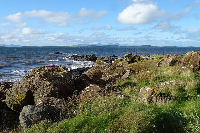
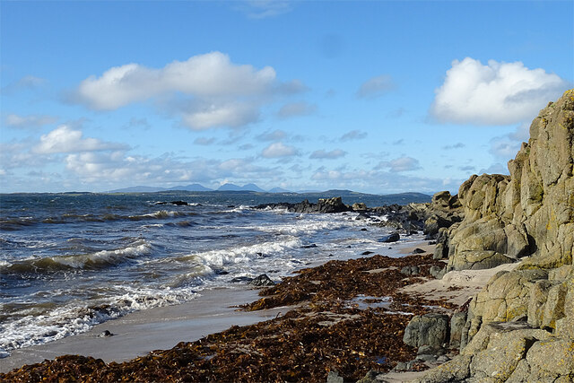
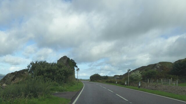
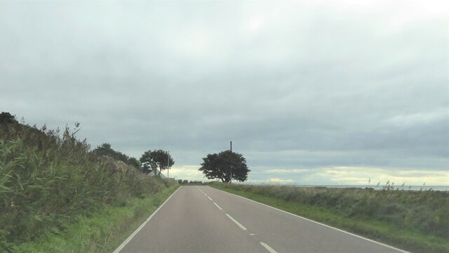
A' Chleit is a prominent coastal feature located in Argyllshire, Scotland. It is a headland or point that extends into the sea, offering breathtaking views of the surrounding landscape. The rocky cliffs and rugged terrain make it an impressive natural landmark.

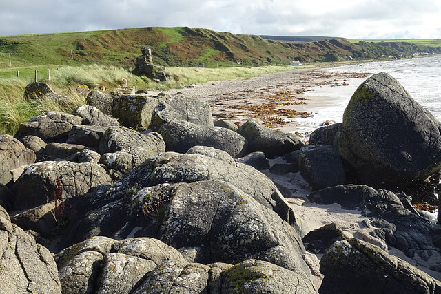
Situated on the western coast of Scotland, A' Chleit is known for its dramatic cliffs, which rise steeply from the water below. These cliffs are composed of ancient rock formations, showcasing the area's geological history. The headland is also characterized by its diverse flora and fauna, with various species of seabirds nesting on the cliffs and the surrounding waters teeming with marine life.

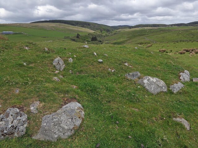
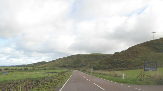
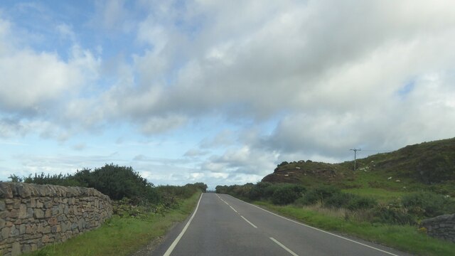
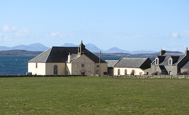
The area surrounding A' Chleit is rich in natural beauty, with rolling hills and lush greenery. It is a popular spot for outdoor enthusiasts, offering opportunities for hiking, birdwatching, and photography. The headland provides an ideal vantage point to admire the stunning sunsets over the sea, creating a captivating atmosphere for visitors.

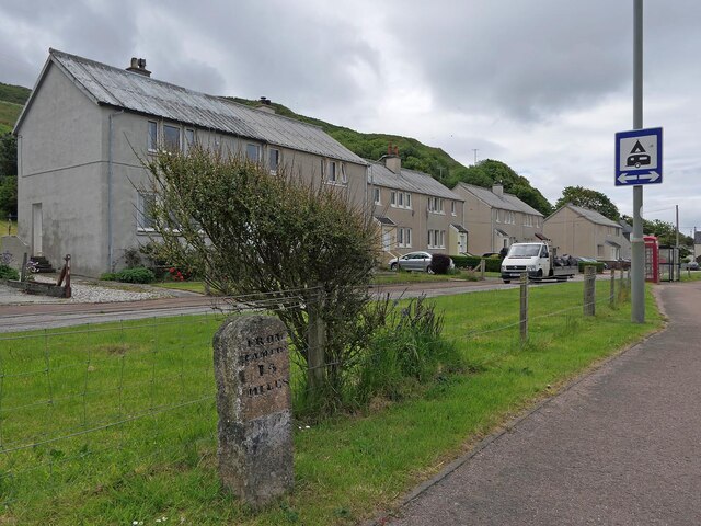
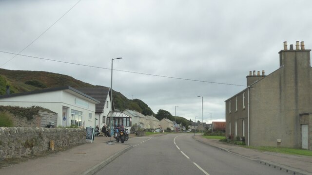
A' Chleit is easily accessible by road, with a nearby car park providing convenient access for visitors. The headland is a short distance from the nearest town, offering amenities such as accommodations, restaurants, and shops. It is also well-connected to other attractions in the region, making it a popular stop along coastal routes.

In summary, A' Chleit is a striking headland in Argyllshire, Scotland, known for its rugged cliffs, diverse wildlife, and stunning views. It is a must-visit destination for nature enthusiasts and those seeking to explore the natural beauty of the Scottish coastline.

If you have any feedback on the listing, please let us know in the comments section below.
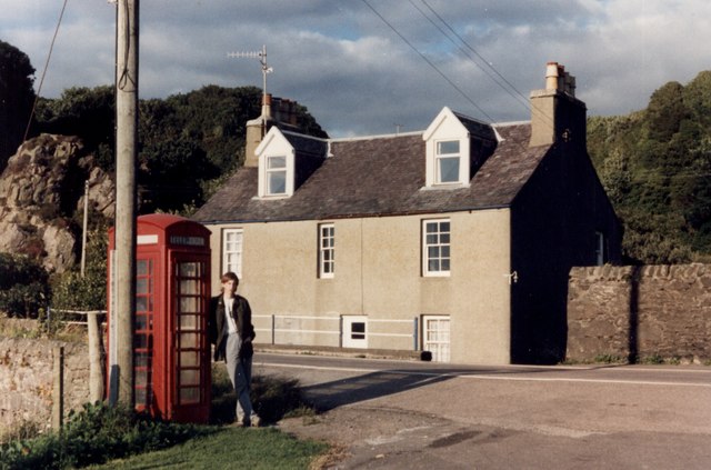
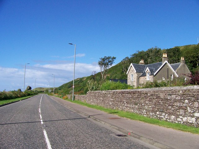
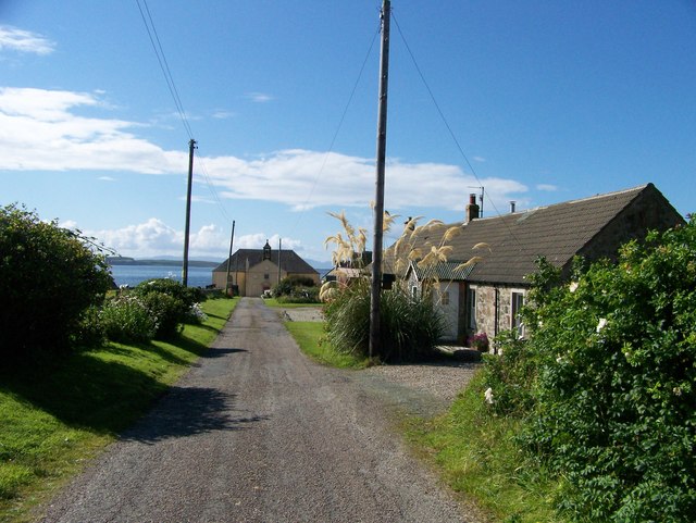
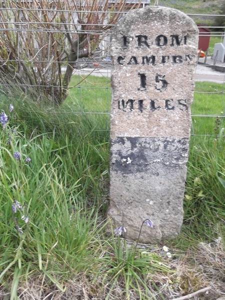
A' Chleit Images

Images are sourced within 2km of 55.615163/-5.6854523 or Grid Reference NR6841. Thanks to Geograph Open Source API. All images are credited.

Bridge House, Muasdale
A83 heading north at Muasdale
Killean Parish Church, A' Chleit near Muasdale, Argyll
Old Milestone by the A83, Muasdale Milestone by the A83, in parish of Killean & Kilchenzie (Kintyre District), Muasdale, at bus stop, East side of road.

Inscription reads:-
FROM
CAMPBᴺ.
15
MILES

Surveyed

Milestone Society National ID: AB_CTTB15
Old Milestone by the A83, Muasdale
Milestone by the A83, in parish of Killean & Kilchenzie (Kintyre District), Muasdale, at bus stop, East side of road. Inscription reads:- FROM CAMPBᴺ. 15 MILES Surveyed Milestone Society National ID: AB_CTTB15
Old milestone The 13 mile stone photographed in 2012 was not seen in 2019.  This 15 mile stone near the bus stop at the south end of Muasdale has lost most of its paint cover in the last 7 years.
Old milestone
The 13 mile stone photographed in 2012 was not seen in 2019. This 15 mile stone near the bus stop at the south end of Muasdale has lost most of its paint cover in the last 7 years.
Dunan Muasdale, Argyll This is a dun which is described at <span class="nowrap"><a title="https://canmore.org.uk/site/38575/dunan-muasdale" rel="nofollow ugc noopener" href="https://canmore.org.uk/site/38575/dunan-muasdale">Link</a><img style="margin-left:2px;" alt="External link" title="External link - shift click to open in new window" src="https://s1.geograph.org.uk/img/external.png" width="10" height="10"/></span> : "On a rocky knoll at a height of 90m OD, there is an almost circular dun measuring 13.5m by 12m internally. The wall has consisted of a core of stones faced on either side with massive boulders, and has measured 4m in thickness."
Dunan Muasdale, Argyll
This is a dun which is described at LinkExternal link : "On a rocky knoll at a height of 90m OD, there is an almost circular dun measuring 13.5m by 12m internally. The wall has consisted of a core of stones faced on either side with massive boulders, and has measured 4m in thickness."
Muasdale Cottages, Muasdale, Argyll The houses appear to be of post-war non-standard construction and still have asbestos roofs.
Muasdale Cottages, Muasdale, Argyll
The houses appear to be of post-war non-standard construction and still have asbestos roofs.
Killean Kirk The rear of the kirk at A' Chleit. This is the parish kirk of Killean and Kilchenzie, and dates from 1787 with later repairs. It is a Category A Listed building.
Killean Kirk
The rear of the kirk at A' Chleit. This is the parish kirk of Killean and Kilchenzie, and dates from 1787 with later repairs. It is a Category A Listed building.
Shore at A' Chleit As I suspected, the promontory of A' Chleit owes its existence to a Palaeogene igneous dyke which extends out to sea as a line of rocks. It is part of a dyke swarm, probably associated with the Arran volcanic centre. Unfortunately the tide was too high to take a proper look at it. From here one can enjoy a fine view over the Isle of Gigha towards the Paps of Jura.
Shore at A' Chleit
As I suspected, the promontory of A' Chleit owes its existence to a Palaeogene igneous dyke which extends out to sea as a line of rocks. It is part of a dyke swarm, probably associated with the Arran volcanic centre. Unfortunately the tide was too high to take a proper look at it. From here one can enjoy a fine view over the Isle of Gigha towards the Paps of Jura.
A' Chleit From the beach, the igneous dyke is even more obvious. It is part of a Palaeogene dyke swarm, probably associated with the Arran volcanic centre. Unfortunately the tide was too high to examine it closely.
A' Chleit
From the beach, the igneous dyke is even more obvious. It is part of a Palaeogene dyke swarm, probably associated with the Arran volcanic centre. Unfortunately the tide was too high to examine it closely.
Beach at A' Chleit Looking along the sandy beach south of A' Chleit. In the background is the slope down from a much earlier beach, left high and dry as sea level fell after the last Ice Age.
Beach at A' Chleit
Looking along the sandy beach south of A' Chleit. In the background is the slope down from a much earlier beach, left high and dry as sea level fell after the last Ice Age.
Killean and Kilchenzie Parish Kirk The kirk is a Category A Listed building, dating from 1787. It is still in regular ecclesiastical use.
Killean and Kilchenzie Parish Kirk
The kirk is a Category A Listed building, dating from 1787. It is still in regular ecclesiastical use.
A83 north of Muasdale, Kintyre
A83 northbound near A'Chleit, Kintyre
A83 northbound at Beachmenach, Kintyre
Muasdale, Kintyre
Muasdale, Kintyre
A83 near Beacharr, Kintyre
Chleit Pasture, Jura and Killean and Kilkenzie Parish Church.
Chleit
Pasture, Jura and Killean and Kilkenzie Parish Church.
Show me another place!

A' Chleit is located at Grid Ref: NR6841 (Lat: 55.615163, Lng: -5.6854523)

Unitary Authority: Argyll and Bute

Police Authority: Argyll and West Dunbartonshire

What 3 Words

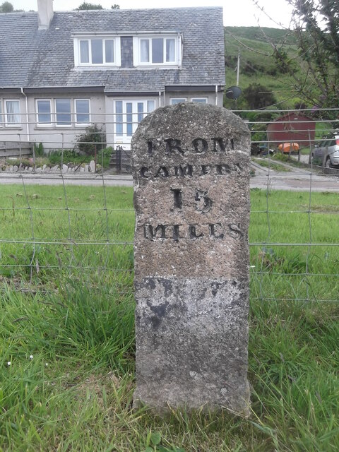
///pinks.dominate.motive. Near Campbeltown, Argyll & Bute

Nearby Locations

A' Chleit

Related Wikis

Muasdale

Muasdale (Scottish Gaelic: Muasdal) is a hamlet on the western coast of the Kintyre Peninsula of Scotland. As of the year 2000 Muasdale had a population...

Dundonald Castle, Kintyre

Dundonald Castle is a ruined castle near Killean, Kintyre, Scotland. It was a stronghold of Clan Donald, but later passed to the Campbells. == Notes... ==

Cara Island

Cara Island (Scottish Gaelic: Cara) is a small island which is located off the west coast of Kintyre in Scotland. == Geography and etymology == Cara is...

St Fionnlagh's Chapel

St Fionnlagh's Chapel (St Finla's Chapel) is a ruined medieval chapel on Cara Island, Argyll and Bute, Scotland. First recorded in the 15th century, the...

Nearby Amenities

Located within 500m of 55.615163,-5.6854523
Power: pole
Lat/Long: 55.611761/-5.6809831
Power: pole
Lat/Long: 55.61305/-5.6814692
Power: pole
Lat/Long: 55.6135164/-5.6810406
Power: pole
Lat/Long: 55.6137257/-5.6806121
Power: pole
Lat/Long: 55.614356/-5.6793281
Power: pole
Lat/Long: 55.6149452/-5.6781963
Power: pole
Lat/Long: 55.6124021/-5.6812683
Power: pole
Lat/Long: 55.6141946/-5.6833417
Power: pole
Lat/Long: 55.6140181/-5.6827525
Power: pole
Lat/Long: 55.6138164/-5.6820896
Power: pole
Lat/Long: 55.6136765/-5.6816053
Bench
Lat/Long: 55.6142825/-5.6838745
Ford: yes
Lat/Long: 55.6173953/-5.6791118
The data included in this document is from www.openstreetmap.org. The data is made available under ODbL.

Have you been to A' Chleit?

Leave your review of A' Chleit below (or comments, questions and feedback).