Rubha Dubh

Coastal Feature, Headland, Point in Argyllshire

Scotland

Rubha Dubh
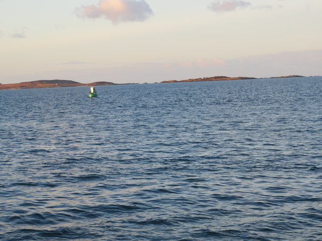
Buoy marking the skerry at Sgeir a' Caolas
Buoy marking the skerry at Sgeir a' Caolas Credit: John Ferguson

Rubha Dubh is a prominent headland located in Argyllshire, Scotland. Situated on the west coast of the country, this coastal feature juts out into the North Atlantic Ocean, offering stunning views of the surrounding landscape. The name "Rubha Dubh" translates to "black point" in Gaelic, likely referencing the dark, rocky cliffs that line the headland.

The headland is known for its rugged beauty and dramatic cliffs that drop off into the sea below. The area is popular among hikers and nature enthusiasts, who come to explore the coastal trails and take in the breathtaking views of the ocean and surrounding countryside.

Rubha Dubh is also home to a variety of wildlife, including seabirds such as puffins and gannets, as well as seals and otters that can be spotted along the rocky shoreline. The headland's remote location and unspoiled natural beauty make it a peaceful and picturesque destination for those looking to escape the hustle and bustle of city life.

Overall, Rubha Dubh is a must-visit destination for anyone exploring the rugged coastline of Argyllshire, offering a glimpse into the wild and untamed beauty of Scotland's western shores.

If you have any feedback on the listing, please let us know in the comments section below.

Rubha Dubh Images

Images are sourced within 2km of 55.659105/-5.7371762 or Grid Reference NR6546. Thanks to Geograph Open Source API. All images are credited.
Buoy marking the skerry at Sgeir a' Caolas
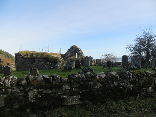
Ruins of St Cathan's Church Ardminish
Refuelling facilities on Gigha With a rather tropical appearance with the Cordyline palms [not really palms, but related to Asparagus] by the pumps, at the Post Office on the island.
Refuelling facilities on Gigha
With a rather tropical appearance with the Cordyline palms [not really palms, but related to Asparagus] by the pumps, at the Post Office on the island.
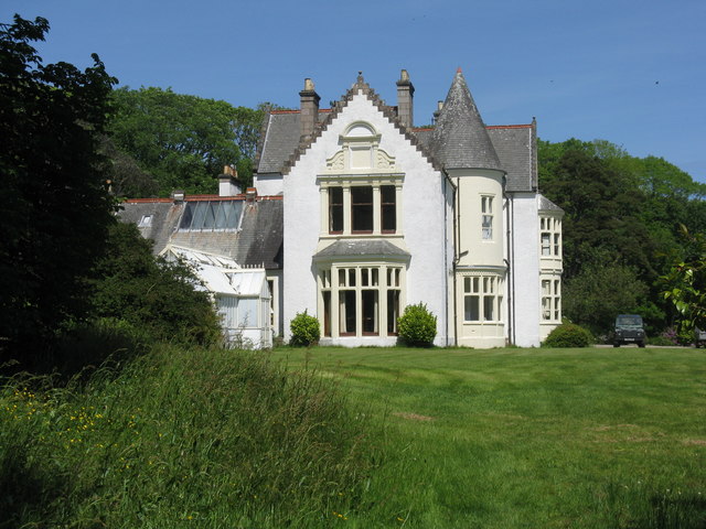
Achamore House, Gigha A Scottish baronial-style mansion built in 1884 <span class="nowrap"><a title="https://canmore.org.uk/site/38541/gigha-achamore-estate-achamore-house" rel="nofollow ugc noopener" href="https://canmore.org.uk/site/38541/gigha-achamore-estate-achamore-house">Link</a><img style="margin-left:2px;" alt="External link" title="External link - shift click to open in new window" src="https://s1.geograph.org.uk/img/external.png" width="10" height="10"/></span>.
Achamore House, Gigha
A Scottish baronial-style mansion built in 1884 LinkExternal link.
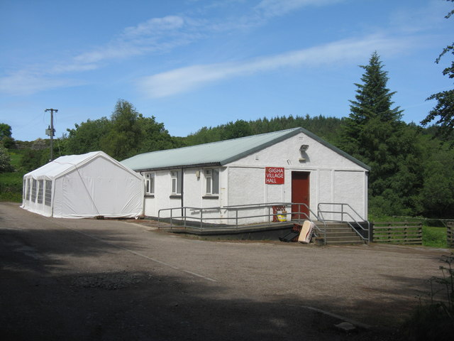
Gigha Village Hall Adjacent to the car park for Achamore House.
Gigha Village Hall
Adjacent to the car park for Achamore House.
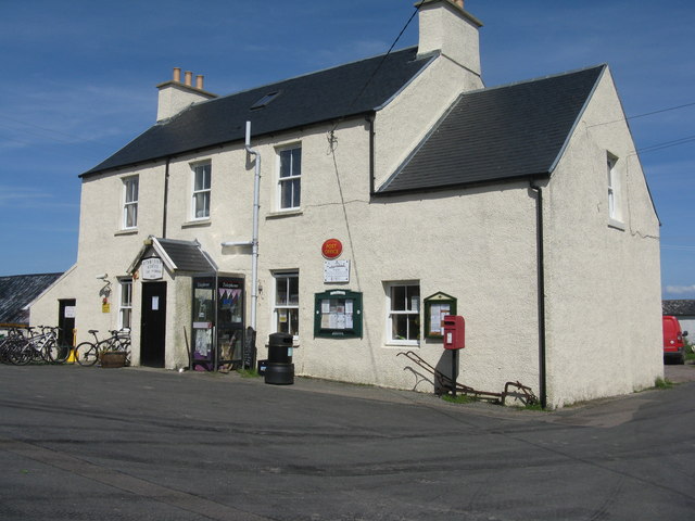
Ardminish Stores and Post Office The commercial centre of the Isle of Gigha.
Ardminish Stores and Post Office
The commercial centre of the Isle of Gigha.
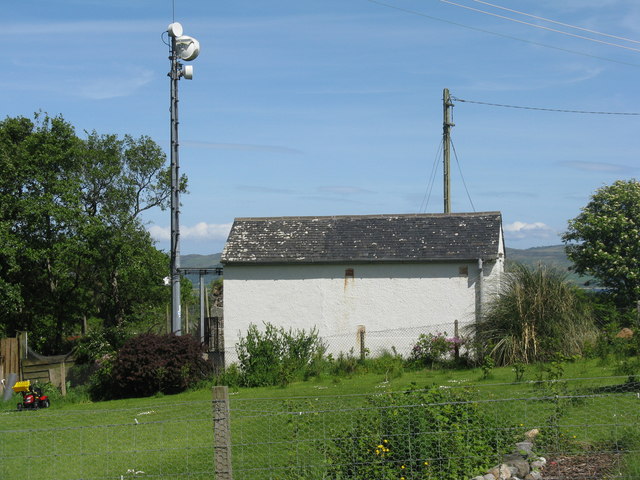
Mast and telephone building, Gigha Behind the Post Office and store at Ardminish.
Mast and telephone building, Gigha
Behind the Post Office and store at Ardminish.
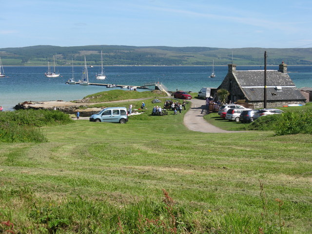
Boat House Café and Bar, Gigha Handy for the jetty serving the moorings, and not far from the ferry terminal.
Boat House Café and Bar, Gigha
Handy for the jetty serving the moorings, and not far from the ferry terminal.
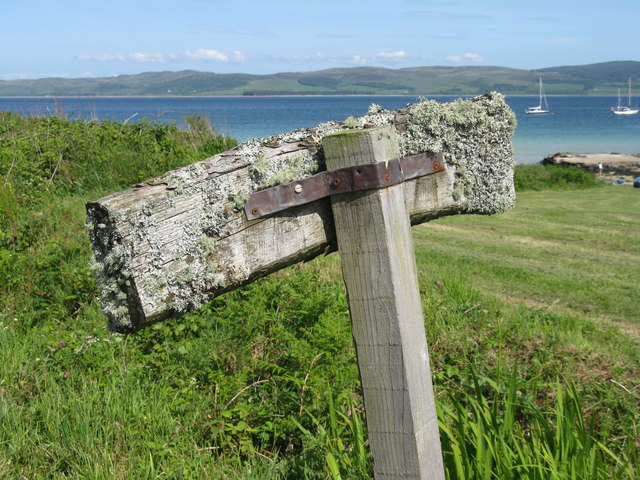
Sign with lichens Showing the way to the Boat House Café and Bar <a href="https://www.geograph.org.uk/photo/5429987">NR6548 : Boat House Café and Bar, Gigha</a>, but the writing was on the wrong side for photography! Ardminish Bay, the Sound of Gigha and Kintyre beyond.
Sign with lichens
Showing the way to the Boat House Café and Bar NR6548 : Boat House Café and Bar, Gigha, but the writing was on the wrong side for photography! Ardminish Bay, the Sound of Gigha and Kintyre beyond.
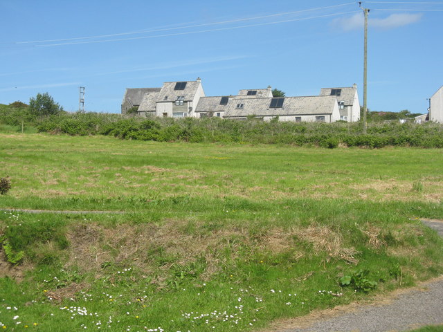
Houses on Gigha Almost at the centre of the island, at Achadh na h-Atha.
Houses on Gigha
Almost at the centre of the island, at Achadh na h-Atha.
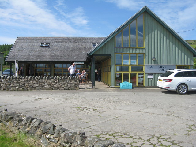
Gigha Gallery Craft workshop, art gallery, tea room, and offices of the Isle of Gigha Heritage Trust at Ardminish
Gigha Gallery
Craft workshop, art gallery, tea room, and offices of the Isle of Gigha Heritage Trust at Ardminish
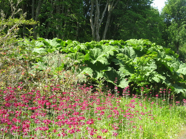
Gunnera and Primula at Achamore Gardens The gardens are  a highlight of the Island of Gigha - plenty of rambling paths and a delightful informality.
Gunnera and Primula at Achamore Gardens
The gardens are a highlight of the Island of Gigha - plenty of rambling paths and a delightful informality.
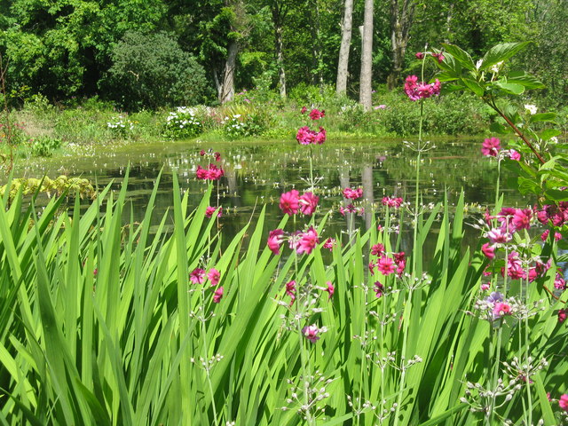
The pond at Achamore Marginal primulas and irises, with emergent Potamogeton flowers, and lilies on the far side.
The pond at Achamore
Marginal primulas and irises, with emergent Potamogeton flowers, and lilies on the far side.
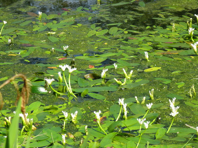
Emergent flowers on the pond at Achamore Gardens I'm not sure what they are; possibly a water lily of some sort - I thought at first Potamogeton flowers, from the plant with floating leaves, but I now think not.
Emergent flowers on the pond at Achamore Gardens
I'm not sure what they are; possibly a water lily of some sort - I thought at first Potamogeton flowers, from the plant with floating leaves, but I now think not.
Pond-edge plants at Achamore Garden Primula [pink] and Libertia [white flowers, of the Iris family], with a carved Otter by the pond.
Pond-edge plants at Achamore Garden
Primula [pink] and Libertia [white flowers, of the Iris family], with a carved Otter by the pond.
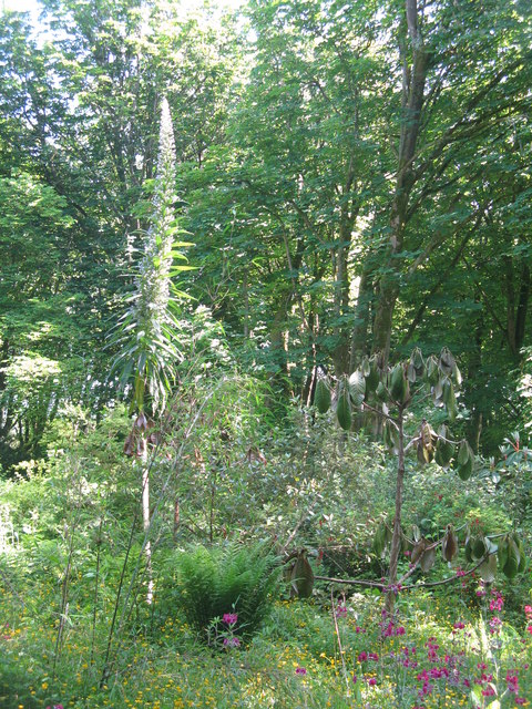
Giant Viper's Bugloss at Achamore An impressive plant that grows up to 4m high, with spikes of blue flowers. Echium pininana is native to La Palma in the Canary Islands.
Giant Viper's Bugloss at Achamore
An impressive plant that grows up to 4m high, with spikes of blue flowers. Echium pininana is native to La Palma in the Canary Islands.
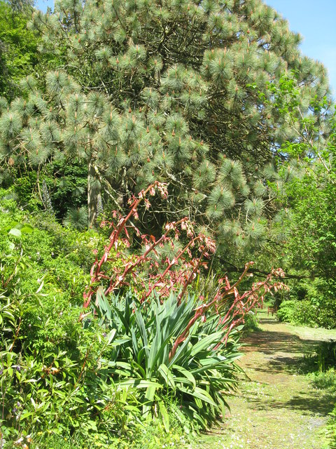
Path in Achamore Gardens With a fine Pine tree and an Agave/Aloe type plant.
Path in Achamore Gardens
With a fine Pine tree and an Agave/Aloe type plant.
Cabbage Tree and Giant Viper's Bugloss at Achamore Two plants [Cordyline australis, from New Zealand and Echium pininana, from the Canary Islands, resp.] that demonstrate the mildness of the Argyll climate.
Cabbage Tree and Giant Viper's Bugloss at Achamore
Two plants [Cordyline australis, from New Zealand and Echium pininana, from the Canary Islands, resp.] that demonstrate the mildness of the Argyll climate.
Show me another place!

Rubha Dubh is located at Grid Ref: NR6546 (Lat: 55.659105, Lng: -5.7371762)

Unitary Authority: Argyll and Bute

Police Authority: Argyll and West Dunbartonshire

What 3 Words

///breeze.rate.scoring. Near Craighouse, Argyll & Bute

Have you been to Rubha Dubh?

Leave your review of Rubha Dubh below (or comments, questions and feedback).
Nearby Amenities

Located within 500m of 55.659105,-5.7371762
Created By: dmgroom_coastlines
Lat/Long: 55.661629/-5.731321
Created By: dmgroom_coastlines
Lat/Long: 55.661619/-5.731774
Created By: dmgroom_coastlines
Lat/Long: 55.662131/-5.731809
Created By: dmgroom_coastlines
Lat/Long: 55.66212/-5.732262
Created By: dmgroom_coastlines
Lat/Long: 55.661092/-5.732417
Created By: dmgroom_coastlines
Lat/Long: 55.66057/-5.732834
Created By: dmgroom_coastlines
Lat/Long: 55.660437/-5.733051
Created By: dmgroom_coastlines
Lat/Long: 55.660305/-5.733269
Created By: dmgroom_coastlines
Lat/Long: 55.659527/-5.733668
Created By: dmgroom_coastlines
Lat/Long: 55.659394/-5.733884
Created By: dmgroom_coastlines
Lat/Long: 55.659261/-5.734102
Created By: dmgroom_coastlines
Lat/Long: 55.659128/-5.734319
Created By: dmgroom_coastlines
Lat/Long: 55.658852/-5.735206
Created By: dmgroom_coastlines
Lat/Long: 55.658684/-5.737007
Created By: dmgroom_coastlines
Lat/Long: 55.657917/-5.736953
Created By: dmgroom_coastlines
Lat/Long: 55.657907/-5.737406
Created By: dmgroom_coastlines
Lat/Long: 55.658418/-5.737442
Created By: dmgroom_coastlines
Lat/Long: 55.658398/-5.738347
Created By: dmgroom_coastlines
Lat/Long: 55.658818/-5.738532
Created By: dmgroom_coastlines
Lat/Long: 55.658751/-5.739731
Created By: dmgroom_coastlines
Lat/Long: 55.6590447/-5.7403247
Created By: dmgroom_coastlines
Lat/Long: 55.658721/-5.741088
Created By: dmgroom_coastlines
Lat/Long: 55.658588/-5.741306
Created By: dmgroom_coastlines
Lat/Long: 55.658455/-5.741523
Created By: dmgroom_coastlines
Lat/Long: 55.658179/-5.74241
Created By: dmgroom_coastlines
Lat/Long: 55.658031/-5.743306
Created By: dmgroom_coastlines
Lat/Long: 55.6575442/-5.7433477
Created By: dmgroom_coastlines
Lat/Long: 55.6570463/-5.7432699
Power: pole
Lat/Long: 55.6605349/-5.7443383
Power: pole
Lat/Long: 55.6605349/-5.7430607
Power: pole
Lat/Long: 55.6606125/-5.7418134
Power: pole
Lat/Long: 55.6607032/-5.7406847
Power: pole
Lat/Long: 55.660772/-5.73967
Power: pole
Lat/Long: 55.6601839/-5.7392801
The data included in this document is from www.openstreetmap.org. The data is made available under ODbL.