Eastern Tye

Coastal Feature, Headland, Point in Cornwall

England

Eastern Tye

Porthleven - The Bickford Smith Institute The Bickford Smith Institute was built 1883-4 at the town end of Porthleven's pier. It incorporates a library and a conspicuous clock tower.
Photo taken from Mount Pleasant Road.
The institute is EH Grade II listed: <span class="nowrap"><a title="https://historicengland.org.uk/listing/the-list/list-entry/1297626" rel="nofollow ugc noopener" href="https://historicengland.org.uk/listing/the-list/list-entry/1297626">Link</a><img style="margin-left:2px;" alt="External link" title="External link - shift click to open in new window" src="https://s1.geograph.org.uk/img/external.png" width="10" height="10"/></span>
Porthleven - The Bickford Smith Institute Credit: Rob Farrow

The requested URL returned error: 429 Too Many Requests

If you have any feedback on the listing, please let us know in the comments section below.
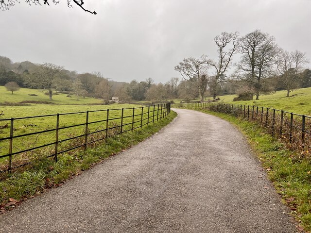
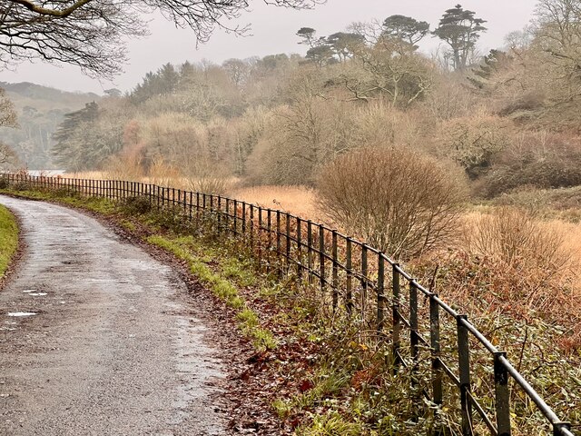
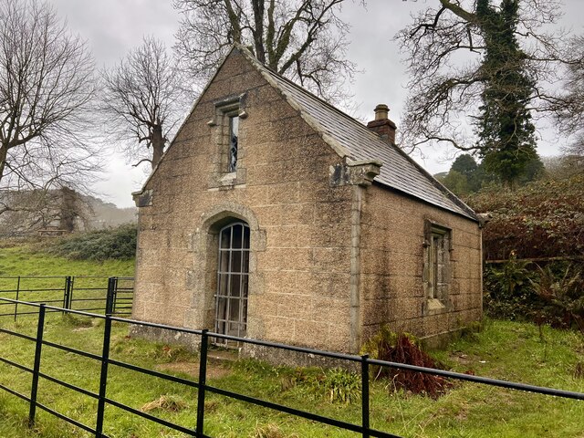
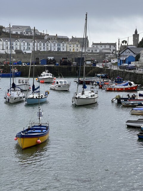
Eastern Tye Images

Images are sourced within 2km of 50.077755/-5.3079466 or Grid Reference SW6324. Thanks to Geograph Open Source API. All images are credited.

Porthleven - The Bickford Smith Institute The Bickford Smith Institute was built 1883-4 at the town end of Porthleven's pier. It incorporates a library and a conspicuous clock tower.
Photo taken from Mount Pleasant Road.
The institute is EH Grade II listed: <span class="nowrap"><a title="https://historicengland.org.uk/listing/the-list/list-entry/1297626" rel="nofollow ugc noopener" href="https://historicengland.org.uk/listing/the-list/list-entry/1297626">Link</a><img style="margin-left:2px;" alt="External link" title="External link - shift click to open in new window" src="https://s1.geograph.org.uk/img/external.png" width="10" height="10"/></span>
Porthleven - The Bickford Smith Institute
The Bickford Smith Institute was built 1883-4 at the town end of Porthleven's pier. It incorporates a library and a conspicuous clock tower. Photo taken from Mount Pleasant Road. The institute is EH Grade II listed: LinkExternal link
Penrose in the rain Walking to the Loe Pool, in the rain.
Penrose in the rain
Walking to the Loe Pool, in the rain.
Estate Building A small well built pump house. To supply water to the Estate Gardens.
Estate Building
A small well built pump house. To supply water to the Estate Gardens.
Penrose Stream Looking northwest up the stream, again in the drizzle, making the photo drab.
Penrose Stream
Looking northwest up the stream, again in the drizzle, making the photo drab.
Penrose House and Gardens A damp view of the house and gardens.
Penrose House and Gardens
A damp view of the house and gardens.
Penrose Stables The stables have been converted to holiday accommodation and a cafe, which looked rather busy today.
Penrose Stables
The stables have been converted to holiday accommodation and a cafe, which looked rather busy today.
Lane at Penrose Very few visitors are down near Loe Pool, preferring the cafe up near the house.
Lane at Penrose
Very few visitors are down near Loe Pool, preferring the cafe up near the house.
Path and Rushes The rushes growing in the boggy low lying lakeside.
Path and Rushes
The rushes growing in the boggy low lying lakeside.
Large branch One of the main limbs has been blown off the Oak tree in a recent storm.
Large branch
One of the main limbs has been blown off the Oak tree in a recent storm.
The Loe Loe Pool in the rain.
The Loe
Loe Pool in the rain.
The Pump House Access is difficult to get closer to this well built structure.
The Pump House
Access is difficult to get closer to this well built structure.
Seat and Grass A small area of grass with seating overlooking Porthleven harbour.
Seat and Grass
A small area of grass with seating overlooking Porthleven harbour.
Inner Harbour The sheltered inner harbour at Porthleven.
Inner Harbour
The sheltered inner harbour at Porthleven.
The Mackerel Loft A former warehouse used in the fishing industry for processing Mackeral.
The Mackerel Loft
A former warehouse used in the fishing industry for processing Mackeral.
Very Old Anchor This was dredged up by local fishermen in 1977, now on public display.
Very Old Anchor
This was dredged up by local fishermen in 1977, now on public display.
Old Lime Kilns An old lime kiln, used for calcining Lime, this would have been very hot and dusty unpleasant work.
Old Lime Kilns
An old lime kiln, used for calcining Lime, this would have been very hot and dusty unpleasant work.
Former Lifeboat Station The now disused lifeboat station.
Former Lifeboat Station
The now disused lifeboat station.
Clock Tower The iconic clock tower and institute at Porthleven. The sea has a large swell due to very windy weather.
Clock Tower
The iconic clock tower and institute at Porthleven. The sea has a large swell due to very windy weather.
Show me another place!

Eastern Tye is located at Grid Ref: SW6324 (Lat: 50.077755, Lng: -5.3079466)

Unitary Authority: Cornwall

Police Authority: Devon and Cornwall

What 3 Words

///implanted.heaven.constants. Near Porthleven, Cornwall

Related Wikis

Porthleven

Porthleven () is a town, civil parish and fishing port near Helston, Cornwall, England, United Kingdom. The most southerly port in Great Britain, it was...

Penrose, Cornwall

Penrose (Cornish: Penros) is a house (in private ownership) and National Trust estate amounting to 1536 acres, east of Porthleven and in the civil parish...

Penrose Hill

Penrose Hill is a hamlet near Porthleven, Cornwall, England, UK. == References ==

The Loe

The Loe (Cornish: An Logh), also known as Loe Pool, is the largest natural freshwater lake (50 hectares (120 acres)) in Cornwall, United Kingdom. The earliest...

Nearby Amenities

Located within 500m of 50.077755,-5.3079466
Source: PGS
Lat/Long: 50.0803579/-5.3133153
Source: PGS
Lat/Long: 50.0801016/-5.3127323
Source: PGS
Lat/Long: 50.0798973/-5.3123295
Source: PGS
Lat/Long: 50.0796305/-5.3118137
Source: PGS
Lat/Long: 50.079407/-5.3114417
Source: PGS
Lat/Long: 50.0787937/-5.3106542
Source: PGS
Lat/Long: 50.0783564/-5.3096485
Source: PGS
Lat/Long: 50.078026/-5.3090491
Source: PGS
Lat/Long: 50.0777615/-5.3085042
Source: PGS
Lat/Long: 50.0774605/-5.3081816
Source: PGS
Lat/Long: 50.077049/-5.307657
Source: PGS
Lat/Long: 50.0768626/-5.3071568
Source: PGS
Lat/Long: 50.076429/-5.306631
Source: PGS
Lat/Long: 50.076304/-5.306426
Source: PGS
Lat/Long: 50.075932/-5.305811
Source: PGS
Lat/Long: 50.075684/-5.305401
Source: PGS
Lat/Long: 50.075436/-5.30499
Source: PGS
Lat/Long: 50.074943/-5.30397
Source: PGS
Lat/Long: 50.074311/-5.303541
Maxwidth: 6'6"
Note: Maxwidth taken from a sign south-east of this point which states "Restricted width 6'-6" 250 yds ahead Unsuitable for wide vehicles"
Source: survey
Lat/Long: 50.0804233/-5.3117536
Telephone
Booth: KX100
Mapillary: 250585553515232
Survey Date: 2023-05-28
Lat/Long: 50.0807943/-5.3122796
Barrier: bollard
Bicycle: yes
Foot: yes
Lat/Long: 50.0807762/-5.312698
Bench
Backrest: no
Material: wood
Lat/Long: 50.0760841/-5.3034407
Madallan Cottage
Lat/Long: 50.0793497/-5.3084927
Carn del
Lat/Long: 50.0791122/-5.308761
Carn Rose
Lat/Long: 50.0792869/-5.3091432
The Bungalow
Lat/Long: 50.0802949/-5.3103112
Sea Witch
Lat/Long: 50.0803981/-5.310499
Boscrecan
Lat/Long: 50.0805634/-5.3108369
Boswartha
Lat/Long: 50.08014/-5.3099947
Highburrow
Lat/Long: 50.0804764/-5.3070714
Dragon's Hill
Lat/Long: 50.0811236/-5.3073021
Bench
Backrest: no
Lat/Long: 50.0759345/-5.3033163
Bench
Backrest: no
Lat/Long: 50.0759386/-5.3033444
Bench
Inscription: I've come home to my beautiful Cornwall; Michelle James; 1965-2002
Lat/Long: 50.0768747/-5.3031939
Highburrow, Penrose
Check Date: 2023-05-28
Information: map
Map Size: region
Map Type: hiking
Tourism: information
Lat/Long: 50.0794663/-5.3074067
Barrier: bollard
Bollard: fixed
Lat/Long: 50.0794736/-5.3074238
Waste Basket
Waste: dog_excrement
Lat/Long: 50.0790631/-5.3065246
Bench
Backrest: no
Lat/Long: 50.0787688/-5.3046101
Bench
Lat/Long: 50.0774339/-5.3035373
Waste Basket
Survey Date: 2023-05-28
Waste: dog_excrement
Lat/Long: 50.0771095/-5.3054349
Waste Basket
Waste: dog_excrement
Lat/Long: 50.0798218/-5.3104126
Barrier: cycle_barrier
Cycle Barrier: double
Cycle Barrier Installation: fixed
Lat/Long: 50.0818441/-5.3081339
Addr Housenumber: 7
Survey Date: 2018-01-25
Lat/Long: 50.0809339/-5.3128261
Fire Hydrant
Emergency: fire_hydrant
Fire Hydrant Type: underground
Survey Date: 2023-05-28
Lat/Long: 50.0800069/-5.310979
Waste Basket
Survey Date: 2023-05-28
Waste: dog_excrement
Lat/Long: 50.0784013/-5.30371
Fire Hydrant
Emergency: fire_hydrant
Fire Hydrant Type: underground
Survey Date: 2023-05-28
Lat/Long: 50.0797131/-5.3100404
Parking
Parking: layby
Lat/Long: 50.0796541/-5.3075855
The data included in this document is from www.openstreetmap.org. The data is made available under ODbL.

Have you been to Eastern Tye?

Leave your review of Eastern Tye below (or comments, questions and feedback).