Common, Long

Settlement in Hampshire Eastleigh

England

Common, Long

Deer Park School, entrance The larger brick building is the Sports Hall. The main school building is out of sight to the left. The school is currently under the final stages of construction, and is due to open in September this year. Currently, the school is surrounded by open fields, though these are destined to shortly be turned into a new housing estate.
Deer Park School, entrance Credit: Richard Dorrell

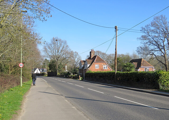
Common, Long is a charming village located in the county of Hampshire, England. Situated amidst the picturesque countryside, it is surrounded by rolling hills, meandering rivers, and lush green fields. With a population of approximately 1,500 residents, it maintains a close-knit community atmosphere.

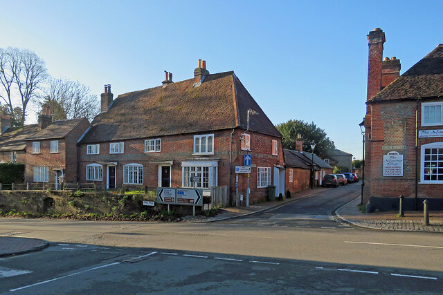
The village is renowned for its beautiful traditional architecture, consisting of quaint cottages and historic buildings. The local church, St. Mary's, dating back to the 12th century, is a prominent landmark that adds to the village's timeless charm.

Common, Long offers several amenities to its residents and visitors. The village boasts a well-maintained village green, which serves as a focal point for community events such as fairs and festivals. There are also a few local shops, a post office, and a cozy village pub where locals and visitors can gather.

The surrounding natural beauty of Common, Long provides ample opportunities for outdoor activities. The village is surrounded by numerous walking and cycling paths, allowing residents to explore the stunning countryside. The nearby river is a popular spot for fishing and boating enthusiasts.

In terms of education, Common, Long has a primary school within the village, providing education for children up to the age of 11. For further education, residents have easy access to nearby towns and cities with secondary schools and colleges.

Overall, Common, Long offers a tranquil and idyllic lifestyle in a quintessential English village setting. Its natural beauty, historic charm, and strong sense of community make it a sought-after place to live or visit in Hampshire.

If you have any feedback on the listing, please let us know in the comments section below.
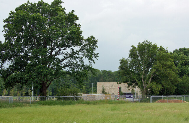
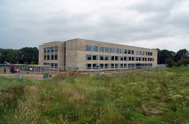
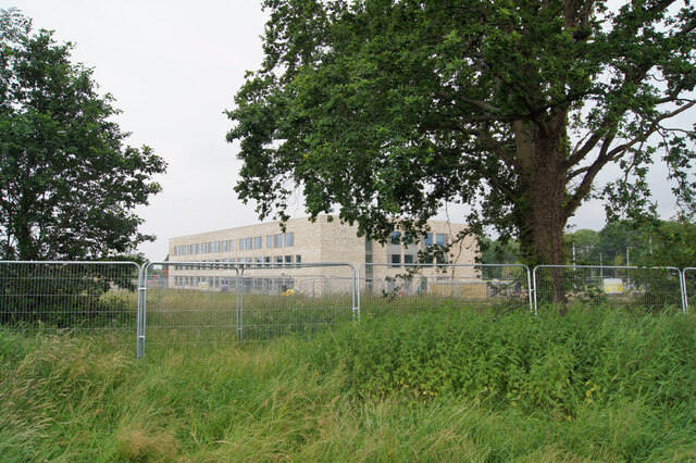
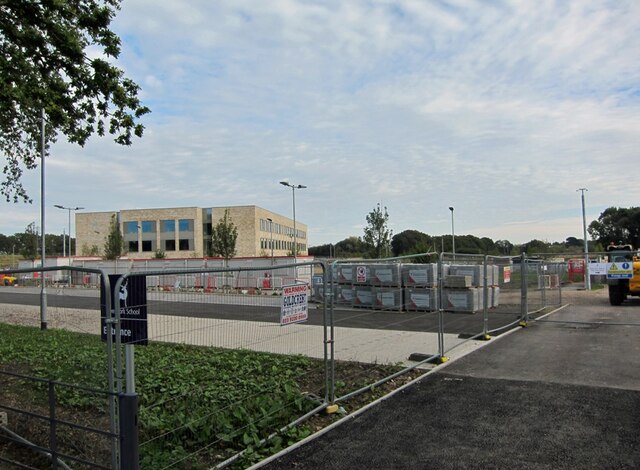
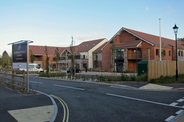
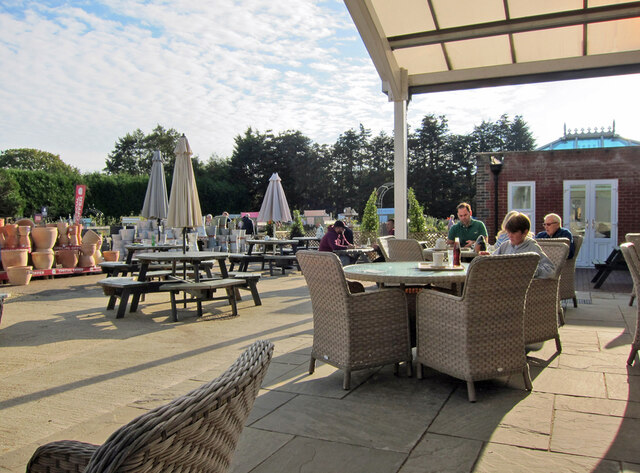
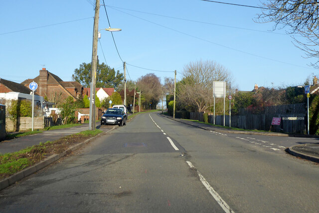
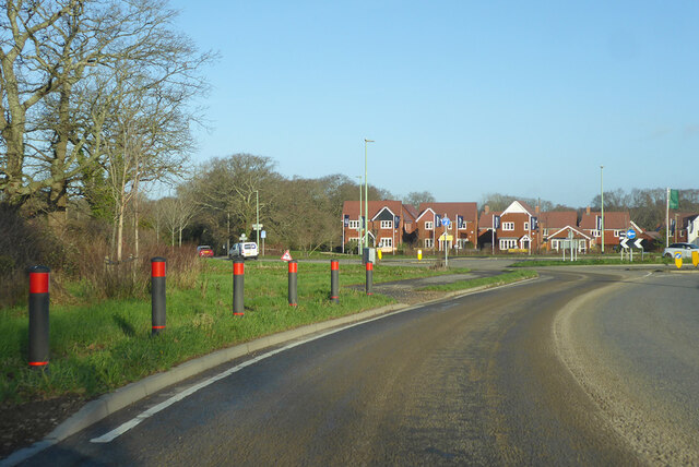
Common, Long Images

Images are sourced within 2km of 50.929496/-1.284505 or Grid Reference SU5014. Thanks to Geograph Open Source API. All images are credited.

Deer Park School, entrance The larger brick building is the Sports Hall. The main school building is out of sight to the left. The school is currently under the final stages of construction, and is due to open in September this year. Currently, the school is surrounded by open fields, though these are destined to shortly be turned into a new housing estate.
Deer Park School, entrance
The larger brick building is the Sports Hall. The main school building is out of sight to the left. The school is currently under the final stages of construction, and is due to open in September this year. Currently, the school is surrounded by open fields, though these are destined to shortly be turned into a new housing estate.
Deer Park School, nearing completion This new secondary school is due to open in September this year. It is currently surrounded by open fields, though very shortly, construction of a new housing estate will swallow them up.
Deer Park School, nearing completion
This new secondary school is due to open in September this year. It is currently surrounded by open fields, though very shortly, construction of a new housing estate will swallow them up.
Deer Park School, under construction The leafy rural setting of the new school will soon change. While most of the larger trees will survive, the fields which surround the school are soon to become a housing development.
Deer Park School, under construction
The leafy rural setting of the new school will soon change. While most of the larger trees will survive, the fields which surround the school are soon to become a housing development.
Deer Park School - now open This view is across the not-yet open car park of the school towards the main building. The school started accepting pupils in September of this year, though clearly parts of the campus are still unfinished.
Deer Park School - now open
This view is across the not-yet open car park of the school towards the main building. The school started accepting pupils in September of this year, though clearly parts of the campus are still unfinished.
Snowdrop Place Care Home Newly opened residential care home operated by Barchester Healthcare.
(See also <a href="https://www.geograph.org.uk/photo/6635397">SU5013 : Snowdrop Place Care Home - under construction</a>).
Snowdrop Place Care Home
Newly opened residential care home operated by Barchester Healthcare. (See also SU5013 : Snowdrop Place Care Home - under construction).
Garden centre café A pleasant place to enjoy a cup of tea and enjoy the autumn sunshine while thinking about all that gardening you could be doing.
Garden centre café
A pleasant place to enjoy a cup of tea and enjoy the autumn sunshine while thinking about all that gardening you could be doing.
A334 High Street, Botley Eastwards towards Wickham.
A334 High Street, Botley
Eastwards towards Wickham.
A334 towards Botley
A334 towards Botley
B3354 Winchester Road, Boorley Green Towards Winchester.
B3354 Winchester Road, Boorley Green
Towards Winchester.
Roundabout on B3354 Winchester Road Inserted in the straight a few years ago to serve a housing development of a golf course site.
Roundabout on B3354 Winchester Road
Inserted in the straight a few years ago to serve a housing development of a golf course site.
Botley: at the corner of Church Lane and Mill Hill High Street is to the left and Winchester Street ahead. The house on the corner is one of many fine Grade II listed 18th-century houses in Botley. The bricks of the single-storey wing on the right are laid in Chinese bond - on their sides, rather than laid flat, they appear larger than bricks laid normally.
Botley: at the corner of Church Lane and Mill Hill
High Street is to the left and Winchester Street ahead. The house on the corner is one of many fine Grade II listed 18th-century houses in Botley. The bricks of the single-storey wing on the right are laid in Chinese bond - on their sides, rather than laid flat, they appear larger than bricks laid normally.
Broadoak, nearing Botley A stretch of the A334 between Hedge End and Botley.
Broadoak, nearing Botley
A stretch of the A334 between Hedge End and Botley.
Botley: William Cobbett memorial and the Market Hall Cobbett, journalist, pamphleteer, reformer and author of "Rural Rides", lived in Botley for some time.

The memorial stone reads

William Cobbett
1763-1835
Lived in Botley near this spot
circa 1805-1817
A great Englishman and
a champion of free journalism
This memorial was erected
by public subscription
Opened by Hampshire members
of the Institute of Journalists
1957

The Grade II listed Market Hall is dated 1848 and the clock turret was added in 1897 to mark Queen Victoria's Diamond Jubilee.
Botley: William Cobbett memorial and the Market Hall
Cobbett, journalist, pamphleteer, reformer and author of "Rural Rides", lived in Botley for some time. The memorial stone reads William Cobbett 1763-1835 Lived in Botley near this spot circa 1805-1817 A great Englishman and a champion of free journalism This memorial was erected by public subscription Opened by Hampshire members of the Institute of Journalists 1957 The Grade II listed Market Hall is dated 1848 and the clock turret was added in 1897 to mark Queen Victoria's Diamond Jubilee.
Botley: Winchester Street Looking from the corner of High Street past a fine Grade II listed timber-framed house of 1610 towards The Brewery Bar.
Botley: Winchester Street
Looking from the corner of High Street past a fine Grade II listed timber-framed house of 1610 towards The Brewery Bar.
Botley: listed buildings at the crossroads Mill Hill is to the left, Church Lane ahead and High Street to the right in this view from the corner of Winchester Street. The house to the left of centre is "Late C18. Two storeys, 4 windows (west end ground floor a bay). Massive red tile roof, half-hipped at one end and fully-hipped at corner; red brick dentil eaves. Walling in Flemish bond, red stretchers/blue headers, flush first floor red band, cambered ground floor openings, plinth. Three and 4-light casements" (Grade II listing).

<a href="https://www.geograph.org.uk/photo/7451183">SU5113 : Botley: at the corner of Church Lane and Mill Hill</a> shows the rear and side of the house from Church Lane.
Botley: listed buildings at the crossroads
Mill Hill is to the left, Church Lane ahead and High Street to the right in this view from the corner of Winchester Street. The house to the left of centre is "Late C18. Two storeys, 4 windows (west end ground floor a bay). Massive red tile roof, half-hipped at one end and fully-hipped at corner; red brick dentil eaves. Walling in Flemish bond, red stretchers/blue headers, flush first floor red band, cambered ground floor openings, plinth. Three and 4-light casements" (Grade II listing). SU5113 : Botley: at the corner of Church Lane and Mill Hill shows the rear and side of the house from Church Lane.
Botley High Street on an April morning The 18th-century Dolphin public house and the mid-Victorian Market Hall are Grade II listed, as are a good number of buildings in this attractive village.
Botley High Street on an April morning
The 18th-century Dolphin public house and the mid-Victorian Market Hall are Grade II listed, as are a good number of buildings in this attractive village.
Botley Church and War Memorial All Saints is Victorian, with later alterations, and Grade II listed. For more about the War Memorial, see the Grade II listing: <span class="nowrap"><a title="https://britishlistedbuildings.co.uk/101450876-botley-war-memorial-botley" rel="nofollow ugc noopener" href="https://britishlistedbuildings.co.uk/101450876-botley-war-memorial-botley">Link</a><img style="margin-left:2px;" alt="External link" title="External link - shift click to open in new window" src="https://s1.geograph.org.uk/img/external.png" width="10" height="10"/></span> .
Botley Church and War Memorial
All Saints is Victorian, with later alterations, and Grade II listed. For more about the War Memorial, see the Grade II listing: LinkExternal link .
Botley: a penny farthing in the window A Grade II listed 18th-century house with a 20th-century shopfront. Chris Downer's <a href="https://www.geograph.org.uk/photo/626351">SU5113 : Botley: old shop</a> shows it in 2007.
Botley: a penny farthing in the window
A Grade II listed 18th-century house with a 20th-century shopfront. Chris Downer's SU5113 : Botley: old shop shows it in 2007.
Show me another place!

Common, Long is located at Grid Ref: SU5014 (Lat: 50.929496, Lng: -1.284505)

Administrative County: Hampshire

District: Eastleigh

Police Authority: Hampshire

What 3 Words

///again.beads.struggle. Near Botley, Hampshire

Related Wikis

Long Common

Long Common is a village in the civil parish of Botley in the Eastleigh district of Hampshire, England. It lies approximately 5.6 miles (9.0 km) north...

Shamblehurst Farmhouse

Shamblehurst Farmhouse is a Grade II listed building in Hedge End, Hampshire. Situated on Shamblehurst Lane, it was first listed on 14 February 1983. The...

Hedge End railway station

Hedge End railway station is situated on the northern edge of the town of Hedge End in the English county of Hampshire. The station was opened by British...

Wildern School

Wildern School is an 11–16 mixed secondary school with academy status in Hedge End, Hampshire, England. It was formerly a foundation school that was established...

Nearby Amenities

Located within 500m of 50.929496,-1.284505
Power: tower
Ref: M 63
Source: interpolation
Lat/Long: 50.92968/-1.2904008
Power: tower
Ref: M 62
Source: interpolation
Lat/Long: 50.9281262/-1.2878156
Power: tower
Ref: M 61
Source: interpolation
Lat/Long: 50.926696/-1.2857978
Power: tower
Ref: M 60
Source: interpolation
Lat/Long: 50.925644/-1.2831702
Bus Stop
Pear Tree Inn Ph
Bus: yes
Naptan AtcoCode: 1900HA030547
Naptan Bearing: W
Naptan CommonName: Boorley Green - Pear Tree Inn Ph
Naptan Crossing: Pear Tree Close
Naptan NaptanCode: hamdjwga
Naptan Street: Maddoxford Lane
Naptan Verified: no
Public Transport: platform
Source: naptan_import
Lat/Long: 50.9286771/-1.2812425
Bus Stop
Pear Tree Inn Ph
Bus: yes
Naptan AtcoCode: 1900HA030548
Naptan Bearing: W
Naptan CommonName: Boorley Green - Pear Tree Inn Ph
Naptan Crossing: Pear Tree Close
Naptan NaptanCode: hamdjwgm
Naptan Street: Maddoxford Lane
Naptan Verified: no
Public Transport: platform
Source: naptan_import
Lat/Long: 50.9287573/-1.2811132
Bus Stop
Braxells Farm
Bus: yes
Naptan AtcoCode: 1900HA030549
Naptan Bearing: N
Naptan CommonName: Braxells Farm
Naptan NaptanCode: hamdjwaj
Naptan Street: Winchester Road
Naptan Verified: no
Public Transport: platform
Source: naptan_import
Lat/Long: 50.9327204/-1.2838199
Bus Stop
Braxells Farm
Bus: yes
Naptan AtcoCode: 1900HA030550
Naptan Bearing: S
Naptan CommonName: Braxells Farm
Naptan NaptanCode: hamdjwat
Naptan Street: Winchester Road
Naptan Verified: no
Public Transport: platform
Source: naptan_import
Lat/Long: 50.9327933/-1.2837549
Odbl: clean
Lat/Long: 50.9311149/-1.2827153
Odbl: clean
Lat/Long: 50.9304803/-1.2819749
Odbl: clean
Lat/Long: 50.931308/-1.2823579
Odbl: clean
Lat/Long: 50.9307073/-1.2821593
Odbl: clean
Lat/Long: 50.9304213/-1.2812147
Odbl: clean
Lat/Long: 50.9305285/-1.2808999
Odbl: clean
Lat/Long: 50.9309129/-1.280812
Odbl: clean
Lat/Long: 50.9306894/-1.2805084
Odbl: clean
Lat/Long: 50.9309487/-1.2823408
Odbl: clean
Lat/Long: 50.9305321/-1.2821026
Odbl: clean
Lat/Long: 50.9304642/-1.2809538
Odbl: clean
Lat/Long: 50.9305643/-1.2816771
Odbl: clean
Lat/Long: 50.9313187/-1.2825592
Odbl: clean
Lat/Long: 50.9306358/-1.2805708
Odbl: clean
Lat/Long: 50.9309165/-1.28069
Odbl: clean
Lat/Long: 50.9306108/-1.2821593
Odbl: clean
Lat/Long: 50.9306054/-1.2806871
Odbl: clean
Lat/Long: 50.9310506/-1.2826245
Odbl: clean
Lat/Long: 50.9305475/-1.2810113
Odbl: clean
Lat/Long: 50.9305017/-1.281731
Odbl: clean
Lat/Long: 50.9312222/-1.2826954
Odbl: clean
Lat/Long: 50.9308217/-1.2804999
Odbl: clean
Lat/Long: 50.9308807/-1.2805538
Odbl: clean
Lat/Long: 50.9304713/-1.2818558
Odbl: clean
Lat/Long: 50.930575/-1.2808857
Odbl: clean
Lat/Long: 50.9304123/-1.2810729
Odbl: clean
Lat/Long: 50.930752/-1.2804914
Odbl: clean
Lat/Long: 50.9309022/-1.2809311
Fountain
Lat/Long: 50.9306546/-1.2785847
Crossing
Lat/Long: 50.9271678/-1.2802714
Generator Method: photovoltaic
Generator Output Electricity: yes
Generator Source: solar
Generator Type: solar_photovoltaic_panel
Location: roof
Power: generator
Lat/Long: 50.9336726/-1.2847607
Generator Method: photovoltaic
Generator Output Electricity: yes
Generator Source: solar
Generator Type: solar_photovoltaic_panel
Location: roof
Power: generator
Lat/Long: 50.9338087/-1.2848358
Generator Method: photovoltaic
Generator Output Electricity: yes
Generator Source: solar
Generator Type: solar_photovoltaic_panel
Location: roof
Power: generator
Lat/Long: 50.9339634/-1.2849122
Generator Method: photovoltaic
Generator Output Electricity: yes
Generator Source: solar
Generator Type: solar_photovoltaic_panel
Location: roof
Power: generator
Lat/Long: 50.9339008/-1.2852328
Generator Method: photovoltaic
Generator Output Electricity: yes
Generator Source: solar
Generator Type: solar_photovoltaic_panel
Location: roof
Power: generator
Lat/Long: 50.9338526/-1.2852059
Generator Method: photovoltaic
Generator Output Electricity: yes
Generator Source: solar
Generator Type: solar_photovoltaic_panel
Location: roof
Power: generator
Lat/Long: 50.9336532/-1.2853602
Generator Method: photovoltaic
Generator Output Electricity: yes
Generator Source: solar
Generator Type: solar_photovoltaic_panel
Location: roof
Power: generator
Lat/Long: 50.9336608/-1.2852958
Generator Method: photovoltaic
Generator Output Electricity: yes
Generator Source: solar
Generator Type: solar_photovoltaic_panel
Location: roof
Power: generator
Lat/Long: 50.9337064/-1.2851509
Generator Method: photovoltaic
Generator Output Electricity: yes
Generator Source: solar
Generator Type: solar_photovoltaic_panel
Location: roof
Power: generator
Lat/Long: 50.9337191/-1.2850718
Generator Method: photovoltaic
Generator Output Electricity: yes
Generator Source: solar
Generator Type: solar_photovoltaic_panel
Location: roof
Power: generator
Lat/Long: 50.9338332/-1.2826417
Generator Method: photovoltaic
Generator Output Electricity: yes
Generator Source: solar
Generator Type: solar_photovoltaic_panel
Location: roof
Power: generator
Lat/Long: 50.9337073/-1.2825868
Generator Method: photovoltaic
Generator Output Electricity: yes
Generator Source: solar
Generator Type: solar_photovoltaic_panel
Location: roof
Power: generator
Lat/Long: 50.9337047/-1.2819859
Generator Method: photovoltaic
Generator Output Electricity: yes
Generator Source: solar
Generator Type: solar_photovoltaic_panel
Location: roof
Power: generator
Lat/Long: 50.9336878/-1.2820557
Generator Method: photovoltaic
Generator Output Electricity: yes
Generator Source: solar
Generator Type: solar_photovoltaic_panel
Location: roof
Power: generator
Lat/Long: 50.9336709/-1.2821415
Generator Method: photovoltaic
Generator Output Electricity: yes
Generator Source: solar
Generator Type: solar_photovoltaic_panel
Location: roof
Power: generator
Lat/Long: 50.9336532/-1.2822193
Generator Method: photovoltaic
Generator Output Electricity: yes
Generator Source: solar
Generator Type: solar_photovoltaic_panel
Location: roof
Power: generator
Lat/Long: 50.9336118/-1.2825251
Generator Method: photovoltaic
Generator Output Electricity: yes
Generator Source: solar
Generator Type: solar_photovoltaic_panel
Location: roof
Power: generator
Lat/Long: 50.9335889/-1.2825049
Generator Method: photovoltaic
Generator Output Electricity: yes
Generator Source: solar
Generator Type: solar_photovoltaic_panel
Location: roof
Power: generator
Lat/Long: 50.9334715/-1.2824607
Generator Method: photovoltaic
Generator Output Electricity: yes
Generator Source: solar
Generator Type: solar_photovoltaic_panel
Location: roof
Power: generator
Lat/Long: 50.9334233/-1.2824258
Generator Method: photovoltaic
Generator Output Electricity: yes
Generator Source: solar
Generator Type: solar_photovoltaic_panel
Location: roof
Power: generator
Lat/Long: 50.9332306/-1.2822756
Generator Method: photovoltaic
Generator Output Electricity: yes
Generator Source: solar
Generator Type: solar_photovoltaic_panel
Location: roof
Power: generator
Lat/Long: 50.9332652/-1.2821992
Generator Method: photovoltaic
Generator Output Electricity: yes
Generator Source: solar
Generator Type: solar_photovoltaic_panel
Location: roof
Power: generator
Lat/Long: 50.9333024/-1.2820677
Generator Method: photovoltaic
Generator Output Electricity: yes
Generator Source: solar
Generator Type: solar_photovoltaic_panel
Location: roof
Power: generator
Lat/Long: 50.9333421/-1.2819819
Generator Method: photovoltaic
Generator Output Electricity: yes
Generator Source: solar
Generator Type: solar_photovoltaic_panel
Location: roof
Power: generator
Lat/Long: 50.9334123/-1.2819055
Generator Method: photovoltaic
Generator Output Electricity: yes
Generator Source: solar
Generator Type: solar_photovoltaic_panel
Location: roof
Power: generator
Lat/Long: 50.9334503/-1.2817982
Generator Method: photovoltaic
Generator Output Electricity: yes
Generator Source: solar
Generator Type: solar_photovoltaic_panel
Location: roof
Power: generator
Lat/Long: 50.9335509/-1.2815179
Generator Method: photovoltaic
Generator Output Electricity: yes
Generator Source: solar
Generator Type: solar_photovoltaic_panel
Location: roof
Power: generator
Lat/Long: 50.9283713/-1.2792072
Generator Method: photovoltaic
Generator Output Electricity: yes
Generator Source: solar
Generator Type: solar_photovoltaic_panel
Location: roof
Power: generator
Lat/Long: 50.9282665/-1.2793064
Generator Method: photovoltaic
Generator Output Electricity: yes
Generator Source: solar
Generator Type: solar_photovoltaic_panel
Location: roof
Power: generator
Lat/Long: 50.9282276/-1.2793762
Generator Method: photovoltaic
Generator Output Electricity: yes
Generator Source: solar
Generator Type: solar_photovoltaic_panel
Location: roof
Power: generator
Lat/Long: 50.9278979/-1.2793922
Generator Method: photovoltaic
Generator Output Electricity: yes
Generator Source: solar
Generator Type: solar_photovoltaic_panel
Location: roof
Power: generator
Lat/Long: 50.9277914/-1.279572
Generator Method: photovoltaic
Generator Output Electricity: yes
Generator Source: solar
Generator Type: solar_photovoltaic_panel
Location: roof
Power: generator
Lat/Long: 50.9273975/-1.2796283
Generator Method: photovoltaic
Generator Output Electricity: yes
Generator Source: solar
Generator Type: solar_photovoltaic_panel
Location: roof
Power: generator
Lat/Long: 50.927247/-1.2799609
Generator Method: photovoltaic
Generator Output Electricity: yes
Generator Source: solar
Generator Type: solar_photovoltaic_panel
Location: roof
Power: generator
Lat/Long: 50.9283645/-1.2893352
Generator Method: photovoltaic
Generator Output Electricity: yes
Generator Source: solar
Generator Type: solar_photovoltaic_panel
Location: roof
Power: generator
Lat/Long: 50.9285336/-1.2910518
Generator Method: photovoltaic
Generator Output Electricity: yes
Generator Source: solar
Generator Type: solar_photovoltaic_panel
Location: roof
Power: generator
Lat/Long: 50.9292064/-1.2916231
Crossing
Lat/Long: 50.9306649/-1.2790075
Bus Stop
Braxells Road
Bus: yes
Public Transport: platform
Lat/Long: 50.9305875/-1.2789119
Braxells Road
Bus: yes
Network: Bluestar
Operator: Go South Coast Limited
Public Transport: stop_position
Lat/Long: 50.930568/-1.2790052
Bus Stop
Braxells Road
Bus: yes
Naptan AtcoCode: 1900HAA92159
Naptan NaptanCode: hampajdw
Public Transport: platform
Lat/Long: 50.9305427/-1.2790827
Turning Circle
Turning Circle: circle
Lat/Long: 50.9284211/-1.2801874
Crossing
Bicycle: yes
Crossing: unmarked
Crossing Markings: no
Source: Esri World Imagery
Lat/Long: 50.925258/-1.2842984
Bus Stop
Bus: yes
Public Transport: platform
Lat/Long: 50.9250756/-1.2845333
Crossing
Crossing: unmarked
Crossing Island: yes
Crossing Markings: no
Source: Esri
Lat/Long: 50.9319455/-1.283591
Crossing
Crossing: unmarked
Crossing Island: yes
Crossing Markings: no
Source: Esri
Lat/Long: 50.9320212/-1.2840473
Crossing
Crossing: unmarked
Crossing Island: yes
Crossing Markings: no
Source: Esri
Lat/Long: 50.9319685/-1.2840026
Crossing
Crossing: unmarked
Crossing Island: yes
Crossing Markings: no
Source: Esri
Lat/Long: 50.931948/-1.2835254
Crossing
Crossing: unmarked
Crossing Island: yes
Crossing Markings: no
Source: Esri
Lat/Long: 50.9322331/-1.2838144
Crossing
Crossing: unmarked
Crossing Island: yes
Crossing Markings: no
Source: Esri
Lat/Long: 50.9322314/-1.2837243
Barrier: kerb
Kerb: lowered
Source: Esri World Imagery
Tactile Paving: yes
Lat/Long: 50.9252647/-1.2843553
The data included in this document is from www.openstreetmap.org. The data is made available under ODbL.

Have you been to Common, Long?

Leave your review of Common, Long below (or comments, questions and feedback).