Clawson, Long

Settlement in Leicestershire Melton

England

Clawson, Long

Grass field off Clawson Lane A hazy Vale of Belvour beyond.
Grass field off Clawson Lane Credit: Jonathan Thacker

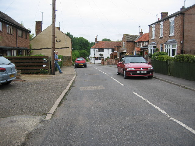
Clawson, Long is a quaint village located in the county of Leicestershire, England. Situated approximately 10 miles south-east of Melton Mowbray, it is a small and tight-knit community with a population of around 600 residents.

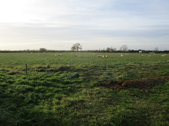
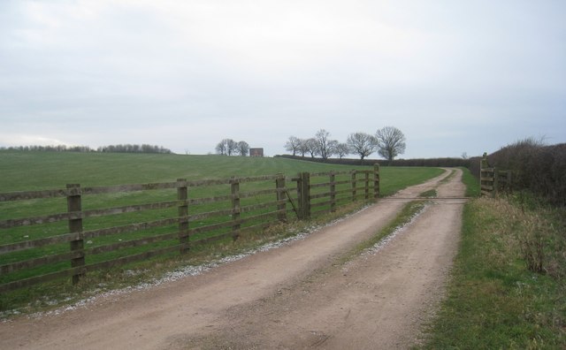
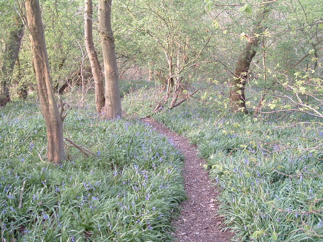
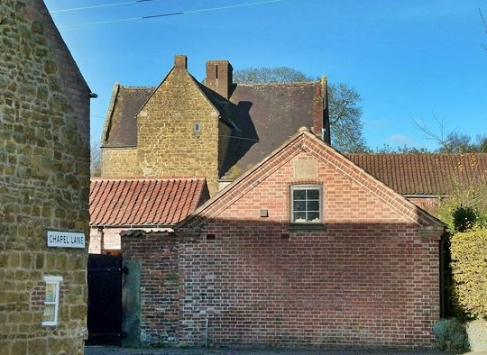
The village is known for its picturesque countryside, surrounded by rolling hills, meadows, and farmland, which adds to its idyllic charm. Clawson, Long is particularly famous for its beautiful thatched cottages, which date back several centuries and are a sight to behold.

In terms of amenities, the village offers a range of facilities to cater to the needs of its residents. It has a primary school, a village hall, and a local pub, which serves as the social hub for the community. The pub often hosts events and gatherings that bring people together and foster a sense of community spirit.

The village is also well-connected to neighboring towns and cities, with good transport links. The nearby town of Melton Mowbray provides access to a wider range of amenities, including supermarkets, shops, and leisure facilities. Additionally, Clawson, Long is within easy reach of Leicester and Nottingham, both of which offer further employment and recreational opportunities.

Overall, Clawson, Long is a charming and peaceful village that offers a close-knit community, stunning natural surroundings, and convenient access to nearby towns and cities. It is an ideal place for those seeking a tranquil rural lifestyle while still having access to essential amenities.

If you have any feedback on the listing, please let us know in the comments section below.

Clawson, Long Images

Images are sourced within 2km of 52.836246/-0.924311 or Grid Reference SK7227. Thanks to Geograph Open Source API. All images are credited.

Grass field off Clawson Lane A hazy Vale of Belvour beyond.
Grass field off Clawson Lane
A hazy Vale of Belvour beyond.
Mill Farm seen from Sandpit Lane, Long Clawson Mill Farm is in the centre of the picture.
Mill Farm seen from Sandpit Lane, Long Clawson
Mill Farm is in the centre of the picture.
Stubble field near Hall Farm, Long Clawson
Rusting shed, Hose Lane
Dutch barn, Hose Lane
Grass field with sheep, Hose Lane
Sand Pit Lane, Long Clawson
Grass field and horses, Long Clawson
Footpath and houses, Long Clawson
Clawson Lane
Clawson Lane
Brock Hill down to the Vale of Belvoir The route of  'le ferdgate' into the Vale of Belvoir.
The village of Harby, where " ...  Walter son of Roger de Herdebi  [granted] land and meadow in Herdebi ... part abutting 'in le Ferdgate' ... " <span class="nowrap"><a title="https://www.british-history.ac.uk/ancient-deeds/vol3/pp387-399" rel="nofollow ugc noopener" href="https://www.british-history.ac.uk/ancient-deeds/vol3/pp387-399">Link</a><img style="margin-left:2px;" alt="External link" title="External link - shift click to open in new window" src="https://s1.geograph.org.uk/img/external.png" width="10" height="10"/></span> lies in the vale about 3 miles ahead.
Brock Hill down to the Vale of Belvoir
The route of 'le ferdgate' into the Vale of Belvoir. The village of Harby, where " ... Walter son of Roger de Herdebi [granted] land and meadow in Herdebi ... part abutting 'in le Ferdgate' ... " LinkExternal link lies in the vale about 3 miles ahead.
Looking towards a clump of trees Taken from Canal Lane on a cold February afternoon.
Looking towards a clump of trees
Taken from Canal Lane on a cold February afternoon.
The Old Manor House, Long Clawson Shows a contrast between the ironstone used in the construction of the building and the freestone used for window surrounds.
The Old Manor House, Long Clawson
Shows a contrast between the ironstone used in the construction of the building and the freestone used for window surrounds.
The track to Clawson Hill Farm Looks isolated and bleak on a cold February afternoon.
The track to Clawson Hill Farm
Looks isolated and bleak on a cold February afternoon.
Bridleway to Hose Follows the hedge on the right.
Bridleway to Hose
Follows the hedge on the right.
Footpath at Long Clawson Successive diversions of this path around the site of Long Clawson Dairies has made it far from the short cut from the Nether Broughton road into the village that it once was. Nonetheless it probably makes a convenient route for dog-walkers.
Footpath at Long Clawson
Successive diversions of this path around the site of Long Clawson Dairies has made it far from the short cut from the Nether Broughton road into the village that it once was. Nonetheless it probably makes a convenient route for dog-walkers.
Abandoned field The location of this field close to the village suggests that it is planned (at least in someone's mind) that it should be developed.
Abandoned field
The location of this field close to the village suggests that it is planned (at least in someone's mind) that it should be developed.
Entrance to a footpath Long Clawson Dairy in the background. Note also the exotic planting of eucalyptus.
Entrance to a footpath
Long Clawson Dairy in the background. Note also the exotic planting of eucalyptus.
Show me another place!

Clawson, Long is located at Grid Ref: SK7227 (Lat: 52.836246, Lng: -0.924311)

Administrative County: Leicestershire

District: Melton

Police Authority: Leicestershire

What 3 Words

///fairy.reporters.supreme. Near Long Clawson, Leicestershire

Nearby Locations

Long Clawson Clawson, Long

Related Wikis

Long Clawson

Long Clawson is a village and former civil parish, now included in that of Clawson, Hose and Harby, in the Melton district and the county of Leicestershire...

Long Clawson and Hose railway station

Long Clawson and Hose railway station was a railway station serving the villages of Long Clawson and Hose, Leicestershire on the Great Northern and London...

Hose, Leicestershire

Hose is a village and former civil parish, now in the parish of Clawson, Hose and Harby, in the Borough of Melton and the county of Leicestershire, England...

Clawson, Hose and Harby

Clawson, Hose and Harby is a civil parish in Leicestershire, England, forming part of the Melton district. It contains the villages of Harby, Hose and...

Holwell Mouth

Holwell Mouth is a 14.5-hectare (36-acre) biological Site of Special Scientific Interest south-east of Nether Broughton in Leicestershire. It is common...

Hickling, Nottinghamshire

Hickling is a village in the Rushcliffe borough of Nottinghamshire, England. It is located close to the border with Leicestershire, approximately 8 miles...

Harby Hill Wood

Harby Hill Wood is a 16.9-hectare (42-acre) biological Site of Special Scientific Interest west of Eastwell in Leicestershire.This site has steeply sloping...

Ab Kettleby Manor

Ab Kettleby Manor is an early 17th-century house in the village of Ab Kettleby, Leicestershire. Built of ironstone with a central brick chimney the house...

Nearby Amenities

Located within 500m of 52.836246,-0.924311
Barrier: stile
Source: survey
Step Count: 2
Stile: stepover
Lat/Long: 52.8378791/-0.9256446
Bus Stop
The Sands
Bus: yes
Naptan AtcoCode: 260000603
Naptan Bearing: E
Naptan CommonName: The Sands
Naptan Indicator: outside
Naptan Landmark: Crown & Plough
Naptan NaptanCode: leidmwgm
Naptan Notes: Hourly - County
Naptan Street: East End
Naptan Verified: no
Public Transport: platform
Source: naptan_import
Lat/Long: 52.8396036/-0.9230799
Bus Stop
The Sands
Alt Name: Long Clawson - Packhorse
Bus: yes
Naptan AltCommonName: Long Clawson - Packhorse
Naptan AtcoCode: 260000604
Naptan Bearing: S
Naptan CommonName: The Sands
Naptan Indicator: opposite
Naptan Landmark: 13 The Sands
Naptan NaptanCode: leidmwgp
Naptan Notes: Hourly - County
Naptan Street: The Sands
Naptan Verified: no
Public Transport: platform
Source: naptan_import
Lat/Long: 52.8392673/-0.9236672
Bus Stop
Back Lane
Bus: yes
Naptan AtcoCode: 260000605
Naptan Bearing: SW
Naptan CommonName: Back Lane
Naptan Indicator: behind
Naptan Landmark: 7 Kings Road
Naptan NaptanCode: leidmwgt
Naptan Notes: Hourly - County
Naptan Street: Back Lane
Naptan Verified: no
Public Transport: platform
Source: naptan_import
Lat/Long: 52.8365961/-0.9275189
Pub
The Crown & Plough
Addr City: Melton Mowbray
Addr Country: GB
Addr Housenumber: 3
Addr Postcode: LE14 4NG
Addr Street: East End
Addr Village: Long Clawson
Fhrs Authority: Melton
Fhrs Id: 647337
Fhrs Local Authority Id: 14/00015/COMM
Source: survey
Wikidata: Q26337765
Lat/Long: 52.8396759/-0.9232375
Squirrel Stores
Addr City: Melton Mowbray
Addr Country: GB
Addr Housenumber: 5
Addr Postcode: LE14 4PA
Addr Street: The Sands
Addr Village: Long Clawson
Fhrs Authority: Melton
Fhrs Id: 736920
Fhrs Local Authority Id: 15/00020/COMM
Shop: convenience
Source: survey
Source Addr: FHRS Open Data
Lat/Long: 52.8388658/-0.9240046
Doctors
Long Clawson Surgery
Healthcare: doctor
Lat/Long: 52.8390636/-0.9235528
Bench
Lat/Long: 52.83895/-0.9234816
Bench
Lat/Long: 52.8389297/-0.9234622
Barrier: cycle_barrier
Source: survey
Lat/Long: 52.8379828/-0.929112
Post Box
Brand: Royal Mail
Brand Wikidata: Q638098
Brand Wikipedia: en:Royal Mail
Collection Times: Mo-Fr 09:00; Sa 07:00
Operator: Royal Mail
Operator Wikidata: Q638098
Post Box Mounting: pier
Post Box Type: lamp
Ref: LE14 51D
Royal Cypher: EIIR
Royal Cypher Wikidata: Q33102113
Source: survey
Lat/Long: 52.836392/-0.9280376
Post Box
Brand: Royal Mail
Brand Wikidata: Q638098
Brand Wikipedia: en:Royal Mail
Operator: Royal Mail
Operator Wikidata: Q638098
Post Box Type: pillar
Ref: LE14 55
Royal Cypher: EIIR
Royal Cypher Wikidata: Q33102113
Source: survey
Lat/Long: 52.8389488/-0.9237787
Pharmacy
Long Clawson Pharmacy
Healthcare: pharmacy
Source: survey
Lat/Long: 52.8390347/-0.9234729
Cafe
The Clawson Kitchen
Addr City: Melton Mowbray
Addr Country: GB
Addr Housenumber: 7a
Addr Postcode: LE14 4PA
Addr Street: The Sands
Addr Village: Long Clawson
Fhrs Authority: Melton
Fhrs Id: 1225093
Fhrs Local Authority Id: 20/00001/COMM
Shop: deli
Source: survey
Lat/Long: 52.8389861/-0.9239503
Addr Housenumber: 20
Source: survey
Lat/Long: 52.840127/-0.9210474
A.E. Pears & Son
Shop: butcher
Source: survey
Lat/Long: 52.8398434/-0.9221739
Defibrillator
Defibrillator Location: Outside Long Clawson Surgery facing car park
Emergency: defibrillator
Indoor: no
Ref: CHT-10-155
Source: survey
Supplier: Community Hearth Beat Trust
Lat/Long: 52.8390927/-0.9236515
Power: pole
Source: Bing
Lat/Long: 52.8336671/-0.9296911
Addr Housenumber: 12
Addr Postcode: LE14 4PE
Addr Street: West End
Source: survey
Lat/Long: 52.8365173/-0.931008
Addr Housenumber: 10
Addr Postcode: LE14 4PE
Addr Street: West End
Source: survey
Lat/Long: 52.8365563/-0.930884
Addr Housenumber: 10
Addr Postcode: LE14 4PE
Addr Street: West End
Lat/Long: 52.8365731/-0.9309543
Generator Method: photovoltaic
Generator Output Electricity: yes
Generator Source: solar
Generator Type: solar_photovoltaic_panel
Location: roof
Power: generator
Lat/Long: 52.8392826/-0.9274718
Generator Method: photovoltaic
Generator Output Electricity: yes
Generator Source: solar
Generator Type: solar_photovoltaic_panel
Location: roof
Power: generator
Lat/Long: 52.8400133/-0.9226599
Generator Method: photovoltaic
Generator Output Electricity: yes
Generator Source: solar
Generator Type: solar_photovoltaic_panel
Location: roof
Power: generator
Lat/Long: 52.8400587/-0.9225338
Generator Method: photovoltaic
Generator Output Electricity: yes
Generator Source: solar
Generator Type: solar_photovoltaic_panel
Location: roof
Power: generator
Lat/Long: 52.8396229/-0.9205839
Generator Method: photovoltaic
Generator Output Electricity: yes
Generator Source: solar
Generator Type: solar_photovoltaic_panel
Location: roof
Power: generator
Lat/Long: 52.8356236/-0.9264584
Generator Method: photovoltaic
Generator Output Electricity: yes
Generator Source: solar
Generator Type: solar_photovoltaic_panel
Location: roof
Power: generator
Lat/Long: 52.8355701/-0.9262143
Generator Method: photovoltaic
Generator Output Electricity: yes
Generator Source: solar
Generator Type: solar_photovoltaic_panel
Location: roof
Power: generator
Lat/Long: 52.8347178/-0.9261204
Generator Method: photovoltaic
Generator Output Electricity: yes
Generator Source: solar
Generator Type: solar_photovoltaic_panel
Location: roof
Power: generator
Lat/Long: 52.8346563/-0.9264262
Generator Method: photovoltaic
Generator Output Electricity: yes
Generator Source: solar
Generator Type: solar_photovoltaic_panel
Location: roof
Power: generator
Lat/Long: 52.8346822/-0.926225
Generator Method: photovoltaic
Generator Output Electricity: yes
Generator Source: solar
Generator Type: solar_photovoltaic_panel
Location: roof
Power: generator
Lat/Long: 52.8366752/-0.9256054
Generator Method: photovoltaic
Generator Output Electricity: yes
Generator Source: solar
Generator Type: solar_photovoltaic_panel
Location: roof
Power: generator
Lat/Long: 52.8387588/-0.9258012
Village Hair
Shop: hairdresser
Lat/Long: 52.8389258/-0.9239741
Kindergarten
Brunts Farmhouse Day Nursery
Addr City: Melton Mowbray
Addr Country: GB
Addr Housenumber: 9
Addr Postcode: LE14 4NG
Addr Street: East End
Addr Village: Long Clawson
Fhrs Authority: Melton
Fhrs Id: 7321
Fhrs Local Authority Id: 02950/0009/2/000
Lat/Long: 52.8399546/-0.9224787
Historic: memorial
Lat/Long: 52.8389216/-0.9236219
Man Made: village_sign
Lat/Long: 52.8389103/-0.9237198
Public Bookcase
Booth: K6
Colour: red
Disused Amenity: telephone
Man Made: telephone_box
Old Phone: +44 1664 822548
Operator: Clawson Hose & Harby Parish Council
Public Bookcase Type: phone_box
Lat/Long: 52.8392084/-0.9236823
Power: pole
Lat/Long: 52.8362302/-0.9175906
Power: pole
Lat/Long: 52.8357292/-0.9199974
Power: pole
Lat/Long: 52.8354983/-0.9211804
Power: pole
Lat/Long: 52.8352331/-0.9224204
Power: pole
Lat/Long: 52.8349654/-0.9237986
Power: pole
Lat/Long: 52.8346852/-0.9253304
Power: pole
Lat/Long: 52.8342324/-0.9271041
Power: pole
Lat/Long: 52.833944/-0.9284573
The data included in this document is from www.openstreetmap.org. The data is made available under ODbL.

Have you been to Clawson, Long?

Leave your review of Clawson, Long below (or comments, questions and feedback).