An Roinn
Coastal Feature, Headland, Point in Inverness-shire
Scotland
An Roinn

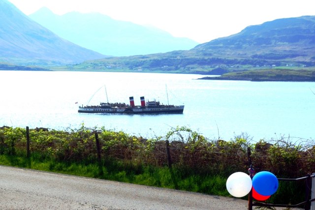
An Roinn is a prominent headland located in Inverness-shire, Scotland. Situated on the west coast of the country, it is known for its breathtaking coastal features and stunning views of the North Atlantic Ocean.
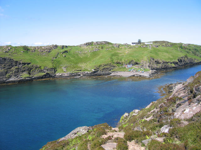
Rising majestically from the surrounding landscape, An Roinn is characterized by its rugged cliffs and rocky terrain. The headland juts out into the ocean, creating a dramatic and picturesque scene that attracts visitors from near and far.
At the tip of An Roinn, there is a prominent point that offers panoramic vistas of the surrounding area. From this vantage point, one can admire the vast expanse of the ocean, with its ever-changing hues and the sound of crashing waves against the cliffs below. The point also provides an excellent vantage point for observing local marine life, such as seals, dolphins, and seabirds.
An Roinn is a popular destination for outdoor enthusiasts and nature lovers alike. The headland offers a variety of walking trails, allowing visitors to explore its diverse flora and fauna while enjoying the fresh sea air. Photography enthusiasts are particularly drawn to An Roinn due to its stunning natural beauty and unique geological formations.
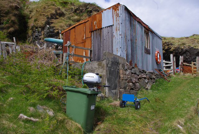
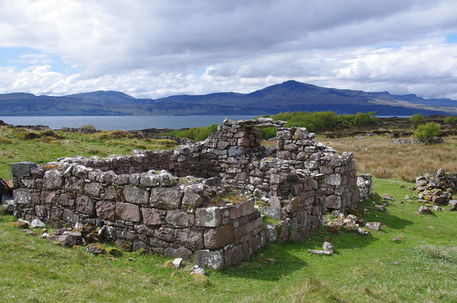
In addition to its natural attractions, An Roinn also has historical significance. The headland is home to ancient ruins and archaeological sites, providing a glimpse into the region's rich history and cultural heritage.
Overall, An Roinn is a remarkable coastal feature that showcases the raw beauty of Scotland's west coast. Its striking cliffs, breathtaking views, and rich history make it a must-visit destination for anyone exploring Inverness-shire.
If you have any feedback on the listing, please let us know in the comments section below.
An Roinn Images
Images are sourced within 2km of 57.497083/-6.0244304 or Grid Reference NG5852. Thanks to Geograph Open Source API. All images are credited.


An Roinn is located at Grid Ref: NG5852 (Lat: 57.497083, Lng: -6.0244304)
Unitary Authority: Highland
Police Authority: Highlands and Islands
What 3 Words
///coining.differ.palms. Near Portree, Highland
Nearby Locations
Related Wikis
Eilean Fladday
Eilean Fladday (also Fladda; Scottish Gaelic: Eilean Fladaigh) is a previously populated tidal island off Raasay, near the Isle of Skye, Scotland. ��2...

Eilean Tigh
Eilean Tigh (Scottish Gaelic: Eilean Taighe) is a tidal island in the Sound of Raasay of Scotland, that lies between Rona and Raasay. Approximately 54...
Sound of Raasay
The Sound of Raasay (Scottish Gaelic: Linne Ratharsair) is the sound between the islands of Raasay and Skye. == See also == Inner Sound, Scotland Isle...

Bearreraig Sandstone Formation
The Bearreraig Sandstone Formation is a geological formation in Scotland. It preserves fossils dating back to the lower to middle parts of the Jurassic...

South Rona
Rona (Scottish Gaelic: Rònaigh), sometimes called South Rona to distinguish it from North Rona (a small uninhabited island to the northwest of Cape Wrath...

Storr Lochs Hydro-Electric Scheme
Storr Lochs is a hydro-electric power station built on the Isle of Skye, Inner Hebrides, Scotland and commissioned in 1952. It was built by the North of...
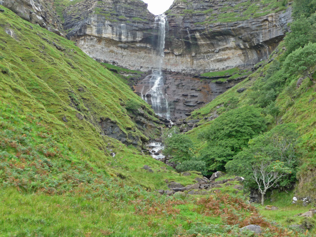
Bearreraig Waterfall
Bearreraig Waterfall is a waterfall of Scotland.It is located on the Trotternish peninsula of the island of Skye, on the Bearreraig River which runs from...

BUTEC
The British Underwater Test and Evaluation Centre (BUTEC) is an underwater military test and evaluation range in the Inner Sound between the island of...
Nearby Amenities
Located within 500m of 57.497083,-6.0244304Have you been to An Roinn?
Leave your review of An Roinn below (or comments, questions and feedback).