An Ceanach

Coastal Feature, Headland, Point in Ross-shire

Scotland

An Ceanach

Tiumpan Head Lighthouse
Tiumpan Head Lighthouse Credit: Peter Moore

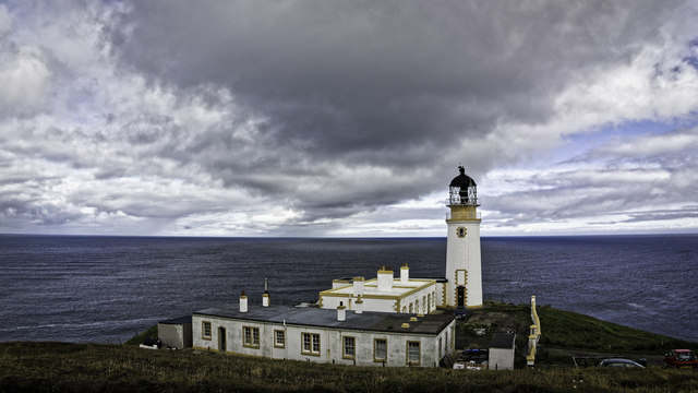
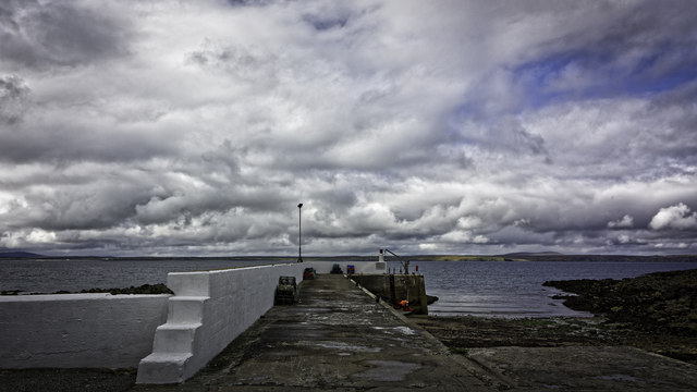
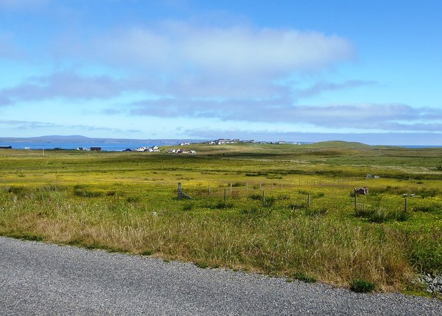
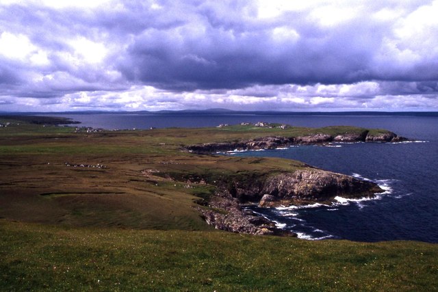
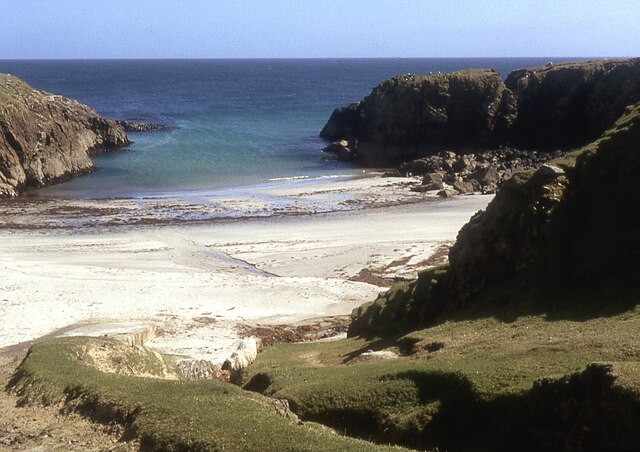
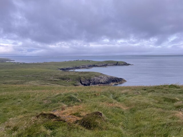
An Ceanach is a prominent coastal feature located in Ross-shire, Scotland. This headland, also referred to as a point, is situated along the rugged coastline of the North Atlantic Ocean. An Ceanach is known for its picturesque beauty and is a popular destination for locals and tourists alike.

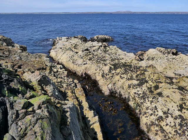
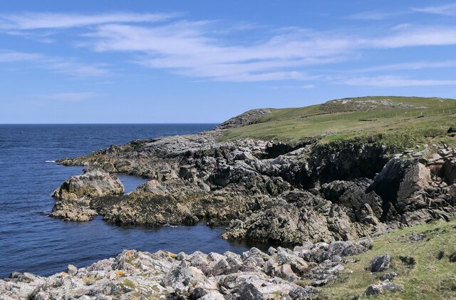
The headland is characterized by its towering cliffs which provide breathtaking panoramic views of the surrounding area. These cliffs, composed of sedimentary rock formations, are a result of millions of years of erosion by the relentless waves of the ocean. They stand as a testament to the power and force of nature.

An Ceanach is home to a diverse ecosystem, with various species of birds, plants, and marine life inhabiting the area. Seabirds such as gannets, puffins, and guillemots can often be spotted nesting on the cliffs, while seals and dolphins can sometimes be seen swimming in the waters below.

Visitors to An Ceanach can explore the headland by following a network of walking paths that wind through the coastal landscape. These paths offer stunning views and opportunities for wildlife spotting. Additionally, the area is a popular spot for rock climbing enthusiasts, with its challenging cliffs providing a thrilling experience for climbers of all skill levels.

Overall, An Ceanach is a remarkable coastal feature that showcases the natural beauty and ruggedness of the Scottish coastline. Its stunning views, diverse wildlife, and outdoor recreational opportunities make it a must-visit destination for nature lovers and adventure seekers.

If you have any feedback on the listing, please let us know in the comments section below.

An Ceanach Images

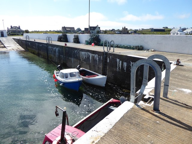
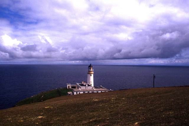
Images are sourced within 2km of 58.248613/-6.150931 or Grid Reference NB5636. Thanks to Geograph Open Source API. All images are credited.

Tiumpan Head Lighthouse
The Pier at Port nan Giuran
Coastline, Rubha Chuidhtinis, Eye Peninsula, Isle of Lewis
Coastline below Cnoc Beag, Isle of Lewis Looking across Broad Bay/Loch a Tuath towards Bac and Griais.
Coastline below Cnoc Beag, Isle of Lewis
Looking across Broad Bay/Loch a Tuath towards Bac and Griais.
Coastline, Gob Chaileagadh, Isle of Lewis Looking towards Port nan Giuran.

The OS Name Book of 1848-1852 says of what was then spelled Gob cha leig, "A low rocky shore forming a part of the northern boundary of Portnagiuran Farm.  NB The name is derived from the words "we can't weather it" i.e. if the wind is in a certain direction the fishermen in their boats are not able to pass the shore without making another tack".
Coastline, Gob Chaileagadh, Isle of Lewis
Looking towards Port nan Giuran. The OS Name Book of 1848-1852 says of what was then spelled Gob cha leig, "A low rocky shore forming a part of the northern boundary of Portnagiuran Farm. NB The name is derived from the words "we can't weather it" i.e. if the wind is in a certain direction the fishermen in their boats are not able to pass the shore without making another tack".
Looking across fields towards Cnoc Beag from the A866
The small pier at Portnagnan
View west from Tiumpan Head
Tiumpan Head Lighthouse
Coast below Cnoc Beag, Isle of Lewis Looking towards Rubha Meadhonach, the northern tip of the Eye Peninsula/An Rubha.
Coast below Cnoc Beag, Isle of Lewis
Looking towards Rubha Meadhonach, the northern tip of the Eye Peninsula/An Rubha.
Remains of the Wyre Law, Gob Chaileagadh, Isle of Lewis The Wyre Law was a Fleetwood based steam trawler which was built in Hull in 1915 and launched with the name Miletus. She ran around during a gale in October 1952.  At first she remained upright but continuing bad weather made her unsalvageable.
Remains of the Wyre Law, Gob Chaileagadh, Isle of Lewis
The Wyre Law was a Fleetwood based steam trawler which was built in Hull in 1915 and launched with the name Miletus. She ran around during a gale in October 1952. At first she remained upright but continuing bad weather made her unsalvageable.
Small beach at Sinigeadh, Eye Peninsula
Roads around An Rubha In around 1999, the Ordnance Survey replaced English-language placenames in the Western Isles with Gaelic-language names. Some of the more prominent features (e.g. Isle of Barra; Stornoway; Sound of Harris) do have bilingual labels but, on the whole, villages, lochs, peaks etc. generally have the Gaelic names on the modern-day mapping.

Because the English versions have a tendency not to appear on the maps any more, I have decided to use them in my image titles and, as such, a translation will be readily available from the Gaelic labelling on the map. 

(NB I have not translated some of the more minor loch and river names, where I have not easily found the English version.)
Roads around An Rubha
In around 1999, the Ordnance Survey replaced English-language placenames in the Western Isles with Gaelic-language names. Some of the more prominent features (e.g. Isle of Barra; Stornoway; Sound of Harris) do have bilingual labels but, on the whole, villages, lochs, peaks etc. generally have the Gaelic names on the modern-day mapping. Because the English versions have a tendency not to appear on the maps any more, I have decided to use them in my image titles and, as such, a translation will be readily available from the Gaelic labelling on the map. (NB I have not translated some of the more minor loch and river names, where I have not easily found the English version.)
Roads around An Rubha Geocaching is a type of global treasure hunt of people looking for caches, or hidden stashes of objects. Geocaching may also be described as a series of hide-and-seek games, where hiders provide online clues for seekers. Seekers use global positioning system (GPS) devices to find hidden caches
Roads around An Rubha
Geocaching is a type of global treasure hunt of people looking for caches, or hidden stashes of objects. Geocaching may also be described as a series of hide-and-seek games, where hiders provide online clues for seekers. Seekers use global positioning system (GPS) devices to find hidden caches
Roads around An Rubha
Roads around An Rubha Geocaching is a type of global treasure hunt of people looking for caches, or hidden stashes of objects. Geocaching may also be described as a series of hide-and-seek games, where hiders provide online clues for seekers. Seekers use global positioning system (GPS) devices to find hidden caches
Roads around An Rubha
Geocaching is a type of global treasure hunt of people looking for caches, or hidden stashes of objects. Geocaching may also be described as a series of hide-and-seek games, where hiders provide online clues for seekers. Seekers use global positioning system (GPS) devices to find hidden caches
Coastline of An Rubhan
Tiumpan Head Lighthouse Geocaching is a type of global treasure hunt of people looking for caches, or hidden stashes of objects. Geocaching may also be described as a series of hide-and-seek games, where hiders provide online clues for seekers. Seekers use global positioning system (GPS) devices to find hidden caches
Tiumpan Head Lighthouse
Geocaching is a type of global treasure hunt of people looking for caches, or hidden stashes of objects. Geocaching may also be described as a series of hide-and-seek games, where hiders provide online clues for seekers. Seekers use global positioning system (GPS) devices to find hidden caches
Show me another place!

An Ceanach is located at Grid Ref: NB5636 (Lat: 58.248613, Lng: -6.150931)

Unitary Authority: Na h-Eileanan an Iar

Police Authority: Highlands and Islands

What 3 Words

///withdrew.plodding.supple. Near North Tolsta, Na h-Eileanan Siar

Related Wikis

Portvoller

Portvoller (Scottish Gaelic: Port Mholair) is a small village on the north tip of the Eye Peninsula (which along with Melbost and Parkend makes up Point...

Broker, Lewis

Broker (Scottish Gaelic: Brocair) is a small hamlet next to the village of Portvoller and Portnaguran on the Eye Peninsula located on the east side of...

Aird, Lewis

Aird (Scottish Gaelic: Àird an Rubha) is a village in the Scottish council area of Eileanan Siar (Western Isles). It is located on the Eye Peninsula on...

Portnaguran

Portnaguran (Scottish Gaelic: Port nan Giùran) is a settlement situated within Point, on the Isle of Lewis, in the Outer Hebrides, Scotland. Portnaguran...

Nearby Amenities

Located within 500m of 58.248613,-6.150931
Port Mholair
Name En: Portvoller
Name Gd: Port Mholair
Place: village
Wikidata: Q7232821
Wikipedia: en:Portvoller
Lat/Long: 58.2516642/-6.1526411
Passing Place
Lat/Long: 58.2506216/-6.149634
Turning Circle
Lat/Long: 58.2513899/-6.1481936
Passing Place
Lat/Long: 58.2520687/-6.1544412
Passing Place
Lat/Long: 58.251706/-6.1551333
Passing Place
Lat/Long: 58.2528605/-6.1525583
Generator Method: wind_turbine
Generator Output Electricity: small_installation
Generator Source: wind
Generator Type: horizontal_axis
Power: generator
Lat/Long: 58.2481655/-6.1558695
Power: pole
Lat/Long: 58.2512376/-6.1577753
Power: pole
Lat/Long: 58.2508958/-6.1564808
Ford: yes
Lat/Long: 58.2480416/-6.1520172
Ford: yes
Lat/Long: 58.2493428/-6.151386
Ford: yes
Lat/Long: 58.2499051/-6.1507367
Street Lamp
Lamp Type: electric
Lat/Long: 58.2492773/-6.1584214
Street Lamp
Lamp Type: electric
Lat/Long: 58.2494788/-6.1581914
Street Lamp
Lamp Type: electric
Lat/Long: 58.2490663/-6.1586809
Street Lamp
Lamp Type: electric
Lat/Long: 58.2486757/-6.1592375
Barrier: cattle_grid
Lat/Long: 58.2514223/-6.1552196
Street Lamp
Lamp Type: electric
Lat/Long: 58.2512109/-6.1558836
Street Lamp
Lamp Type: electric
Lat/Long: 58.2510052/-6.1562115
Post Box
Post Box Type: wall
Lat/Long: 58.2512843/-6.1557702
Maxspeed: 30 mph
Traffic Sign: maxspeed
Traffic Sign Direction: forward
Lat/Long: 58.2517882/-6.1549765
Maxspeed: 40 mph
Traffic Sign: maxspeed
Traffic Sign Direction: backward
Lat/Long: 58.2517917/-6.1549698
The data included in this document is from www.openstreetmap.org. The data is made available under ODbL.

Have you been to An Ceanach?

Leave your review of An Ceanach below (or comments, questions and feedback).