Toll Slagan Neisdeil

Coastal Feature, Headland, Point in Ross-shire

Scotland

Toll Slagan Neisdeil

Traigh Mhòr Beach Traigh Mhòr Beach, Isle of Lewis, looking south with the cliffs backing onto the Minch
Traigh Mhòr Beach Credit: Adam Forsyth

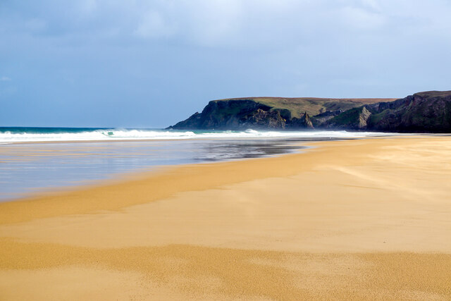
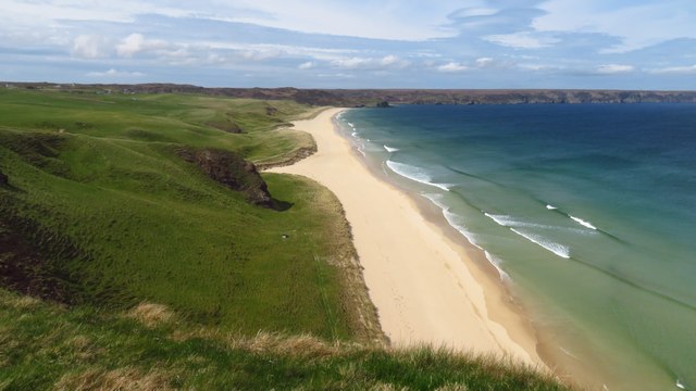
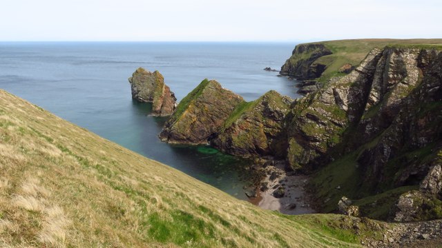
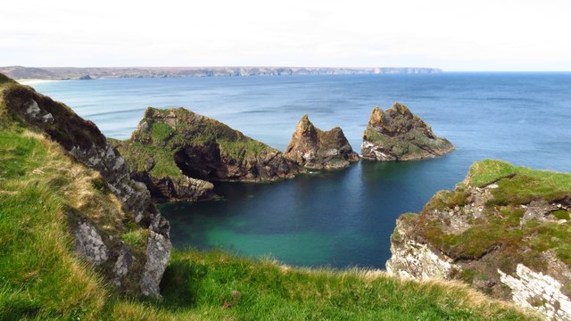
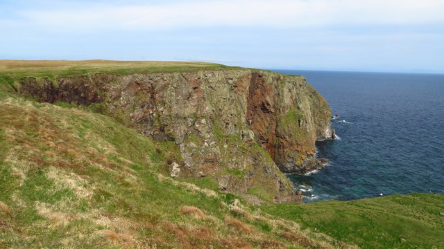
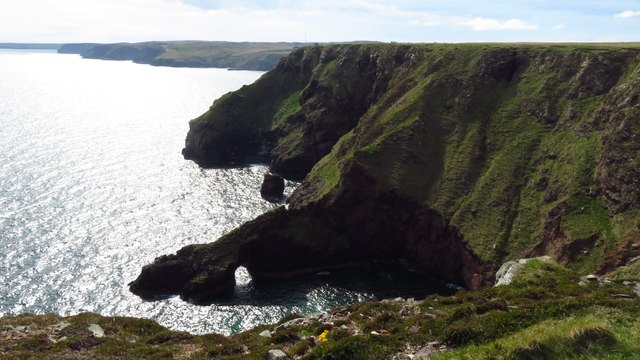
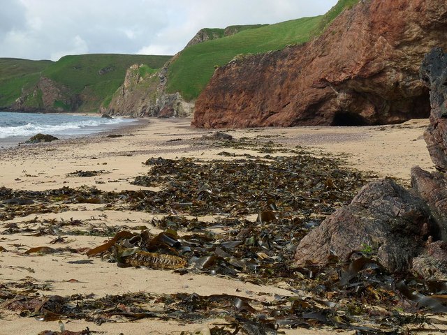
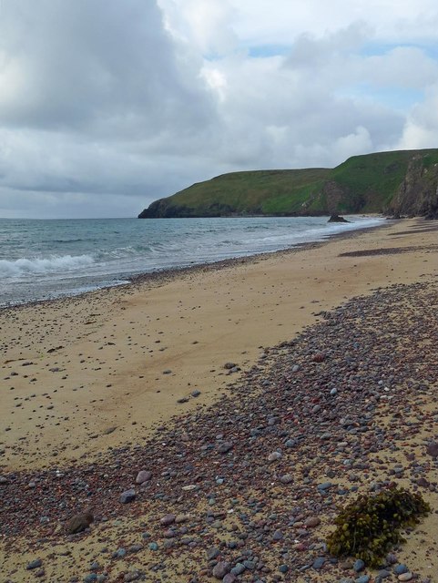
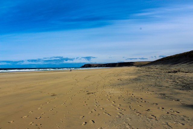
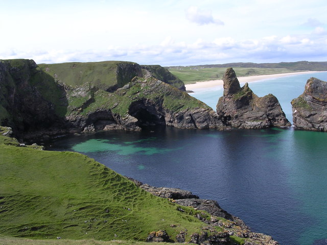
Toll Slagan Neisdeil is a coastal feature located in Ross-shire, Scotland. It is a prominent headland that juts out into the North Sea, forming a distinctive point along the coastline. The headland is situated in a picturesque and rugged landscape, characterized by steep cliffs and rocky terrain.

The name "Toll Slagan Neisdeil" is of Gaelic origin, reflecting the rich cultural heritage of the area. The headland itself offers stunning panoramic views of the surrounding sea and the nearby coastal cliffs. The cliffs are home to a variety of seabirds, including puffins, guillemots, and razorbills, making it a popular spot for birdwatchers and nature enthusiasts.

The rocky shores of Toll Slagan Neisdeil are also known for their diverse marine life. Tide pools form along the shoreline, providing a habitat for a range of intertidal species such as crabs, anemones, and small fish. The area is often explored by scuba divers who are drawn to its underwater caves and marine biodiversity.

Access to Toll Slagan Neisdeil is relatively easy, with a well-maintained footpath leading to the headland. The path offers visitors the opportunity to experience the rugged beauty of the Scottish coastline up close. It is advisable to wear appropriate footwear and exercise caution when exploring the rocky terrain.

Overall, Toll Slagan Neisdeil is a captivating coastal feature that showcases the natural beauty and ecological diversity of Ross-shire. It is a must-visit destination for those seeking breathtaking views, wildlife encounters, and an immersive experience in Scotland's coastal landscape.

If you have any feedback on the listing, please let us know in the comments section below.

Toll Slagan Neisdeil Images

Images are sourced within 2km of 58.342108/-6.1700846 or Grid Reference NB5646. Thanks to Geograph Open Source API. All images are credited.

Traigh Mhòr Beach Traigh Mhòr Beach, Isle of Lewis, looking south with the cliffs backing onto the Minch
Traigh Mhòr Beach
Traigh Mhòr Beach, Isle of Lewis, looking south with the cliffs backing onto the Minch
Sròn na Ribha Pier Geocaching is a type of global treasure hunt of people looking for caches, or hidden stashes of objects. Geocaching may also be described as a series of hide-and-seek games, where hiders provide online clues for seekers. Seekers use global positioning system (GPS) devices to find hidden caches
Sròn na Ribha Pier
Geocaching is a type of global treasure hunt of people looking for caches, or hidden stashes of objects. Geocaching may also be described as a series of hide-and-seek games, where hiders provide online clues for seekers. Seekers use global positioning system (GPS) devices to find hidden caches
Tràigh Ghioradail beach
Traigh Mhor, North Tolsta - view from cliffs above Gob an t-Seabhaig
Cliffs at Tolsta Head - view to Eilean a Muigh Heisgeir
Cliffs at south eastern corner of Tolsta Head
Cliffs at Tolsta Head - Rodha & Sron an Fhuaraidh
Boat mooring above Tràigh Ghioradail, Isle of Lewis There are three platforms on which boats can be moored near the foot of the steep block paved access track between the car park and the beach.
Boat mooring above Tràigh Ghioradail, Isle of Lewis
There are three platforms on which boats can be moored near the foot of the steep block paved access track between the car park and the beach.
Tràigh Ghioradail, Isle of Lewis Looking towards Tolsta Head.
Tràigh Ghioradail, Isle of Lewis
Looking towards Tolsta Head.
Tràigh Ghioradail, Isle of Lewis The seaward end of the <a href="https://www.geograph.org.uk/photo/2425150">NB5446 : Old Landslide?</a> is to the left of centre.
Tràigh Ghioradail, Isle of Lewis
The seaward end of the NB5446 : Old Landslide? is to the left of centre.
Tràigh Ghioradail, Isle of Lewis Looking towards Gob Girdabirie.
Tràigh Ghioradail, Isle of Lewis
Looking towards Gob Girdabirie.
Tràigh Ghioradail, Isle of Lewis Looking towards Gob Girdabirie.
Tràigh Ghioradail, Isle of Lewis
Looking towards Gob Girdabirie.
Access to Tràigh Ghioradail, Isle of Lewis The <a href="https://www.geograph.org.uk/photo/5439687">NB5446 : Boat mooring above Tràigh Ghioradail, Isle of Lewis</a> can be seen beyond the strip of sand.
Access to Tràigh Ghioradail, Isle of Lewis
The NB5446 : Boat mooring above Tràigh Ghioradail, Isle of Lewis can be seen beyond the strip of sand.
Access to Tràigh Ghioradail, Isle of Lewis Looking towards the <a href="https://www.geograph.org.uk/photo/2425150">NB5446 : Old Landslide?</a>.
Access to Tràigh Ghioradail, Isle of Lewis
Looking towards the NB5446 : Old Landslide?.
Traigh Mhòr Beach Pictured here is the stunning Traigh Mhòr beach near Tolsta, Isle of Lewis.

The beach stretches for two miles and provides a stunning walk (when the weather is nice). There also high sand dunes as an alternative route to walk and public WCs in the car park. This is great to exhaust any dog (including my Springer Spaniel).
Traigh Mhòr Beach
Pictured here is the stunning Traigh Mhòr beach near Tolsta, Isle of Lewis. The beach stretches for two miles and provides a stunning walk (when the weather is nice). There also high sand dunes as an alternative route to walk and public WCs in the car park. This is great to exhaust any dog (including my Springer Spaniel).
Eilean Heisker before the rockfall This picture was taken in 2007, August 11th. Since then the rock pillar to the right of the centre has disappeared. Tráigh Mhór is in the background.
Eilean Heisker before the rockfall
This picture was taken in 2007, August 11th. Since then the rock pillar to the right of the centre has disappeared. Tráigh Mhór is in the background.
Show me another place!

Toll Slagan Neisdeil is located at Grid Ref: NB5646 (Lat: 58.342108, Lng: -6.1700846)

Unitary Authority: Na h-Eileanan an Iar

Police Authority: Highlands and Islands

What 3 Words

///drummers.soccer.marsh. Near North Tolsta, Na h-Eileanan Siar

Related Wikis

North Tolsta

North Tolsta (Scottish Gaelic: Tolastadh bho Thuath) is a village in the Scottish Outer Hebrides, on the east side of the Isle of Lewis. North Tolsta is...

New Tolsta

New Tolsta (Scottish Gaelic: Baile Ùr Tholastaidh) is a village on the Isle of Lewis in the Outer Hebrides, Scotland. New Tolsta is within the parish of...

Gress

Gress (Scottish Gaelic: Griais), a hamlet on the Isle of Lewis in Scotland, is adjacent to the larger village of Back. Gress is within the parish of Stornoway...

Tiumpan Head Lighthouse

The Tiumpan Head Lighthouse is an active lighthouse located in Tiumpan Head, Isle of Lewis, Outer Hebrides, Scotland. == History == The idea for the Tiumpan...

Nearby Amenities

Located within 500m of 58.342108,-6.1700846
Ceann Tholastaidh
Alt Name Gd: Rubha Tholastaidh
Name En: Tolsta Head
Name Gd: Ceann Tholastaidh
Natural: cape
Lat/Long: 58.3430485/-6.1647961
Natural: arch
Source: OS OpenData StreetView
Lat/Long: 58.341043/-6.174649
The data included in this document is from www.openstreetmap.org. The data is made available under ODbL.

Have you been to Toll Slagan Neisdeil?

Leave your review of Toll Slagan Neisdeil below (or comments, questions and feedback).