Àird Ghlas

Coastal Feature, Headland, Point in Argyllshire

Scotland

Àird Ghlas

Forking dyke at Carraig Mhòr This dyke doesn't seem to have been thought big enough to map on the 1:50000 1992 Geological sheet 44 but seems to be parallel to a fault which marks the boundary between lava flows to the east downfault past the Lower Jurassic Strata exposed either side of the dyke. On the aerial view it appears very curved, but seen here close up, the main dyke indeed curves west, but a subsidiary dyke, on the left in this view, and much more jointed, suggesting more rapid cooling, splits off from the main one and continues straight down towards the tide line. For anyone wanting to get across the slippery weed-covered tidal rocks to reach the tiny bit of land in the square to the south, the dyke forms a convenient walkway, for the most part remaining high enough not to have been colonised by the seaweed.
Forking dyke at Carraig Mhòr Credit: Andy Waddington

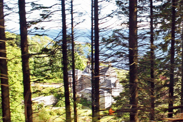
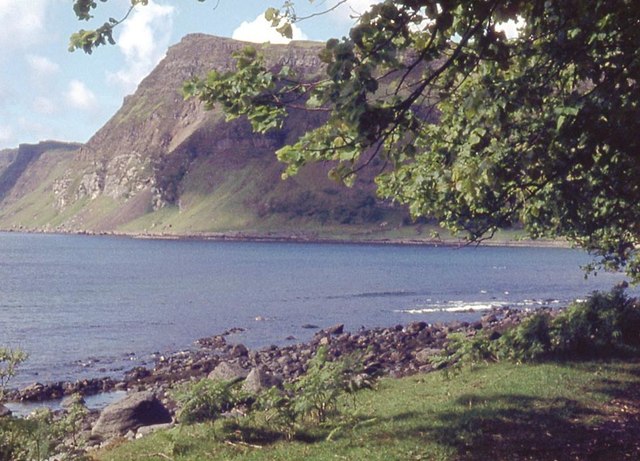
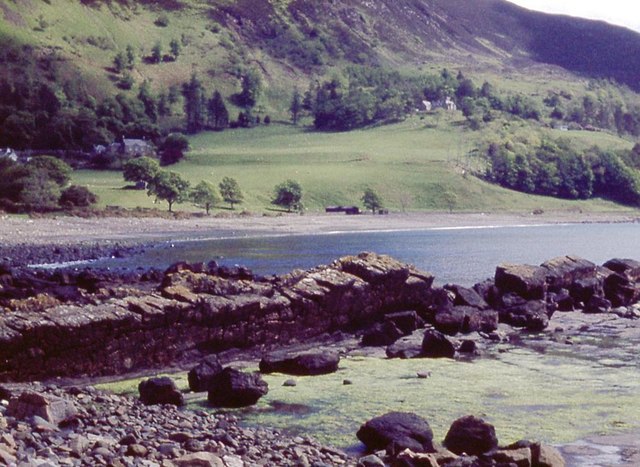
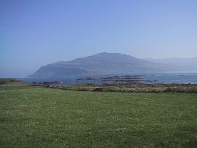
Àird Ghlas is a prominent coastal feature located in Argyllshire, Scotland. It is a headland that extends into the sea, forming a distinct point along the rugged coastline. The name "Àird Ghlas" translates to "green headland" in English, which aptly describes its picturesque surroundings.

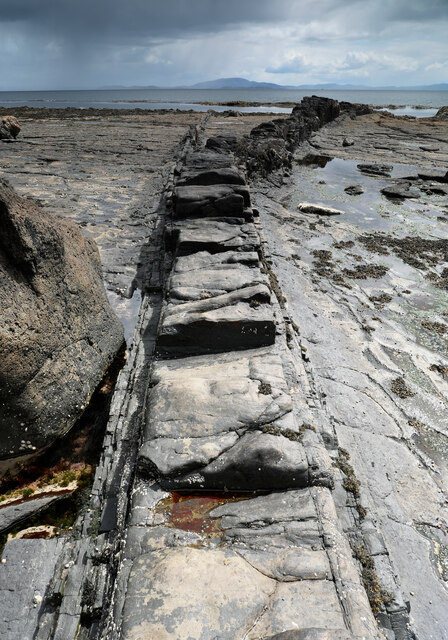
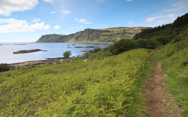
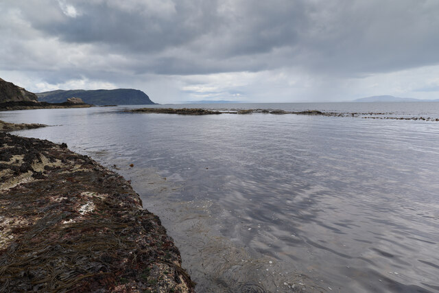
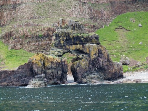
Situated in an area of outstanding natural beauty, Àird Ghlas offers breathtaking views of the surrounding landscape and the vast expanse of the Atlantic Ocean. The headland is characterized by its steep cliffs, which provide nesting sites for various seabird species, including puffins, guillemots, and razorbills. These cliffs also serve as a natural barrier, protecting the coast from erosion caused by the relentless waves.

The headland itself is covered in lush green vegetation, giving it a vibrant appearance and adding to its beauty. The rugged terrain and rocky outcrops provide a habitat for a diverse range of flora and fauna, making Àird Ghlas a popular spot for nature enthusiasts and hikers.

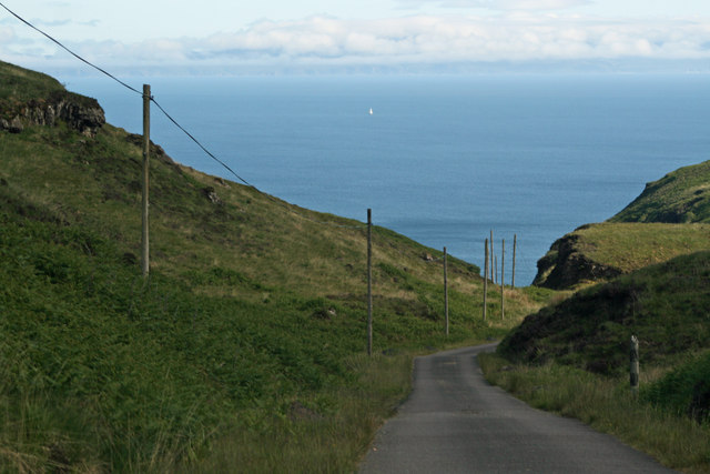
Access to Àird Ghlas is relatively easy, with well-maintained paths and trails leading to the headland. Visitors can explore the area on foot, taking in the stunning views and enjoying the fresh sea breeze. The headland is also a popular spot for fishing, with anglers often casting their lines into the waters below in search of a catch.

Overall, Àird Ghlas is a captivating coastal feature that showcases the natural beauty of Argyllshire. Its striking cliffs, abundant wildlife, and panoramic views make it a must-visit destination for those seeking a connection with nature and the Scottish coastline.

If you have any feedback on the listing, please let us know in the comments section below.

Àird Ghlas Images

Images are sourced within 2km of 56.31887/-5.9895355 or Grid Reference NM5321. Thanks to Geograph Open Source API. All images are credited.

Forking dyke at Carraig Mhòr This dyke doesn't seem to have been thought big enough to map on the 1:50000 1992 Geological sheet 44 but seems to be parallel to a fault which marks the boundary between lava flows to the east downfault past the Lower Jurassic Strata exposed either side of the dyke. On the aerial view it appears very curved, but seen here close up, the main dyke indeed curves west, but a subsidiary dyke, on the left in this view, and much more jointed, suggesting more rapid cooling, splits off from the main one and continues straight down towards the tide line. For anyone wanting to get across the slippery weed-covered tidal rocks to reach the tiny bit of land in the square to the south, the dyke forms a convenient walkway, for the most part remaining high enough not to have been colonised by the seaweed.
Forking dyke at Carraig Mhòr
This dyke doesn't seem to have been thought big enough to map on the 1:50000 1992 Geological sheet 44 but seems to be parallel to a fault which marks the boundary between lava flows to the east downfault past the Lower Jurassic Strata exposed either side of the dyke. On the aerial view it appears very curved, but seen here close up, the main dyke indeed curves west, but a subsidiary dyke, on the left in this view, and much more jointed, suggesting more rapid cooling, splits off from the main one and continues straight down towards the tide line. For anyone wanting to get across the slippery weed-covered tidal rocks to reach the tiny bit of land in the square to the south, the dyke forms a convenient walkway, for the most part remaining high enough not to have been colonised by the seaweed.
Footpath to Carsaig The part of the Carsaig to Loch Buie coast path nearest the road system at the west end is an easy walking route through bracken-infested grassland with none of the obstacles that those heading east from here will encounter along the way. A change in the geology a short way to the east is caused by a fault, dropping the rough basalt plateau lavas to sea level, whilst here we are above softer Lower Jurassic sedimentary rocks which make for gentler terrain. The sediments form the shore for some way round Carsaig Bay before dipping below the shore just shy of Carsaig Arches and Malcolm's Point seen in the distance.
Footpath to Carsaig
The part of the Carsaig to Loch Buie coast path nearest the road system at the west end is an easy walking route through bracken-infested grassland with none of the obstacles that those heading east from here will encounter along the way. A change in the geology a short way to the east is caused by a fault, dropping the rough basalt plateau lavas to sea level, whilst here we are above softer Lower Jurassic sedimentary rocks which make for gentler terrain. The sediments form the shore for some way round Carsaig Bay before dipping below the shore just shy of Carsaig Arches and Malcolm's Point seen in the distance.
Emerging square They say that time and tide waits for no man. Well, here, no man was waiting for time and tide - although it was falling it was going to be getting late if we waited until the land emerged much more. As it was, the GPS said I was in the square (but just by a metre or so with my feet overhanging the sea) and that was going to have to be good enough.
Emerging square
They say that time and tide waits for no man. Well, here, no man was waiting for time and tide - although it was falling it was going to be getting late if we waited until the land emerged much more. As it was, the GPS said I was in the square (but just by a metre or so with my feet overhanging the sea) and that was going to have to be good enough.
Road down Glen Leidle with Firth of Lorn in the distance
Glimps of Carsaig House from the Glen Leidle road Category B Listed house of about 1800 formerly the seat of Macleans of Pennycross and called Pennycross House that was superseded by Innimore Lodge in 1877. George Well Cheape of Wellfield acquired the house in the late 19th century. The house is currently (2015) available for holiday rental.
Glimps of Carsaig House from the Glen Leidle road
Category B Listed house of about 1800 formerly the seat of Macleans of Pennycross and called Pennycross House that was superseded by Innimore Lodge in 1877. George Well Cheape of Wellfield acquired the house in the late 19th century. The house is currently (2015) available for holiday rental.
Carsaig Bay
Carsaig Bay
Aird Ghlas basalt dyke in Carsaig Bay
Shore at Rubh' a' Chromain
Cadha an Aon Dorais Very steep coastal slope.
Cadha an Aon Dorais
Very steep coastal slope.
Sgeir Bhuidhe, the yellow rock
Intertidal rocks and boulders The Paps of Jura on the horizon.
Intertidal rocks and boulders
The Paps of Jura on the horizon.
Hollow boulder cast in sandstone
Waterfall near the Nuns' Pass Following in the footsteps of David Balfour, the hero of Robert Louis Stevenson's Kidnapped, as he makes his way back to Edinburgh to confront his wicked uncle.

Stage 1, June 2016 from Erraid to Fishnish on the Isle of Mull.

See <span class="nowrap"><a title="http://www.stevensonway.org.uk" rel="nofollow ugc noopener" href="http://www.stevensonway.org.uk">Link</a><img style="margin-left:2px;" alt="External link" title="External link - shift click to open in new window" src="https://s1.geograph.org.uk/img/external.png" width="10" height="10"/></span>
Waterfall near the Nuns' Pass
Following in the footsteps of David Balfour, the hero of Robert Louis Stevenson's Kidnapped, as he makes his way back to Edinburgh to confront his wicked uncle. Stage 1, June 2016 from Erraid to Fishnish on the Isle of Mull. See LinkExternal link
Coast below Sròn nam Boc Following in the footsteps of David Balfour, the hero of Robert Louis Stevenson's Kidnapped, as he makes his way back to Edinburgh to confront his wicked uncle.

Stage 1, June 2016 from Erraid to Fishnish on the Isle of Mull.

See <span class="nowrap"><a title="http://www.stevensonway.org.uk" rel="nofollow ugc noopener" href="http://www.stevensonway.org.uk">Link</a><img style="margin-left:2px;" alt="External link" title="External link - shift click to open in new window" src="https://s1.geograph.org.uk/img/external.png" width="10" height="10"/></span>
Coast below Sròn nam Boc
Following in the footsteps of David Balfour, the hero of Robert Louis Stevenson's Kidnapped, as he makes his way back to Edinburgh to confront his wicked uncle. Stage 1, June 2016 from Erraid to Fishnish on the Isle of Mull. See LinkExternal link
Àird Ghlas Basalt dyke extending into the sea.
Àird Ghlas
Basalt dyke extending into the sea.
Show me another place!

Àird Ghlas is located at Grid Ref: NM5321 (Lat: 56.31887, Lng: -5.9895355)

Unitary Authority: Argyll and Bute

Police Authority: Argyll and West Dunbartonshire

What 3 Words

///soups.suave.recently. Near Lochbuie, Argyll & Bute

Nearby Locations

Àird Ghlas

Related Wikis

Carsaig Bay

Carsaig Bay is a cove on the Ross of Mull in the south of the Isle of Mull, off the west coast of Scotland. It is situated 5 kilometres (3 miles) eastward...

Carsaig Arches

Carsaig Arches are natural arch cliff formations on the Ross of Mull in the south of the Isle of Mull, on the west coast of Scotland. They are situated...

Pennyghael

Pennyghael (Scottish Gaelic: Peighinn nan Gàidheal) is a small village in the Ross of Mull, Argyll and Bute, Scotland. It is located along the A849 road...

Loch Buie

Loch Buie (Scottish Gaelic: Locha Buidhe, meaning "yellow loch") is a sea loch on the south coast of the Isle of Mull, off the west coast of Scotland....

Aird of Kinloch

Aird of Kinloch (Gaelic:An Àird) is a rocky outcrop between Loch Scridain and Loch Beg on the Isle of Mull, Argyll and Bute, Scotland. == References ==

Loch Scridain

Loch Scridain is a 15-kilometre-long (9-mile) sea loch, with a west-south west aspect, on the western, or Atlantic coastline of the Isle of Mull, in the...

Tiroran

Tiroran is hamlet on the Isle of Mull in Argyll and Bute, Scotland. == History == In the late 18th century Tiroran House was associated with the McKinnon...

Moy Castle

Moy Castle is a ruined castle near Lochbuie on the Isle of Mull, Scotland. The site is now a scheduled monument. == History == The land upon which Moy...

Have you been to Àird Ghlas?

Leave your review of Àird Ghlas below (or comments, questions and feedback).