Rubhachan Eoghainn

Coastal Feature, Headland, Point in Argyllshire

Scotland

Rubhachan Eoghainn

Looking south-west along the coastline of south-west Jura
Looking south-west along the coastline of south-west Jura Credit: Peter Edwards

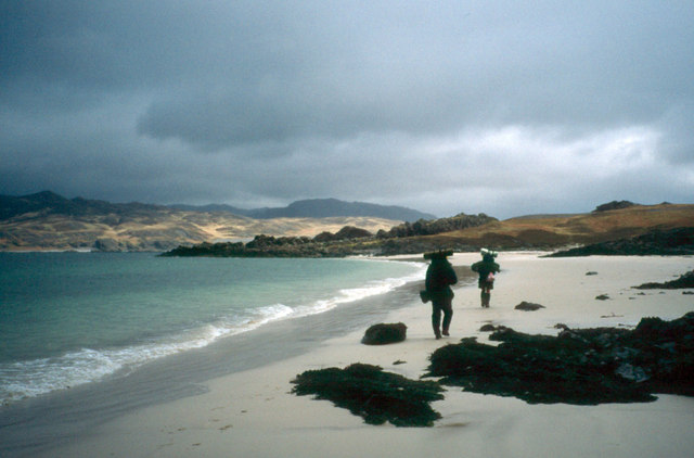
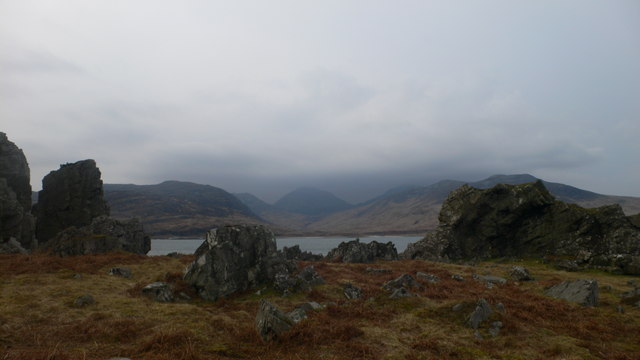
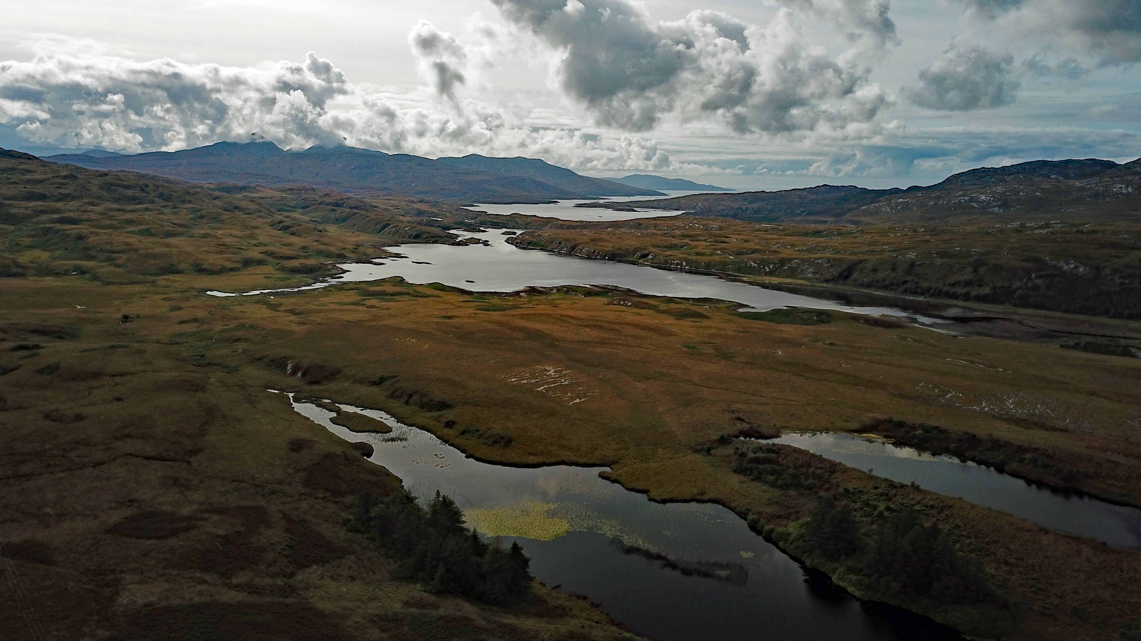
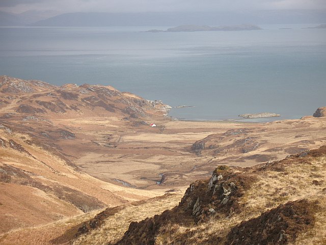
Rubhachan Eoghainn is a prominent headland located on the western coast of Argyllshire, Scotland. Situated on the picturesque shores of the North Atlantic Ocean, this coastal feature offers breathtaking panoramic views of the surrounding landscape.

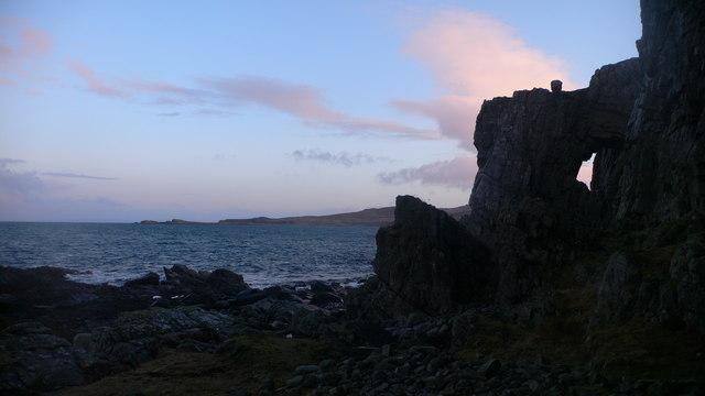
The headland is characterized by its rugged cliffs, which rise dramatically from the sea, creating a striking and imposing sight. The cliffs are composed of layers of ancient rock formations, providing a glimpse into the geological history of the region. These cliffs also serve as nesting sites for various seabirds, including puffins, guillemots, and razorbills, making it a popular spot for birdwatching enthusiasts.

The area surrounding Rubhachan Eoghainn is rich in biodiversity, with a diverse range of flora and fauna. The headland is home to a wide variety of plant species, including heather, gorse, and wildflowers, which create a colorful and vibrant landscape. The coastal waters are teeming with marine life, and occasional sightings of seals and dolphins are not uncommon.

Rubhachan Eoghainn is a popular destination for outdoor activities such as hiking and photography. The headland offers several scenic walking trails, allowing visitors to explore its rugged terrain and enjoy the stunning coastal views. It is also a favorite spot for landscape photographers, who are drawn to its dramatic cliffs, crashing waves, and ever-changing light conditions.

Overall, Rubhachan Eoghainn is a natural wonder that showcases the beauty and diversity of the Argyllshire coastline. Its rugged cliffs, diverse wildlife, and breathtaking views make it a must-visit destination for nature lovers and outdoor enthusiasts alike.

If you have any feedback on the listing, please let us know in the comments section below.

Rubhachan Eoghainn Images

Images are sourced within 2km of 55.951497/-5.9862182 or Grid Reference NR5180. Thanks to Geograph Open Source API. All images are credited.

Looking south-west along the coastline of south-west Jura
Morning of sea mist at Rubha a' Bhàillein Waking up to this was fantastic. A route from Craighouse along Evan's Walk and until this beach was tough but worth it.
Morning of sea mist at Rubha a' Bhàillein
Waking up to this was fantastic. A route from Craighouse along Evan's Walk and until this beach was tough but worth it.
Fine sandy beach near Glenbatrick A beautiful fine white sandy beach slightly further north than Glenbatrick.
Fine sandy beach near Glenbatrick
A beautiful fine white sandy beach slightly further north than Glenbatrick.
Fine sandy beach near Glenbatrick Beautiful beach, with the hill Scrinadle in the background.
Fine sandy beach near Glenbatrick
Beautiful beach, with the hill Scrinadle in the background.
Camping at Glenbatrick, Jura
Glen Batrick beach One of the least visited parts of Scotland.
Glen Batrick beach
One of the least visited parts of Scotland.
Camping by the Glenbatrick River
Overnight Camp Lowe Alpine Mountain Marathon 1997 Competitors in the 1997 relax at the overnight camp after the first days competition. Midges would not be a problem in the heatwave conditions but these competitors are leaving themselves available for a meal by deer ticks.
In the immediate distance is the rocky headland Rubh' a' Bhaillean.
Overnight Camp Lowe Alpine Mountain Marathon 1997
Competitors in the 1997 relax at the overnight camp after the first days competition. Midges would not be a problem in the heatwave conditions but these competitors are leaving themselves available for a meal by deer ticks. In the immediate distance is the rocky headland Rubh' a' Bhaillean.
Aird Reamhar One of the pilotage routes out of Middle Loch Tarbert takes you up to this point on the north shore of the loch.
Aird Reamhar
One of the pilotage routes out of Middle Loch Tarbert takes you up to this point on the north shore of the loch.
The Astor family's Summer House at Glenbatrick bay
Beach at Glenbatrick Bay The Astor family's summer house, with Corra Bheinn (left) and Beinn Shiantiadh (right) dominating the head of Glen Batrick in the background
Beach at Glenbatrick Bay
The Astor family's summer house, with Corra Bheinn (left) and Beinn Shiantiadh (right) dominating the head of Glen Batrick in the background
Rock arch at Rubh' a' Chrois-aoinidh
Aird Reamhar, Loch Tarbert, Jura Looking south through broken basalt dikes towards Beinn Shiantaidh on southern Jura
Aird Reamhar, Loch Tarbert, Jura
Looking south through broken basalt dikes towards Beinn Shiantaidh on southern Jura
Sron Bheithe Looking down the Sron Bheithe to Loch Tarbet, the sea loch that almost divides Jura into two.
Sron Bheithe
Looking down the Sron Bheithe to Loch Tarbet, the sea loch that almost divides Jura into two.
North ridge of Scrinadle Looking down the north ridge of Scrinadle to Glenbatrick and Loch Tarbet.
North ridge of Scrinadle
Looking down the north ridge of Scrinadle to Glenbatrick and Loch Tarbet.
North ridge of Beinn Bhreac to Glen Batrick The north ridge of Beinn Bhreac drops steeply down into Glen Batrick on its west side.
North ridge of Beinn Bhreac to Glen Batrick
The north ridge of Beinn Bhreac drops steeply down into Glen Batrick on its west side.
House at Glenbatrick Bay from Glenbatrick
Show me another place!

Rubhachan Eoghainn is located at Grid Ref: NR5180 (Lat: 55.951497, Lng: -5.9862182)

Unitary Authority: Argyll and Bute

Police Authority: Argyll and West Dunbartonshire

What 3 Words

///drilled.rounds.ivory. Near Craighouse, Argyll & Bute

Nearby Locations

Rubhachan Eoghainn

Related Wikis

Loch Tarbert, Jura

Loch Tarbert is a sea loch on the west coast of Jura, an island in Scotland. As the name Tarbert suggests, it comes close to cutting the island in half...

Battle of the Western Isles

The Battle of the Western Isles was a series of conflicts in 1585 and 1586 on the islands of Jura, Islay, Mull and Tiree, Scotland as well as the peninsula...

Beinn an Òir

Beinn an Òir (Gaelic for "mountain of gold") is the highest peak of the Paps of Jura on the island of Jura, Scotland. It is the highest peak on the island...

Beinn Shiantaidh

Beinn Shiantaidh (Scottish Gaelic for 'holy mountain') is the second highest peak of the Paps of Jura on the island of Jura, Scotland. It stands at 757...

Nearby Amenities

Located within 500m of 55.951497,-5.9862182
Source: PGS
Lat/Long: 55.9492927/-5.9797749
Source: PGS
Lat/Long: 55.9493324/-5.9804332
Source: PGS
Lat/Long: 55.9494404/-5.9809538
Source: PGS
Lat/Long: 55.9496101/-5.9815307
Source: PGS
Lat/Long: 55.94979/-5.9819208
Rubhachan Eoghainn
Natural: cape
Source: OS_OpenData_StreetView
Lat/Long: 55.952056/-5.9855535
The data included in this document is from www.openstreetmap.org. The data is made available under ODbL.

Have you been to Rubhachan Eoghainn?

Leave your review of Rubhachan Eoghainn below (or comments, questions and feedback).