An Dubh-laimhrig

Coastal Feature, Headland, Point in Inverness-shire

Scotland

An Dubh-laimhrig

Lochan on Beinn Bhreac The local lies only just below the 141m summit of the hill. The background skyline is part of the nearby Isle of Skye.
Lochan on Beinn Bhreac Credit: John Allan

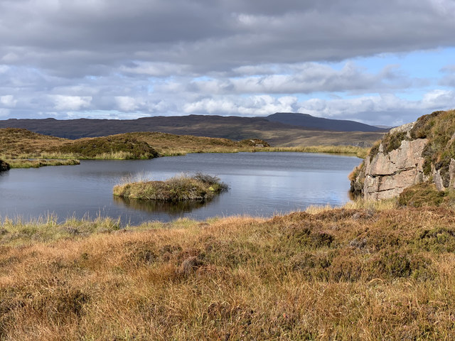
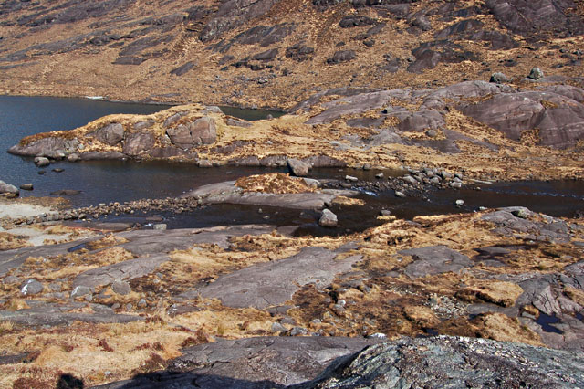
An Dubh-laimhrig is a prominent coastal feature located in Inverness-shire, Scotland. It is a headland or point that juts out into the sea, offering breathtaking views of the surrounding landscape. The name "An Dubh-laimhrig" translates to "The Black Rock" in English, which accurately describes the dark color of the rocks found in this area.

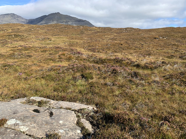
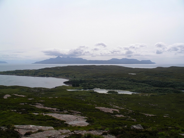
Situated along the western coast of Scotland, An Dubh-laimhrig is known for its rugged beauty and dramatic cliffs that drop down into the sea. The headland is characterized by steep slopes and jagged rocks, creating a stunning natural spectacle. The crashing waves and sea spray add to the allure of this coastal feature, making it a popular spot for photographers and nature enthusiasts.

Visitors to An Dubh-laimhrig can enjoy panoramic views of the surrounding landscape, including the vast expanse of the North Atlantic Ocean and the distant mountains on the horizon. The headland also provides an excellent vantage point for spotting wildlife, such as seabirds and seals, which inhabit the area.

Access to An Dubh-laimhrig is relatively easy, with a well-maintained footpath leading to the headland. However, caution is advised as the cliffs can be treacherous, especially during inclement weather. It is advisable to wear appropriate footwear and stay away from the edges for safety reasons.

Overall, An Dubh-laimhrig is a natural marvel that showcases the raw beauty of Scotland's coastline. It attracts visitors from near and far, who come to admire its striking landscape and immerse themselves in the tranquility of this remote coastal location.

If you have any feedback on the listing, please let us know in the comments section below.

An Dubh-laimhrig Images

Images are sourced within 2km of 57.157299/-6.1794049 or Grid Reference NG4715. Thanks to Geograph Open Source API. All images are credited.

Lochan on Beinn Bhreac The local lies only just below the 141m summit of the hill. The background skyline is part of the nearby Isle of Skye.
Lochan on Beinn Bhreac
The local lies only just below the 141m summit of the hill. The background skyline is part of the nearby Isle of Skye.
Trig point on Beinn Bhreac, Soay A vanessa tube on the 141m high point of the island.
The central mountain in the background is Bla-Bheinn on the Isle of Skye.
Trig point on Beinn Bhreac, Soay
A vanessa tube on the 141m high point of the island. The central mountain in the background is Bla-Bheinn on the Isle of Skye.
Doire Mhòr moorland, Soay Heathery and in places very wet moorland in south east Soay.
The background peak is the top of Gars-bheinn on Skye.
Doire Mhòr moorland, Soay
Heathery and in places very wet moorland in south east Soay. The background peak is the top of Gars-bheinn on Skye.
Cattle pens at the head of Camas nan Gall Long disused pens and shed on Soay, which no longer has any cattle.
Cattle pens at the head of Camas nan Gall
Long disused pens and shed on Soay, which no longer has any cattle.
Beinn Bhreac (Soay) Second island of the day on a RIB from Elgol on day of Marhofn 2011 annual meeting in Portree organised by Alan Holmes. Did Wiay first,with Rob Woodall and Bob Taylor. This was Ann Bowker's last sub Marilyn so whisky to celebrate.
Name: Beinn Bhreac (Soay)
Hill number: 1278
Height: 141m / 463ft
Area: 17B: Minginish and the Cuillin Hills
Class: Hu,sMa
Grid ref: NG 46214 15484
Summit feature: rock 4m N of trig point
Drop: 141m
Col: Sea
Beinn Bhreac (Soay)
Second island of the day on a RIB from Elgol on day of Marhofn 2011 annual meeting in Portree organised by Alan Holmes. Did Wiay first,with Rob Woodall and Bob Taylor. This was Ann Bowker's last sub Marilyn so whisky to celebrate. Name: Beinn Bhreac (Soay) Hill number: 1278 Height: 141m / 463ft Area: 17B: Minginish and the Cuillin Hills Class: Hu,sMa Grid ref: NG 46214 15484 Summit feature: rock 4m N of trig point Drop: 141m Col: Sea
Loch Mor, Soay Looking SW from the upper slopes of Beinn Bhreac.  In the distance is the west of the island and a distant view of Rum
Loch Mor, Soay
Looking SW from the upper slopes of Beinn Bhreac. In the distance is the west of the island and a distant view of Rum
Soay harbour Looking WSW from the upper slopes of Beinn Bhreac to the natural harbour of Soay (right middle distance).  In the distance is Rum and Canna
Soay harbour
Looking WSW from the upper slopes of Beinn Bhreac to the natural harbour of Soay (right middle distance). In the distance is Rum and Canna
Soay: Shark Fishing Station As well as being the spiritual home of all midgies (!), much more importantly there are, to steam enthusiasts at any rate, the rusting remains of a Fowler steam ploughing engine boiler behind the derelict buildings: how on earth did they get it there?
Soay: Shark Fishing Station
As well as being the spiritual home of all midgies (!), much more importantly there are, to steam enthusiasts at any rate, the rusting remains of a Fowler steam ploughing engine boiler behind the derelict buildings: how on earth did they get it there?
Rocky beach near An Dubh-sgeire Swarms of dykes are picked out on the coast of Soay, where the (usually) hard dolerite of the dykes has resisted erosion to form rocky promontories separated by inlets and rocky beaches. Many are only accessible from the sea! In the distance is the Isle of Eigg.
Rocky beach near An Dubh-sgeire
Swarms of dykes are picked out on the coast of Soay, where the (usually) hard dolerite of the dykes has resisted erosion to form rocky promontories separated by inlets and rocky beaches. Many are only accessible from the sea! In the distance is the Isle of Eigg.
The loch on Beinn Bhreac In the hills of eastern Soay lies this little gem. There was a great Northern Diver here When I took this picture.
The loch on Beinn Bhreac
In the hills of eastern Soay lies this little gem. There was a great Northern Diver here When I took this picture.
Fishing boat in Camas nan Gall bay This is the boat that brought our team here to do a radio amateur expedition
Fishing boat in Camas nan Gall bay
This is the boat that brought our team here to do a radio amateur expedition
Loch Doire an Lochain The local football goals can be seen in the background; when this photo was taken there were two players in the Soay team.
Loch Doire an Lochain
The local football goals can be seen in the background; when this photo was taken there were two players in the Soay team.
Fishermans cottage
Fishermans cottage
An Dubh-laimhrig The easternmost tip of Soay.
An Dubh-laimhrig
The easternmost tip of Soay.
Eastern shoreline of Soay The east coast is quite rocky; some of the bays here are collapsed sea caves.
Eastern shoreline of Soay
The east coast is quite rocky; some of the bays here are collapsed sea caves.
Seagull on a rock Very little is exposed at (neap) low tide, but this wee rock made it.  Elgol is directly behind the gull (and that's where I went next, to drive home).
Seagull on a rock
Very little is exposed at (neap) low tide, but this wee rock made it. Elgol is directly behind the gull (and that's where I went next, to drive home).
Off Skye Sailing off the Isle of Skye, hiding from Gales. The channel between Soay and Skye is very deep till just offshore.
Off Skye
Sailing off the Isle of Skye, hiding from Gales. The channel between Soay and Skye is very deep till just offshore.
Soay Coast Sailing along the North of the Soay coastline
Soay Coast
Sailing along the North of the Soay coastline
Show me another place!

An Dubh-laimhrig is located at Grid Ref: NG4715 (Lat: 57.157299, Lng: -6.1794049)

Unitary Authority: Highland

Police Authority: Highlands and Islands

What 3 Words

///mailer.unheated.fiction. Near Elgol, Highland

Related Wikis

Soay, Inner Hebrides

Soay (Scottish Gaelic: Sòdhaigh, pronounced [ˈs̪ɔː.aj]) is an island just off the coast of Skye, in the Inner Hebrides of Scotland. == Geography == Soay...

Sgùrr nan Eag

Sgùrr nan Eag is a mountain 924 metres (3,031 ft) high in the Cuillin range on the Isle of Skye, Scotland. It is the southernmost Munro of the Cuillins...

Scavaig River

The Scavaig River or River Coruisk is a river on the Isle of Skye, in Scotland. It is located amongst the Cuillin, and flows from Loch Coruisk to meet...

Strathaird

Strathaird is a peninsula on the island of Skye, Scotland, situated between Loch Slapin and Loch Scavaig on the south coast.W. H. Murray said that "Skye...

Have you been to An Dubh-laimhrig?

Leave your review of An Dubh-laimhrig below (or comments, questions and feedback).