An Fhearsaid

Coastal Feature, Headland, Point in Argyllshire

Scotland

An Fhearsaid

Basalt crags, Mull View past Gribun on the south side of Loch na Keal.
Basalt crags, Mull Credit: Richard Webb

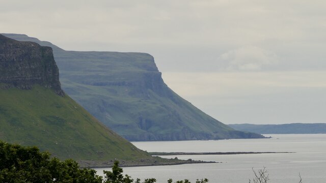
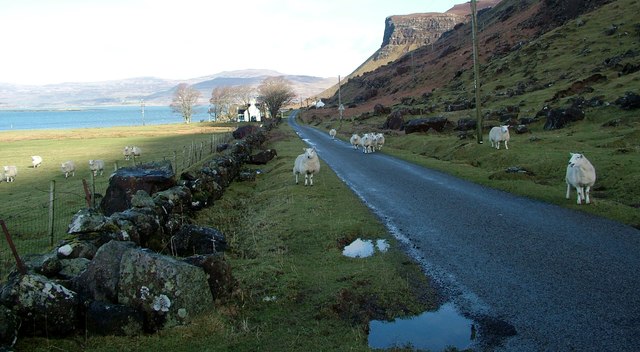
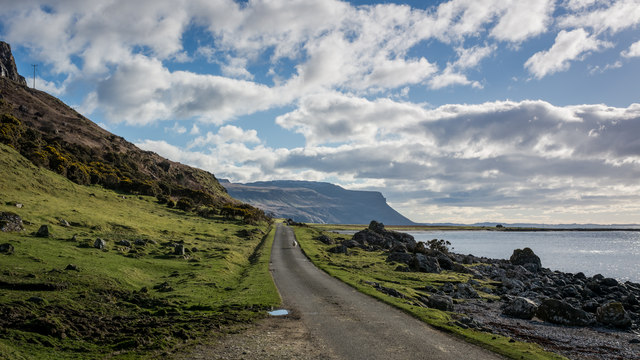
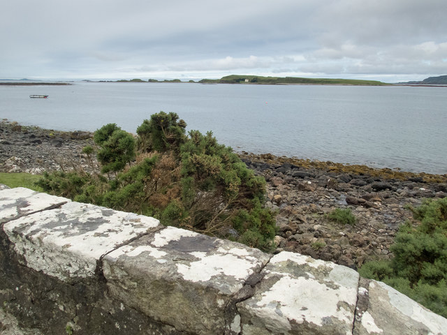
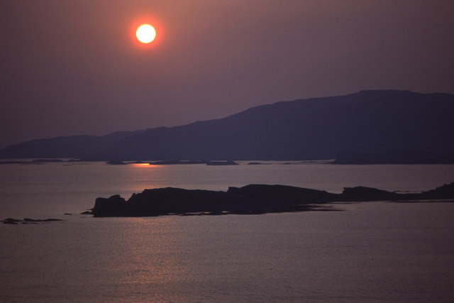
An Fhearsaid, also known as Ardfern Point, is a prominent headland located in Argyllshire, Scotland. Situated on the west coast of the country, this coastal feature offers breathtaking views of the surrounding landscape and is a popular destination for tourists and nature enthusiasts.

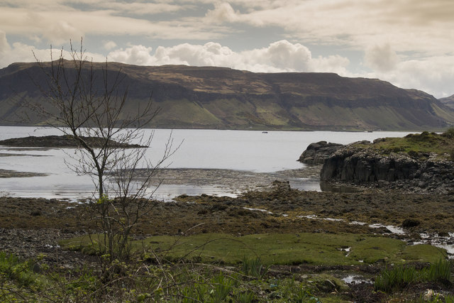
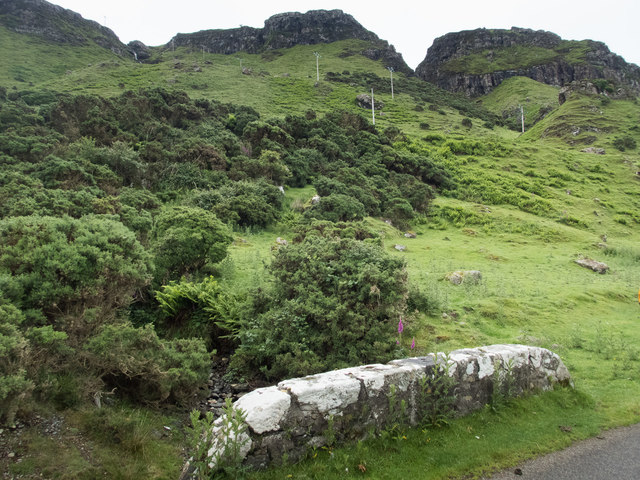
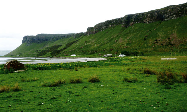
The headland is characterized by its rugged cliffs, which provide a striking backdrop against the vast expanse of the North Atlantic Ocean. The cliffs are composed of ancient rock formations, showcasing layers of sedimentary rocks that have been shaped by centuries of erosion.

An Fhearsaid is home to a diverse range of flora and fauna, with its coastal habitats supporting a variety of plant and animal species. Seabirds such as gannets, fulmars, and kittiwakes can often be spotted nesting on the cliffs, while seals and dolphins are occasionally seen swimming in the waters below.

The headland is also known for its archaeological significance, with the remains of ancient settlements and structures scattered along its coastline. These remnants provide valuable insights into the area's rich history, dating back thousands of years.

For visitors, An Fhearsaid offers several opportunities for outdoor activities. The headland is a popular spot for hiking, providing stunning views and a chance to explore the rugged coastal terrain. It is also a favored location for birdwatching and photography, with its dramatic cliffs and diverse wildlife offering endless photo opportunities.

Overall, An Fhearsaid in Argyllshire is a captivating coastal feature that combines natural beauty, wildlife, and historical significance, making it a must-visit destination for those seeking to experience the wonders of Scotland's west coast.

If you have any feedback on the listing, please let us know in the comments section below.

An Fhearsaid Images

Images are sourced within 2km of 56.447637/-6.1466924 or Grid Reference NM4436. Thanks to Geograph Open Source API. All images are credited.

Basalt crags, Mull View past Gribun on the south side of Loch na Keal.
Basalt crags, Mull
View past Gribun on the south side of Loch na Keal.
Old milepost One of the remaining mileposts on the B8035 road from Salen southwards to join the A849 for the 38 miles from Salen to Fionnphort and the Iona Ferry jetty.   These posts on Mull made by Smith, Patterson of Blaydon are the only ones known to have been cast at that foundry that have a date, 1897.   This post is on the west side of the road north of Balnahard.
Old milepost
One of the remaining mileposts on the B8035 road from Salen southwards to join the A849 for the 38 miles from Salen to Fionnphort and the Iona Ferry jetty. These posts on Mull made by Smith, Patterson of Blaydon are the only ones known to have been cast at that foundry that have a date, 1897. This post is on the west side of the road north of Balnahard.
Rocks on the shore of Loch na Keal at Rubha a'Ghearrain The low-lying island in the centre of the photo is Samalan Island.
Rocks on the shore of Loch na Keal at Rubha a'Ghearrain
The low-lying island in the centre of the photo is Samalan Island.
Inch Kenneth from Gribun Field gate and track leading from the B8035 at Gribun, Mull, down to the Loch opposite Inch Kenneth island
Inch Kenneth from Gribun
Field gate and track leading from the B8035 at Gribun, Mull, down to the Loch opposite Inch Kenneth island
Gribun sheep Very inquisitive and/or hungry sheep along the B8035 at Gribun, Mull - February 2016
Gribun sheep
Very inquisitive and/or hungry sheep along the B8035 at Gribun, Mull - February 2016
Road near Clachandhu
Cliffs on Mull The road passes directly below these cliffs. It is very narrow with passing places so you hope not to meet something large coming the other way.
Cliffs on Mull
The road passes directly below these cliffs. It is very narrow with passing places so you hope not to meet something large coming the other way.
Marvellous scenery on the Mull coast The scenery here is wonderful. This bridge <a href="https://www.geograph.org.uk/photo/3045622">NM4535 : Road towards the Bungalow, Loch na Keal</a> over an unnamed stream has a rivet benchmark <a href="https://www.geograph.org.uk/photo/5461796">NM4535 : Benchmark and lichen</a> on it.
Marvellous scenery on the Mull coast
The scenery here is wonderful. This bridge NM4535 : Road towards the Bungalow, Loch na Keal over an unnamed stream has a rivet benchmark NM4535 : Benchmark and lichen on it.
Benchmark and lichen The lichen is doing a good job of very slowly obscuring the accompanying arrow of this rivet benchmark (OS description: RIVET E PARA BR 1.3M N END). The bridge parapet is shown in <a href="https://www.geograph.org.uk/photo/5461790">NM4535 : Marvellous scenery on the Mull coast</a>.
Benchmark and lichen
The lichen is doing a good job of very slowly obscuring the accompanying arrow of this rivet benchmark (OS description: RIVET E PARA BR 1.3M N END). The bridge parapet is shown in NM4535 : Marvellous scenery on the Mull coast.
View to Inch Kenneth Beyond the parapet of this bridge over an unnamed stream is a narrow strip of coast and a view to Inch Kenneth two squares to the west. There is a rivet benchmark <a href="https://www.geograph.org.uk/photo/5461820">NM4535 : Benchmark on bridge parapet</a> on the central stone of the parapet.
View to Inch Kenneth
Beyond the parapet of this bridge over an unnamed stream is a narrow strip of coast and a view to Inch Kenneth two squares to the west. There is a rivet benchmark NM4535 : Benchmark on bridge parapet on the central stone of the parapet.
Benchmark on bridge parapet The OS description is: RIVET NW PARA BR 1.6M N END. The bridge is shown in <a href="https://www.geograph.org.uk/photo/5461816">NM4535 : View to Inch Kenneth</a>.
Benchmark on bridge parapet
The OS description is: RIVET NW PARA BR 1.6M N END. The bridge is shown in NM4535 : View to Inch Kenneth.
Where is the benchmark? This is a fine view of the vegetated talus slope below the cliffs of Creag Mhor. Bits are still falling off. There is a rivet benchmark on the rocks left foreground. I thought it would be on the largest rock, but it was actually on the higher of the smaller pair just in front of it <a href="https://www.geograph.org.uk/photo/5461881">NM4636 : Boulders from the cliff</a>.
Where is the benchmark?
This is a fine view of the vegetated talus slope below the cliffs of Creag Mhor. Bits are still falling off. There is a rivet benchmark on the rocks left foreground. I thought it would be on the largest rock, but it was actually on the higher of the smaller pair just in front of it NM4636 : Boulders from the cliff.
Boulders from the cliff This is a closer view of the boulders <a href="https://www.geograph.org.uk/photo/5461834">NM4636 : Where is the benchmark?</a> below the cliffs of Creag Mhor. The rivet <a href="https://www.geograph.org.uk/photo/5461883">NM4636 : An easily overlooked rivet benchmark</a> is on the near top surface of the higher of the two smaller stones in front of the large boulder.
Boulders from the cliff
This is a closer view of the boulders NM4636 : Where is the benchmark? below the cliffs of Creag Mhor. The rivet NM4636 : An easily overlooked rivet benchmark is on the near top surface of the higher of the two smaller stones in front of the large boulder.
An easily overlooked rivet benchmark We were lucky to spot this one, almost covered in moss, on one in a group of boulders <a href="https://www.geograph.org.uk/photo/5461881">NM4636 : Boulders from the cliff</a>.
An easily overlooked rivet benchmark
We were lucky to spot this one, almost covered in moss, on one in a group of boulders NM4636 : Boulders from the cliff.
Arrow revealed Scraping the moss <a href="https://www.geograph.org.uk/photo/5461883">NM4636 : An easily overlooked rivet benchmark</a> away revealed the arrow of the rivet benchmark.
Arrow revealed
Scraping the moss NM4636 : An easily overlooked rivet benchmark away revealed the arrow of the rivet benchmark.
Clachandhu from Rubha Baile na h-Airde This is the point where the "Wilderness coast" of Mull becomes a little more subdued and is accessible to road building - the B8035 cuts across the Ardmeanach peninsula from Loch Scridain, and here drops down to a wide enough coastal plain on the shore of Loch na Keal. The flat area is at its most extensive just at this point, where a reef extends out into Loch na Keal towards Inch Kenneth and has provided enough shelter from the sea for a wide grassy area to form and provide some grazing, hence the habitation.
Clachandhu from Rubha Baile na h-Airde
This is the point where the "Wilderness coast" of Mull becomes a little more subdued and is accessible to road building - the B8035 cuts across the Ardmeanach peninsula from Loch Scridain, and here drops down to a wide enough coastal plain on the shore of Loch na Keal. The flat area is at its most extensive just at this point, where a reef extends out into Loch na Keal towards Inch Kenneth and has provided enough shelter from the sea for a wide grassy area to form and provide some grazing, hence the habitation.
Balnahard from Rubha Baile na h-Airde Having avoided the "Wilderness coast" by cutting across the Ardmeanach peninsula from Loch Scridain, the road rejoins the coast just north of Balnahard, where an area of low lying grassland provides enough grazing to support a tiny community. The screes, and cliffs behind rising to 200m face west, across a short and shallow stretch of Loch na Keal towards Inch Kenneth. The connecting reef is responsible for the shelter which has helped form the raised beach, now grassy but with a lot of flag iris which, being too tough to graze, thrives whilst other vegetation is kept down by the sheep.
Balnahard from Rubha Baile na h-Airde
Having avoided the "Wilderness coast" by cutting across the Ardmeanach peninsula from Loch Scridain, the road rejoins the coast just north of Balnahard, where an area of low lying grassland provides enough grazing to support a tiny community. The screes, and cliffs behind rising to 200m face west, across a short and shallow stretch of Loch na Keal towards Inch Kenneth. The connecting reef is responsible for the shelter which has helped form the raised beach, now grassy but with a lot of flag iris which, being too tough to graze, thrives whilst other vegetation is kept down by the sheep.
Setting sun over Inch Kenneth and Ulva Looking across the mouth of Loch na Keal to Ulva. The southern part of Inch Kenneth is nearest the camera.
Setting sun over Inch Kenneth and Ulva
Looking across the mouth of Loch na Keal to Ulva. The southern part of Inch Kenneth is nearest the camera.
Show me another place!

An Fhearsaid is located at Grid Ref: NM4436 (Lat: 56.447637, Lng: -6.1466924)

Unitary Authority: Argyll and Bute

Police Authority: Argyll and West Dunbartonshire

What 3 Words

///humble.amps.shout. Near Salen, Argyll & Bute

Related Wikis

Samalan Island

Samalan Island is a small island, just off the Isle of Mull at the mouth of Loch na Keal in the Inner Hebrides, Scotland. To its south west is the island...

St Kenneth's Chapel

St. Kenneth's Chapel is a ruined chapel on Inch Kenneth Island, Parish of Kilfinichen and Kilvickeon, Isle of Mull, Argyll and Bute, Scotland. It dates...

Inch Kenneth

Inch Kenneth (Scottish Gaelic: Innis Choinnich) is a small grassy island off the west coast of the Isle of Mull, in Scotland. It is at the entrance of...

Ulva Ferry

Ulva Ferry (Scottish Gaelic: Caolas Ulbha) is a hamlet on the Hebridean island of Mull, on its west coast. Ulva Ferry is on the shore of Ulva Sound (Caolas...

Nearby Amenities

Located within 500m of 56.447637,-6.1466924
Source: PGS
Lat/Long: 56.447189/-6.1504583
Source: PGS
Lat/Long: 56.446972/-6.1502351
Source: PGS
Lat/Long: 56.4466527/-6.149976
Source: PGS
Lat/Long: 56.4463906/-6.1496606
Source: PGS
Lat/Long: 56.4463627/-6.1491488
Source: PGS
Lat/Long: 56.4462832/-6.1491123
Source: PGS
Lat/Long: 56.4461987/-6.1491113
The data included in this document is from www.openstreetmap.org. The data is made available under ODbL.

Have you been to An Fhearsaid?

Leave your review of An Fhearsaid below (or comments, questions and feedback).