Boscawen Point

Coastal Feature, Headland, Point in Cornwall

England

Boscawen Point

Merry Maidens Stone Circle <span class="nowrap"><a title="https://www.megalithic.co.uk/article.php?sid=118" rel="nofollow ugc noopener" href="https://www.megalithic.co.uk/article.php?sid=118">Link</a><img style="margin-left:2px;" alt="External link" title="External link - shift click to open in new window" src="https://s1.geograph.org.uk/img/external.png" width="10" height="10"/></span>
Merry Maidens Stone Circle Credit: Sandy Gerrard

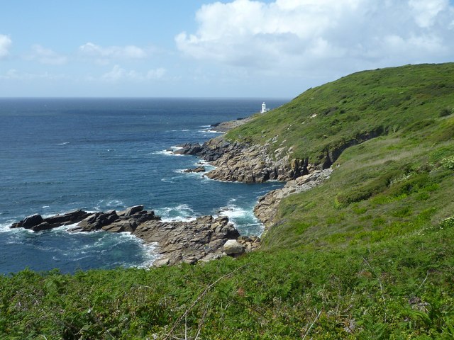
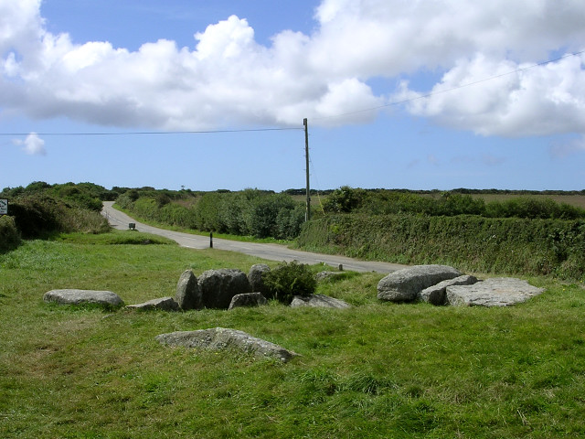
Boscawen Point is a prominent headland located on the southwestern coast of Cornwall, England. Situated near the town of Penzance, it juts out into the Atlantic Ocean, offering stunning panoramic views of the surrounding coastline.

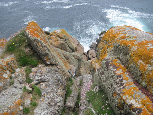
The headland is known for its rugged cliffs, which stand tall against the crashing waves below. These cliffs are composed of granite, a common rock type in this region, and exhibit a weathered appearance due to the constant erosion caused by the powerful ocean currents.

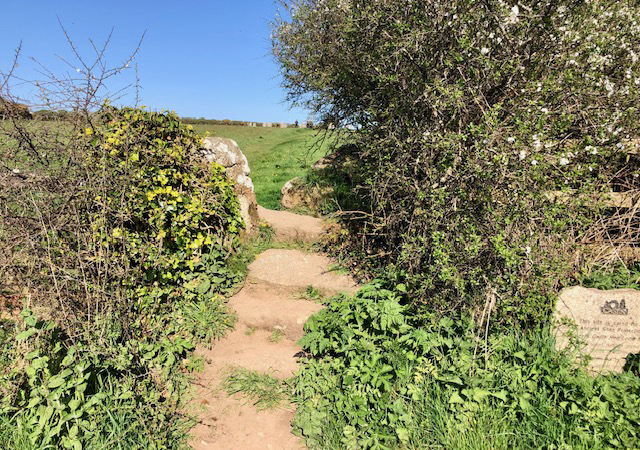
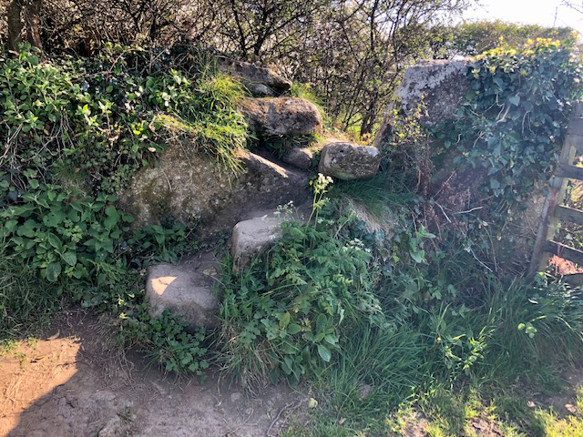
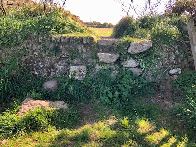
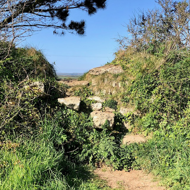
At the top of Boscawen Point, visitors can find a well-maintained footpath that leads to a viewpoint. From here, one can take in the breathtaking vistas of the azure sea, sandy beaches, and neighboring headlands. On clear days, it is even possible to spot the distant Isles of Scilly on the horizon.

The area around Boscawen Point is rich in biodiversity, hosting a variety of plant and animal species. Wildflowers, such as thrift and sea campion, dot the cliffs, adding vibrant colors to the landscape. Birdwatchers often flock to this spot, as it provides an excellent vantage point for observing seabirds like gulls, cormorants, and fulmars.

Due to its striking natural beauty, Boscawen Point is a popular destination for outdoor enthusiasts and nature lovers. Visitors can enjoy coastal walks, picnics, and photography sessions in this idyllic setting. Furthermore, its proximity to Penzance makes it easily accessible, with ample parking and nearby amenities.

In conclusion, Boscawen Point is a captivating headland in Cornwall, offering breathtaking views, diverse wildlife, and a peaceful escape from the bustling city life.

If you have any feedback on the listing, please let us know in the comments section below.

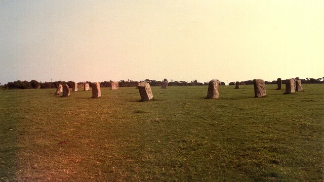
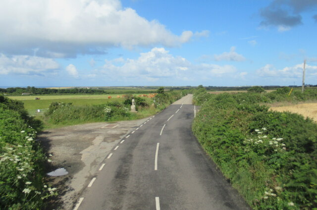
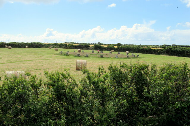
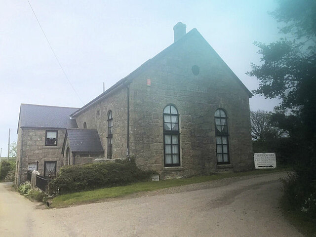
Boscawen Point Images

Images are sourced within 2km of 50.050481/-5.5899677 or Grid Reference SW4322. Thanks to Geograph Open Source API. All images are credited.

Merry Maidens Stone Circle <span class="nowrap"><a title="https://www.megalithic.co.uk/article.php?sid=118" rel="nofollow ugc noopener" href="https://www.megalithic.co.uk/article.php?sid=118">Link</a><img style="margin-left:2px;" alt="External link" title="External link - shift click to open in new window" src="https://s1.geograph.org.uk/img/external.png" width="10" height="10"/></span>
Merry Maidens Stone Circle
The B3315 at Boskenna Cross
The Merry Maidens stone circle
Borah Chapel
Borah Chapel
Stone Stile, Merry Maidens Stone Circle From a little car park on the B3315, Cornwall footpath 121/90/2 looking to the field with the Stone Circle. 
The view SW is <a href="https://www.geograph.org.uk/photo/7557453">SW4324 : Stone Stile, Merry Maidens Stone Circle</a>.
Merry Maidens (aka Dawns Men) see <a href="https://www.geograph.org.uk/photo/912784">SW4324 : The Merry Maidens - they all look stoned to me</a> is Grade II listed <span class="nowrap"><a title="https://www.heritagegateway.org.uk/Gateway/Results_Single.aspx?uid=MCO18453&resourceID=1020" rel="nofollow ugc noopener" href="https://www.heritagegateway.org.uk/Gateway/Results_Single.aspx?uid=MCO18453&resourceID=1020">Link</a><img style="margin-left:2px;" alt="External link" title="External link - shift click to open in new window" src="https://s1.geograph.org.uk/img/external.png" width="10" height="10"/></span>
Stone Stile, Merry Maidens Stone Circle
From a little car park on the B3315, Cornwall footpath 121/90/2 looking to the field with the Stone Circle. The view SW is SW4324 : Stone Stile, Merry Maidens Stone Circle. Merry Maidens (aka Dawns Men) see SW4324 : The Merry Maidens - they all look stoned to me is Grade II listed LinkExternal link
Stone Stile, Merry Maidens Stone Circle From a little car park on the B3315, Cornwall footpath 121/90/2 looking from the field with the Stone Circle. 
The view NE is <a href="https://www.geograph.org.uk/photo/7557450">SW4324 : Stone Stile, Merry Maidens Stone Circle</a>. 
Merry Maidens (aka Dawns Men) see <a href="https://www.geograph.org.uk/photo/912784">SW4324 : The Merry Maidens - they all look stoned to me</a> is Grade II listed <span class="nowrap"><a title="https://www.heritagegateway.org.uk/Gateway/Results_Single.aspx?uid=MCO18453&resourceID=1020" rel="nofollow ugc noopener" href="https://www.heritagegateway.org.uk/Gateway/Results_Single.aspx?uid=MCO18453&resourceID=1020">Link</a><img style="margin-left:2px;" alt="External link" title="External link - shift click to open in new window" src="https://s1.geograph.org.uk/img/external.png" width="10" height="10"/></span>
Stone Stile, Merry Maidens Stone Circle
From a little car park on the B3315, Cornwall footpath 121/90/2 looking from the field with the Stone Circle. The view NE is SW4324 : Stone Stile, Merry Maidens Stone Circle. Merry Maidens (aka Dawns Men) see SW4324 : The Merry Maidens - they all look stoned to me is Grade II listed LinkExternal link
Stone Stile, Merry Maidens Stone Circle On Cornwall footpath 121/90/2 looking in the direction of the Stone Circle. The view NE is <a href="https://www.geograph.org.uk/photo/7557712">SW4324 : Stone Stile, Merry Maidens Stone Circle</a>.
Stone Stile, Merry Maidens Stone Circle
On Cornwall footpath 121/90/2 looking in the direction of the Stone Circle. The view NE is SW4324 : Stone Stile, Merry Maidens Stone Circle.
Stone Stile, Merry Maidens Stone Circle On Cornwall footpath 121/90/2 leading to the Stone Circle (behind the camera). The view SW is <a href="https://www.geograph.org.uk/photo/7557711">SW4324 : Stone Stile, Merry Maidens Stone Circle</a>.
Stone Stile, Merry Maidens Stone Circle
On Cornwall footpath 121/90/2 leading to the Stone Circle (behind the camera). The view SW is SW4324 : Stone Stile, Merry Maidens Stone Circle.
Entrance to Choone Farm,  near St. Buryan
Entrance to Choone Farm, near St. Buryan
Tater-du lighthouse and coastline to the north-east
The Coast and Tater Du
Tater-du Lighthouse
Tater-du Lighthouse
The tip of Porthguarnon Cove east cliff The ropes and iron stakes visible on the rock are to assist fishermen in descending the awkward rocks.
The tip of Porthguarnon Cove east cliff
The ropes and iron stakes visible on the rock are to assist fishermen in descending the awkward rocks.
Treverven Farm house
Disused path near to the Merry Maidens This is at the end of what looks on the map to be a field access track. It is not shown as a right-of-way, yet has a good-quality footpath gate. The track is blocked by thorny branches. Perhaps it was intended to be an alternative route to the Merry maidens.
Disused path near to the Merry Maidens
This is at the end of what looks on the map to be a field access track. It is not shown as a right-of-way, yet has a good-quality footpath gate. The track is blocked by thorny branches. Perhaps it was intended to be an alternative route to the Merry maidens.
Some of the Merry Maidens Not really maiden-shaped. The road can be seen snaking away into the distance.
Some of the Merry Maidens
Not really maiden-shaped. The road can be seen snaking away into the distance.
Merry Maidens Stone Circle in 1961 Having researched this location using streetview, I assume the house on the right could be Dolphin Cottage.
Merry Maidens Stone Circle in 1961
Having researched this location using streetview, I assume the house on the right could be Dolphin Cottage.
Boskenna Cross in 1977 Standing beside the B3315, which can be seen to its left.
Boskenna Cross in 1977
Standing beside the B3315, which can be seen to its left.
Show me another place!

Boscawen Point is located at Grid Ref: SW4322 (Lat: 50.050481, Lng: -5.5899677)

Unitary Authority: Cornwall

Police Authority: Devon and Cornwall

What 3 Words

///feasting.gushes.extensive. Near St Buryan, Cornwall

Nearby Locations

Boscawen Point

Related Wikis

St Loy's Cove

St Loy's Cove is a small wooded valley and beach in the civil parish of St Buryan in Cornwall, England, UK. It is located two miles to the south of St...
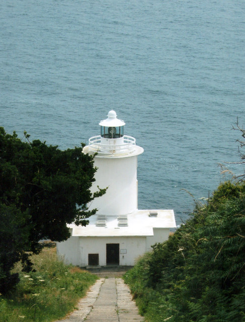
Tater Du Lighthouse

Tater Du Lighthouse is Cornwall's most recently built lighthouse. The construction of the lighthouse came out of the tragedy of losing a small Spanish...

Boskenna

Boskenna is an early medieval settlement and large 17th-century manor house (formerly with associated farms and cottages) in the civil parish of St Buryan...

Tregiffian Burial Chamber

The Tregiffian Burial Chamber (Cornish: Hirvedh Treguhyon) is a Neolithic or early Bronze Age chambered tomb. It is near Lamorna in west Cornwall, United...

Nearby Amenities

Located within 500m of 50.050481,-5.5899677
Created By: almien_coastlines
Source: PGS
Lat/Long: 50.051443/-5.591511
The data included in this document is from www.openstreetmap.org. The data is made available under ODbL.

Have you been to Boscawen Point?

Leave your review of Boscawen Point below (or comments, questions and feedback).