Tanga Deas

Coastal Feature, Headland, Point in Ross-shire

Scotland

Tanga Deas

Loch na Buaile Duibhe The sea can just be seen in the distance.
Loch na Buaile Duibhe Credit: Rob Burke

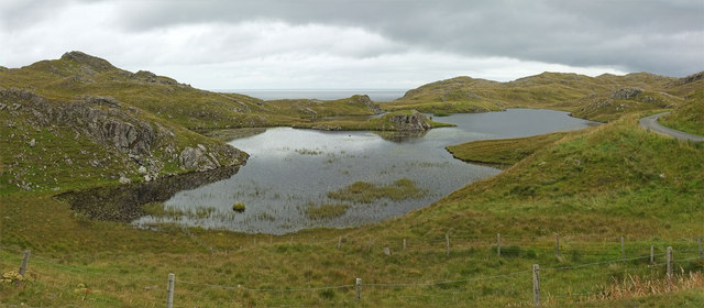
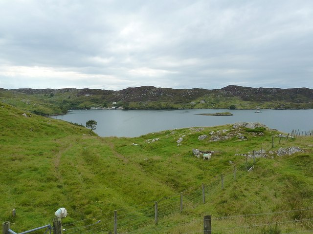
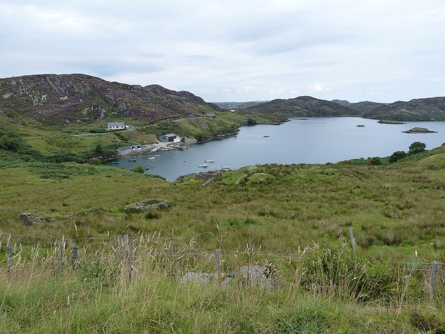
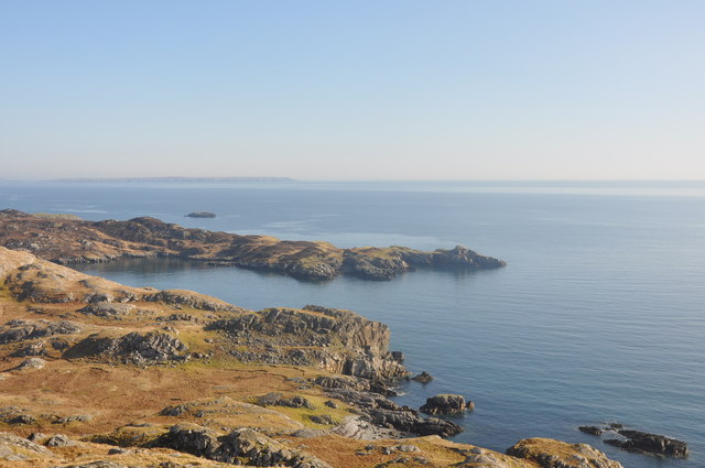
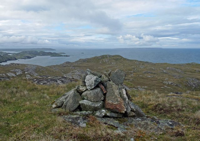
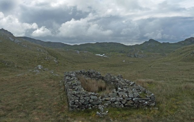
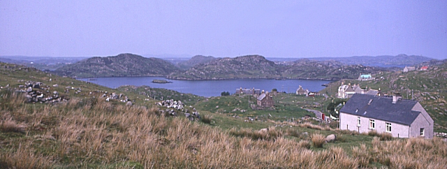
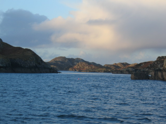
Tanga Deas is a prominent coastal feature located in Ross-shire, Scotland. It is a headland or point that extends out into the North Sea, offering breathtaking views and a rugged, picturesque landscape. The name "Tanga Deas" is derived from the Scottish Gaelic language, with "Tanga" meaning "tongue" and "Deas" meaning "south."

The headland is characterized by steep cliffs that rise dramatically from the sea, creating an imposing and majestic sight. These cliffs are composed of ancient rock formations, displaying layers of sedimentary rock that have been shaped by millions of years of erosion from the crashing waves. The constant battering of the sea has carved intricate patterns and caves into the rock face, adding to the allure and intrigue of Tanga Deas.

The headland is also home to a diverse range of flora and fauna. The coastal heathland surrounding Tanga Deas is rich in vegetation, with hardy shrubs and grasses clinging to the cliffs. Seabirds such as gulls, puffins, and cormorants can often be spotted nesting on the ledges of the cliffs, while seals can sometimes be seen basking on the rocks below.

Tanga Deas is a popular destination for nature lovers and hikers, offering stunning coastal walks and breathtaking views of the surrounding coastline. Its remote location and wild beauty make it an ideal spot for those seeking tranquility and a connection with nature. Visitors can also explore the nearby beaches and coves, where they may encounter unique rock pools teaming with marine life.

Overall, Tanga Deas is a remarkable coastal feature that showcases the raw power of nature and provides a haven for both wildlife and outdoor enthusiasts.

If you have any feedback on the listing, please let us know in the comments section below.
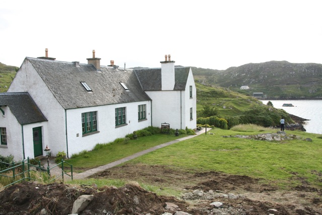
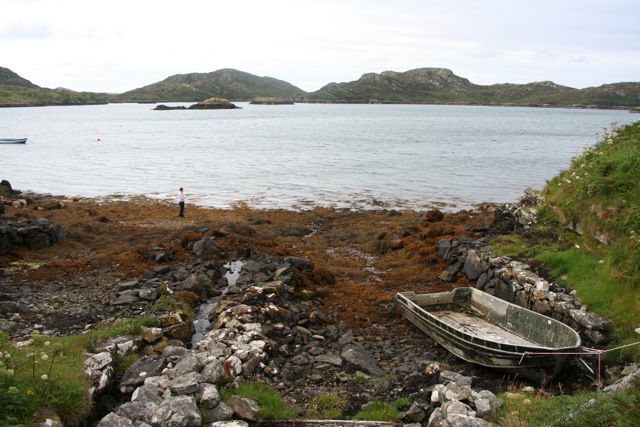
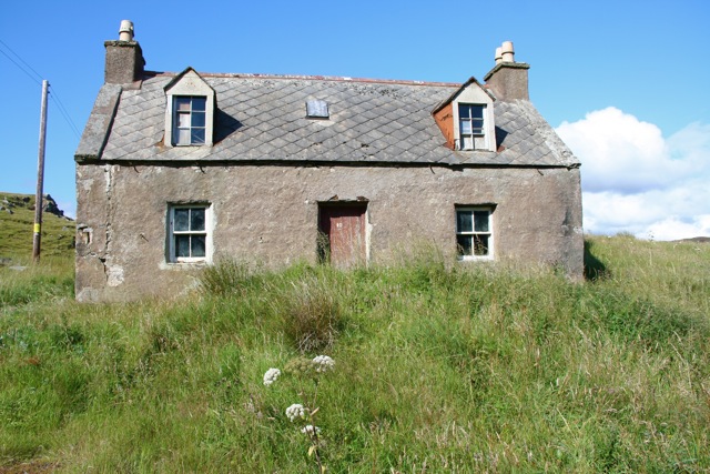
Tanga Deas Images

Images are sourced within 2km of 58.090646/-6.3722562 or Grid Reference NB4219. Thanks to Geograph Open Source API. All images are credited.

Loch na Buaile Duibhe The sea can just be seen in the distance.
Loch na Buaile Duibhe
The sea can just be seen in the distance.
Telephone Box, Marvig (Marbhig) In case you don't recognize the classic bright red K6 telephone box for what it is, there is a splendid enamelled sign with a wrought iron frame to make sure you do !
Telephone Box, Marvig (Marbhig)
In case you don't recognize the classic bright red K6 telephone box for what it is, there is a splendid enamelled sign with a wrought iron frame to make sure you do !
Loch Mharabhig from Rubha na h-Easgainn, Marvig Loch Mharabhig forms a natural harbour for the community of Marvig (Marbhig), the "capital" of the Lochs area of southeastern Lewis. The little islet which can be seen in the loch is Sgeir a' Bhuic.
Loch Mharabhig from Rubha na h-Easgainn, Marvig
Loch Mharabhig forms a natural harbour for the community of Marvig (Marbhig), the "capital" of the Lochs area of southeastern Lewis. The little islet which can be seen in the loch is Sgeir a' Bhuic.
Loch Mharabhig from the south This view into Loch Mharabhig is effectively out to sea, though there are various islands, islets and channels to navigate around to exit this natural harbour.
The nearest islet is Sgeir a'Bhuic while the slightly more distant one is Sgeir Ghlas
Loch Mharabhig from the south
This view into Loch Mharabhig is effectively out to sea, though there are various islands, islets and channels to navigate around to exit this natural harbour. The nearest islet is Sgeir a'Bhuic while the slightly more distant one is Sgeir Ghlas
Mol nam Braithrean Looking towards the South Entrance of Loch Marvig. "Mol" is Gaelic for shingle and "braithrean" is brothers. People in the village talk of "going for a walk to the mol".
Mol nam Braithrean
Looking towards the South Entrance of Loch Marvig. "Mol" is Gaelic for shingle and "braithrean" is brothers. People in the village talk of "going for a walk to the mol".
Loch na Buaile Duibhe
Rough moor above Loch Mharabhig
Cairn, Sidhean Rubha na Creige Mòire, Isle of Lewis Under the cairn is an OS bolt.  It is marked with the triangulation pillar symbol on the OS 1:25,000 map, but is not shown on the 1:50,000.
Cairn, Sidhean Rubha na Creige Mòire, Isle of Lewis
Under the cairn is an OS bolt. It is marked with the triangulation pillar symbol on the OS 1:25,000 map, but is not shown on the 1:50,000.
Coastline, Rubha na Creige Mòire, Isle of Lewis Looking along the east coast of Lewis as far as the Raerinis peninsula.
Coastline, Rubha na Creige Mòire, Isle of Lewis
Looking along the east coast of Lewis as far as the Raerinis peninsula.
Ruined farmstead below Sidhean Rubha na Creige Mòire, Isle of Lewis The island in <a href="https://www.geograph.org.uk/photo/926371">NB4118 : Loch na Buaile Duibhe</a> can just be seen in the distance.
Ruined farmstead below Sidhean Rubha na Creige Mòire, Isle of Lewis
The island in NB4118 : Loch na Buaile Duibhe can just be seen in the distance.
Marbhig A sheltered sea-loch on the east coast of Lewis.
Marbhig
A sheltered sea-loch on the east coast of Lewis.
Loch Mharabhig Mharabhig is a Coastal Fishing Village 6 miles South of Stornoway the main town in the Western Isles
Loch Mharabhig
Mharabhig is a Coastal Fishing Village 6 miles South of Stornoway the main town in the Western Isles
South Entrance to  Loch Marvig Eilean Thoraidh to right of picture.
South Entrance to Loch Marvig
Eilean Thoraidh to right of picture.
Marbhig Scattered Hebridean community with open land and an old stone wall at its southern end in the foreground.
Marbhig
Scattered Hebridean community with open land and an old stone wall at its southern end in the foreground.
Planasker Old School, Marbhig
The Jetty, Marbhig
The Jetty, Marbhig
Empty house, number 10 Marbhig
Jetty on Loch Mharabhig
Show me another place!

Tanga Deas is located at Grid Ref: NB4219 (Lat: 58.090646, Lng: -6.3722562)

Unitary Authority: Na h-Eileanan an Iar

Police Authority: Highlands and Islands

What 3 Words

///pods.roosts.hype. Near Leurbost, Na h-Eileanan Siar

Related Wikis

Calbost

Calbost (Scottish Gaelic: Calabost) is a village on the Isle of Lewis in the Outer Hebrides, Scotland. Calbost is within the parish of Lochs, and within...

Cromore

Cromore (Scottish Gaelic: Crò Mòr) is a crofting township on the Isle of Lewis in the district of Pairc, in the Outer Hebrides, Scotland. The settlement...

Eilean Chaluim Chille

Eilean Chaluim Chille (Gaelic: island of Saint Columba, Calum Cille) is an unpopulated island in the Outer Hebrides. It lies off the east coast of Lewis...

Cabharstadh

Cabharstadh or Caversta (Scottish Gaelic: Cabharstaigh) is a village on the Isle of Lewis in the Outer Hebrides, Scotland. Caversta is situated in the...

Crossbost

Crossbost is a village on the Isle of Lewis in the parish of North Lochs, in the Outer Hebrides, Scotland. It is located approximately ten miles away...

Gravir

Gravir (Scottish Gaelic: Grabhair), is a village on the shore of Loch Odhairn (a sea loch) in the Park district of the Isle of Lewis. Gravir is within...

North Lochs

North Lochs, (Scottish Gaelic: Ceann a Tuath nan Loch), an area in eastern Lewis, Outer Hebrides, Scotland, is named for the many lochans (small lochs...

Loch Erisort

Loch Erisort (Scottish Gaelic: Èireasort) is an 8-mile-long narrow sea inlet on the east coast of the Isle of Lewis in the Outer Hebrides off the west...

Related Videos

A time-lapse trip from Marvig past Kebock head the Miolaid Light and Stac'a Chomhraig

A time-lapse trip from Marvig past Kebock head the Miolaid Light and Stac'a Chomhraig 2022.

Up date from the Isle of Lewis

A quick update from Marvig on the Isle of Lewis Scotland.

Have you been to Tanga Deas?

Leave your review of Tanga Deas below (or comments, questions and feedback).