Am Brèideanach

Coastal Feature, Headland, Point in Argyllshire

Scotland

Am Brèideanach

Eilean an Righ One of the islands off Ulva.
Eilean an Righ Credit: Richard Webb

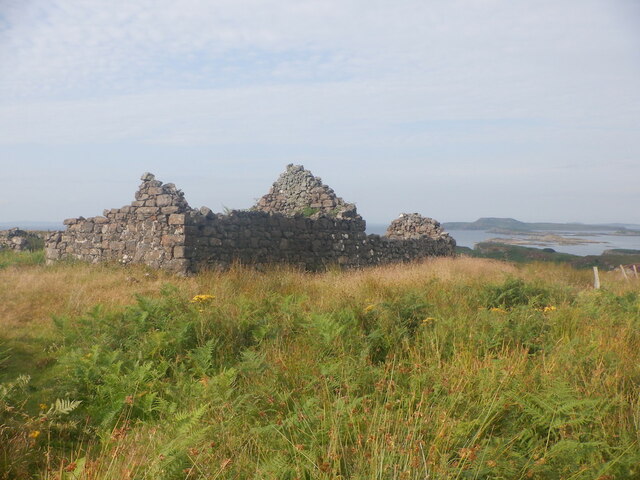
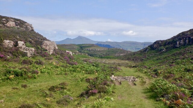
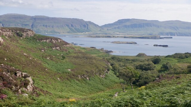
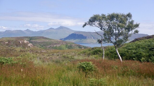
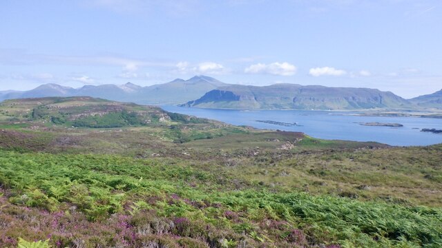
Am Brèideanach is a prominent headland located in Argyllshire, Scotland. Situated along the picturesque coastal region, this point offers breathtaking views of the surrounding landscape and is a popular destination for visitors and locals alike.

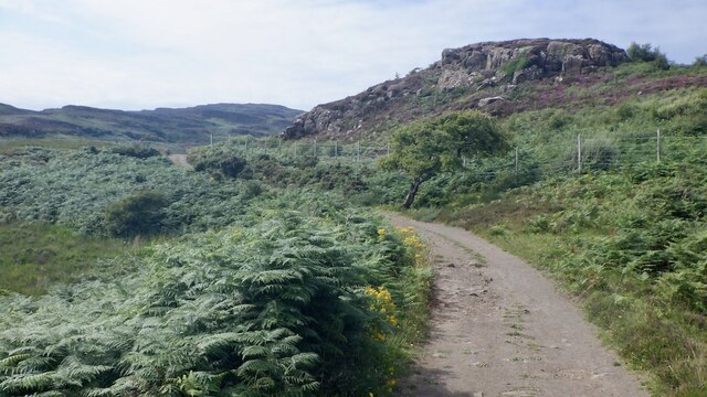
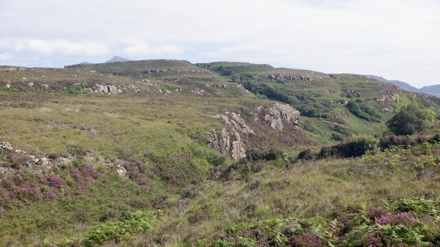
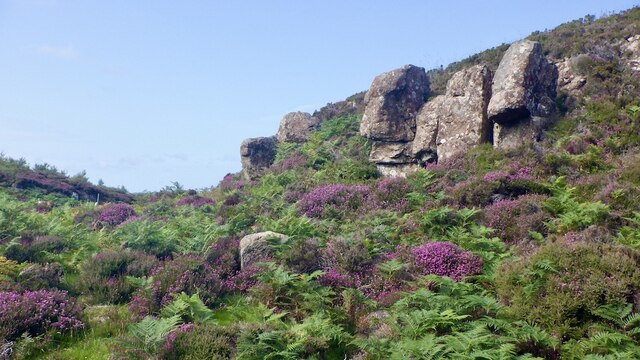
The headland is characterized by its rugged cliffs and rocky terrain, which provide a dramatic backdrop to the crashing waves of the Atlantic Ocean. It stands tall and proud, jutting out into the sea, creating a sense of grandeur and awe-inspiring beauty.

Am Brèideanach is known for its diverse wildlife, attracting nature enthusiasts and birdwatchers. The cliffs provide nesting grounds for various seabird species, including puffins, guillemots, and razorbills. Visitors can witness these magnificent creatures in their natural habitat, making it an ideal spot for birdwatching and photography.

The headland also offers opportunities for outdoor activities such as hiking and walking. There are well-maintained trails that wind their way around the headland, providing stunning panoramic views of the coast and the distant islands. It is a place where one can immerse themselves in nature, surrounded by the sights and sounds of the Scottish countryside.

Am Brèideanach is easily accessible by road, with parking facilities available nearby. It is an ideal location for those seeking tranquility and a chance to connect with nature. Whether exploring the cliffs, observing the wildlife, or simply enjoying the breathtaking views, this headland is a must-visit destination for anyone traveling through Argyllshire.

If you have any feedback on the listing, please let us know in the comments section below.

Am Brèideanach Images

Images are sourced within 2km of 56.461055/-6.1929253 or Grid Reference NM4137. Thanks to Geograph Open Source API. All images are credited.

Eilean an Righ One of the islands off Ulva.
Eilean an Righ
One of the islands off Ulva.
Ruin, Ormaig One of the many ruins on the south side of Ulva which was brutally cleared in the 19th century. Some of the buildings are quite substantial and may be post clearance.
Ruin, Ormaig
One of the many ruins on the south side of Ulva which was brutally cleared in the 19th century. Some of the buildings are quite substantial and may be post clearance.
Anchorage, Eilean Reilen South side of Ulva. I was kindly given a coffee the previous evening by the owners of the boat - was interesting drinking it while holding on as there is a very strong tidal current between the islands. 
Former arable land is being taken over by bracken.
Anchorage, Eilean Reilen
South side of Ulva. I was kindly given a coffee the previous evening by the owners of the boat - was interesting drinking it while holding on as there is a very strong tidal current between the islands. Former arable land is being taken over by bracken.
Port na h-Uine An inlet at Cragaig, on the south side of Ulva.  The ruin of the mill is beside the large tree.  Descent from here was unpleasant due to the bracken.
Port na h-Uine
An inlet at Cragaig, on the south side of Ulva. The ruin of the mill is beside the large tree. Descent from here was unpleasant due to the bracken.
Basalt crags, Ulva
Basalt crags, Ulva
Shoreline, Cragaig South side of Ulva.
Shoreline, Cragaig
South side of Ulva.
Road on Ulva Passing an enclosed area with young trees.
Road on Ulva
Passing an enclosed area with young trees.
A' Chrannag Hill on Ulva
A' Chrannag
Hill on Ulva
Crags and heather, Ulva One of the basalt steps on Ulva.
Crags and heather, Ulva
One of the basalt steps on Ulva.
Path from the South Side A very good path from Cragaig and a very scenic walk.
Path from the South Side
A very good path from Cragaig and a very scenic walk.
View south from Ulva The sticky up thing by the coast is the site of a fort.  The far gap carries the road from Loch Sgriodain to Loch na Keal on Mull.
View south from Ulva
The sticky up thing by the coast is the site of a fort. The far gap carries the road from Loch Sgriodain to Loch na Keal on Mull.
View towards Ben More From the South Side path on Ulva
View towards Ben More
From the South Side path on Ulva
View towards Ben More South side of Ulva.
View towards Ben More
South side of Ulva.
South Side path, Ulva A very scenic walk on Ulva.
South Side path, Ulva
A very scenic walk on Ulva.
Moorland, Ulva
Moorland, Ulva
South side of Ulva The path through the ruins of Ormaig.
South side of Ulva
The path through the ruins of Ormaig.
Crags, Ormaig The layer cake formations of Ulva's traps. Successive lava flows have formed a distinctive layered outline.
Crags, Ormaig
The layer cake formations of Ulva's traps. Successive lava flows have formed a distinctive layered outline.
Moorland, Ulva With some of the notorious bracken which makes moving about the lower parts of the island difficult in Summer.
Moorland, Ulva
With some of the notorious bracken which makes moving about the lower parts of the island difficult in Summer.
Show me another place!

Am Brèideanach is located at Grid Ref: NM4137 (Lat: 56.461055, Lng: -6.1929253)

Unitary Authority: Argyll and Bute

Police Authority: Argyll and West Dunbartonshire

What 3 Words

///regal.turkeys.birdcage. Near Dervaig, Argyll & Bute

Related Wikis

Ulva

Ulva (; Scottish Gaelic: Ulbha) is a small island in the Inner Hebrides of Scotland, off the west coast of Mull. It is separated from Mull by a narrow...

Inch Kenneth

Inch Kenneth (Scottish Gaelic: Innis Choinnich) is a small grassy island off the west coast of the Isle of Mull, in Scotland. It is at the entrance of...

St Kenneth's Chapel

St. Kenneth's Chapel is a ruined chapel on Inch Kenneth Island, Parish of Kilfinichen and Kilvickeon, Isle of Mull, Argyll and Bute, Scotland. It dates...

Samalan Island

Samalan Island is a small island, just off the Isle of Mull at the mouth of Loch na Keal in the Inner Hebrides, Scotland. To its south west is the island...

Ulva Ferry

Ulva Ferry (Scottish Gaelic: Caolas Ulbha) is a hamlet on the Hebridean island of Mull, on its west coast. Ulva Ferry is on the shore of Ulva Sound (Caolas...

Loch Tuath

Loch Tuath (Scottish Gaelic: Loch-a-Tuath) is a sea loch in the Inner Hebrides, Scotland that separates the Isle of Mull and the island of Ulva. Loch Tuath...

Little Colonsay

Little Colonsay (Scottish Gaelic: Colbhasa Beag) is an uninhabited island west of the island of the Isle of Mull in Scotland. The geology of the island...

Eorsa

Eorsa is an uninhabited island in the Inner Hebrides of Scotland. == Geography == Eorsa lies in Loch na Keal on the west coast of the Isle of Mull, to...

Nearby Amenities

Located within 500m of 56.461055,-6.1929253
Source: PGS
Lat/Long: 56.4652273/-6.1931402
Source: PGS
Lat/Long: 56.465088/-6.1936563
Source: PGS
Lat/Long: 56.4649804/-6.1943118
Source: PGS
Lat/Long: 56.4648986/-6.1945082
Source: PGS
Lat/Long: 56.4640484/-6.1950682
Source: PGS
Lat/Long: 56.4638492/-6.194322
Source: PGS
Lat/Long: 56.4637108/-6.1941117
Source: PGS
Lat/Long: 56.4635499/-6.1938017
Source: PGS
Lat/Long: 56.4628336/-6.1937464
Source: PGS
Lat/Long: 56.46242/-6.1941117
Source: PGS
Lat/Long: 56.4613096/-6.1935179
Source: PGS
Lat/Long: 56.4612136/-6.1931928
Source: PGS
Lat/Long: 56.4611851/-6.1926848
Source: PGS
Lat/Long: 56.4609486/-6.1925276
Created By: dmgroom_coastlines
Source: PGS
Lat/Long: 56.46074/-6.19268
Created By: dmgroom_coastlines
Source: PGS
Lat/Long: 56.46025/-6.19318
Source: PGS
Lat/Long: 56.4605112/-6.1938706
Source: PGS
Lat/Long: 56.4603415/-6.194114
Source: PGS
Lat/Long: 56.4604341/-6.1944413
Source: PGS
Lat/Long: 56.4612471/-6.1946171
Source: PGS
Lat/Long: 56.4610191/-6.1954137
Source: PGS
Lat/Long: 56.4605322/-6.1957409
Source: PGS
Lat/Long: 56.4606169/-6.1985202
Created By: dmgroom_coastlines
Source: PGS
Lat/Long: 56.46026/-6.19943
Source: PGS
Lat/Long: 56.4602951/-6.1998452
Source: PGS
Lat/Long: 56.4605474/-6.1998473
Source: PGS
Lat/Long: 56.4607548/-6.199967
Eilean Ormaig
Natural: peninsula
Lat/Long: 56.4620863/-6.1986589
The data included in this document is from www.openstreetmap.org. The data is made available under ODbL.

Have you been to Am Brèideanach?

Leave your review of Am Brèideanach below (or comments, questions and feedback).