Airigh Ard

Coastal Feature, Headland, Point in Ross-shire

Scotland

Airigh Ard

Shore at  Cuidhir Rocky shoreline backed by equally rocky hills at the Cuidhir road end.
Shore at Cuidhir Credit: Colin Smith

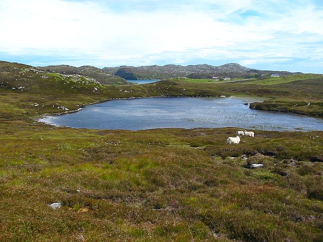
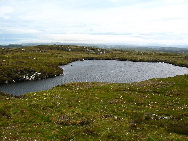
Airigh Ard is a picturesque coastal feature located in Ross-shire, Scotland. It is characterized as a headland or point that juts out into the North Atlantic Ocean, offering breathtaking views and a serene atmosphere. The name "Airigh Ard" translates to "high shieling" in Gaelic, reflecting the elevated position of the headland.

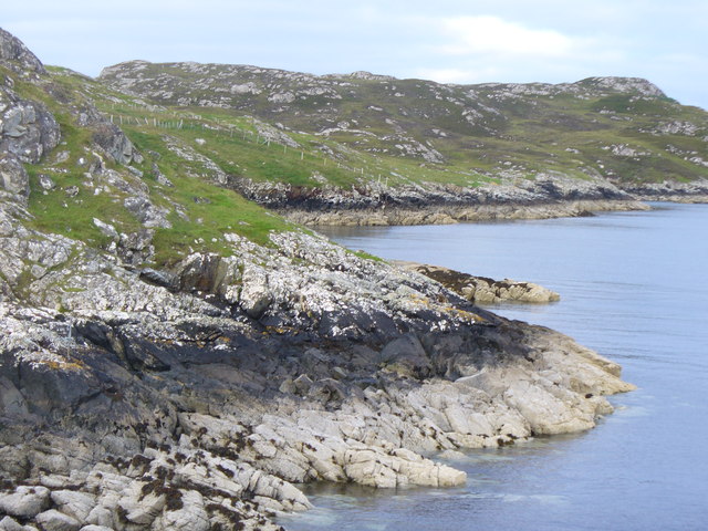
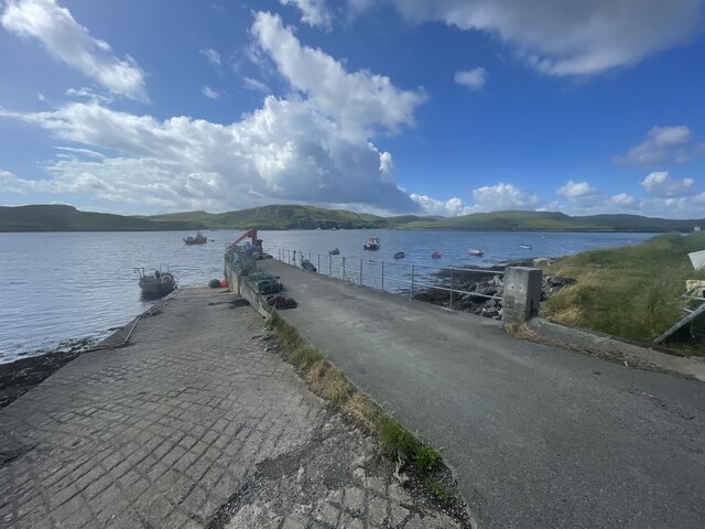
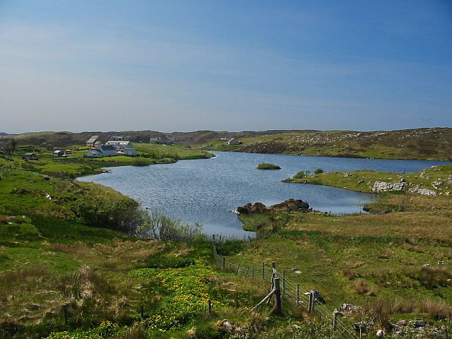
Situated on the western coast of Ross-shire, Airigh Ard boasts rugged cliffs that stand tall against the crashing waves. These cliffs are composed of various rock formations, including sandstone and limestone, which have been shaped by the relentless force of the ocean over time. The headland is also surrounded by pristine, sandy beaches, providing a perfect spot for sunbathing, picnicking, and beachcombing.

The area surrounding Airigh Ard is rich in wildlife, making it a popular destination for nature enthusiasts. Seabird colonies, such as puffins and gannets, can be observed nesting on the cliffs during the breeding season. Visitors may also catch a glimpse of seals basking on the rocks or dolphins gracefully swimming offshore.

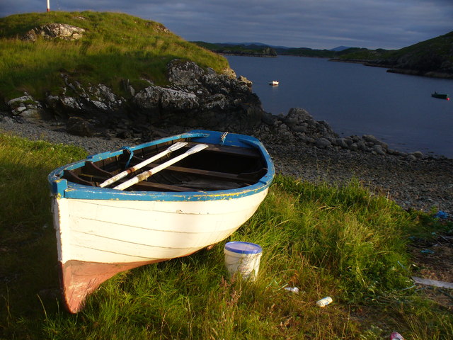
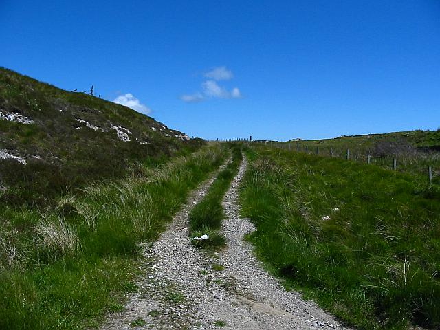
Access to Airigh Ard is relatively easy, with a well-maintained footpath leading to the headland. This path meanders through rolling green hills, offering stunning views of the surrounding countryside. A small parking area is available nearby, making it convenient for visitors to explore this natural wonder.

With its dramatic cliffs, sandy beaches, and abundant wildlife, Airigh Ard is a true gem of Ross-shire's coastline. Whether one seeks tranquility, breathtaking scenery, or a chance to immerse themselves in nature, this coastal feature has something to offer to all who venture there.

If you have any feedback on the listing, please let us know in the comments section below.
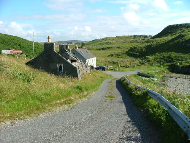
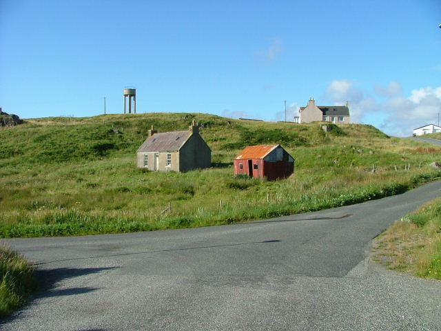
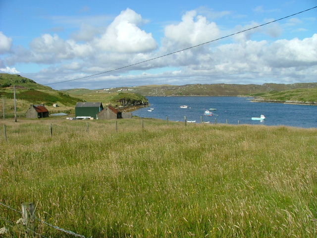
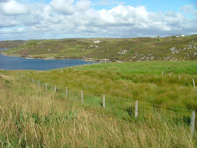
Airigh Ard Images

Images are sourced within 2km of 58.143251/-6.4203157 or Grid Reference NB3925. Thanks to Geograph Open Source API. All images are credited.

Shore at  Cuidhir Rocky shoreline backed by equally rocky hills at the Cuidhir road end.
Shore at Cuidhir
Rocky shoreline backed by equally rocky hills at the Cuidhir road end.
Evening at Cuidhir Rowing boat, in the evening sunshine, pulled up onto the grass above the small, rocky cove at Cuidhir.
Evening at Cuidhir
Rowing boat, in the evening sunshine, pulled up onto the grass above the small, rocky cove at Cuidhir.
Grimshader Salmon Farm Marine Harvest - Arachas Bhratan Griomshadair. Sea loch industry on the shores of Loch Griomsiadair.
Grimshader Salmon Farm
Marine Harvest - Arachas Bhratan Griomshadair. Sea loch industry on the shores of Loch Griomsiadair.
Loch Griomsiadair Yacht and lobster boat moored in the sheltered sea loch at Grimshader which is also used for salmon farming.
Loch Griomsiadair
Yacht and lobster boat moored in the sheltered sea loch at Grimshader which is also used for salmon farming.
Crosbost Jetty Geocaching is a type of global treasure hunt of people looking for caches, or hidden stashes of objects. Geocaching may also be described as a series of hide-and-seek games, where hiders provide online clues for seekers. Seekers use global positioning system (GPS) devices to find hidden caches
Crosbost Jetty
Geocaching is a type of global treasure hunt of people looking for caches, or hidden stashes of objects. Geocaching may also be described as a series of hide-and-seek games, where hiders provide online clues for seekers. Seekers use global positioning system (GPS) devices to find hidden caches
Loch Grimshader Ordnance survey maps show two Loch Grimshaders! One is the sea loch as shown on  <a href="https://www.geograph.org.uk/gridref/NB3925">NB3925</a>; the second is this small freshwater loch in the village of Grimshader. It seems likely that the ordnance survey got it wrong many years ago when it first named the sea loch as Loch Grimshader. Its name was originally Loch Hurnavay.

This freshwater loch has a small island in it. Although I have found no archaeological reference to it, I suspect that the island is possibly a crannog, as it has a sunken overgrown interior within a ring of large stones and boulders. The loch is good for brown trout and eels.

The village, Grimshader, takes its name from the Norse, and means Grim's summer pasture.
Loch Grimshader
Ordnance survey maps show two Loch Grimshaders! One is the sea loch as shown on NB3925; the second is this small freshwater loch in the village of Grimshader. It seems likely that the ordnance survey got it wrong many years ago when it first named the sea loch as Loch Grimshader. Its name was originally Loch Hurnavay. This freshwater loch has a small island in it. Although I have found no archaeological reference to it, I suspect that the island is possibly a crannog, as it has a sunken overgrown interior within a ring of large stones and boulders. The loch is good for brown trout and eels. The village, Grimshader, takes its name from the Norse, and means Grim's summer pasture.
Grimshader's 'Peat Road' This track is used by local crofters to reach their flocks grazing on the open moorland, and by some villagers who cut peat for fuel.
Grimshader's 'Peat Road'
This track is used by local crofters to reach their flocks grazing on the open moorland, and by some villagers who cut peat for fuel.
Peat Cuttings, Bog Cotton and Water Tower The peat cuttings just right of centre in this photograph were, until recently, worked by Torcuil MacRath (Torquil MacRae), a Gaelic poet and author of some distinction who died late in 2006. A wonderful character and a good neighbour, it was our privilege and pleasure to count him as a friend during the few years my family and I have lived here. I now work these peat cuttings myself.

While much of the UK has suffered a wet spring and summer in 2007, the weather on the Isle of Lewis has been relatively dry. Perhaps this accounts for the fine crop of bog cotton seen on the moorland this year.

On the horizon is a water tower, no longer used.
Peat Cuttings, Bog Cotton and Water Tower
The peat cuttings just right of centre in this photograph were, until recently, worked by Torcuil MacRath (Torquil MacRae), a Gaelic poet and author of some distinction who died late in 2006. A wonderful character and a good neighbour, it was our privilege and pleasure to count him as a friend during the few years my family and I have lived here. I now work these peat cuttings myself. While much of the UK has suffered a wet spring and summer in 2007, the weather on the Isle of Lewis has been relatively dry. Perhaps this accounts for the fine crop of bog cotton seen on the moorland this year. On the horizon is a water tower, no longer used.
Loch nan Capull Loch nan Capull (the loch of the colt). A reasonably good trout loch.
Loch nan Capull
Loch nan Capull (the loch of the colt). A reasonably good trout loch.
Wrecked car at end of the peat road This car graces the far end of Grimshaders peat road. Although the tyres appear in good order, it is probable that the vehicle would fail its MoT on other counts.
Wrecked car at end of the peat road
This car graces the far end of Grimshaders peat road. Although the tyres appear in good order, it is probable that the vehicle would fail its MoT on other counts.
Loch Beinn Bhreac This loch is unusual in that no streams run into it, and no (surface) streams run out of it, as it is drained by an underground stream running through the peat. It is not believed to contain any fish.
Loch Beinn Bhreac
This loch is unusual in that no streams run into it, and no (surface) streams run out of it, as it is drained by an underground stream running through the peat. It is not believed to contain any fish.
Boats at Cuidhir Loch Leurbost The Islands of Tabhaidh Bheag and Tabhaidh are clearly seen in distance.
Boats at Cuidhir Loch Leurbost
The Islands of Tabhaidh Bheag and Tabhaidh are clearly seen in distance.
Road end at Crosbost
Old croft buildings at Ranais
Grazing land at Ranais Overlooking Loch Griomsiadar.
Grazing land at Ranais
Overlooking Loch Griomsiadar.
Loch Sgeireach On Aird Raerinis.
Loch Sgeireach
On Aird Raerinis.
Loch Liurboist at Crosbost Small boats at moorings in the sea loch while an ancient boat lies rotting on the grassy shore. View looking south-east to Tannaraidh and The Minch.
Loch Liurboist at Crosbost
Small boats at moorings in the sea loch while an ancient boat lies rotting on the grassy shore. View looking south-east to Tannaraidh and The Minch.
Fish Farming at Crosbost Salmon cages in the sea loch, Loch Liurboist.
Fish Farming at Crosbost
Salmon cages in the sea loch, Loch Liurboist.
Show me another place!

Airigh Ard is located at Grid Ref: NB3925 (Lat: 58.143251, Lng: -6.4203157)

Unitary Authority: Na h-Eileanan an Iar

Police Authority: Highlands and Islands

What 3 Words

///stint.baking.hood. Near Leurbost, Na h-Eileanan Siar

Related Wikis

Crossbost

Crossbost is a village on the Isle of Lewis in the parish of North Lochs, in the Outer Hebrides, Scotland. It is located approximately ten miles away...

North Lochs

North Lochs, (Scottish Gaelic: Ceann a Tuath nan Loch), an area in eastern Lewis, Outer Hebrides, Scotland, is named for the many lochans (small lochs...

Rainish Eilean Mòr

Rainish Eilean Mòr is an uninhabited island in Loch Orasaigh, north of the village of Leurbost in the area of South Lochs on the Isle of Lewis, Lewis and...

Leurbost

Leurbost (Scottish Gaelic: Liùrbost) is a village on the east coast of the Isle of Lewis in the Outer Hebrides of Scotland. It is approximately 6 miles...

Eilean Chaluim Chille

Eilean Chaluim Chille (Gaelic: island of Saint Columba, Calum Cille) is an unpopulated island in the Outer Hebrides. It lies off the east coast of Lewis...

Cromore

Cromore (Scottish Gaelic: Crò Mòr) is a crofting township on the Isle of Lewis in the district of Pairc, in the Outer Hebrides, Scotland. The settlement...

HMY Iolaire

HMY Iolaire was an Admiralty Yacht that sank at the entrance to Stornoway harbour on 1 January 1919, with the loss of at least 201 men out of the 283 on...

Cabharstadh

Cabharstadh or Caversta (Scottish Gaelic: Cabharstaigh) is a village on the Isle of Lewis in the Outer Hebrides, Scotland. Caversta is situated in the...

Nearby Amenities

Located within 500m of 58.143251,-6.4203157
Passing Place
Lat/Long: 58.1469277/-6.4161309
Passing Place
Lat/Long: 58.1463098/-6.4141726
Passing Place
Lat/Long: 58.1459322/-6.4142767
Griomsiadar
Name En: Grimshader
Name Gd: Griomsiadar
Place: village
Lat/Long: 58.1444582/-6.4124769
Power: pole
Lat/Long: 58.1394669/-6.4241879
Power: pole
Lat/Long: 58.1401818/-6.4236618
Power: pole
Lat/Long: 58.140658/-6.4227474
Power: pole
Lat/Long: 58.1411173/-6.4217961
Power: pole
Lat/Long: 58.1415831/-6.4208054
Power: pole
Lat/Long: 58.1421436/-6.4197976
Power: pole
Lat/Long: 58.1429026/-6.4187406
Power: pole
Lat/Long: 58.1435851/-6.4176934
Power: pole
Lat/Long: 58.1445802/-6.4161128
Power: pole
Lat/Long: 58.1449136/-6.4140995
Power: pole
Lat/Long: 58.1452496/-6.4131961
Power: pole
Lat/Long: 58.1433243/-6.4128643
Power: pole
Lat/Long: 58.1437446/-6.4139606
Power: pole
Lat/Long: 58.1441974/-6.4151283
Power: pole
Lat/Long: 58.1460358/-6.4139459
Power: pole
Lat/Long: 58.1456401/-6.4135722
Power: pole
Lat/Long: 58.1449123/-6.4128913
Power: pole
Lat/Long: 58.1446736/-6.4122547
Power: pole
Lat/Long: 58.1454351/-6.4171686
Power: pole
Lat/Long: 58.1463458/-6.418228
Power: pole
Lat/Long: 58.1469893/-6.4190773
Power: pole
Lat/Long: 58.147636/-6.4198652
Loch Beag
Natural: bay
Lat/Long: 58.1453557/-6.4205003
Loch Griomsiadair
Natural: bay
Lat/Long: 58.1406217/-6.4135266
The data included in this document is from www.openstreetmap.org. The data is made available under ODbL.

Have you been to Airigh Ard?

Leave your review of Airigh Ard below (or comments, questions and feedback).