Creag-an-Tigh Shaillinn

Coastal Feature, Headland, Point in Ross-shire

Scotland

Creag-an-Tigh Shaillinn

Loch Nighe at Cromore The sealoch beyond is Loch Erisort.
Loch Nighe at Cromore Credit: Alan Reid

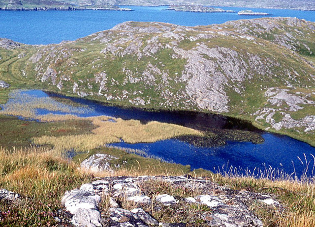
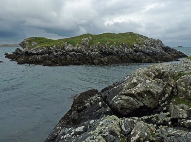
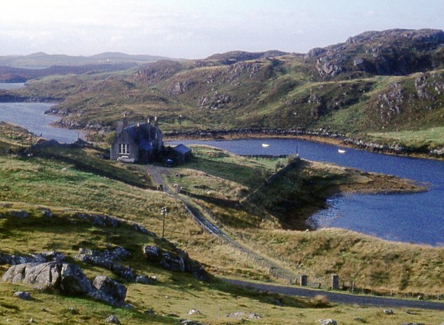
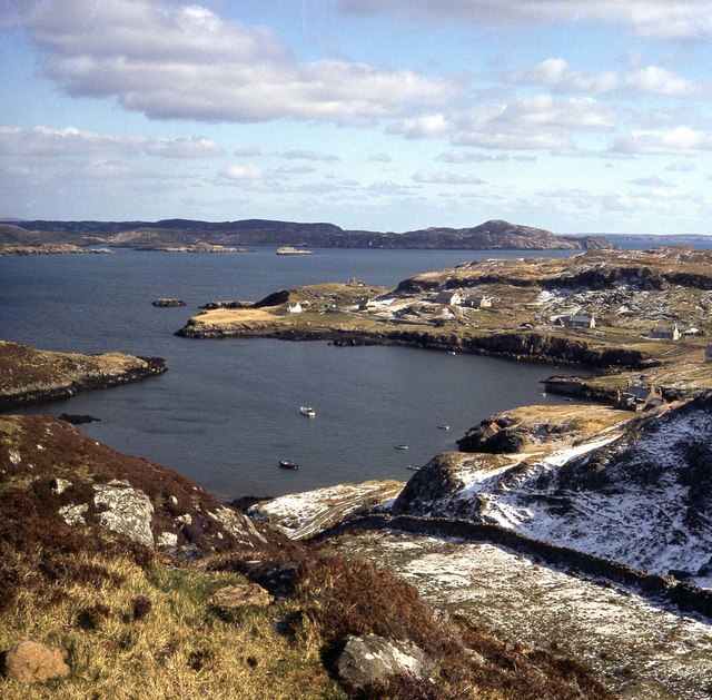
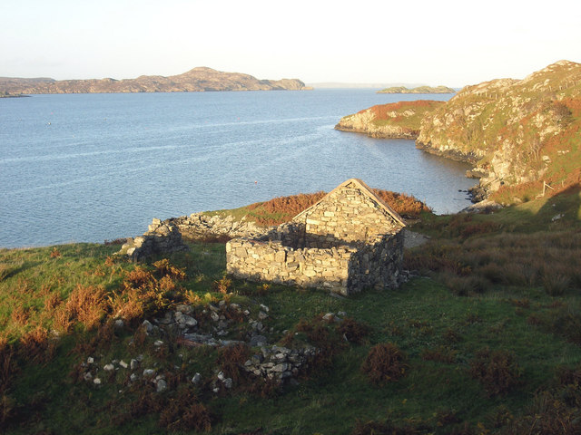
Creag-an-Tigh Shaillinn is a prominent coastal feature located in Ross-shire, Scotland. This headland, also known as Shaillinn Point, is situated on the northwestern coast of the country, overlooking the vast waters of the North Atlantic Ocean. The name "Creag-an-Tigh Shaillinn" is Gaelic and translates to "Rock of the Willow House," reflecting the historical connection to the surrounding landscape.

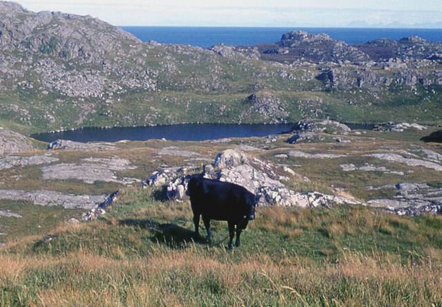
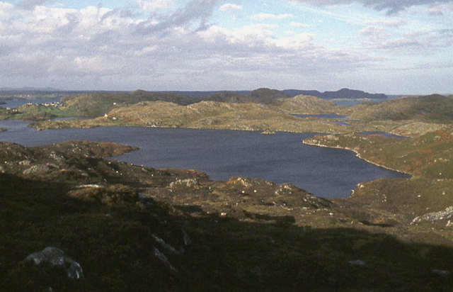
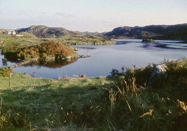
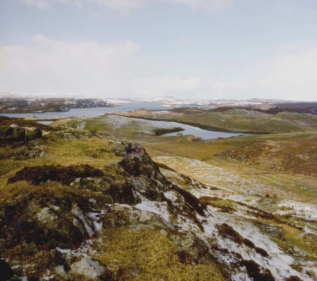
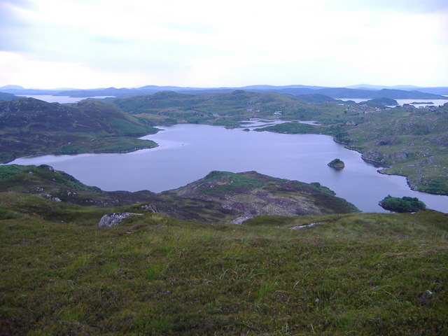
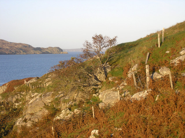
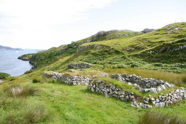
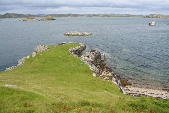
This headland is characterized by its rugged and rocky terrain, jutting out into the sea and providing spectacular views of the surrounding coastline. The cliffs that make up Creag-an-Tigh Shaillinn are made of sedimentary rocks, displaying layers that provide valuable insights into the geological history of the area.

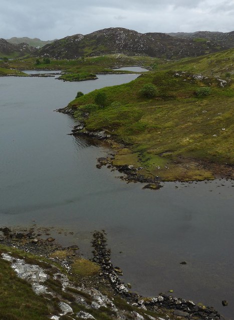
The location of Creag-an-Tigh Shaillinn also offers a diverse range of flora and fauna, making it a significant site for wildlife enthusiasts. The coastal waters are home to various marine species, including seals, dolphins, and seabirds that can be spotted from the headland. The surrounding land is covered in heather, grasses, and other vegetation, providing habitat for a variety of bird species and small mammals.

Due to its scenic beauty, Creag-an-Tigh Shaillinn attracts both locals and tourists alike. Walking trails have been established along the headland, allowing visitors to explore and appreciate the natural beauty of the area. Additionally, the headland offers opportunities for rock climbing and birdwatching, adding to its appeal for outdoor enthusiasts.

In summary, Creag-an-Tigh Shaillinn is a captivating headland on the Ross-shire coast of Scotland, offering stunning views of the North Atlantic Ocean, diverse wildlife, and recreational activities for visitors to enjoy.

If you have any feedback on the listing, please let us know in the comments section below.

Creag-an-Tigh Shaillinn Images

Images are sourced within 2km of 58.103909/-6.4178493 or Grid Reference NB3921. Thanks to Geograph Open Source API. All images are credited.

Loch Nighe at Cromore The sealoch beyond is Loch Erisort.
Loch Nighe at Cromore
The sealoch beyond is Loch Erisort.
Loch Dubh at Cromore
Loch Chromor
Loch Chromor
Loch Chromor
Loch Chromor
Stangraidh, Isle of Lewis The rocks from which the photo was taken, the channel and approximately three quarters of the island lie within the grid square.

The snout of a nosy seal can just be seen at the left hand end of the channel.
Stangraidh, Isle of Lewis
The rocks from which the photo was taken, the channel and approximately three quarters of the island lie within the grid square. The snout of a nosy seal can just be seen at the left hand end of the channel.
Wall, Loch nam Bodach, Isle of Lewis From <span class="nowrap"><a title="https://canmore.org.uk/site/336071/ecc-41-loch-nam-bodach" rel="nofollow ugc noopener" href="https://canmore.org.uk/site/336071/ecc-41-loch-nam-bodach">Link</a><img style="margin-left:2px;" alt="External link" title="External link - shift click to open in new window" src="https://s1.geograph.org.uk/img/external.png" width="10" height="10"/></span> :"Situated on the north-western shore of Loch nam Bodach the remains of this wall run for 9 metres from west to east before turning south and running out into the loch for a further 3 metres. They are constructed entirely of stone, but terminate by a wooden post that might provide an aid for a person boarding a boat or for mooring a boat to a jetty".
Wall, Loch nam Bodach, Isle of Lewis
From LinkExternal link :"Situated on the north-western shore of Loch nam Bodach the remains of this wall run for 9 metres from west to east before turning south and running out into the loch for a further 3 metres. They are constructed entirely of stone, but terminate by a wooden post that might provide an aid for a person boarding a boat or for mooring a boat to a jetty".
Dun Cromore There is a significant portion of wall still standing.
Dun Cromore
There is a significant portion of wall still standing.
Rough moor above Loch Mharabhig
Croft at Tòb Cromore
The Old School, Cromore
Crobeg from Meall na Mòine
Tòb Cromore
Tòb Cromore
"Witches Pool" This sheltered anchorage is 6 miles south of Stornoway and much favoured by visiting pleasure craft. In recent years it has become known as "Witches Pool"
"Witches Pool"
This sheltered anchorage is 6 miles south of Stornoway and much favoured by visiting pleasure craft. In recent years it has become known as "Witches Pool"
Loch Chromor There is a Dun or fort at the far end of this Loch close to the village of Cromore. Parts of Loch Erisort (sealoch) can be seen in the distance as can the Hill Roineval 281m on the far left horizon.
Loch Chromor
There is a Dun or fort at the far end of this Loch close to the village of Cromore. Parts of Loch Erisort (sealoch) can be seen in the distance as can the Hill Roineval 281m on the far left horizon.
House at Cromore Ruined house at the end of Cromore, on Loch Erisort
House at Cromore
Ruined house at the end of Cromore, on Loch Erisort
Cromore Common Grazings Steep rocky slopes to the shore at the north end of Cromore Grazings.  Loch Erisort and the island of Tannaraidh beyond.
Cromore Common Grazings
Steep rocky slopes to the shore at the north end of Cromore Grazings. Loch Erisort and the island of Tannaraidh beyond.
Remains of crofts, Cromor
Promontory, Cromor
Promontory, Cromor
Show me another place!

Creag-an-Tigh Shaillinn is located at Grid Ref: NB3921 (Lat: 58.103909, Lng: -6.4178493)

Unitary Authority: Na h-Eileanan an Iar

Police Authority: Highlands and Islands

What 3 Words

///assurance.trading.flame. Near Leurbost, Na h-Eileanan Siar

Related Wikis

Cromore

Cromore (Scottish Gaelic: Crò Mòr) is a crofting township on the Isle of Lewis in the district of Pairc, in the Outer Hebrides, Scotland. The settlement...

Eilean Chaluim Chille

Eilean Chaluim Chille (Gaelic: island of Saint Columba, Calum Cille) is an unpopulated island in the Outer Hebrides. It lies off the east coast of Lewis...

Cabharstadh

Cabharstadh or Caversta (Scottish Gaelic: Cabharstaigh) is a village on the Isle of Lewis in the Outer Hebrides, Scotland. Caversta is situated in the...

Crossbost

Crossbost is a village on the Isle of Lewis in the parish of North Lochs, in the Outer Hebrides, Scotland. It is located approximately ten miles away...

Calbost

Calbost (Scottish Gaelic: Calabost) is a village on the Isle of Lewis in the Outer Hebrides, Scotland. Calbost is within the parish of Lochs, and within...

North Lochs

North Lochs, (Scottish Gaelic: Ceann a Tuath nan Loch), an area in eastern Lewis, Outer Hebrides, Scotland, is named for the many lochans (small lochs...

Leurbost

Leurbost (Scottish Gaelic: Liùrbost) is a village on the east coast of the Isle of Lewis in the Outer Hebrides of Scotland. It is approximately 6 miles...

Loch Erisort

Loch Erisort (Scottish Gaelic: Èireasort) is an 8-mile-long narrow sea inlet on the east coast of the Isle of Lewis in the Outer Hebrides off the west...

Nearby Amenities

Located within 500m of 58.103909,-6.4178493
Bus Stop
Cromor
Bus: yes
Naptan AtcoCode: 6010731619
Naptan Bearing: N
Naptan CommonName: Cromor
Naptan Indicator: Village
Naptan Landmark: Village
Naptan NaptanCode: 94723742
Naptan Street: Village
Naptan Verified: no
Public Transport: platform
Source: naptan_import
Lat/Long: 58.1040586/-6.4152009
Barrier: cattle_grid
Lat/Long: 58.107545/-6.4152825
Turning Circle
Lat/Long: 58.1066617/-6.415281
Turning Circle
Lat/Long: 58.1026743/-6.4180901
Turning Circle
Lat/Long: 58.1038835/-6.4129689
Crò Mòr
Name En: Cromore
Name Gd: Crò Mòr
Place: village
Wikidata: Q5187629
Wikipedia: en:Cromore
Lat/Long: 58.1030865/-6.4149989
Passing Place
Lat/Long: 58.1013772/-6.4139281
Passing Place
Lat/Long: 58.0999553/-6.4160582
Power: pole
Lat/Long: 58.1020799/-6.4249105
Power: pole
Lat/Long: 58.1022759/-6.4236975
Power: pole
Lat/Long: 58.1025127/-6.4224706
Power: pole
Lat/Long: 58.1024832/-6.421483
Power: pole
Lat/Long: 58.1024771/-6.4199691
Power: pole
Lat/Long: 58.1024529/-6.417252
Power: pole
Lat/Long: 58.1025599/-6.416443
Power: pole
Lat/Long: 58.102679/-6.4156915
Power: pole
Lat/Long: 58.1027563/-6.4180862
Power: pole
Lat/Long: 58.1028448/-6.416666
Street Lamp
Lamp Type: solar_lamp
Lat/Long: 58.1024889/-6.4149821
Power: pole
Lat/Long: 58.1032854/-6.4160376
Power: pole
Lat/Long: 58.1040657/-6.4149409
Power: pole
Lat/Long: 58.1047999/-6.4138915
Power: pole
Lat/Long: 58.1076624/-6.4147029
Power: pole
Lat/Long: 58.107071/-6.414768
Power: pole
Lat/Long: 58.1068047/-6.4147161
Power: pole
Lat/Long: 58.1064085/-6.414614
Power: pole
Lat/Long: 58.1060755/-6.4145433
Power: pole
Lat/Long: 58.1056149/-6.4144282
Power: pole
Lat/Long: 58.1051902/-6.4143143
Power: pole
Lat/Long: 58.1044429/-6.4134911
Power: pole
Lat/Long: 58.1041151/-6.4132074
Power: pole
Lat/Long: 58.1037546/-6.412855
Power: pole
Lat/Long: 58.1033725/-6.4124929
Power: pole
Lat/Long: 58.103053/-6.4122168
Power: pole
Lat/Long: 58.102705/-6.4118822
Power: pole
Lat/Long: 58.1023354/-6.4115399
Power: pole
Lat/Long: 58.1021141/-6.4110631
Power: pole
Lat/Long: 58.1019163/-6.4106607
Power: pole
Lat/Long: 58.1023007/-6.4105649
Power: pole
Lat/Long: 58.1035294/-6.4136544
Power: pole
Lat/Long: 58.103542/-6.4144942
Power: pole
Lat/Long: 58.0995467/-6.4161705
Power: pole
Lat/Long: 58.1000931/-6.4163799
Power: pole
Lat/Long: 58.1002843/-6.4163369
Power: pole
Lat/Long: 58.1005736/-6.4159505
Power: pole
Lat/Long: 58.1004368/-6.4170069
Power: pole
Lat/Long: 58.0997577/-6.419397
Power: pole
Lat/Long: 58.0998834/-6.4182107
Power: pole
Lat/Long: 58.1015642/-6.4179635
Power: pole
Lat/Long: 58.1018848/-6.4182711
Power: pole
Lat/Long: 58.1019576/-6.4141869
Power: pole
Lat/Long: 58.1019587/-6.4139093
Power: pole
Lat/Long: 58.1023372/-6.4149744
Power: pole
Lat/Long: 58.1005855/-6.4187425
Power: pole
Lat/Long: 58.1036937/-6.4145988
Power: pole
Lat/Long: 58.1038238/-6.4150458
Power: pole
Lat/Long: 58.1033295/-6.4143451
Power: pole
Lat/Long: 58.1029738/-6.4151192
Historic: ruins
Historic Civilization: modern
Ruins: building
Lat/Long: 58.1037656/-6.4180223
Telephone
Booth: K6
Covered: booth
Man Made: telephone_box
Operator: BT
Phone: +44 1851 880258
Lat/Long: 58.1031419/-6.4152958
Power: pole
Lat/Long: 58.1022122/-6.4192081
Power: pole
Lat/Long: 58.0999602/-6.4162719
The data included in this document is from www.openstreetmap.org. The data is made available under ODbL.

Have you been to Creag-an-Tigh Shaillinn?

Leave your review of Creag-an-Tigh Shaillinn below (or comments, questions and feedback).