Meall na Eoin

Coastal Feature, Headland, Point in Ross-shire

Scotland

Meall na Eoin

Loch Nighe at Cromore The sealoch beyond is Loch Erisort.
Loch Nighe at Cromore Credit: Alan Reid

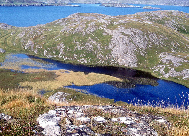
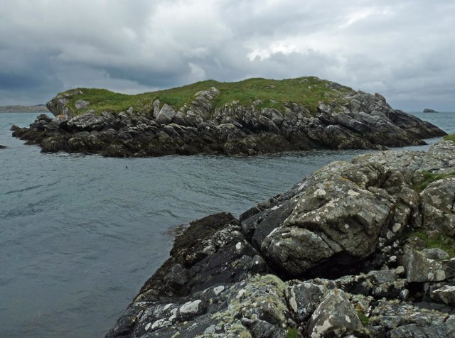
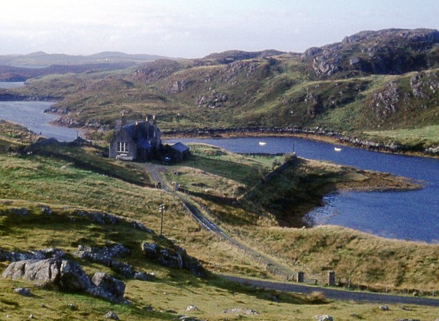
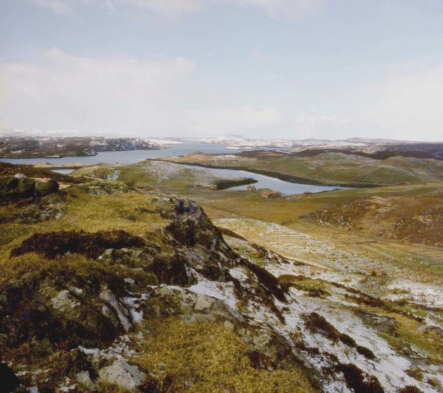
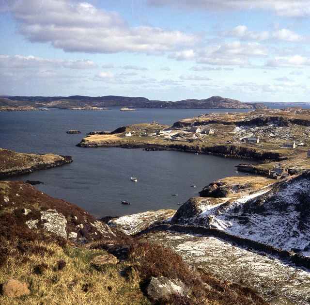
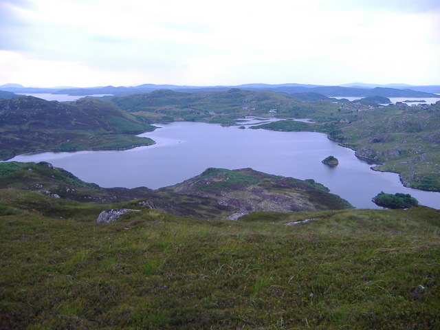
Meall na Eoin is a prominent coastal feature located in Ross-shire, Scotland. Situated on the western coast of the Highlands, it is classified as a headland or point due to its distinctive geographical characteristics.

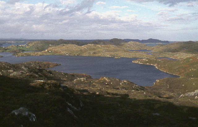
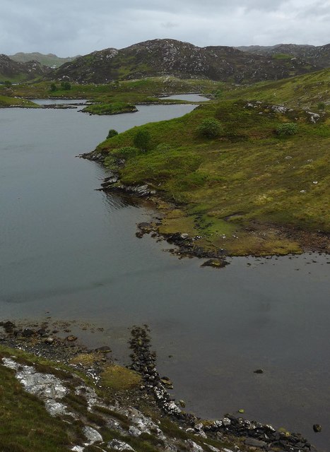
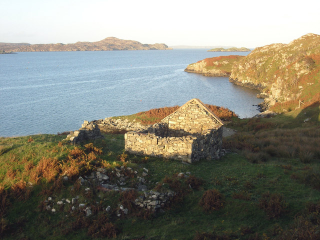
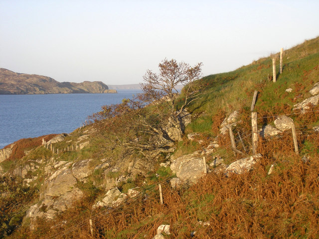
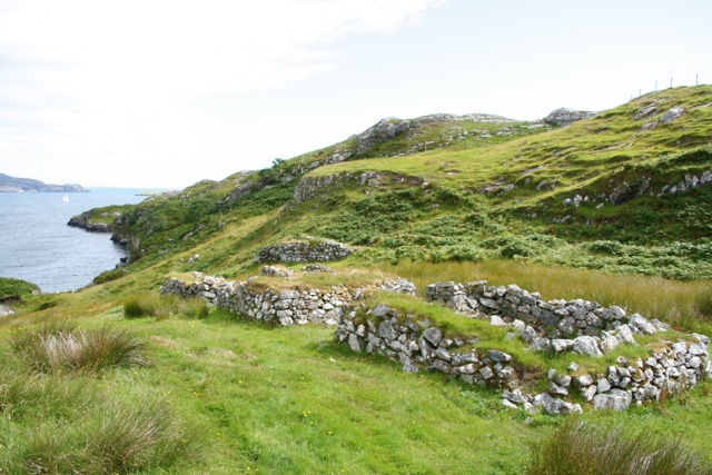
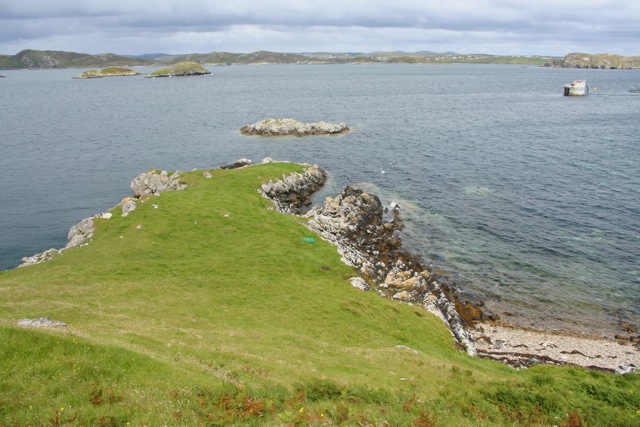
Meall na Eoin is characterized by its rugged and dramatic landscape, with steep cliffs that drop down to the sea below. These cliffs are composed of ancient rock formations, including sandstone and shale, which have been shaped by centuries of erosion from the powerful waves of the North Atlantic Ocean.

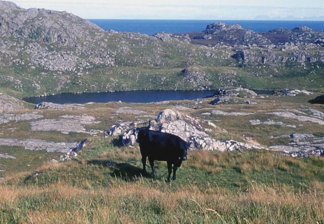
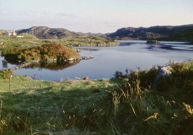
The headland offers breathtaking views of the surrounding area, including the vast expanse of the sea and the distant mountains of the Highlands. It is a popular spot for nature enthusiasts and photographers, who are drawn to its wild beauty and the abundance of birdlife that can be found there. The headland is particularly renowned for its large population of seabirds, including gannets, puffins, and kittiwakes, which nest on the cliffs and provide a vibrant display during the breeding season.

Access to Meall na Eoin is relatively easy, with a well-maintained footpath leading visitors to the headland. However, caution is advised when approaching the cliff edges, as they can be unstable and dangerous. The headland also experiences strong winds and unpredictable weather conditions, so it is advisable to come prepared with appropriate clothing and equipment.

Overall, Meall na Eoin is a captivating coastal feature that offers visitors a chance to immerse themselves in the untamed beauty of the Scottish coastline.

If you have any feedback on the listing, please let us know in the comments section below.

Meall na Eoin Images

Images are sourced within 2km of 58.10382/-6.4263666 or Grid Reference NB3921. Thanks to Geograph Open Source API. All images are credited.

Loch Nighe at Cromore The sealoch beyond is Loch Erisort.
Loch Nighe at Cromore
The sealoch beyond is Loch Erisort.
Loch Dubh at Cromore
Loch Chromor
Loch Chromor
Loch Chromor
Loch Chromor
Stangraidh, Isle of Lewis The rocks from which the photo was taken, the channel and approximately three quarters of the island lie within the grid square.

The snout of a nosy seal can just be seen at the left hand end of the channel.
Stangraidh, Isle of Lewis
The rocks from which the photo was taken, the channel and approximately three quarters of the island lie within the grid square. The snout of a nosy seal can just be seen at the left hand end of the channel.
Wall, Loch nam Bodach, Isle of Lewis From <span class="nowrap"><a title="https://canmore.org.uk/site/336071/ecc-41-loch-nam-bodach" rel="nofollow ugc noopener" href="https://canmore.org.uk/site/336071/ecc-41-loch-nam-bodach">Link</a><img style="margin-left:2px;" alt="External link" title="External link - shift click to open in new window" src="https://s1.geograph.org.uk/img/external.png" width="10" height="10"/></span> :"Situated on the north-western shore of Loch nam Bodach the remains of this wall run for 9 metres from west to east before turning south and running out into the loch for a further 3 metres. They are constructed entirely of stone, but terminate by a wooden post that might provide an aid for a person boarding a boat or for mooring a boat to a jetty".
Wall, Loch nam Bodach, Isle of Lewis
From LinkExternal link :"Situated on the north-western shore of Loch nam Bodach the remains of this wall run for 9 metres from west to east before turning south and running out into the loch for a further 3 metres. They are constructed entirely of stone, but terminate by a wooden post that might provide an aid for a person boarding a boat or for mooring a boat to a jetty".
Dun Cromore There is a significant portion of wall still standing.
Dun Cromore
There is a significant portion of wall still standing.
Rough moor above Loch Mharabhig
Croft at Tòb Cromore
The Old School, Cromore
Crobeg from Meall na Mòine
Tòb Cromore
Tòb Cromore
"Witches Pool" This sheltered anchorage is 6 miles south of Stornoway and much favoured by visiting pleasure craft. In recent years it has become known as "Witches Pool"
"Witches Pool"
This sheltered anchorage is 6 miles south of Stornoway and much favoured by visiting pleasure craft. In recent years it has become known as "Witches Pool"
Loch Chromor There is a Dun or fort at the far end of this Loch close to the village of Cromore. Parts of Loch Erisort (sealoch) can be seen in the distance as can the Hill Roineval 281m on the far left horizon.
Loch Chromor
There is a Dun or fort at the far end of this Loch close to the village of Cromore. Parts of Loch Erisort (sealoch) can be seen in the distance as can the Hill Roineval 281m on the far left horizon.
House at Cromore Ruined house at the end of Cromore, on Loch Erisort
House at Cromore
Ruined house at the end of Cromore, on Loch Erisort
Cromore Common Grazings Steep rocky slopes to the shore at the north end of Cromore Grazings.  Loch Erisort and the island of Tannaraidh beyond.
Cromore Common Grazings
Steep rocky slopes to the shore at the north end of Cromore Grazings. Loch Erisort and the island of Tannaraidh beyond.
Remains of crofts, Cromor
Promontory, Cromor
Promontory, Cromor
Show me another place!

Meall na Eoin is located at Grid Ref: NB3921 (Lat: 58.10382, Lng: -6.4263666)

Unitary Authority: Na h-Eileanan an Iar

Police Authority: Highlands and Islands

What 3 Words

///massaging.counters.sizes. Near Leurbost, Na h-Eileanan Siar

Related Wikis

Eilean Chaluim Chille

Eilean Chaluim Chille (Gaelic: island of Saint Columba, Calum Cille) is an unpopulated island in the Outer Hebrides. It lies off the east coast of Lewis...

Cromore

Cromore (Scottish Gaelic: Crò Mòr) is a crofting township on the Isle of Lewis in the district of Pairc, in the Outer Hebrides, Scotland. The settlement...

Cabharstadh

Cabharstadh or Caversta (Scottish Gaelic: Cabharstaigh) is a village on the Isle of Lewis in the Outer Hebrides, Scotland. Caversta is situated in the...

Crossbost

Crossbost is a village on the Isle of Lewis in the parish of North Lochs, in the Outer Hebrides, Scotland. It is located approximately ten miles away...

North Lochs

North Lochs, (Scottish Gaelic: Ceann a Tuath nan Loch), an area in eastern Lewis, Outer Hebrides, Scotland, is named for the many lochans (small lochs...

Calbost

Calbost (Scottish Gaelic: Calabost) is a village on the Isle of Lewis in the Outer Hebrides, Scotland. Calbost is within the parish of Lochs, and within...

Loch Erisort

Loch Erisort (Scottish Gaelic: Èireasort) is an 8-mile-long narrow sea inlet on the east coast of the Isle of Lewis in the Outer Hebrides off the west...

Leurbost

Leurbost (Scottish Gaelic: Liùrbost) is a village on the east coast of the Isle of Lewis in the Outer Hebrides of Scotland. It is approximately 6 miles...

Nearby Amenities

Located within 500m of 58.10382,-6.4263666
Crò Beag
Alt Name En: Crobeg
Name En: Crobeag
Name Gd: Crò Beag
Place: hamlet
Lat/Long: 58.1009752/-6.4282809
Power: pole
Lat/Long: 58.1016412/-6.4278373
Power: pole
Lat/Long: 58.1018333/-6.4271067
Power: pole
Lat/Long: 58.1020799/-6.4249105
Power: pole
Lat/Long: 58.1022759/-6.4236975
Power: pole
Lat/Long: 58.1025127/-6.4224706
Power: pole
Lat/Long: 58.1024832/-6.421483
Power: pole
Lat/Long: 58.1024771/-6.4199691
Power: pole
Lat/Long: 58.101976/-6.4258358
Historic: ruins
Historic Civilization: modern
Ruins: building
Lat/Long: 58.1037656/-6.4180223
Power: pole
Lat/Long: 58.1022122/-6.4192081
The data included in this document is from www.openstreetmap.org. The data is made available under ODbL.

Have you been to Meall na Eoin?

Leave your review of Meall na Eoin below (or comments, questions and feedback).