Àird Fèiltinis

Coastal Feature, Headland, Point in Ross-shire

Scotland

Àird Fèiltinis

Evening at Cuidhir Rowing boat, in the evening sunshine, pulled up onto the grass above the small, rocky cove at Cuidhir.
Evening at Cuidhir Credit: Colin Smith

Àird Fèiltinis, located in Ross-shire, Scotland, is a prominent coastal feature that commands attention with its remarkable geological formations and stunning natural beauty. Commonly referred to as a headland or a point, Àird Fèiltinis is situated on the western coast of Scotland, overlooking the North Atlantic Ocean.

This coastal feature is characterized by its rugged cliffs, which are composed of ancient rocks, primarily sandstone and limestone. These cliffs rise steeply from the sea, creating a dramatic landscape that offers breathtaking views of the surrounding area. The exposed nature of Àird Fèiltinis makes it susceptible to strong winds and crashing waves, highlighting the wild and untamed nature of the Scottish coastline.

The headland is also home to a diverse range of flora and fauna, making it an important ecological habitat. Seabirds such as gannets, puffins, and fulmars can be spotted nesting on the cliffs, while colonies of seals can often be seen basking on the nearby rocky outcrops. The surrounding waters, rich in marine life, provide ample feeding opportunities for these creatures.

Àird Fèiltinis is a popular destination for nature enthusiasts and hikers, who are drawn to its rugged beauty and the opportunity to explore the coastal trails that wind around the headland. The site also attracts geologists and researchers interested in studying its unique rock formations, which offer insights into Scotland's geological history.

Overall, Àird Fèiltinis is a remarkable coastal feature that showcases the raw power of nature and provides a haven for various wildlife. Its stunning cliffs, diverse ecosystem, and scenic trails make it a must-visit destination for anyone seeking an authentic Scottish coastal experience.

If you have any feedback on the listing, please let us know in the comments section below.

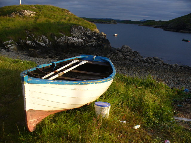
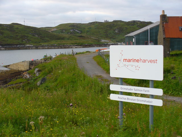
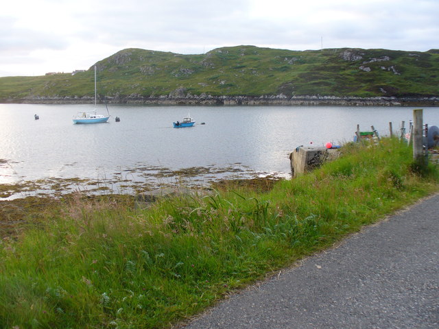
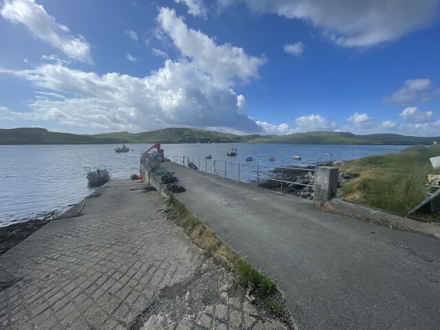
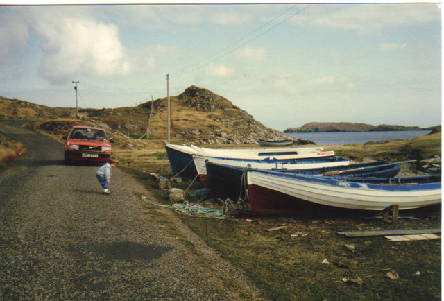
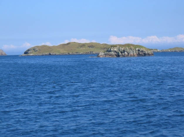
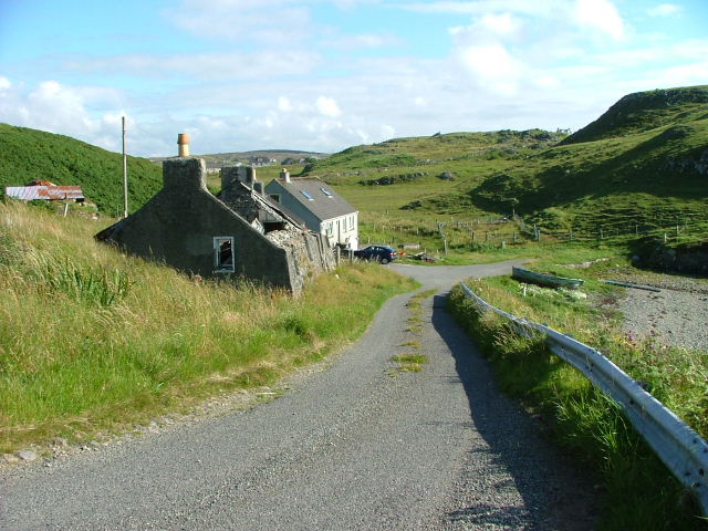
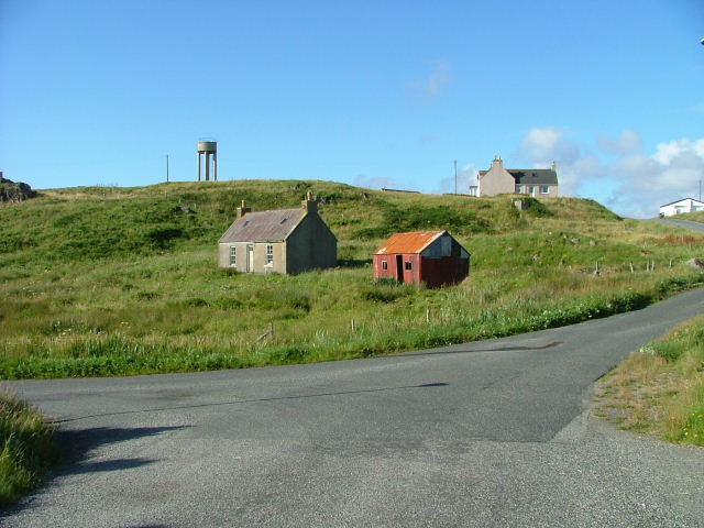
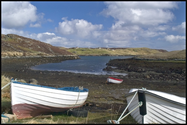
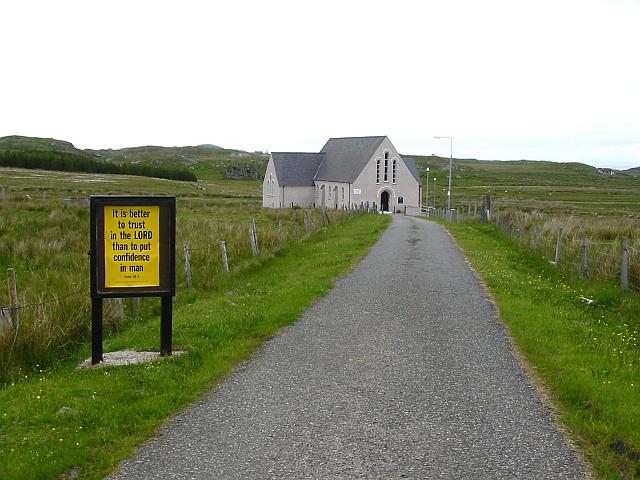
Àird Fèiltinis Images

Images are sourced within 2km of 58.129963/-6.4307884 or Grid Reference NB3924. Thanks to Geograph Open Source API. All images are credited.

Evening at Cuidhir Rowing boat, in the evening sunshine, pulled up onto the grass above the small, rocky cove at Cuidhir.
Evening at Cuidhir
Rowing boat, in the evening sunshine, pulled up onto the grass above the small, rocky cove at Cuidhir.
Grimshader Salmon Farm Marine Harvest - Arachas Bhratan Griomshadair. Sea loch industry on the shores of Loch Griomsiadair.
Grimshader Salmon Farm
Marine Harvest - Arachas Bhratan Griomshadair. Sea loch industry on the shores of Loch Griomsiadair.
Loch Griomsiadair Yacht and lobster boat moored in the sheltered sea loch at Grimshader which is also used for salmon farming.
Loch Griomsiadair
Yacht and lobster boat moored in the sheltered sea loch at Grimshader which is also used for salmon farming.
Crosbost Jetty Geocaching is a type of global treasure hunt of people looking for caches, or hidden stashes of objects. Geocaching may also be described as a series of hide-and-seek games, where hiders provide online clues for seekers. Seekers use global positioning system (GPS) devices to find hidden caches
Crosbost Jetty
Geocaching is a type of global treasure hunt of people looking for caches, or hidden stashes of objects. Geocaching may also be described as a series of hide-and-seek games, where hiders provide online clues for seekers. Seekers use global positioning system (GPS) devices to find hidden caches
Boats at Cuidhir Loch Leurbost The Islands of Tabhaidh Bheag and Tabhaidh are clearly seen in distance.
Boats at Cuidhir Loch Leurbost
The Islands of Tabhaidh Bheag and Tabhaidh are clearly seen in distance.
Eilean Bhatarsaidh Unnamed Islet in foreground and Stac at Loch Erisort Entrance in distance (left of frame). Collectively these Islands are referred to as Na h-Eileanan Bairclin or Barkin Isles.
Eilean Bhatarsaidh
Unnamed Islet in foreground and Stac at Loch Erisort Entrance in distance (left of frame). Collectively these Islands are referred to as Na h-Eileanan Bairclin or Barkin Isles.
Road end at Crosbost
Old croft buildings at Ranais
Fish farm east of Cheòis We walked around Loch Cheòis, then headed south-east from the outflow to reach this viewpoint, but picked up a good track for the return leg. There was a good view across Loch Èireasort of Eilean Chaluim Chille (St Columba's Island)  which can be reached on foot from Cromor around low tide.
Fish farm east of Cheòis
We walked around Loch Cheòis, then headed south-east from the outflow to reach this viewpoint, but picked up a good track for the return leg. There was a good view across Loch Èireasort of Eilean Chaluim Chille (St Columba's Island) which can be reached on foot from Cromor around low tide.
Eilean Chalaibrigh Eilean Chalaibrigh is the islet to the right of the picture.
Eilean Chalaibrigh
Eilean Chalaibrigh is the islet to the right of the picture.
Loch Liurboist at Crosbost Small boats at moorings in the sea loch while an ancient boat lies rotting on the grassy shore. View looking south-east to Tannaraidh and The Minch.
Loch Liurboist at Crosbost
Small boats at moorings in the sea loch while an ancient boat lies rotting on the grassy shore. View looking south-east to Tannaraidh and The Minch.
Fish Farming at Crosbost Salmon cages in the sea loch, Loch Liurboist.
Fish Farming at Crosbost
Salmon cages in the sea loch, Loch Liurboist.
Crossbost: the Free Church of Scotland The church occupies a lovely setting by the shore of Loch Leurbost.
Crossbost: the Free Church of Scotland
The church occupies a lovely setting by the shore of Loch Leurbost.
Crossbost: motorist’s warning at the jetty A warning as the road reaches the shore of Loch Leurbost at the jetty by the church.
Crossbost: motorist’s warning at the jetty
A warning as the road reaches the shore of Loch Leurbost at the jetty by the church.
Crossbost: the church and Loch Leurbost Looking east along the shore from the jetty, with <a href="https://www.geograph.org.uk/photo/3285118">NB3824 : Crossbost: the Free Church of Scotland</a> at the waterside.
Crossbost: the church and Loch Leurbost
Looking east along the shore from the jetty, with NB3824 : Crossbost: the Free Church of Scotland at the waterside.
Crossbost: a boat on the loch Looking across Loch Leurbost from the end of the jetty.
Crossbost: a boat on the loch
Looking across Loch Leurbost from the end of the jetty.
Boats at Loch Griomsiadair Fishing boats drawn up behind Buaile Mhor near the crofting settlement of Ranais, Isle of Lewis
Boats at Loch Griomsiadair
Fishing boats drawn up behind Buaile Mhor near the crofting settlement of Ranais, Isle of Lewis
Church at Leurbost This is the Church of Scotland's building in Leurbost.
Church at Leurbost
This is the Church of Scotland's building in Leurbost.
Show me another place!

Àird Fèiltinis is located at Grid Ref: NB3924 (Lat: 58.129963, Lng: -6.4307884)

Unitary Authority: Na h-Eileanan an Iar

Police Authority: Highlands and Islands

What 3 Words

///rely.router.permanent. Near Leurbost, Na h-Eileanan Siar

Related Wikis

Crossbost

Crossbost is a village on the Isle of Lewis in the parish of North Lochs, in the Outer Hebrides, Scotland. It is located approximately ten miles away...

North Lochs

North Lochs, (Scottish Gaelic: Ceann a Tuath nan Loch), an area in eastern Lewis, Outer Hebrides, Scotland, is named for the many lochans (small lochs...

Leurbost

Leurbost (Scottish Gaelic: Liùrbost) is a village on the east coast of the Isle of Lewis in the Outer Hebrides of Scotland. It is approximately 6 miles...

Eilean Chaluim Chille

Eilean Chaluim Chille (Gaelic: island of Saint Columba, Calum Cille) is an unpopulated island in the Outer Hebrides. It lies off the east coast of Lewis...

Nearby Amenities

Located within 500m of 58.129963,-6.4307884
Created By: dmgroom_coastlines
Lat/Long: 58.13097/-6.43088
Bus Stop
Crossbost
Naptan AtcoCode: 6010731625
Naptan Bearing: E
Naptan CommonName: Crossbost
Naptan Indicator: Village
Naptan Landmark: Village
Naptan NaptanCode: 94723748
Naptan Street: Village
Naptan Verified: no
Source: naptan_import
Lat/Long: 58.1331187/-6.4312779
Passing Place
Lat/Long: 58.1315281/-6.4238527
Crosbost
Alt Name Gd: Crosabost
Name En: Crossbost
Name Gd: Crosbost
Place: village
Wikidata: Q5188513
Lat/Long: 58.1332218/-6.4305218
Loch Liurboist
Natural: bay
Lat/Long: 58.1281947/-6.4287186
Power: pole
Lat/Long: 58.1314749/-6.4239347
Power: pole
Lat/Long: 58.1317592/-6.4254907
Power: pole
Lat/Long: 58.1319889/-6.4267247
Power: pole
Lat/Long: 58.1322069/-6.4283275
Power: pole
Lat/Long: 58.1324172/-6.4298712
Power: pole
Lat/Long: 58.1326079/-6.4313707
Power: pole
Lat/Long: 58.132752/-6.4323785
Power: pole
Lat/Long: 58.1328532/-6.433175
Power: pole
Lat/Long: 58.1329726/-6.4341189
Power: pole
Lat/Long: 58.1329324/-6.4357118
Power: pole
Lat/Long: 58.1328653/-6.437197
Power: pole
Lat/Long: 58.133044/-6.4326883
Power: pole
Lat/Long: 58.1333114/-6.432231
Power: pole
Lat/Long: 58.1341108/-6.4309921
Power: pole
Lat/Long: 58.1339083/-6.4309246
Power: pole
Lat/Long: 58.133572/-6.4313579
Power: pole
Lat/Long: 58.1332568/-6.4318033
Power: pole
Lat/Long: 58.1311998/-6.4241486
Power: pole
Lat/Long: 58.1308377/-6.4243747
Power: pole
Lat/Long: 58.1305989/-6.4231259
Power: pole
Lat/Long: 58.1339992/-6.4343869
Booth: K6
Covered: booth
Disused Amenity: telephone
Man Made: telephone_box
Lat/Long: 58.1335546/-6.4353142
Give Way
Direction: forward
Lat/Long: 58.1335852/-6.4342844
The data included in this document is from www.openstreetmap.org. The data is made available under ODbL.

Have you been to Àird Fèiltinis?

Leave your review of Àird Fèiltinis below (or comments, questions and feedback).