Am Binnean Crom

Coastal Feature, Headland, Point in Argyllshire

Scotland

Am Binnean Crom

Dunes south of Port a' Chapuill, Colonsay Having turned Colonsay's SW corner you head on fine white sand towards the Strand.  This can be a warm place in northerly winds.
Dunes south of Port a' Chapuill, Colonsay Credit: Julian Paren

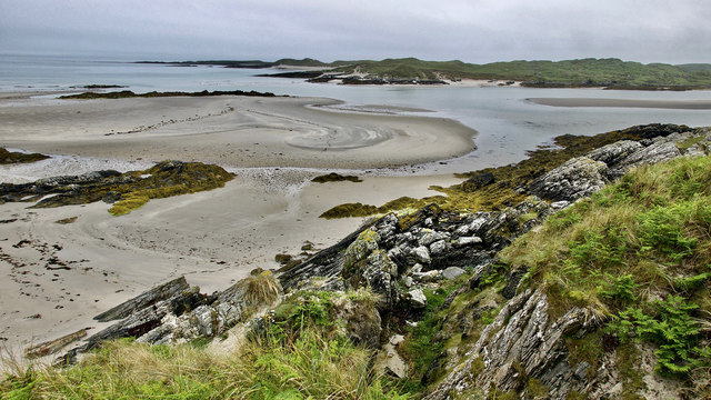
Am Binnean Crom is a prominent coastal feature located in Argyllshire, Scotland. It is specifically classified as a headland or point due to its geographic characteristics and its position jutting out into the surrounding body of water. This coastal formation is situated along the picturesque west coast of Scotland, near the village of Arduaine.

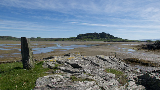
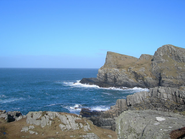
Am Binnean Crom stands tall, offering breathtaking views of the surrounding landscape and the vast expanse of the Atlantic Ocean. Its rocky cliffs and rugged terrain create a dramatic and awe-inspiring sight. The headland's elevation provides an ideal vantage point for observing marine wildlife, such as seals, dolphins, and a variety of seabirds that frequent the area.

The headland is blessed with a diverse ecosystem, which includes rich vegetation clinging to its slopes. This vegetation, consisting of grasses, shrubs, and hardy plants, contributes to the area's unique charm and provides a habitat for various species of insects and small mammals.

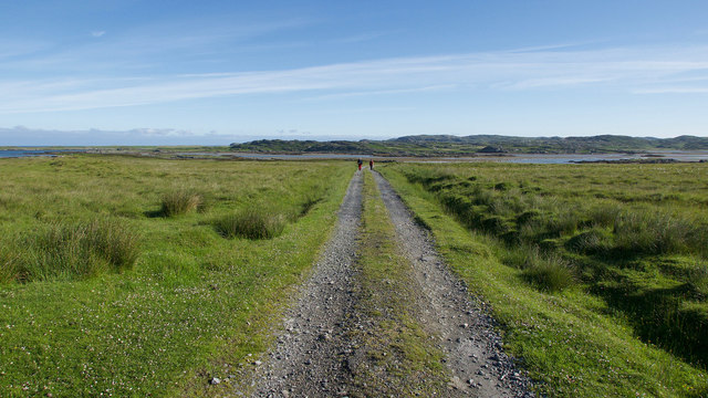
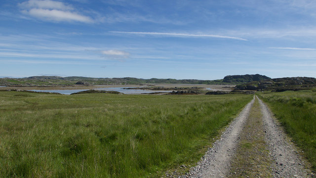
Visitors to Am Binnean Crom can enjoy numerous outdoor activities, including hiking along the rugged coastal trails that lead to the headland. These trails offer stunning vistas of the surrounding coastline and provide an opportunity to explore the diverse flora and fauna found in the area. It is also a popular spot for fishing enthusiasts, who can cast their lines into the abundant waters teeming with marine life.

Overall, Am Binnean Crom is a captivating coastal feature in Argyllshire, offering visitors a chance to immerse themselves in the natural beauty and tranquility of the Scottish coastline.

If you have any feedback on the listing, please let us know in the comments section below.

Am Binnean Crom Images

Images are sourced within 2km of 56.033113/-6.2137985 or Grid Reference NR3790. Thanks to Geograph Open Source API. All images are credited.
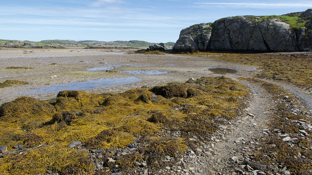
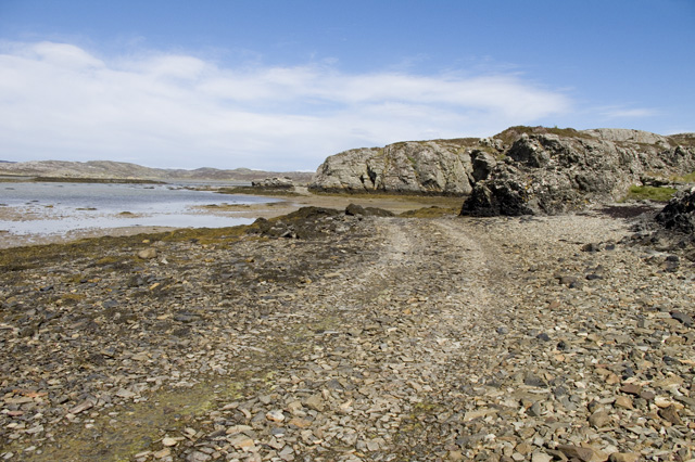
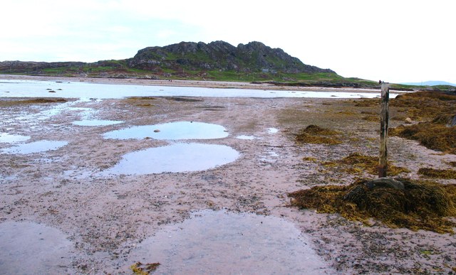
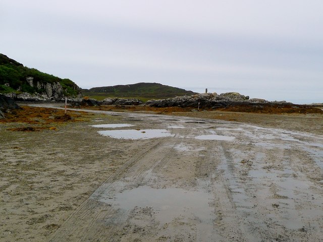
Dunes south of Port a' Chapuill, Colonsay Having turned Colonsay's SW corner you head on fine white sand towards the Strand.  This can be a warm place in northerly winds.
Dunes south of Port a' Chapuill, Colonsay
Having turned Colonsay's SW corner you head on fine white sand towards the Strand. This can be a warm place in northerly winds.
Dunes at south-east corner of Colonsay Looking over to Jura
Dunes at south-east corner of Colonsay
Looking over to Jura
Track to Oronsay Priory An excellent track connects the farmland of Oronsay with the tidal route across the Strand.
Track to Oronsay Priory
An excellent track connects the farmland of Oronsay with the tidal route across the Strand.
Descent to the Strand A straight evenly falling path back to sea level.
Descent to the Strand
A straight evenly falling path back to sea level.
Land Rover track by the Strand, Oronsay Having crossed the Strand, the track hugs the coast before heading inland.
Land Rover track by the Strand, Oronsay
Having crossed the Strand, the track hugs the coast before heading inland.
Landfall markers for the Strand crossing, Oronsay An older standing stone on a prominent hillock and a newer marker at sea level show where the best route for crossing the Strand makes landfall.
Landfall markers for the Strand crossing, Oronsay
An older standing stone on a prominent hillock and a newer marker at sea level show where the best route for crossing the Strand makes landfall.
Coastline below Beinn Eibhne, Colonsay A cloudy evening after rain but still an exciting place to be.
Coastline below Beinn Eibhne, Colonsay
A cloudy evening after rain but still an exciting place to be.
The Strand between Colonsay and Oronsay After low tide the Strand fills with water and the oysters are happy while those on Oronsay must await the next low water to cross back to the shop or their ferry.  Yellow lichens are a feature of Colonsay.
The Strand between Colonsay and Oronsay
After low tide the Strand fills with water and the oysters are happy while those on Oronsay must await the next low water to cross back to the shop or their ferry. Yellow lichens are a feature of Colonsay.
The East end of the Strand The Strand is the area of tidal sands separating Colonsay and Oronsay.
Looking SE from Rubha Bagh nan Capull, Colonsay. The sand dunes on the right are Rubha Ban, Oronsay.
Jura is in the distance.
The East end of the Strand
The Strand is the area of tidal sands separating Colonsay and Oronsay. Looking SE from Rubha Bagh nan Capull, Colonsay. The sand dunes on the right are Rubha Ban, Oronsay. Jura is in the distance.
Oyster Farm on Rubha Bagh nan Capull It looks disused but all the machinery was well oiled and covered up.
Oyster Farm on Rubha Bagh nan Capull
It looks disused but all the machinery was well oiled and covered up.
Rock formations south-east corner of Colonsay Looking across to the very eastern tip of Oronsay
Rock formations south-east corner of Colonsay
Looking across to the very eastern tip of Oronsay
The Colonsay to Oronsay Road
Tidal road, Oronsay The post on the right acts as a marker for those heading from Colonsay to Oronsay. The photographer couldn't wait for the tide, so paddled across.
Tidal road, Oronsay
The post on the right acts as a marker for those heading from Colonsay to Oronsay. The photographer couldn't wait for the tide, so paddled across.
The Oronsay road Clear track through the seaweed on the Oronsay side of the Strand. Most vehicles [of which there are very few] seem to take the alternative route to the right.
The Oronsay road
Clear track through the seaweed on the Oronsay side of the Strand. Most vehicles [of which there are very few] seem to take the alternative route to the right.
On firm ground Hard surfaced track on Oronsay, looking back towards the tidal sands and Colonsay.
On firm ground
Hard surfaced track on Oronsay, looking back towards the tidal sands and Colonsay.
Tidal rocks at Rubha Bagh nan Capull The strand beyond, just drying about a couple of hours before low tide.  Having arrived a little early for the crossing to Oronsay from Colonsay, we waited here for the sands to dry and permit us across - but we still got wet feet!
Tidal rocks at Rubha Bagh nan Capull
The strand beyond, just drying about a couple of hours before low tide. Having arrived a little early for the crossing to Oronsay from Colonsay, we waited here for the sands to dry and permit us across - but we still got wet feet!
Bagh nan Capull Looking over to Oronsay.
Bagh nan Capull
Looking over to Oronsay.
Leaving The Strand for Oronsay The end of the route over The Strand.  Here it is well marked by vehicle tracks as a wedding procession of cars and tractors have just carried a wedding party across for the ceremony at the Priory ruins.
Leaving The Strand for Oronsay
The end of the route over The Strand. Here it is well marked by vehicle tracks as a wedding procession of cars and tractors have just carried a wedding party across for the ceremony at the Priory ruins.
Show me another place!

Am Binnean Crom is located at Grid Ref: NR3790 (Lat: 56.033113, Lng: -6.2137985)

Unitary Authority: Argyll and Bute

Police Authority: Argyll and West Dunbartonshire

What 3 Words

///custodial.canal.splice. Near Scalasaig, Argyll & Bute

Related Wikis

Dùn Cholla

Dùn Cholla is a hill fort located on the Inner Hebridean island of Colonsay, Scotland. The site is located at grid reference NR37759150.According to tradition...

Oronsay, Colonsay

Oronsay (Scottish Gaelic: Orasaigh), also sometimes spelt and pronounced Oransay by the local community, is a small tidal island south of Colonsay in the...

Colonsay Airport

Colonsay Airport (Scottish Gaelic: Port-adhair Colbhasaigh) (IATA: CSA, ICAO: EGEY) is located on the island of Colonsay, Argyll and Bute, Scotland. Located...

Ardskenish

Ardskenish is a hamlet on the island of Colonsay, in the civil parish of Colonsay and Oronsay, in the council area of Argyll and Bute, Scotland. ��2�...

Colonsay Group

The Colonsay Group is an estimated 5,000 m thick sequence of mildly metamorphosed Neoproterozoic sedimentary rocks that outcrop on the islands of Colonsay...

Colonsay

Colonsay (; Scottish Gaelic: Colbhasa; Scots: Colonsay) is an island in the Inner Hebrides of Scotland, located north of Islay and south of Mull. The ancestral...

Oronsay Priory

Oronsay Priory was a monastery of canons regular on the island of Oronsay, Inner Hebrides, Argyll, off the coast of Scotland. It was in existence by 1353...

Dùn Galláin

Dùn Galláin (English: Fort of the Strangers) is a promontory fort located on the Inner Hebridean island of Colonsay, Scotland. The site is located at grid...

Nearby Amenities

Located within 500m of 56.033113,-6.2137985
Beinn Eibhne
Ele: 98
Name Gd: Beinn Eibhinn
Natural: peak
Lat/Long: 56.0340316/-6.2085622
Power: pole
Lat/Long: 56.0290475/-6.2170139
Power: pole
Lat/Long: 56.0293929/-6.2164233
Power: pole
Lat/Long: 56.0312779/-6.2165664
Power: pole
Lat/Long: 56.0317594/-6.216603
Power: pole
Lat/Long: 56.0336799/-6.2179453
Power: pole
Lat/Long: 56.0316721/-6.2152773
Power: pole
Lat/Long: 56.032683/-6.2174237
Power: pole
Lat/Long: 56.0354661/-6.2175608
Power: pole
Lat/Long: 56.0361505/-6.2174219
Power: pole
Lat/Long: 56.0369419/-6.2175145
Power: pole
Lat/Long: 56.0344795/-6.2177732
Power: pole
Lat/Long: 56.0350175/-6.2176574
Power: pole
Lat/Long: 56.0330866/-6.2176349
Power: pole
Lat/Long: 56.032403/-6.2171749
Power: pole
Lat/Long: 56.0307442/-6.2165259
Power: pole
Lat/Long: 56.0301845/-6.2164834
The data included in this document is from www.openstreetmap.org. The data is made available under ODbL.

Have you been to Am Binnean Crom?

Leave your review of Am Binnean Crom below (or comments, questions and feedback).