Bayworth

Settlement in Berkshire Vale of White Horse

England

Bayworth

House on Sunningwell Road
House on Sunningwell Road Credit: David Howard

Bayworth is a small village located in the county of Berkshire, England. Situated approximately 8 miles southwest of Oxford, it is nestled in the picturesque Vale of White Horse. With a population of around 500 residents, it exudes a charming and tranquil atmosphere.

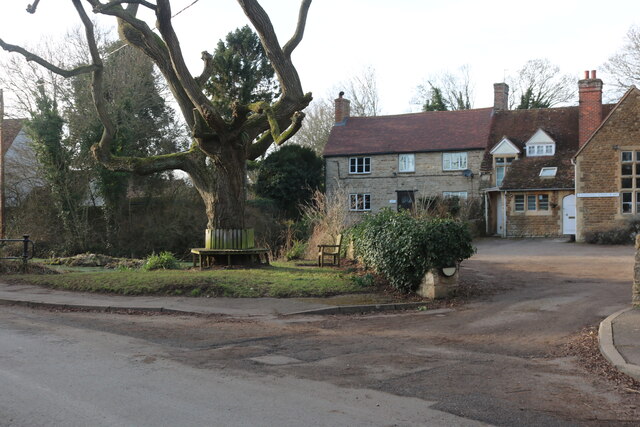
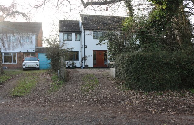
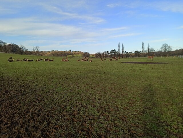
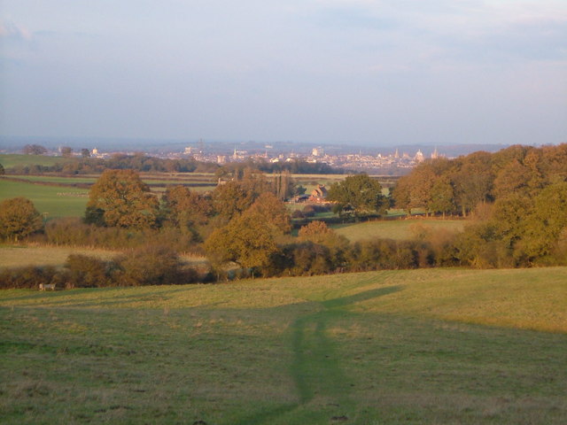
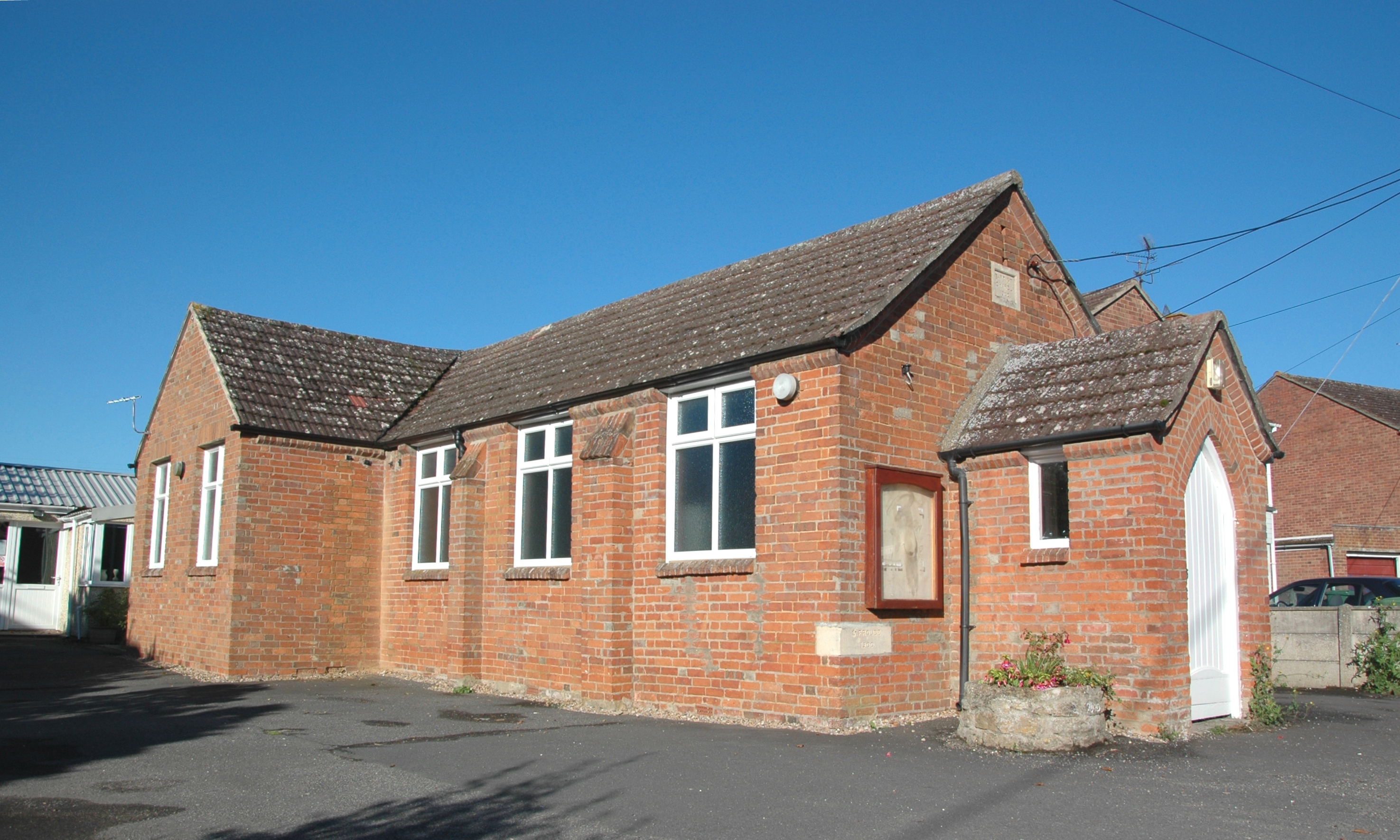
The village is known for its idyllic countryside setting, with rolling hills, lush green fields, and meandering streams. The architecture in Bayworth is predominantly traditional, with beautiful thatched cottages and historic buildings dotting the landscape. Surrounded by woodlands, the village offers ample opportunities for outdoor activities such as hiking, cycling, and horse riding.

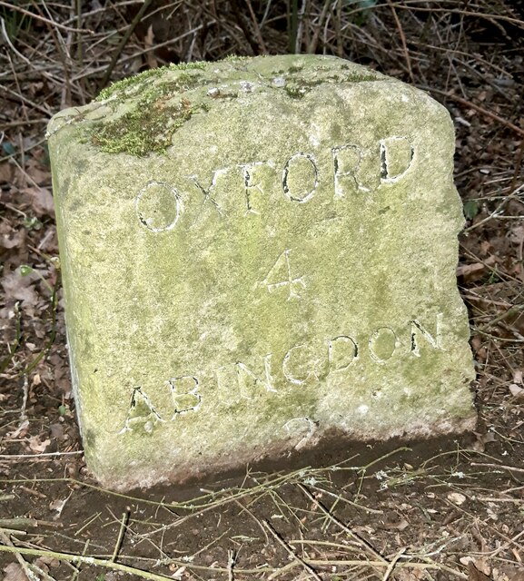
Despite its rural character, Bayworth benefits from its proximity to larger towns and cities. Abingdon, a historic market town, is only a short drive away, providing residents with access to a range of amenities including shops, restaurants, and leisure facilities. The city of Oxford, renowned for its prestigious university and cultural heritage, is also within easy reach.

The village boasts a strong sense of community, with various local events and activities taking place throughout the year. The annual Bayworth Village Fete, for example, brings together residents and visitors for a day of festivities, including traditional games, live music, and a selection of local produce.

Overall, Bayworth offers a peaceful and scenic haven for those seeking a countryside lifestyle, while still being conveniently located near larger urban areas. Its natural beauty, friendly community, and proximity to amenities make it a highly desirable place to live.

If you have any feedback on the listing, please let us know in the comments section below.

Bayworth Images

Images are sourced within 2km of 51.708432/-1.276625 or Grid Reference SP5001. Thanks to Geograph Open Source API. All images are credited.

House on Sunningwell Road
New track in Sunningwell This has not quite been finished, the gate just went into a field before this year.
New track in Sunningwell
This has not quite been finished, the gate just went into a field before this year.
Sunningwell pond
Sunningwell pond
The centre of Sunningwell Sunningwell School of Art is on the right.
The centre of Sunningwell
Sunningwell School of Art is on the right.
Entrance to houses in Sunningwell
Pen Lane, Sunningwell
Houses on Brumcombe Lane, Bayworth
Bayworth Lane, Boars Hill
Brumcombe Lane, Bayworth
Oxford Greenbelt Way near Sunningwell
Sunningwell village
Sunningwell village
Deer in Oxford Greenbelt Way
Oxford Greenbelt Way
Old milestone at Lodge Hill alongside the A4183 road Carved granite post by the A4183 (Oxford Road), in the parish of Radley (Vale of White Horse District). Located at Lodge Hill, hidden in the hedge on the east side of the road but accurately located on the OS maps. Erected by the Hinksey Road turnpike trust in the early 19th century.

Inscription reads:-
OXFORD
4
ABINGDON
2

It has a rivet and engraved benchmark on the top.

Grade II listed.
Old milestone at Lodge Hill alongside the A4183 road
Carved granite post by the A4183 (Oxford Road), in the parish of Radley (Vale of White Horse District). Located at Lodge Hill, hidden in the hedge on the east side of the road but accurately located on the OS maps. Erected by the Hinksey Road turnpike trust in the early 19th century. Inscription reads:- OXFORD 4 ABINGDON 2 It has a rivet and engraved benchmark on the top. Grade II listed.
The View  from the footbridge over the A34 Looking across the Thames Valley, dominating the skyline is Didcot Power Station but beyond is the ancient Ridgeway.
The View from the footbridge over the A34
Looking across the Thames Valley, dominating the skyline is Didcot Power Station but beyond is the ancient Ridgeway.
Footbridge over the A34 near Sunningwell
Farm access road over the A34 near Abingdon
Show me another place!

Bayworth is located at Grid Ref: SP5001 (Lat: 51.708432, Lng: -1.276625)

Administrative County: Oxfordshire

District: Vale of White Horse

Police Authority: Thames Valley

What 3 Words

///soaks.tables.analogy. Near Radley, Oxfordshire

Related Wikis

Midvale Ridge

The Midvale Ridge is a natural region in South Central England formed by a band of low-lying limestone hills that run from southeast to northwest from...
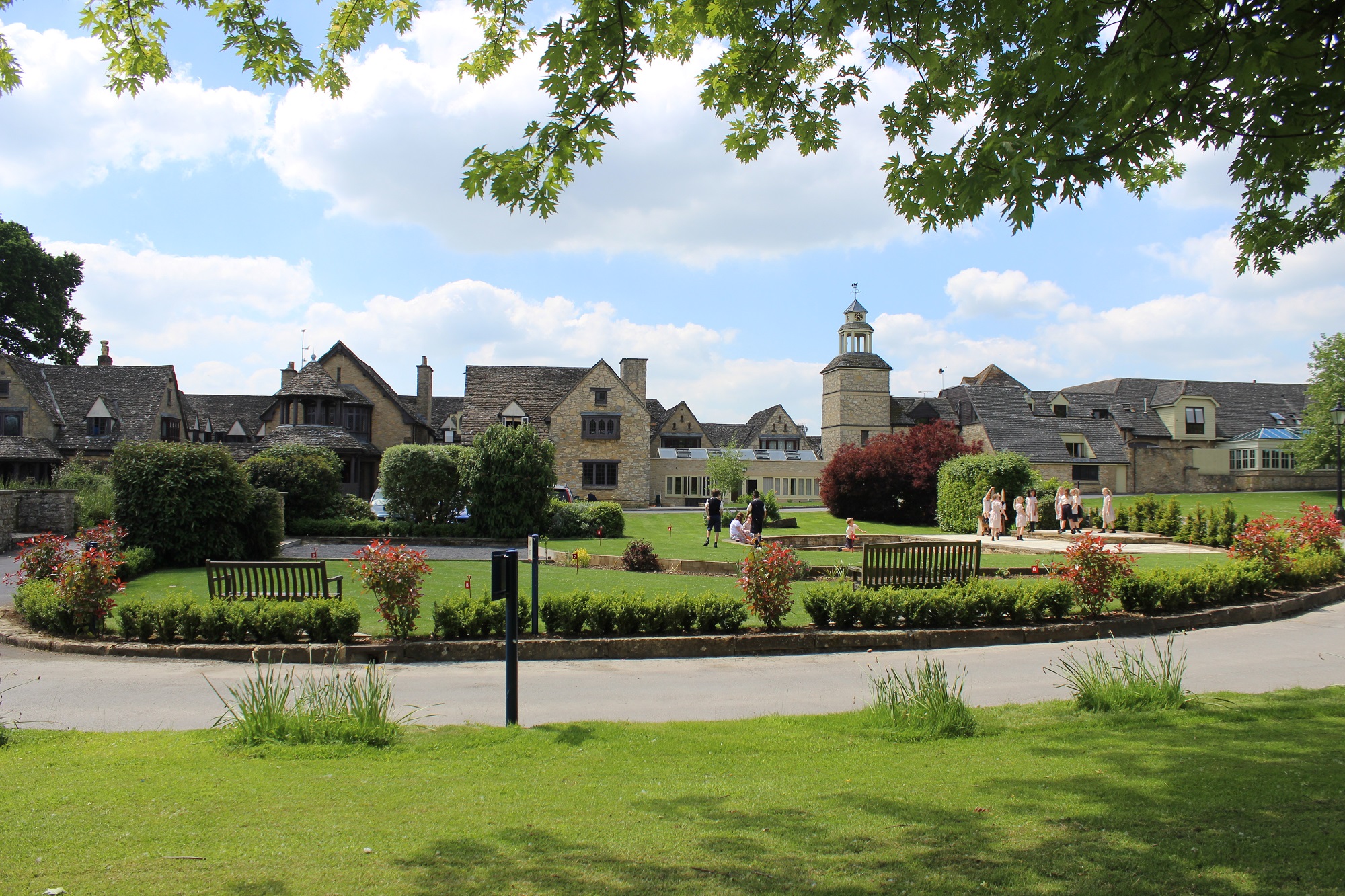
Chandlings

Chandlings, or Chandlings Prep School, known until 2007 as Chandlings Manor School, is an independent co-educational preparatory school at Bagley Wood...

Sunningwell

Sunningwell is a village and civil parish about 3+1⁄2 miles (6 km) south of Oxford, England. The parish includes the village of Bayworth and the eastern...

Bayworth

Bayworth is a hamlet in the civil parish of Sunningwell about 3 miles (5 km) south of Oxford. Bayworth was part of Berkshire until the 1974 boundary changes...

Nearby Amenities

Located within 500m of 51.708432,-1.276625
Note: Sign marking village edge
Lat/Long: 51.7061996/-1.2767798
Note: Sign marking village edge
Lat/Long: 51.7106855/-1.2787943
Bayworth
Is In: Oxfordshire, England, UK
Place: hamlet
Wikidata: Q4875041
Lat/Long: 51.7067933/-1.277277
Post Box
Post Box Type: lamp
Ref: OX13 1157
Royal Cypher: EIIR
Source: photograph
Lat/Long: 51.7072628/-1.2769389
Place Of Worship
Bayworth Chapel
Religion: christian
Lat/Long: 51.7081263/-1.2772014
Quarry Road
Frequency: 0
Journeys: 6
Naptan AtcoCode: 340000082OV
Naptan Bearing: E
Naptan BusStopType: CUS
Naptan CommonName: Quarry Road
Naptan Indicator: Opp Green
Naptan Landmark: Bayworth Triangle
Naptan NaptanCode: oxfgadjg
Naptan Street: Quarry Road
Naptan Verified: no
Source: naptan_import
Lat/Long: 51.7073239/-1.2770152
Bus Stop
Quarry Road
Bus: yes
Frequency: 0
Journeys: 6
Naptan AtcoCode: 340000082V
Naptan Bearing: W
Naptan CommonName: Quarry Road
Naptan Indicator: o/s Green
Naptan Landmark: Bayworth Triangle
Naptan NaptanCode: oxfamtga
Naptan Notes: Timetable Case Only
Naptan Street: Quarry Road
Naptan Verified: no
Public Transport: platform
Source: naptan_import
Lat/Long: 51.7072441/-1.2767427
Bus Stop
Bayworth Park
Bus: yes
Frequency: 0
Journeys: 6
Naptan AtcoCode: 340001376BNH
Naptan Bearing: S
Naptan BusStopType: CUS
Naptan CommonName: Bayworth Park
Naptan Indicator: Opposite
Naptan Landmark: Mobile Home Park
Naptan NaptanCode: oxfagmwg
Naptan Street: Brumcombe Lane
Public Transport: platform
Route Ref: 44
Shelter: no
Source: naptan_import
Lat/Long: 51.7104362/-1.2786038
Bus Stop
Bayworth Park
Bus: yes
Frequency: 0
Journeys: 6
Naptan AtcoCode: 340001376BWP
Naptan Bearing: N
Naptan CommonName: Bayworth Park
Naptan Indicator: Outside
Naptan Landmark: Mobile Home park
Naptan NaptanCode: oxfagmgm
Naptan Street: Brumcombe Lane
Public Transport: platform
Route Ref: 44
Shelter: no
Source: naptan_import
Lat/Long: 51.7104096/-1.2787326
Fixme: incomplete
Note: Path signed from top of field, but not clear where it goes here
Lat/Long: 51.7067179/-1.2809631
Note: Sign marking village edge
Lat/Long: 51.7062262/-1.2768737
Power: pole
Source: Bing
Lat/Long: 51.7062278/-1.2792394
Power: pole
Source: Bing
Lat/Long: 51.7047248/-1.2789499
Power: pole
Source: Bing
Lat/Long: 51.7070984/-1.2794112
Power: pole
Source: Bing
Lat/Long: 51.7102292/-1.280037
Power: pole
Source: Bing
Lat/Long: 51.7093617/-1.2798868
Power: pole
Source: Bing
Lat/Long: 51.7110901/-1.2798894
Power: pole
Source: Bing
Lat/Long: 51.7119843/-1.27975
Power: pole
Source: Bing
Lat/Long: 51.7084383/-1.2796769
Barrier: stile
Bicycle: dismount
Foot: yes
Horse: no
Material: wood
Motor Vehicle: no
Stile: stepover
Lat/Long: 51.7087723/-1.2711086
Chapel Barbers
Addr City: Bayworth Oxford
Addr Postcode: OX13 6QU
Addr Street: Brumcombe Lane
Operator: Paul Maxey
Payment Cash: yes
Payment Credit Cards: yes
Phone: +447825704917
Shop: hairdresser
Lat/Long: 51.7081557/-1.2771309
Power: pole
Lat/Long: 51.7100827/-1.2700454
Power: pole
Lat/Long: 51.710374/-1.2708451
Power: pole
Lat/Long: 51.7103214/-1.2717421
Power: pole
Lat/Long: 51.7102822/-1.2726325
Power: pole
Lat/Long: 51.7102239/-1.2736631
Power: pole
Lat/Long: 51.7101972/-1.2746519
Power: pole
Lat/Long: 51.7098485/-1.2755197
Power: pole
Lat/Long: 51.7094922/-1.2764263
Power: pole
Lat/Long: 51.708566/-1.2792871
Power: pole
Lat/Long: 51.7086842/-1.2788886
Power: pole
Lat/Long: 51.7089302/-1.278114
Power: pole
Lat/Long: 51.7082214/-1.2781344
Power: pole
Lat/Long: 51.707692/-1.2773099
Information: guidepost
Tourism: information
Lat/Long: 51.7072444/-1.276701
Defibrillator
Defibrillator Location: freestanding by grass at end of Quarry Road, Bayworth
Emergency: defibrillator
Indoor: no
Lat/Long: 51.7071025/-1.2770908
Advertising: board
Lat/Long: 51.7070859/-1.277064
Bench
Lat/Long: 51.7071402/-1.276996
Bench
Lat/Long: 51.7071468/-1.2767528
Bench
Lat/Long: 51.7070371/-1.2767975
The data included in this document is from www.openstreetmap.org. The data is made available under ODbL.

Have you been to Bayworth?

Leave your review of Bayworth below (or comments, questions and feedback).