Rubha Thearna Sgùrr

Coastal Feature, Headland, Point in Inverness-shire

Scotland

Rubha Thearna Sgùrr

Moorland above Rubha Thearna Sgurr The island in the distance is Canna.
Moorland above Rubha Thearna Sgurr Credit: John Allan

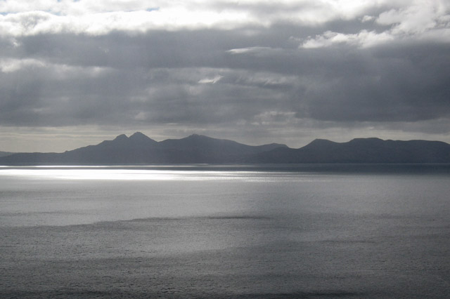
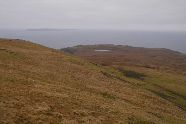
Rubha Thearna Sgùrr is a prominent coastal feature situated in Inverness-shire, Scotland. It is a headland that juts out into the North Atlantic Ocean, forming a point that offers stunning views of the surrounding landscape.

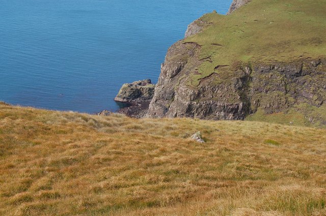
Located on the western coast of the Scottish Highlands, Rubha Thearna Sgùrr is known for its rugged and dramatic cliffs that cascade down to the sea. The headland is composed mainly of sedimentary rocks, with layers of sandstone and shale creating intricate patterns along the shoreline. These rocks provide a unique geological insight into the area's history.

The headland is a popular spot for nature enthusiasts and hikers, who are drawn to its unspoiled beauty and diverse wildlife. The coastal area surrounding Rubha Thearna Sgùrr is teeming with birdlife, including seabird colonies such as puffins and guillemots. The headland is also home to various plant species, adding to its ecological significance.

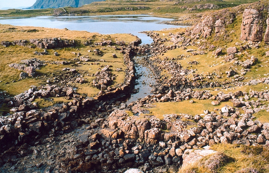
In addition to its natural attractions, Rubha Thearna Sgùrr holds historical significance. It is believed to have been a site of human activity dating back thousands of years, with evidence of ancient settlements and stone structures. The headland's strategic position overlooking the ocean made it an important location for defense and navigation throughout history.

Visitors to Rubha Thearna Sgùrr can enjoy the stunning coastal views, hike along the cliff paths, and explore the area's rich history and natural wonders. With its rugged beauty and diverse wildlife, this headland offers a truly immersive experience for nature lovers and history enthusiasts alike.

If you have any feedback on the listing, please let us know in the comments section below.

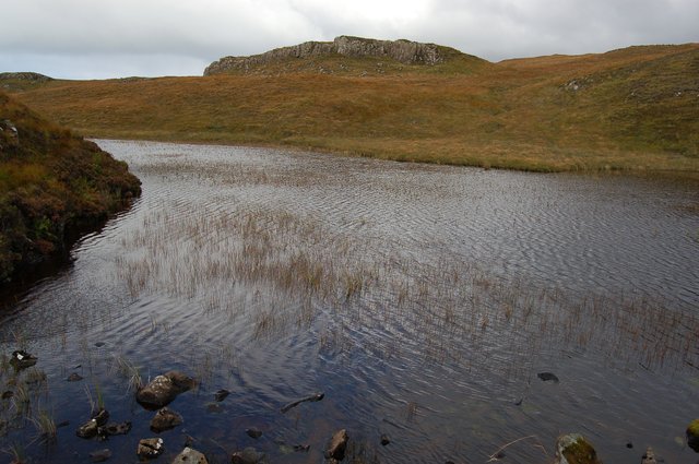
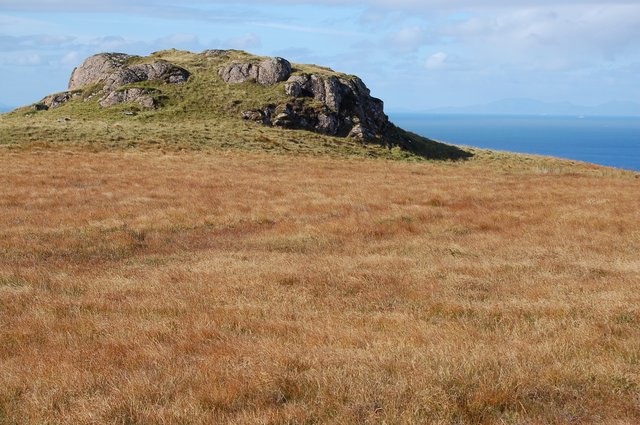
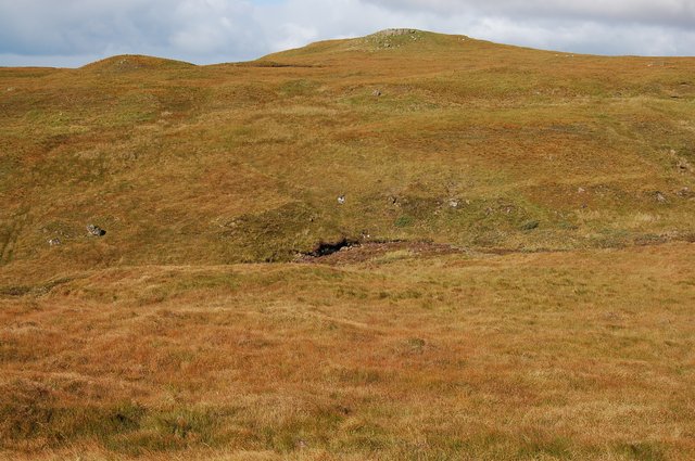
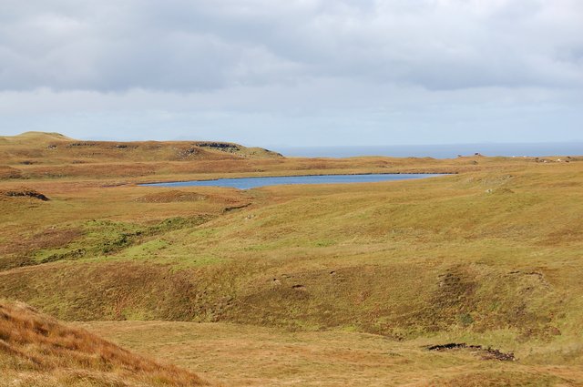
Rubha Thearna Sgùrr Images

Images are sourced within 2km of 57.192532/-6.3630774 or Grid Reference NG3619. Thanks to Geograph Open Source API. All images are credited.

Moorland above Rubha Thearna Sgurr The island in the distance is Canna.
Moorland above Rubha Thearna Sgurr
The island in the distance is Canna.
Moorland west of Loch Brittle With a view over the sea to rain showers near Canna.
Moorland west of Loch Brittle
With a view over the sea to rain showers near Canna.
Round lochan on the Loch Brittle cliff top A small lochan near the edge of the 200m cliffs. The lochan has no outflow.
Across the sea is the distinctive shape of Rum.
Round lochan on the Loch Brittle cliff top
A small lochan near the edge of the 200m cliffs. The lochan has no outflow. Across the sea is the distinctive shape of Rum.
Loch Crocan A small loch trapped behind a rock band above the sea cliffs. Its outflow falls over a high waterfall down to the mouth of Loch Brittle.
Loch Crocan
A small loch trapped behind a rock band above the sea cliffs. Its outflow falls over a high waterfall down to the mouth of Loch Brittle.
Coastline east of Geodha na h-Airigh Moire Steep ground falling to the shoreline at the mouth of Loch Brittle.
Coastline east of Geodha na h-Airigh Moire
Steep ground falling to the shoreline at the mouth of Loch Brittle.
Sea stack west of Geodha na h-Airigh Moire A large, stubby, unnamed sea stack that marks the north side of the entrance to Loch Brittle.
Sea stack west of Geodha na h-Airigh Moire
A large, stubby, unnamed sea stack that marks the north side of the entrance to Loch Brittle.
Dunan Thearna Sgurr A very distinctive lump on the clifftops between Loch Brittle and Loch Eynort.
Dunan Thearna Sgurr
A very distinctive lump on the clifftops between Loch Brittle and Loch Eynort.
Valley of the Allt Mor Not many humans venture here. It is 4km from the nearest road, track, path or habitation - and the going is heavy.
Valley of the Allt Mor
Not many humans venture here. It is 4km from the nearest road, track, path or habitation - and the going is heavy.
On Cnoc nan Uan Looking across the high moorland of this square towards Beinn an Eòin beyond.
On Cnoc nan Uan
Looking across the high moorland of this square towards Beinn an Eòin beyond.
Loch an Leth-uillt An attractive lochan in a remote spot. Seen here from out of square, across the valley of the Allt Mor.
Loch an Leth-uillt
An attractive lochan in a remote spot. Seen here from out of square, across the valley of the Allt Mor.
Mouth of the Geodh of the Allt Mor The Geodh is a big obstacle to walking the cliff-tops between Loch Brittle and Loch Eynort. It requires a lengthy diversion inland to get round the head of it.
Mouth of the Geodh of the Allt Mor
The Geodh is a big obstacle to walking the cliff-tops between Loch Brittle and Loch Eynort. It requires a lengthy diversion inland to get round the head of it.
Tributary of the Allt Mor This unnamed tributary joins the Allt Mor over a big waterfall into its Geodh. Up here on the open moorland, its small gorge provides the walker some welcome shelter from the wind.
Tributary of the Allt Mor
This unnamed tributary joins the Allt Mor over a big waterfall into its Geodh. Up here on the open moorland, its small gorge provides the walker some welcome shelter from the wind.
Beinn an Eòin Seen from the flat bogs of Bealach na h-Airigh Mhùrain.
Beinn an Eòin
Seen from the flat bogs of Bealach na h-Airigh Mhùrain.
Rum from Sgurr an Duine The view to Rum from the cliff top of Sgurr an Duine. A heavy, blustery, but thankfully brief hail shower had just passed over us on this otherwise sunny day. The picture shows the shower heading away across the sea to Rum, creating some interesting patterns of light and shade as it travels.
Rum from Sgurr an Duine
The view to Rum from the cliff top of Sgurr an Duine. A heavy, blustery, but thankfully brief hail shower had just passed over us on this otherwise sunny day. The picture shows the shower heading away across the sea to Rum, creating some interesting patterns of light and shade as it travels.
Loch an Leth-uillt A small lochan perched above a big drop to the sea. View from the summit of An Cruachan.
Loch an Leth-uillt
A small lochan perched above a big drop to the sea. View from the summit of An Cruachan.
Sgurr nam Boc from Dunan Thearna Sgurr The 712ft top of Sgurr nam Boc from across the deep incision of the Allt Mor. The cliffs of Duirinish, as far as Neist Point, appear in the distance. The cream dots are sheep!
Sgurr nam Boc from Dunan Thearna Sgurr
The 712ft top of Sgurr nam Boc from across the deep incision of the Allt Mor. The cliffs of Duirinish, as far as Neist Point, appear in the distance. The cream dots are sheep!
Show me another place!

Rubha Thearna Sgùrr is located at Grid Ref: NG3619 (Lat: 57.192532, Lng: -6.3630774)

Unitary Authority: Highland

Police Authority: Highlands and Islands

What 3 Words

///bunks.forge.thunder. Near Carbost, Highland

Related Wikis

Loch Brittle

Loch Brittle is a sea loch on the southwest coast of Skye in Scotland. A sandy beach separates Glen Brittle from Loch Brittle. The land to the sides of...

Bualintur

Bualintur (Scottish Gaelic: Buaile an Todhair) is a remote township, which lies at the head of Loch Brittle on the island of Skye in the Highlands of...

Rubha an Dùnain

Rubha an Dùnain or Rubh' an Dùnain (Scottish Gaelic pronunciation: [ᵲu(.ə) ən t̪uːnən]) is an uninhabited peninsula to the south of the Cuillin hills on...

Eas Mòr, Glen Brittle

Eas Mòr is a waterfall in Glen Brittle on the island of Skye in Scotland. It lies on the Allt Coire na Bannachdich in a small gorge east of Glenbrittle...

Nearby Amenities

Located within 500m of 57.192532,-6.3630774
Created By: dmgroom_coastlines
Source: PGS
Lat/Long: 57.19681/-6.36353
Created By: dmgroom_coastlines
Source: PGS
Lat/Long: 57.19656/-6.36355
Created By: dmgroom_coastlines
Source: PGS
Lat/Long: 57.1963/-6.36356
Created By: dmgroom_coastlines
Source: PGS
Lat/Long: 57.19617/-6.36334
Created By: dmgroom_coastlines
Source: PGS
Lat/Long: 57.19603/-6.36311
Created By: dmgroom_coastlines
Source: PGS
Lat/Long: 57.195/-6.36271
Created By: dmgroom_coastlines
Source: PGS
Lat/Long: 57.19487/-6.36249
Created By: dmgroom_coastlines
Source: PGS
Lat/Long: 57.19474/-6.36226
Created By: dmgroom_coastlines
Source: PGS
Lat/Long: 57.19448/-6.36228
Created By: dmgroom_coastlines
Source: PGS
Lat/Long: 57.19321/-6.36284
Source: PGS
Lat/Long: 57.19297/-6.3629116
Source: PGS
Lat/Long: 57.1926154/-6.362829
Created By: dmgroom_coastlines
Source: PGS
Lat/Long: 57.19257/-6.36265
Created By: dmgroom_coastlines
Source: PGS
Lat/Long: 57.19252/-6.36029
Created By: dmgroom_coastlines
Source: PGS
Lat/Long: 57.1925/-6.35981
Created By: dmgroom_coastlines
Source: PGS
Lat/Long: 57.19249/-6.35888
Created By: dmgroom_coastlines
Source: PGS
Lat/Long: 57.19248/-6.35841
Created By: dmgroom_coastlines
Source: PGS
Lat/Long: 57.19235/-6.35818
Created By: dmgroom_coastlines
Source: PGS
Lat/Long: 57.19221/-6.35796
Created By: dmgroom_coastlines
Source: PGS
Lat/Long: 57.19208/-6.35773
Created By: dmgroom_coastlines
Source: PGS
Lat/Long: 57.19182/-6.35775
Created By: dmgroom_coastlines
Source: PGS
Lat/Long: 57.19157/-6.35777
Created By: dmgroom_coastlines
Source: PGS
Lat/Long: 57.19143/-6.35754
Created By: dmgroom_coastlines
Source: PGS
Lat/Long: 57.19142/-6.35707
Source: PGS
Lat/Long: 57.1913423/-6.3567831
Created By: dmgroom_coastlines
Source: PGS
Lat/Long: 57.19103/-6.35663
Created By: dmgroom_coastlines
Source: PGS
Lat/Long: 57.19115/-6.35615
Source: PGS
Lat/Long: 57.1908589/-6.355426
Dunan Earr an Sguirr
Natural: peak
Lat/Long: 57.1949475/-6.3590791
The data included in this document is from www.openstreetmap.org. The data is made available under ODbL.

Have you been to Rubha Thearna Sgùrr?

Leave your review of Rubha Thearna Sgùrr below (or comments, questions and feedback).