South Carn Gloose

Coastal Feature, Headland, Point in Cornwall

England

South Carn Gloose

Windswept, St Just Clearly the owners of this shop have an eye for detail and design.
Windswept, St Just Credit: Jonathan Billinger

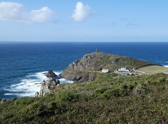
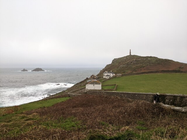
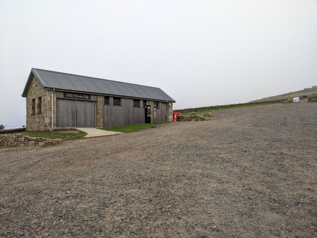
South Carn Gloose is a small headland located on the rugged coastline of Cornwall, England. Situated near the village of Zennor, this coastal feature offers stunning views of the Atlantic Ocean and the surrounding cliffs.

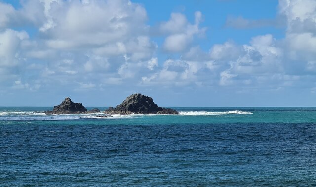
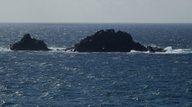
The headland is characterized by its rocky cliffs, which jut out into the sea and provide a dramatic backdrop for visitors. The area is popular with hikers and nature enthusiasts, who come to explore the coastal paths and spot wildlife such as seabirds and seals.

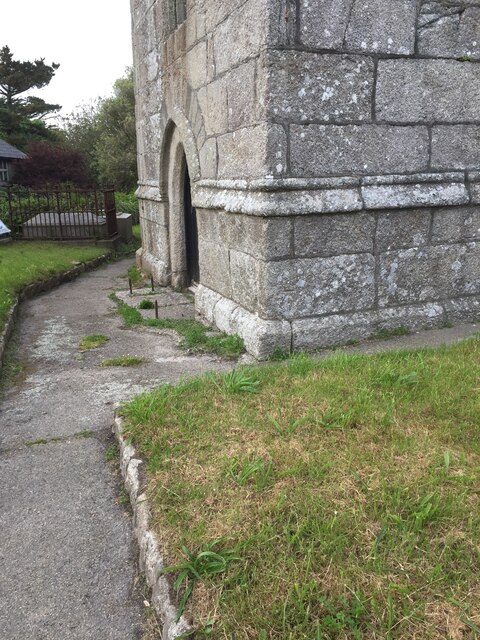
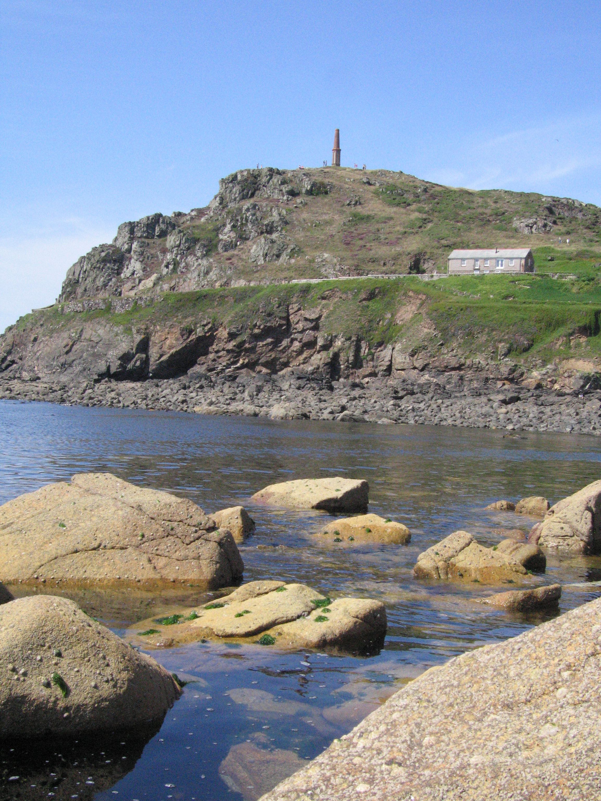
South Carn Gloose is also known for its historic significance, with remnants of ancient settlements and burial mounds scattered throughout the area. Visitors can learn about the area's rich history through informational signs and guided tours.

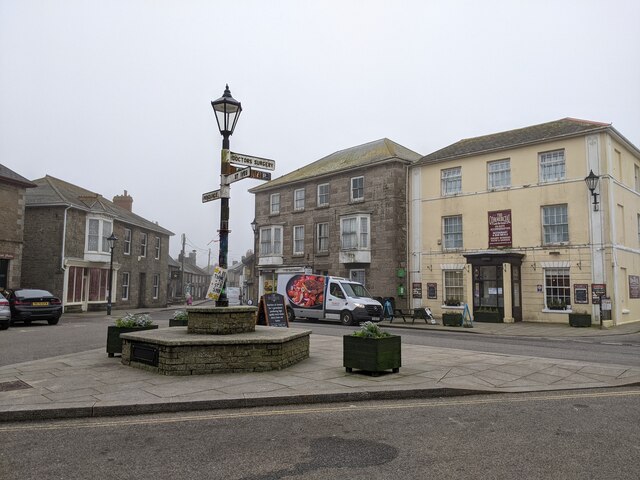
The headland is easily accessible by foot, with a network of walking paths leading from the nearby village of Zennor. Visitors can enjoy a leisurely stroll along the cliffs, taking in the breathtaking views of the ocean and the rugged coastline.

Overall, South Carn Gloose is a must-visit destination for those looking to experience the natural beauty and history of Cornwall's coastline.

If you have any feedback on the listing, please let us know in the comments section below.

South Carn Gloose Images

Images are sourced within 2km of 50.12219/-5.703981 or Grid Reference SW3531. Thanks to Geograph Open Source API. All images are credited.

Windswept, St Just Clearly the owners of this shop have an eye for detail and design.
Windswept, St Just
Clearly the owners of this shop have an eye for detail and design.
St Just Church Tower
St Just from the churchyard of St Just church
OS Cut Mark - St Just, St Just's Church <span class="nowrap"><a title="https://www.bench-marks.org.uk/bm43294" rel="nofollow ugc noopener" href="https://www.bench-marks.org.uk/bm43294">Link</a><img style="margin-left:2px;" alt="External link" title="External link - shift click to open in new window" src="https://s1.geograph.org.uk/img/external.png" width="10" height="10"/></span>
OS Cut Mark - St Just, St Just's Church
Location of OS Cut Mark - St Just, St Just's Church <span class="nowrap"><a title="https://www.bench-marks.org.uk/bm43294" rel="nofollow ugc noopener" href="https://www.bench-marks.org.uk/bm43294">Link</a><img style="margin-left:2px;" alt="External link" title="External link - shift click to open in new window" src="https://s1.geograph.org.uk/img/external.png" width="10" height="10"/></span>
Location of OS Cut Mark - St Just, St Just's Church
Carn Gloose Trig Point Flush Bracket S8141
Ballowall Barrow This Bronze Age barrow was excavated (and radically altered) in 1878 by Cornish antiquarian William Borlase. The internal walls were rebuilt by him which has unfortunately affected the way it is perceived. It is however an evocative site in a stunning location.
See <span class="nowrap"><a title="https://www.english-heritage.org.uk/visit/places/ballowall-barrow" rel="nofollow ugc noopener" href="https://www.english-heritage.org.uk/visit/places/ballowall-barrow">Link</a><img style="margin-left:2px;" alt="External link" title="External link - shift click to open in new window" src="https://s1.geograph.org.uk/img/external.png" width="10" height="10"/></span>
Ballowall Barrow
This Bronze Age barrow was excavated (and radically altered) in 1878 by Cornish antiquarian William Borlase. The internal walls were rebuilt by him which has unfortunately affected the way it is perceived. It is however an evocative site in a stunning location. See LinkExternal link
Cape Cornwall from Ballowall Barrow Looking over to England's only cape - Cape Cornwall as seen from beside <a href="https://www.geograph.org.uk/photo/6982138">SW3531 : Ballowall Barrow</a>
Cape Cornwall from Ballowall Barrow
Looking over to England's only cape - Cape Cornwall as seen from beside SW3531 : Ballowall Barrow
The centre of St Just
Cape Cornwall seen from the National Trust car park
National Trust car park and hut at Cape Cornwall
Truthwall Lane, Botallock, looking east
The Brisons rocks viewed from Porth Nanven
The stream from Cot Valley discharging onto the beach at Porth Nanven
Eroded rocks on the beach at Porth Nanven Worn away by the stream in the Cot Valley, which discharges onto the beach here.
Eroded rocks on the beach at Porth Nanven
Worn away by the stream in the Cot Valley, which discharges onto the beach here.
Emergency call point at Porth Nanven
Ill fated Cargodna shaft and Crowns Engine houses, Botallack Probably the most photographed area in the south west has a sad story attached. The square collar in the foreground is Cargodna shaft, perched halfway down the cliff side. It was here on Tuesday, Jan 10th 1893, 20 miners were drowned after, it is believed, they accidentally holed through to flooded abandoned workings of the adjacent Wheal Drea. This is the shaft they descended on that fateful morning. Because Wheal Owles and Drea were now linked, these flooded combined workings held an immense lake of water and despite local efforts to pump this out, the operation failed and their bodies still remain in this water filled under world. There is a memorial table attached to the shaft collar wall in remembrance of them.
Ill fated Cargodna shaft and Crowns Engine houses, Botallack
Probably the most photographed area in the south west has a sad story attached. The square collar in the foreground is Cargodna shaft, perched halfway down the cliff side. It was here on Tuesday, Jan 10th 1893, 20 miners were drowned after, it is believed, they accidentally holed through to flooded abandoned workings of the adjacent Wheal Drea. This is the shaft they descended on that fateful morning. Because Wheal Owles and Drea were now linked, these flooded combined workings held an immense lake of water and despite local efforts to pump this out, the operation failed and their bodies still remain in this water filled under world. There is a memorial table attached to the shaft collar wall in remembrance of them.
The Brisons The twin peaks of The Brisons are 22m (72') and 27m (89') high. They lie about a mile southwest of Cape Cornwall. The gap between the rocks is called the Adgiwar Gap.
The Brisons
The twin peaks of The Brisons are 22m (72') and 27m (89') high. They lie about a mile southwest of Cape Cornwall. The gap between the rocks is called the Adgiwar Gap.
Show me another place!

South Carn Gloose is located at Grid Ref: SW3531 (Lat: 50.12219, Lng: -5.703981)

Unitary Authority: Cornwall

Police Authority: Devon and Cornwall

What 3 Words

///inkjet.garden.redouble. Near St Just, Cornwall

Related Wikis

Ballowall Barrow

Ballowall Barrow (Cornish: Krug Karrekloos) is a prehistoric funerary cairn (chambered tomb) which Ashbee (1982) and Hencken (1902–81) state contains...

Priest Cove

Priest Cove (Cornish: Porth Ust, meaning St Just's Cove) or Priest's Cove is a small cove one mile (1.6 km) west of St Just, Cornwall, UK. The name is...

Cape Cornwall

Cape Cornwall (Cornish: Kilgoodh, meaning "goose back") is a small headland in West Cornwall, England. It is 4 miles (6.4 km) north of Land's End near...

Porth Nanven

Porth Nanven (grid reference SW355307; most well known as Cot Valley and occasionally known as Penanwell) is a beach in the far west of Cornwall, England...

Nearby Amenities

Located within 500m of 50.12219,-5.703981
Source: Bing
Lat/Long: 50.1261454/-5.7059972
Source: Bing
Lat/Long: 50.1256382/-5.7054651
Source: Bing
Lat/Long: 50.1205611/-5.7023573
Source: PGS
Lat/Long: 50.1189859/-5.7008493
Porth Nanven
Is In: Cornwall, England, UK
Is In Country: England
Is In Country Code: GB
Is In County: Cornwall
Place: locality
Lat/Long: 50.1190076/-5.6999458
Bollowall Cliff
Natural: cliff
Lat/Long: 50.1198803/-5.6992441
Chimney
Historic: ruins
Lat/Long: 50.1221364/-5.6998788
Description: OS trig pillar
Ele: 94.792
Man Made: survey_point
Note: Accurate location import for imagery offset calibration
Ref: S8141
Source: Ordnance Survey (OGL)
Survey Point: pillar
Lat/Long: 50.1226082/-5.7027791
Source: Bing
Lat/Long: 50.1262857/-5.706798
Source: Bing
Lat/Long: 50.1262702/-5.7067819
Source: Bing
Lat/Long: 50.1262521/-5.7067215
Source: Bing
Lat/Long: 50.1262315/-5.7065848
Source: Bing
Lat/Long: 50.126179/-5.7065566
Source: Bing
Lat/Long: 50.1261713/-5.7065311
Source: Bing
Lat/Long: 50.1261343/-5.7065177
Source: Bing
Lat/Long: 50.1261034/-5.7064708
Source: Bing
Lat/Long: 50.1260784/-5.7064681
Source: Bing
Lat/Long: 50.1260527/-5.7064091
Source: Bing
Lat/Long: 50.1260174/-5.7063849
Source: Bing
Lat/Long: 50.1260122/-5.7063568
Source: Bing
Lat/Long: 50.1260277/-5.7063031
Source: Bing
Lat/Long: 50.1260698/-5.7062723
Source: Bing
Lat/Long: 50.1261266/-5.7062843
Source: Bing
Lat/Long: 50.1261593/-5.7063206
Source: Bing
Lat/Long: 50.1261747/-5.7063165
Source: Bing
Lat/Long: 50.1261876/-5.706346
Source: Bing
Lat/Long: 50.1262289/-5.706338
Source: Bing
Lat/Long: 50.1262169/-5.7062119
Source: Bing
Lat/Long: 50.1247308/-5.7059154
Source: Bing
Lat/Long: 50.1260906/-5.706017
Source: Bing
Lat/Long: 50.126069/-5.7059263
Source: Bing
Lat/Long: 50.1260939/-5.7059075
Source: Bing
Lat/Long: 50.126087/-5.7058579
Source: Bing
Lat/Long: 50.1260372/-5.7056983
Source: Bing
Lat/Long: 50.1259589/-5.7055977
Source: Bing
Lat/Long: 50.1258626/-5.7055615
Source: Bing
Lat/Long: 50.1258523/-5.7055829
Source: Bing
Lat/Long: 50.1258411/-5.7056151
Source: Bing
Lat/Long: 50.1258154/-5.7056272
Source: Bing
Lat/Long: 50.1257878/-5.7056192
Source: Bing
Lat/Long: 50.1206146/-5.7023763
Source: Bing
Lat/Long: 50.1206341/-5.7023991
Source: Bing
Lat/Long: 50.1206487/-5.702437
Source: Bing
Lat/Long: 50.1207241/-5.7025356
Source: Bing
Lat/Long: 50.120797/-5.7025698
Source: Bing
Lat/Long: 50.1208287/-5.7026342
Source: Bing
Lat/Long: 50.1208822/-5.7026646
Source: Bing
Lat/Long: 50.1208797/-5.7027063
Source: Bing
Lat/Long: 50.1208895/-5.702748
Source: Bing
Lat/Long: 50.1209089/-5.7027822
Source: Bing
Lat/Long: 50.1209332/-5.7028011
Source: Bing
Lat/Long: 50.1209843/-5.7029415
Source: Bing
Lat/Long: 50.1210962/-5.7030287
Source: Bing
Lat/Long: 50.1211205/-5.7030136
Source: Bing
Lat/Long: 50.12114/-5.7029832
Source: Bing
Lat/Long: 50.1212275/-5.7030629
Source: Bing
Lat/Long: 50.1212956/-5.7031843
Source: Bing
Lat/Long: 50.1213491/-5.7033474
Source: Bing
Lat/Long: 50.121371/-5.7033625
Source: Bing
Lat/Long: 50.1213856/-5.7034384
Source: Bing
Lat/Long: 50.121427/-5.7034763
Source: Bing
Lat/Long: 50.121478/-5.7036736
Source: Bing
Lat/Long: 50.121495/-5.7036963
Source: Bing
Lat/Long: 50.121641/-5.704087
Source: Bing
Lat/Long: 50.1216604/-5.7041174
Source: Bing
Lat/Long: 50.1217042/-5.7042881
Source: Bing
Lat/Long: 50.1217966/-5.7044246
Source: Bing
Lat/Long: 50.1217942/-5.7045233
Source: Bing
Lat/Long: 50.1218404/-5.7046788
Source: Bing
Lat/Long: 50.1218988/-5.7047509
Source: Bing
Lat/Long: 50.1219377/-5.7048419
Source: Bing
Lat/Long: 50.1220641/-5.7049709
Source: Bing
Lat/Long: 50.122086/-5.7049785
Source: Bing
Lat/Long: 50.1221663/-5.705096
Source: Bing
Lat/Long: 50.1221201/-5.7050581
Source: Bing
Lat/Long: 50.1220982/-5.7050771
Source: Bing
Lat/Long: 50.1221128/-5.7051112
Source: Bing
Lat/Long: 50.1221249/-5.7051795
Source: Bing
Lat/Long: 50.122176/-5.7052554
Source: Bing
Lat/Long: 50.1222222/-5.7052895
Source: Bing
Lat/Long: 50.122249/-5.7052895
Source: Bing
Lat/Long: 50.122266/-5.7052516
Source: Bing
Lat/Long: 50.1222198/-5.7052136
Source: Bing
Lat/Long: 50.1221955/-5.705134
Source: Bing
Lat/Long: 50.1222538/-5.7051985
Source: Bing
Lat/Long: 50.1224581/-5.7053047
Source: Bing
Lat/Long: 50.1224849/-5.7053047
Source: Bing
Lat/Long: 50.1226259/-5.7053957
Source: Bing
Lat/Long: 50.1226454/-5.7053616
Source: Bing
Lat/Long: 50.1228497/-5.7054336
Source: Bing
Lat/Long: 50.122874/-5.7054185
Source: Bing
Lat/Long: 50.122891/-5.7053805
Source: Bing
Lat/Long: 50.122874/-5.7053464
Source: Bing
Lat/Long: 50.1227646/-5.705225
Source: Bing
Lat/Long: 50.1227475/-5.7051909
Source: Bing
Lat/Long: 50.1227548/-5.7051491
Source: Bing
Lat/Long: 50.1227816/-5.7051529
Source: Bing
Lat/Long: 50.1228035/-5.7051719
Source: Bing
Lat/Long: 50.122857/-5.7051795
Source: Bing
Lat/Long: 50.1228643/-5.7051416
Source: Bing
Lat/Long: 50.1228886/-5.7051302
Source: Bing
Lat/Long: 50.1229154/-5.7051378
Source: Bing
Lat/Long: 50.1229737/-5.705206
Source: Bing
Lat/Long: 50.1230175/-5.7052288
Source: Bing
Lat/Long: 50.1230345/-5.7052554
Source: Bing
Lat/Long: 50.1230856/-5.7052895
Source: Bing
Lat/Long: 50.1231002/-5.7053236
Source: Bing
Lat/Long: 50.1231245/-5.7053464
Source: Bing
Lat/Long: 50.1231586/-5.7055057
Source: Bing
Lat/Long: 50.1232631/-5.7055171
Source: Bing
Lat/Long: 50.1232826/-5.7055436
Source: Bing
Lat/Long: 50.1233069/-5.7055474
Source: Bing
Lat/Long: 50.1233288/-5.7055285
Source: Bing
Lat/Long: 50.123409/-5.7055285
Source: Bing
Lat/Long: 50.1234577/-5.7055588
Source: Bing
Lat/Long: 50.1234844/-5.7055588
Source: Bing
Lat/Long: 50.1235088/-5.7055361
Source: Bing
Lat/Long: 50.1235671/-5.7055209
Source: Bing
Lat/Long: 50.1236182/-5.7055247
Source: Bing
Lat/Long: 50.1236401/-5.7055398
Source: Bing
Lat/Long: 50.1237106/-5.705555
Source: Bing
Lat/Long: 50.1237884/-5.7055209
Source: Bing
Lat/Long: 50.1238152/-5.7055247
Source: Bing
Lat/Long: 50.1238322/-5.7055512
Source: Bing
Lat/Long: 50.1238808/-5.7055854
Source: Bing
Lat/Long: 50.1239611/-5.7055892
Source: Bing
Lat/Long: 50.1240705/-5.7055626
Source: Bing
Lat/Long: 50.1241654/-5.7056043
Source: Bing
Lat/Long: 50.1242189/-5.7056043
Source: Bing
Lat/Long: 50.1242651/-5.7055778
Source: Bing
Lat/Long: 50.1244305/-5.7055664
Source: Bing
Lat/Long: 50.1244475/-5.7056423
Source: Bing
Lat/Long: 50.1244645/-5.705665
Source: Bing
Lat/Long: 50.1244888/-5.7056726
Source: Bing
Lat/Long: 50.1245192/-5.7056821
Source: Bing
Lat/Long: 50.1245423/-5.7056233
Source: Bing
Lat/Long: 50.1245983/-5.7056423
Source: Bing
Lat/Long: 50.1246469/-5.7056726
Source: Bing
Lat/Long: 50.1246773/-5.7057542
Source: Bing
Lat/Long: 50.1246603/-5.7058016
Source: Bing
Lat/Long: 50.1248293/-5.7058585
Source: Bing
Lat/Long: 50.1249217/-5.7057636
Source: Bing
Lat/Long: 50.1251284/-5.7057219
Source: Bing
Lat/Long: 50.1252184/-5.7056309
Source: Bing
Lat/Long: 50.1252914/-5.7055892
Source: Bing
Lat/Long: 50.1253473/-5.7055247
Source: Bing
Lat/Long: 50.1254008/-5.7054261
Source: Bing
Lat/Long: 50.1254275/-5.7054109
Source: Bing
Lat/Long: 50.1254494/-5.7054185
Source: Bing
Lat/Long: 50.1255029/-5.7053995
Source: Bing
Lat/Long: 50.125554/-5.7054109
Source: Bing
Lat/Long: 50.1256172/-5.7053388
Source: Bing
Lat/Long: 50.1256561/-5.7053919
Source: Bing
Lat/Long: 50.125661/-5.7055361
Source: Bing
Lat/Long: 50.1257267/-5.705593
Source: Bing
Lat/Long: 50.1257753/-5.7055778
Cape Cornwall
Location Transition: yes
Power: pole
Transformer: distribution
Lat/Long: 50.126351/-5.7034493
The data included in this document is from www.openstreetmap.org. The data is made available under ODbL.

Have you been to South Carn Gloose?

Leave your review of South Carn Gloose below (or comments, questions and feedback).