An Càrnach

Coastal Feature, Headland, Point in Inverness-shire

Scotland

An Càrnach

Loch Greshornish
Loch Greshornish Credit: thejackrustles

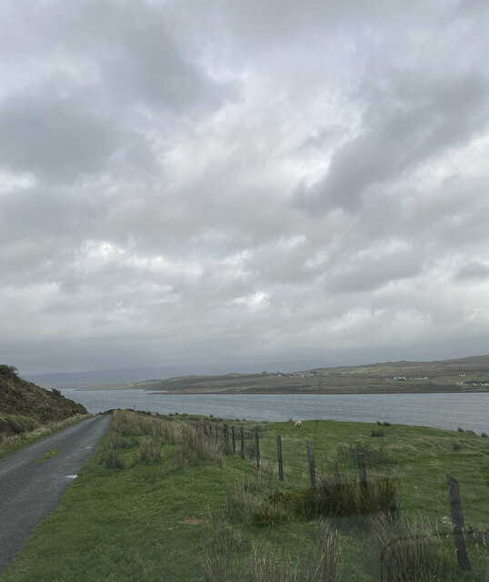
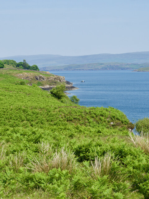
An Càrnach is a prominent coastal feature located in Inverness-shire, Scotland. It is a headland that extends out into the North Atlantic Ocean, forming a distinct point along the coastline. The name "An Càrnach" translates to "the rocky place" in Gaelic, which accurately reflects the rugged and rocky nature of the headland.

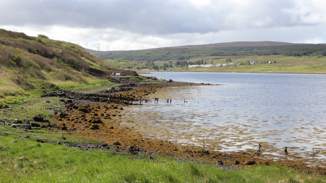
The headland is characterized by steep cliffs that rise dramatically from the sea, offering breathtaking views of the surrounding coastline and the vast ocean beyond. These cliffs are composed of various types of rock, including sandstone, granite, and shale, creating a visually striking and diverse landscape.

An Càrnach is a popular destination for nature enthusiasts and hikers, who are attracted to its unique geological features and stunning vistas. The headland is home to a rich variety of flora and fauna, including seabirds, marine mammals, and coastal plant species. It provides an important habitat for nesting seabirds, such as guillemots and kittiwakes, and serves as a breeding ground for seals.

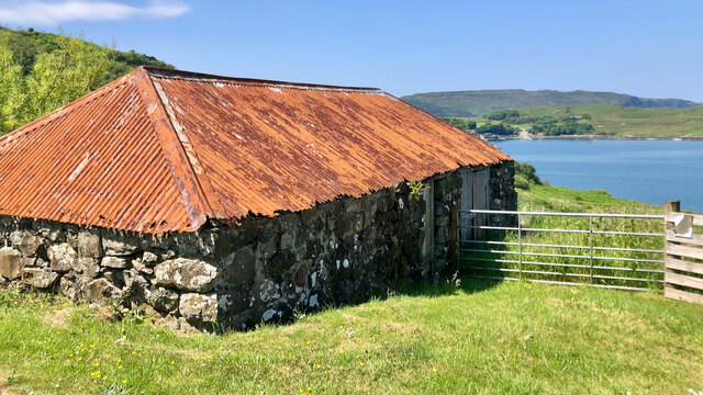
In addition to its natural beauty, An Càrnach also holds historical significance. The headland has been inhabited by humans for thousands of years, with archaeological evidence suggesting human activity dating back to the Bronze Age. Ruins of ancient settlements and stone structures can still be found on the headland, providing insights into the region's past.

Overall, An Càrnach is a remarkable coastal feature that offers a unique blend of natural beauty, geological diversity, and historical significance. It is a must-visit destination for those seeking to explore the rugged and scenic coastline of Inverness-shire.

If you have any feedback on the listing, please let us know in the comments section below.
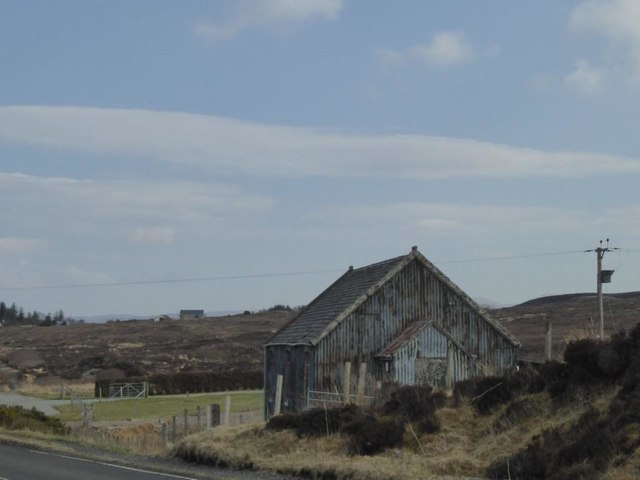
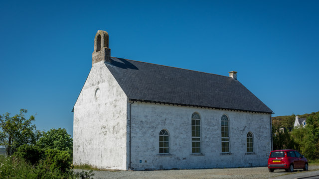
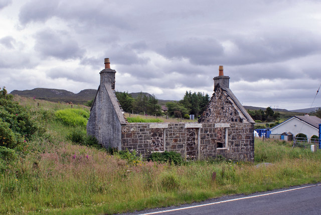
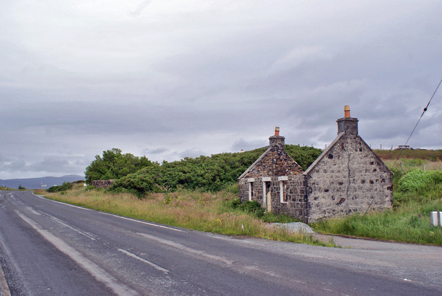
An Càrnach Images

Images are sourced within 2km of 57.493942/-6.4273343 or Grid Reference NG3453. Thanks to Geograph Open Source API. All images are credited.
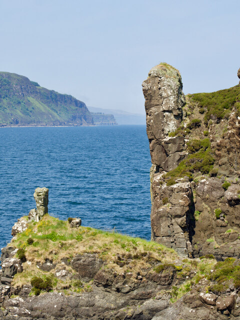
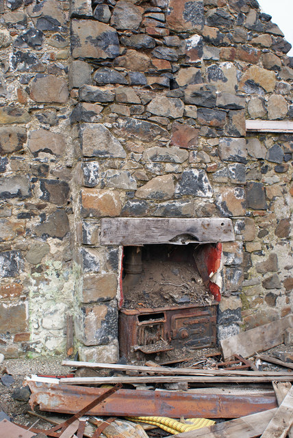
Loch Greshornish
Loch Greshornish
The magnificent bracken-infested coastline of Loch Greshornish
Boc na Caillich—“The old woman’s pimple” First stop after the day’s exertions was to the Ordnance Survey’s website, which has a lovely little page detailing the Gaelic origins of place names. ‘Boc’ turns out to be a buck or a ‘he-goat,’ likely referring to a billy goat. Therefore, Boc na Caillich, I suppose, can be interpreted as ‘the old woman’s billy goat.’

But …

The Scottish Government’s website ScotlandsPlaces has scans of the original surveyors’ notebooks used by the Ordnance Survey. For Boc na Caillich, the surveyor had written:—

<<This name applies to a Small Standing rock, and Signifies “The old woman’s pimple”:, Situated about 3/4 of a mile from “Dunbeg”>>

Mulling this over, it amuses me to entertain the notion that those mischievous Dunbeg crofters were having a jolly good laugh at the befuddlement of those Government officials. I can just picture their impish grins as they spun a yarn, convincingly claiming that "Boc na Caillich" actually pertains to a completely different region of a woman's anatomy altogether. And as for that hilariously prim and proper Victorian surveying brigade, it's no wonder they rendered it as "Pimple" in their records, utterly scandalised by the mere thought of anything remotely risque. Oh, the prudishness of those bygone days!

Adapted from my blog post <span class="nowrap"><a title="http://www.fhithich.uk/?p=32333" rel="nofollow ugc noopener" href="http://www.fhithich.uk/?p=32333">Link</a><img style="margin-left:2px;" alt="External link" title="External link - shift click to open in new window" src="https://s1.geograph.org.uk/img/external.png" width="10" height="10"/></span> which contains relevant sources.
Boc na Caillich—“The old woman’s pimple”
First stop after the day’s exertions was to the Ordnance Survey’s website, which has a lovely little page detailing the Gaelic origins of place names. ‘Boc’ turns out to be a buck or a ‘he-goat,’ likely referring to a billy goat. Therefore, Boc na Caillich, I suppose, can be interpreted as ‘the old woman’s billy goat.’ But … The Scottish Government’s website ScotlandsPlaces has scans of the original surveyors’ notebooks used by the Ordnance Survey. For Boc na Caillich, the surveyor had written:— <<This name applies to a Small Standing rock, and Signifies “The old woman’s pimple”:, Situated about 3/4 of a mile from “Dunbeg”>> Mulling this over, it amuses me to entertain the notion that those mischievous Dunbeg crofters were having a jolly good laugh at the befuddlement of those Government officials. I can just picture their impish grins as they spun a yarn, convincingly claiming that "Boc na Caillich" actually pertains to a completely different region of a woman's anatomy altogether. And as for that hilariously prim and proper Victorian surveying brigade, it's no wonder they rendered it as "Pimple" in their records, utterly scandalised by the mere thought of anything remotely risque. Oh, the prudishness of those bygone days! Adapted from my blog post LinkExternal link which contains relevant sources.
Stacdachan The Victorian surveyor&amp;#039;s notebook contains the following notes:

&amp;lt;&amp;lt;This name spplies to a high Standing rock, Signifying &amp;quot;The Pinnacle&amp;quot; Situated on the Coast 3/4 of a mile north west from Greshornish House.&amp;gt;&amp;gt;

Source: ‘OS1/16/7/111 | ScotlandsPlaces’. 2019. Scotlandsplaces.gov.uk &amp;lt;&lt;span class=&quot;nowrap&quot;&gt;&lt;a title=&quot;https://scotlandsplaces.gov.uk/digital-volumes/ordnance-survey-name-books/inverness-shire-os-name-books-1876-1878/inverness-shire-skye-volume-07/111&quot; rel=&quot;nofollow ugc noopener&quot; href=&quot;https://scotlandsplaces.gov.uk/digital-volumes/ordnance-survey-name-books/inverness-shire-os-name-books-1876-1878/inverness-shire-skye-volume-07/111&quot;&gt;Link&lt;/a&gt;&lt;img style=&quot;margin-left:2px;&quot; alt=&quot;External link&quot; title=&quot;External link - shift click to open in new window&quot; src=&quot;https://s1.geograph.org.uk/img/external.png&quot; width=&quot;10&quot; height=&quot;10&quot;/&gt;&lt;/span&gt; &amp;gt; [accessed 17 July 2023]
Stacdachan
The Victorian surveyor's notebook contains the following notes: <<This name spplies to a high Standing rock, Signifying "The Pinnacle" Situated on the Coast 3/4 of a mile north west from Greshornish House.>> Source: ‘OS1/16/7/111 | ScotlandsPlaces’. 2019. Scotlandsplaces.gov.uk <LinkExternal link > [accessed 17 July 2023]
A charming rust-roofed barn near Kildonan, with Loch Greshornish in the distance
This new seat on the bridge parapet is a brilliant design idea! Lovely view over the Braebost Burn on the old road turned cycle/walkway.
This new seat on the bridge parapet is a brilliant design idea!
Lovely view over the Braebost Burn on the old road turned cycle/walkway.
A sluggish Breabost Burn, right at that magnificent Spring high tide mark, and ... a Wellington boot!
Rainbow over Loch Greshornish  
The photograph was taken from the shore of the Loch from a caravan and camping site at Borve.

See also this rainbow photograph by Norrie Adamson:- &lt;a href=&quot;https://www.geograph.org.uk/photo/109341&quot;&gt;NG3452 : Loch Greshornish, Skye&lt;/a&gt;.
Rainbow over Loch Greshornish
  The photograph was taken from the shore of the Loch from a caravan and camping site at Borve. See also this rainbow photograph by Norrie Adamson:- NG3452 : Loch Greshornish, Skye.
Old walls and fence at Loch Greshornish  
The photograph was taken from the eastern shore of the loch on the southern edge of a caravan and camping site at Borve.

The hamlet in the distance is Coishletter and the summit above the trees beyond is Mullach Ben Sca.

The wind turbines are part of Edinbane Wind Farm.
Old walls and fence at Loch Greshornish
  The photograph was taken from the eastern shore of the loch on the southern edge of a caravan and camping site at Borve. The hamlet in the distance is Coishletter and the summit above the trees beyond is Mullach Ben Sca. The wind turbines are part of Edinbane Wind Farm.
Mission Church at Borve, Arnisort When I lived at the nearby Borve Cottage in the early 1990s, this tin clad meeting house was in regular use.    It now appears to be disused and in disrepair.
Mission Church at Borve, Arnisort
When I lived at the nearby Borve Cottage in the early 1990s, this tin clad meeting house was in regular use. It now appears to be disused and in disrepair.
Arnisort Kirk
Arnisort Kirk
Derelict cottage in Flashader Until recently, this long-uninhabited roadside cottage was roofed and had windows and door. When builders turned up, I had thought that restoration was underway, but it now looks like the cottage is to be left derelict.
Other views: &lt;a href=&quot;https://www.geograph.org.uk/photo/6199938&quot;&gt;NG3553 : Derelict cottage, Flashader&lt;/a&gt;, &lt;a href=&quot;https://www.geograph.org.uk/photo/6199944&quot;&gt;NG3553 : Cooking range in derelict cottage&lt;/a&gt;.
Derelict cottage in Flashader
Until recently, this long-uninhabited roadside cottage was roofed and had windows and door. When builders turned up, I had thought that restoration was underway, but it now looks like the cottage is to be left derelict. Other views: NG3553 : Derelict cottage, Flashader, NG3553 : Cooking range in derelict cottage.
Derelict cottage, Flashader Another view of the small and now roofless cottage in Flashader.
The road is the A850.
See also: &lt;a href=&quot;https://www.geograph.org.uk/photo/6199935&quot;&gt;NG3553 : Derelict cottage in Flashader&lt;/a&gt; and &lt;a href=&quot;https://www.geograph.org.uk/photo/6199944&quot;&gt;NG3553 : Cooking range in derelict cottage&lt;/a&gt;.
Derelict cottage, Flashader
Another view of the small and now roofless cottage in Flashader. The road is the A850. See also: NG3553 : Derelict cottage in Flashader and NG3553 : Cooking range in derelict cottage.
Cooking range in derelict cottage Detail of the interior of a derelict cottage in Flashader (see also &lt;a href=&quot;https://www.geograph.org.uk/photo/6199935&quot;&gt;NG3553 : Derelict cottage in Flashader&lt;/a&gt;). 
The tiny cottage had two fireplaces - this one housing a cast iron range.
Cooking range in derelict cottage
Detail of the interior of a derelict cottage in Flashader (see also NG3553 : Derelict cottage in Flashader). The tiny cottage had two fireplaces - this one housing a cast iron range.
Former road to Edinbane This section of former single track road provides a traffic-free pedestrian and cycle path for a short distance to the east of Flashader. 
The modern two-way A850 runs almost parallel.
Former road to Edinbane
This section of former single track road provides a traffic-free pedestrian and cycle path for a short distance to the east of Flashader. The modern two-way A850 runs almost parallel.
Bay on the east side of Loch Diubaig
Track to Lòn na Stapaig The track ends at a boathouse.
Track to Lòn na Stapaig
The track ends at a boathouse.
Towards Loch Greshornish Looking south east from a track to a boathouse in Lòn na Stapaig.
Towards Loch Greshornish
Looking south east from a track to a boathouse in Lòn na Stapaig.
Show me another place!

An Càrnach is located at Grid Ref: NG3453 (Lat: 57.493942, Lng: -6.4273343)

Unitary Authority: Highland

Police Authority: Highlands and Islands

What 3 Words

///nags.visitors.stand. Near Dunvegan, Highland

Nearby Locations

An Càrnach

Related Wikis

Flashader

Flashader (Scottish Gaelic: Flaiseader) is a small crofting township close to the east coast of the sea loch Loch Greshornish on the Isle of Skye. It is...

A850 road

The A850 road is a road in the Scottish Isles, off the west coast of mainland Scotland. == Road function == It is one of the principal roads of the Isle...

Edinbane

Edinbane (Scottish Gaelic: An t-Aodann Bàn the fair hill-face) is a small village on the island of Skye, Scotland. == Location == Edinbane lies on the...

Suladale

Suladale or Suledale (Scottish Gaelic: Sùladal) is a small mixed crofting hamlet of fewer than a dozen houses, located near Edinbane, on the north of...

Treaslane

Treaslane (Scottish Gaelic: Triaslann) is a small remote scattered crofting hamlet on the Isle of Skye, Scotland. It overlooks the western entrance to...

Kingsburgh, Skye

Kingsburgh (Gaelic: Cinnseaborgh) is a scattered crofting township, overlooking Loch Snizort Beag on the Trotternish peninsula of the Isle of Skye in...

Snizort

Snizort (Scottish Gaelic: Snìosort) is an area of the Isle of Skye comprising the head of Loch Snizort and the western coast of Trotternish up to Uig,...

Bernisdale

Bernisdale (Scottish Gaelic: Beàrnasdal) is a small township, near the head of Loch Snizort Beag, Isle of Skye in the Highlands and Islands and is in the...

Nearby Amenities

Located within 500m of 57.493942,-6.4273343
Created By: dmgroom_coastlines
Source: PGS
Lat/Long: 57.49786/-6.42391
Created By: dmgroom_coastlines
Source: PGS
Lat/Long: 57.49776/-6.42535
Created By: dmgroom_coastlines
Source: PGS
Lat/Long: 57.49725/-6.42562
Created By: dmgroom_coastlines
Source: PGS
Lat/Long: 57.49675/-6.42589
Created By: dmgroom_coastlines
Source: PGS
Lat/Long: 57.49677/-6.42684
Created By: dmgroom_coastlines
Source: PGS
Lat/Long: 57.496/-6.4269
Created By: dmgroom_coastlines
Source: PGS
Lat/Long: 57.49602/-6.42785
Created By: dmgroom_coastlines
Source: PGS
Lat/Long: 57.495/-6.42816
Created By: dmgroom_coastlines
Source: PGS
Lat/Long: 57.49451/-6.42867
Created By: dmgroom_coastlines
Source: PGS
Lat/Long: 57.49399/-6.42894
Created By: dmgroom_coastlines
Source: PGS
Lat/Long: 57.49388/-6.4299
Created By: dmgroom_coastlines
Source: PGS
Lat/Long: 57.49376/-6.43038
Created By: dmgroom_coastlines
Source: PGS
Lat/Long: 57.493/-6.43043
Created By: dmgroom_coastlines
Source: PGS
Lat/Long: 57.49313/-6.4309
Created By: dmgroom_coastlines
Source: PGS
Lat/Long: 57.49318/-6.43328
Created By: dmgroom_coastlines
Source: PGS
Lat/Long: 57.49308/-6.43471
Created By: dmgroom_coastlines
Source: PGS
Lat/Long: 57.49206/-6.43478
Bus Stop
Kildonan (Skye)
Naptan AtcoCode: 670030009
Naptan Bearing: NE
Naptan CommonName: Kildonan (Skye)
Naptan Indicator: Kildonan Road End
Naptan Landmark: Kildonan Road End
Naptan NaptanCode: 45323852
Naptan Street: A850
Naptan Verified: no
Source: naptan_import
Lat/Long: 57.4930117/-6.4208811
Bus Stop
Arnisort Church
Bench: no
Naptan AtcoCode: 670030010
Naptan Bearing: N
Naptan CommonName: Arnisort Church
Naptan Indicator: o/s Arnisort Church
Naptan Landmark: Arnisort Church
Naptan NaptanCode: 45325262
Naptan Street: A850
Shelter: no
Source: naptan_import
Lat/Long: 57.4901462/-6.425753
Bus Stop
Arnisort Church
Bench: no
Naptan AtcoCode: 670030010A
Naptan Bearing: S
Naptan CommonName: Arnisort Church
Naptan Indicator: opp Arnisort Church
Naptan Landmark: Arnisort Church
Naptan NaptanCode: 45325259
Naptan Street: A850
Shelter: no
Source: naptan_import
Lat/Long: 57.4901259/-6.4256182
Bus Stop
Kildonan (Skye)
Naptan AtcoCode: 6700713430A
Naptan Bearing: SW
Naptan CommonName: Kildonan (Skye)
Naptan Indicator: opp Road End
Naptan Landmark: Road End
Naptan NaptanCode: 45329624
Naptan Street: A850
Naptan Verified: no
Source: naptan_import
Lat/Long: 57.4929512/-6.4205564
Flashader
Name En: Flashader
Name Gd: Flaiseadar
Place: hamlet
Wikidata: Q5457575
Wikipedia: en:Flashader
Lat/Long: 57.490586/-6.4254812
Arnisort
Place: hamlet
Source: OSODSV
Lat/Long: 57.4910022/-6.4266474
Removed Amenity: telephone
Source: survey
Lat/Long: 57.4915216/-6.4230299
Post Box
Ref: IV51 15
Source: survey
Lat/Long: 57.4940642/-6.4214036
The data included in this document is from www.openstreetmap.org. The data is made available under ODbL.

Have you been to An Càrnach?

Leave your review of An Càrnach below (or comments, questions and feedback).