Àird a' Chaoil
Coastal Feature, Headland, Point in Ross-shire
Scotland
Àird a' Chaoil
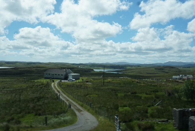
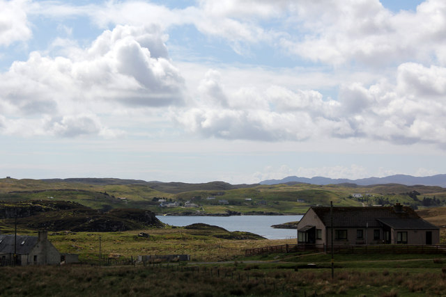
Àird a' Chaoil is a striking coastal feature located in Ross-shire, Scotland. This prominent headland, also known as The Point, juts out into the North Atlantic Ocean, offering breathtaking views and a rich natural environment.
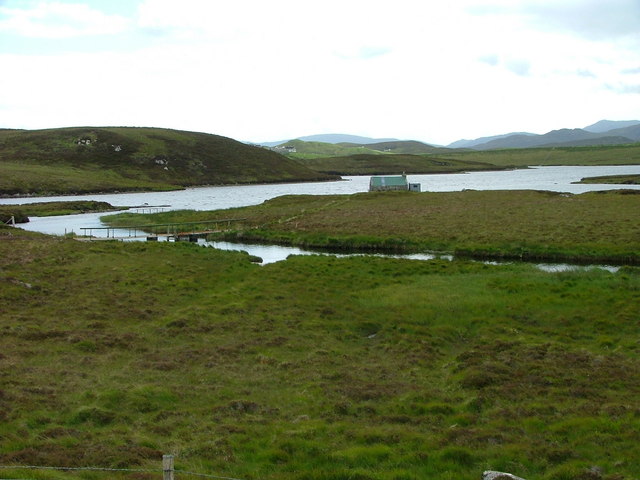
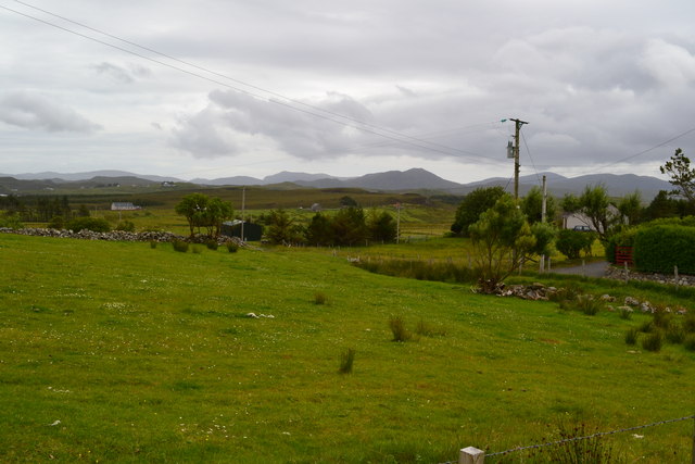
Situated on the northwest coast of Scotland, Àird a' Chaoil is characterized by rugged cliffs that rise dramatically from the sea. These cliffs, composed of ancient rocks, display layers of sedimentary formations, providing geologists with valuable insights into the region's geological history. The headland is also blessed with an abundance of marine life, making it a haven for birdwatchers and nature enthusiasts.
From its elevated position, Àird a' Chaoil offers panoramic vistas of the surrounding landscape. On clear days, visitors can enjoy stunning views across the Atlantic Ocean, with the Outer Hebrides visible in the distance. The headland is often buffeted by strong winds, giving it an exhilarating and untamed atmosphere.
The coastal area around Àird a' Chaoil is also steeped in history. The remnants of an Iron Age fort can still be seen on the headland, providing a glimpse into the ancient cultures that once thrived in this area. Additionally, there are several archaeological sites nearby, including burial mounds and standing stones, which further highlight the historical significance of the region.
For outdoor enthusiasts, Àird a' Chaoil offers a range of activities. Hiking trails along the cliffs provide an opportunity to explore the rugged beauty of the headland, while the nearby beaches offer a chance to relax and enjoy the pristine coastal scenery.
Overall, Àird a' Chaoil is an awe-inspiring coastal feature that combines stunning natural beauty, rich history, and abundant wildlife. It is a must-visit destination for those seeking an authentic and unforgettable Scottish coastal experience.
If you have any feedback on the listing, please let us know in the comments section below.
Àird a' Chaoil Images
Images are sourced within 2km of 58.099006/-6.5284052 or Grid Reference NB3321. Thanks to Geograph Open Source API. All images are credited.
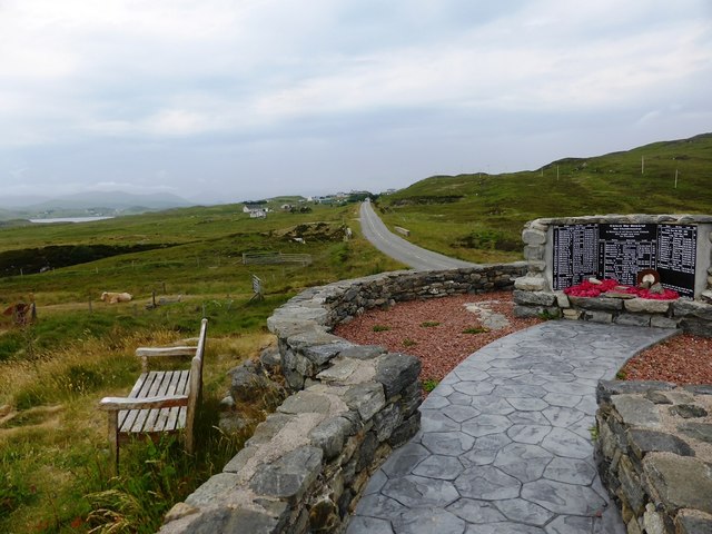
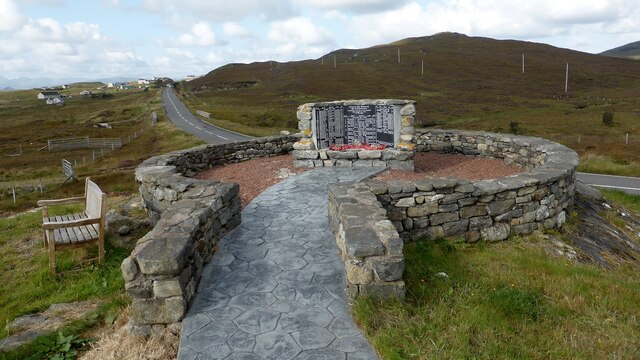
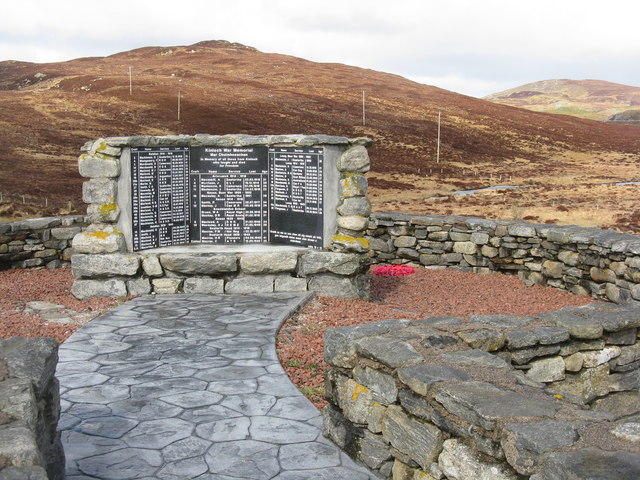
![Kinloch War Memorial 'In memory of all those from Kinloch who fought and died for Freedom'
A list of 54 men and women, aged from 15 - 46, who were lost in the Boer War [2], WW1 [41] and ww2 [11], and the crofts they came from.
The hill beyond is Nabhar.](https://s2.geograph.org.uk/geophotos/05/11/70/5117046_0f95619f.jpg)

Àird a' Chaoil is located at Grid Ref: NB3321 (Lat: 58.099006, Lng: -6.5284052)
Unitary Authority: Na h-Eileanan an Iar
Police Authority: Highlands and Islands
What 3 Words
///quote.guideline.bandstand. Near Leurbost, Na h-Eileanan Siar
Nearby Locations
Related Wikis

Loch Erisort
Loch Erisort (Scottish Gaelic: Èireasort) is an 8-mile-long narrow sea inlet on the east coast of the Isle of Lewis in the Outer Hebrides off the west...

Cabharstadh
Cabharstadh or Caversta (Scottish Gaelic: Cabharstaigh) is a village on the Isle of Lewis in the Outer Hebrides, Scotland. Caversta is situated in the...

Balallan
Balallan (Scottish Gaelic: Baile Ailein, Bail' Ailein), meaning "Allan's Town", is a crofting township on the Isle of Lewis, in the Outer Hebrides, Scotland...
Eilean Chaluim Chille
Eilean Chaluim Chille (Gaelic: island of Saint Columba, Calum Cille) is an unpopulated island in the Outer Hebrides. It lies off the east coast of Lewis...

Leurbost
Leurbost (Scottish Gaelic: Liùrbost) is a village on the east coast of the Isle of Lewis in the Outer Hebrides of Scotland. It is approximately 6 miles...
Crossbost
Crossbost is a village on the Isle of Lewis in the parish of North Lochs, in the Outer Hebrides, Scotland. It is located approximately ten miles away...
North Lochs
North Lochs, (Scottish Gaelic: Ceann a Tuath nan Loch), an area in eastern Lewis, Outer Hebrides, Scotland, is named for the many lochans (small lochs...

Cromore
Cromore (Scottish Gaelic: Crò Mòr) is a crofting township on the Isle of Lewis in the district of Pairc, in the Outer Hebrides, Scotland. The settlement...
Nearby Amenities
Located within 500m of 58.099006,-6.5284052Have you been to Àird a' Chaoil?
Leave your review of Àird a' Chaoil below (or comments, questions and feedback).