Sloc an Luirin

Coastal Feature, Headland, Point in Argyllshire

Scotland

Sloc an Luirin

Torran Cottage On Iona.
Torran Cottage Credit: Andrew Abbott

Sloc an Luirin is a prominent coastal feature located in Argyllshire, Scotland. It is classified as a headland, or a narrow piece of land that juts out into the sea, forming a point. The name "Sloc an Luirin" translates to "the gullet of the small sea," reflecting its unique geographical formation.

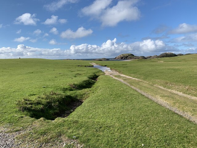
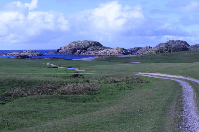
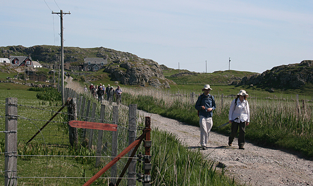
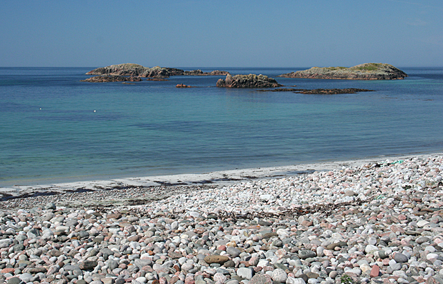
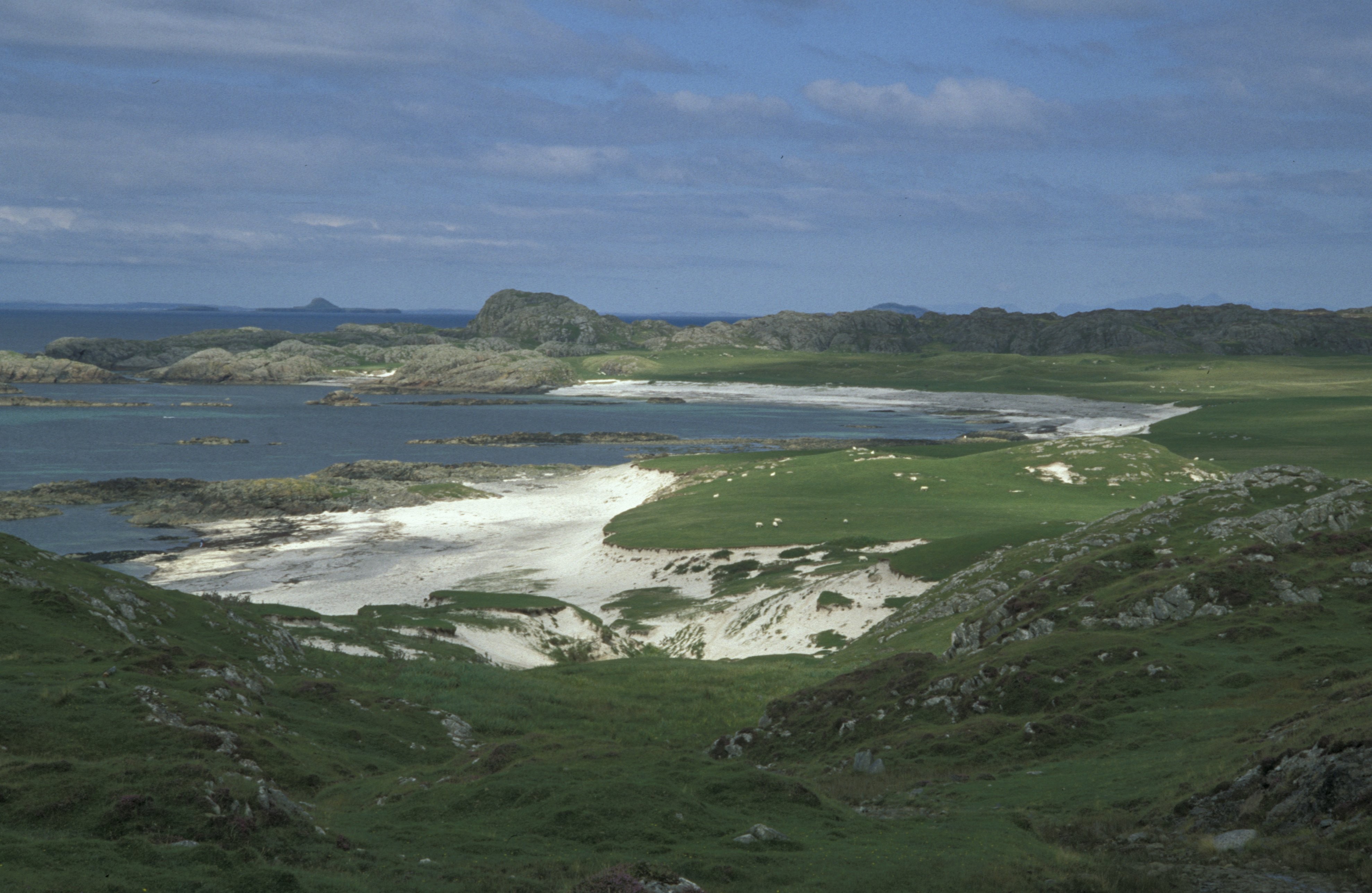
Situated along the picturesque coastline, Sloc an Luirin offers breathtaking views of the surrounding landscape. The headland is characterized by steep cliffs that rise dramatically from the water, creating a stunning natural spectacle. These cliffs are composed of rugged rock formations, showcasing the area's geological diversity.

The headland also provides a habitat for a variety of wildlife species, making it an excellent spot for nature enthusiasts. Seabirds such as gannets, cormorants, and puffins can often be spotted nesting along the cliffs, while seals and dolphins occasionally visit the waters surrounding Sloc an Luirin.

In addition to its natural beauty, Sloc an Luirin holds historical significance. It is believed to have been used as a lookout point during ancient times, serving as a vantage point for monitoring the coasts and spotting potential threats. The headland's strategic location also played a role in maritime navigation, with sailors using it as a landmark for centuries.

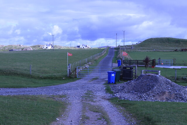
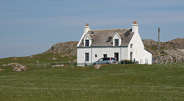
Today, Sloc an Luirin attracts visitors from near and far who come to admire its stunning scenery and explore the surrounding coastal area. Whether it is enjoying a leisurely walk along the cliffs, birdwatching, or simply soaking in the tranquility of the Scottish coast, Sloc an Luirin offers a memorable experience for nature lovers and history enthusiasts alike.

If you have any feedback on the listing, please let us know in the comments section below.

Sloc an Luirin Images

Images are sourced within 2km of 56.311173/-6.4140478 or Grid Reference NM2721. Thanks to Geograph Open Source API. All images are credited.

Torran Cottage On Iona.
Torran Cottage
On Iona.
Iona Golf Course On the western side of the island.
Iona Golf Course
On the western side of the island.
Towards Iona Golf Course From Skerryvore.
Towards Iona Golf Course
From Skerryvore.
Gateway by Skerryvore Leading to Iona Golf Course.
Gateway by Skerryvore
Leading to Iona Golf Course.
Machair house On Iona
Machair house
On Iona
Road in Sligneach On Iona.
Road in Sligneach
On Iona.
Seileastair House On Iona.
Seileastair House
On Iona.
Sandbank on Iona By Mary Foster Arnold Architects.
Sandbank on Iona
By Mary Foster Arnold Architects.
Low springs links Tràigh Mhòr and Eilean Mòr Even at high tide there's some land in this square, but near the bottom of a spring tide, the weed covered rocks are quite extensive and there is no difficulty in being far enough inside the square teo be sure of a point. The low tides, however, mean that the series of cruise ships visiting Iona have been anchoring quite a way south of the jetty, and sending their inmates ashore by long trips on RIBs. There's one there now, but so far south that it is out of shot. This one seems to send them ahsore in identical red waterproofs so that, milling around ashore, they are instantly identifiable as temporary refugees from the prison hulk offshore...
Low springs links Tràigh Mhòr and Eilean Mòr
Even at high tide there's some land in this square, but near the bottom of a spring tide, the weed covered rocks are quite extensive and there is no difficulty in being far enough inside the square teo be sure of a point. The low tides, however, mean that the series of cruise ships visiting Iona have been anchoring quite a way south of the jetty, and sending their inmates ashore by long trips on RIBs. There's one there now, but so far south that it is out of shot. This one seems to send them ahsore in identical red waterproofs so that, milling around ashore, they are instantly identifiable as temporary refugees from the prison hulk offshore...
Dropping down to Tràigh Mhòr There's just a tiny fraction of Iona that isn't under the cosh of the National Trust for Scotland, and this is part of it. The result, however, is that it is well fenced off from the NTS domains, which are a little inaccessible to anyone who has visited this corner to get the Tràigh Mhòr bit of land in NM2824. The solution was to return to the beach via this descent and walk all the way back round to the road.
Dropping down to Tràigh Mhòr
There's just a tiny fraction of Iona that isn't under the cosh of the National Trust for Scotland, and this is part of it. The result, however, is that it is well fenced off from the NTS domains, which are a little inaccessible to anyone who has visited this corner to get the Tràigh Mhòr bit of land in NM2824. The solution was to return to the beach via this descent and walk all the way back round to the road.
Cairn at Tràigh Mhòr A small part of Iona free of the National Trust for Scotland, above Tràigh Mhòr this little grassy peninsula south of Sligneach sports a jolly cairn and looks as though it has been used as a picnic spot.
Cairn at Tràigh Mhòr
A small part of Iona free of the National Trust for Scotland, above Tràigh Mhòr this little grassy peninsula south of Sligneach sports a jolly cairn and looks as though it has been used as a picnic spot.
Sound of Iona Looking SSE from Dun I, at 101 metres the highest point on Iona, over the Sound of Iona towards Mull with, in the centre, Iona Abbey and directly above it  the Paps of Jura 35 miles away. The island to the right off Mull is Erraid which features prominently in 'Kidnapped' where David Balfour was wrecked at Traigh Geal and thought himself marooned till he found that a strand on its east coast dries out over low tide and you can walk across to Mull. Stevenson is believed to have written 'Kidnapped' whilst staying at a cottage on the island.
Sound of Iona
Looking SSE from Dun I, at 101 metres the highest point on Iona, over the Sound of Iona towards Mull with, in the centre, Iona Abbey and directly above it the Paps of Jura 35 miles away. The island to the right off Mull is Erraid which features prominently in 'Kidnapped' where David Balfour was wrecked at Traigh Geal and thought himself marooned till he found that a strand on its east coast dries out over low tide and you can walk across to Mull. Stevenson is believed to have written 'Kidnapped' whilst staying at a cottage on the island.
Old Marble Quarry, Iona The old cutting rig and gas engine can be seen in picture.
Old Marble Quarry, Iona
The old cutting rig and gas engine can be seen in picture.
Walking on Iona Visitors are not permitted to take their cars on to the Island, so the only way to get around is to walk or cycle. This is the route from the pier to the beaches on the west coast of the island.
Walking on Iona
Visitors are not permitted to take their cars on to the Island, so the only way to get around is to walk or cycle. This is the route from the pier to the beaches on the west coast of the island.
Cnoc nam Bradain If I believe the Gaelic dictionary, the name of this place means 'salmon knoll'. It is a typical Hebridean house, standing on the machair by the track across the island.
Cnoc nam Bradain
If I believe the Gaelic dictionary, the name of this place means 'salmon knoll'. It is a typical Hebridean house, standing on the machair by the track across the island.
Camas Cùil an t-Saimh This is the main beach on the west coast of Iona, and an easy one to get to. Its name apparently means either 'sorrel back beach' or 'bad smell back beach', according to the Gaelic dictionary, but there was no evidence for the latter today.
Camas Cùil an t-Saimh
This is the main beach on the west coast of Iona, and an easy one to get to. Its name apparently means either 'sorrel back beach' or 'bad smell back beach', according to the Gaelic dictionary, but there was no evidence for the latter today.
Iona Group The rocks in the foreground belong to the Iona Group, which is of Proterozoic age, like the Torridonian sandstones further north. The beds have been shattered and deformed so that they are now almost vertical, possibly by events associated with a fault that runs along the Sound of Iona. The ship anchored in the Sound is the Silver Discovery.
Iona Group
The rocks in the foreground belong to the Iona Group, which is of Proterozoic age, like the Torridonian sandstones further north. The beds have been shattered and deformed so that they are now almost vertical, possibly by events associated with a fault that runs along the Sound of Iona. The ship anchored in the Sound is the Silver Discovery.
Vertical Strata These rocks were deposited in horizontal beds, but subsequent earth movements have turned them through 90º so they are now vertical.
Vertical Strata
These rocks were deposited in horizontal beds, but subsequent earth movements have turned them through 90º so they are now vertical.
Show me another place!

Sloc an Luirin is located at Grid Ref: NM2721 (Lat: 56.311173, Lng: -6.4140478)

Unitary Authority: Argyll and Bute

Police Authority: Argyll and West Dunbartonshire

What 3 Words

///squabbles.lavished.rehearsal. Near Fionnphort, Argyll & Bute

Nearby Locations

Sloc an Luirin

Related Wikis

Bay at the Back of the Ocean

The Bay at the Back of the Ocean (Scottish Gaelic: Camas Cuil an t-Saimh) is a wide, west facing bay on the island of Iona, Argyll and Bute, Scotland,...

Iona

Iona (; Scottish Gaelic: Ì Chaluim Chille [ˈiː ˈxal̪ˠɪm ˈçiʎə] , sometimes simply Ì) is a small island in the Inner Hebrides, off the Ross of Mull on the...

Sound of Iona

The Sound of Iona is a sound between the Inner Hebridean islands of Mull and Iona in western Scotland. It forms part of the Atlantic Ocean. The tidal...

Bishop's House, Iona

Bishop's House is a retreat house for the Scottish Episcopal Church, located on the island of Iona, off the west coast of Scotland. == History == It was...

Iona Abbey

Iona Abbey is an abbey located on the island of Iona, just off the Isle of Mull on the West Coast of Scotland. It is one of the oldest Christian religious...

St Oran's Chapel

St Oran's Chapel (Odhráin/Orain/Odran) is a medieval chapel located on the island of Iona in the Inner Hebrides off the west coast of Scotland. Built in...

Fionnphort

Fionnphort (English: , Scottish Gaelic: [ˈfjun̪ˠafɔrˠt̪]) is the principal port of the Ross of Mull, and the second largest settlement in the area (its...

Erraid

Erraid (Scottish Gaelic: Eilean Earraid) is a tidal island approximately one mile (two kilometres) square located in the Inner Hebrides of Scotland. It...

Nearby Amenities

Located within 500m of 56.311173,-6.4140478
Marble Quarry (Dis.)
Historic: archaeological_site
Lat/Long: 56.3100198/-6.4180497
Druim Dhughaill
Ele: 76
Natural: peak
Lat/Long: 56.3146581/-6.4116409
The data included in this document is from www.openstreetmap.org. The data is made available under ODbL.

Have you been to Sloc an Luirin?

Leave your review of Sloc an Luirin below (or comments, questions and feedback).