Rubh' a' Bhinnein

Coastal Feature, Headland, Point in Argyllshire

Scotland

Rubh' a' Bhinnein

New house at Cloiche Farm Built in a typical Tiree style with pitch roofs the house has all modern conveniences, including a poly-tunnel and solar panels.
New house at Cloiche Farm Credit: Alpin Stewart

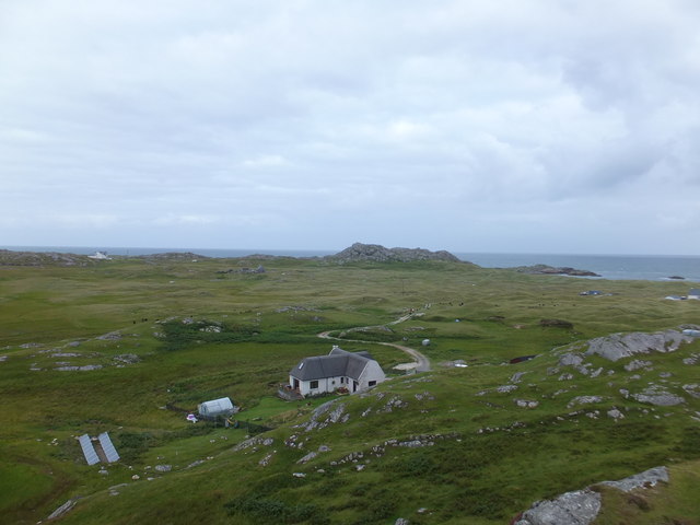
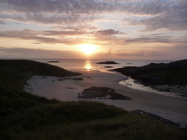
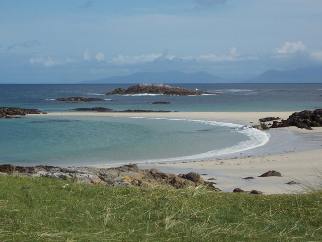
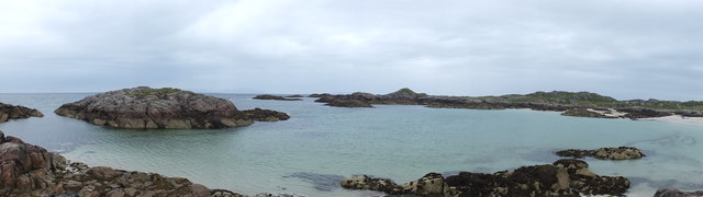
Rubh' a' Bhinnein is a prominent headland located in Argyllshire on the western coast of Scotland. Situated on the Sound of Mull, it offers breathtaking panoramic views of the surrounding landscape and is a popular destination for nature enthusiasts and hikers alike.

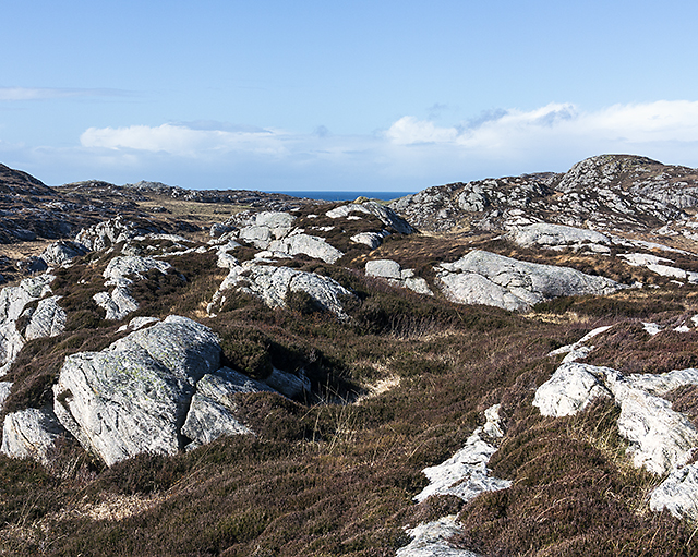
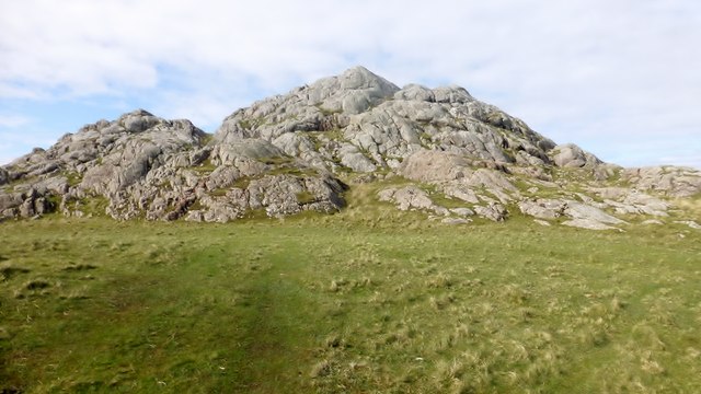
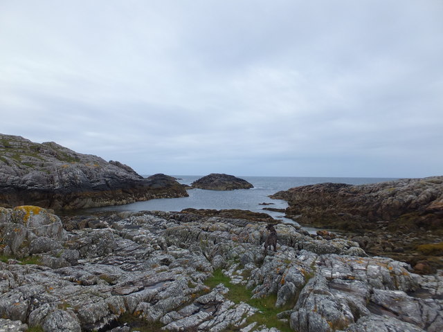
The headland is characterized by its rugged cliffs, which rise dramatically from the sea, providing a dramatic backdrop against the crashing waves. The cliffs are composed of ancient rocks, displaying various geological formations, and are home to a diverse range of seabirds, including kittiwakes, guillemots, and razorbills.

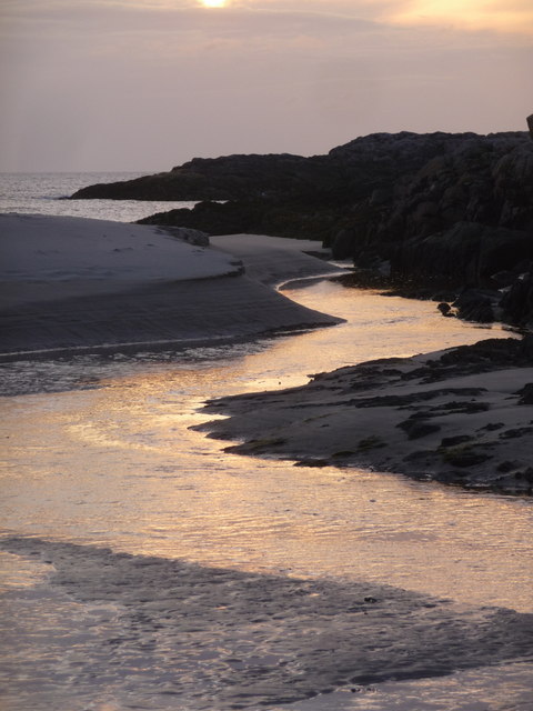
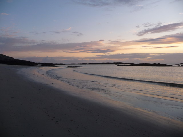
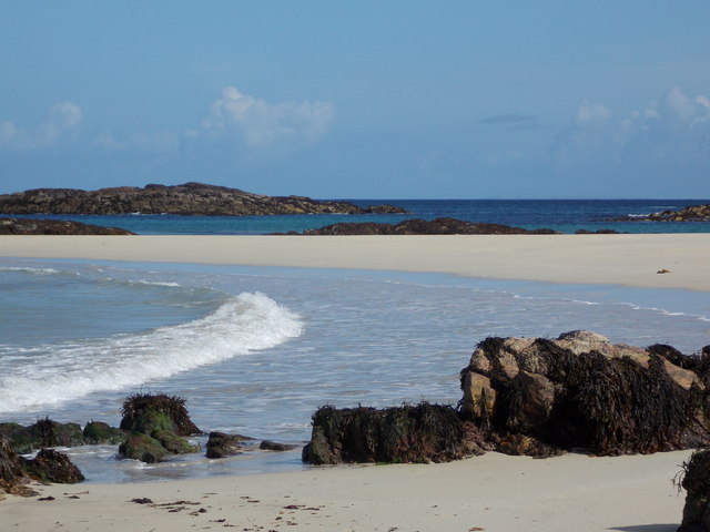
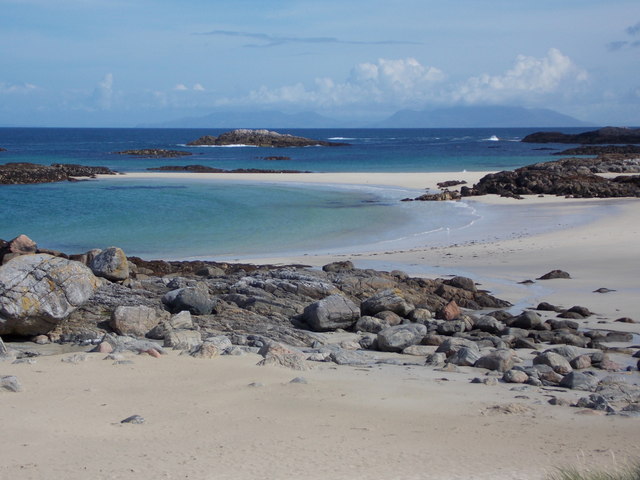
At the tip of Rubh' a' Bhinnein, there is a small rocky outcrop that marks the point where the headland meets the sea. This natural feature is a haven for marine life, with seals often seen basking on the rocks and dolphins occasionally spotted frolicking in the water. The area is also known for its rich marine biodiversity, with kelp forests and thriving underwater ecosystems.

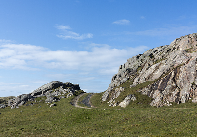
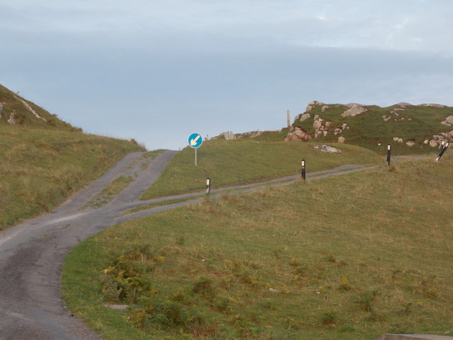
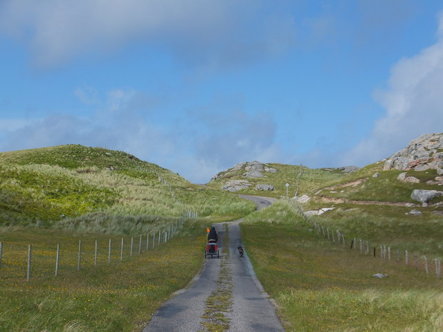
Access to Rubh' a' Bhinnein is relatively easy, with a well-maintained coastal path leading to the headland. The path offers stunning views along the way, passing through heather-covered moorland and offering glimpses of nearby islands, such as Mull and Iona.

Visitors to Rubh' a' Bhinnein can enjoy a range of activities, including hiking, birdwatching, and photography. The headland provides a peaceful and serene escape from the hustle and bustle of everyday life, allowing visitors to immerse themselves in the natural beauty of the Scottish coastline.

If you have any feedback on the listing, please let us know in the comments section below.

Rubh' a' Bhinnein Images

Images are sourced within 2km of 56.675493/-6.5334575 or Grid Reference NM2262. Thanks to Geograph Open Source API. All images are credited.

New house at Cloiche Farm Built in a typical Tiree style with pitch roofs the house has all modern conveniences, including a poly-tunnel and solar panels.
New house at Cloiche Farm
Built in a typical Tiree style with pitch roofs the house has all modern conveniences, including a poly-tunnel and solar panels.
Burial Ground and dunes at Torastan
Moorland north of Loch a' Mhill Aird Rough ground situated to the north of Loch a' Mhill Aird on northern Coll.
Moorland north of Loch a' Mhill Aird
Rough ground situated to the north of Loch a' Mhill Aird on northern Coll.
Track at Torastan A track leading from the B8072 road on Coll to Torastan. As in many places on Coll, the bedrock outcrops here. This is composed of the Scourian Gneisses - Metagranodiorite and Gneissose. these metamorphic rocks were formed approximately 2500 to 4000 million years ago.

Reference: geology of Britain Viewer: <span class="nowrap"><a title="http://www.bgs.ac.uk/discoveringGeology/geologyOfBritain/viewer.html" rel="nofollow ugc noopener" href="http://www.bgs.ac.uk/discoveringGeology/geologyOfBritain/viewer.html">Link</a><img style="margin-left:2px;" alt="External link" title="External link - shift click to open in new window" src="https://s1.geograph.org.uk/img/external.png" width="10" height="10"/></span>
Track at Torastan
A track leading from the B8072 road on Coll to Torastan. As in many places on Coll, the bedrock outcrops here. This is composed of the Scourian Gneisses - Metagranodiorite and Gneissose. these metamorphic rocks were formed approximately 2500 to 4000 million years ago. Reference: geology of Britain Viewer: LinkExternal link
A' Chròic A short scramble is required to gain this rocky summit.

Name: A' Chròic
Hill number: 10525
Height: 43m / 141ft
Parent (Ma/M): none
Area: 17F: Coll and Tiree
Class: 0
Grid ref: NM 22957 62779
Summit feature: rock outcrop
Drop: 30m
Col: 13m  NM229626
A' Chròic
A short scramble is required to gain this rocky summit. Name: A' Chròic Hill number: 10525 Height: 43m / 141ft Parent (Ma/M): none Area: 17F: Coll and Tiree Class: 0 Grid ref: NM 22957 62779 Summit feature: rock outcrop Drop: 30m Col: 13m NM229626
Isle of Coll: sunset over Tràigh Gharbh Below us, a substantial but apparently unnamed stream winds its way into the sea at an impressive sandy beach.
Isle of Coll: sunset over Tràigh Gharbh
Below us, a substantial but apparently unnamed stream winds its way into the sea at an impressive sandy beach.
Isle of Coll: an unnamed stream reaches the sea Looking along the final stretch of an unnamed but fairly substantial river as it nears its journey's end.
Isle of Coll: an unnamed stream reaches the sea
Looking along the final stretch of an unnamed but fairly substantial river as it nears its journey's end.
Isle of Coll: Tràigh Gharbh Looking along this fine sandy beach, with accompanying rocks both onshore and offshore, at dusk.
Isle of Coll: Tràigh Gharbh
Looking along this fine sandy beach, with accompanying rocks both onshore and offshore, at dusk.
Isle of Coll: dual carriageway on the B8072 A small section of 'dual carriageway' on this narrow road with passing places heading to the north of the island. The back of the corresponding sign for oncoming traffic can also be seen.
Isle of Coll: dual carriageway on the B8072
A small section of 'dual carriageway' on this narrow road with passing places heading to the north of the island. The back of the corresponding sign for oncoming traffic can also be seen.
Isle of Coll: arriving at Torastan beach The track leads to the top of the narrow strip of dunes, bringing us out onto this view across a superb sandy bay, separated from the next bay by a sand-bar which is almost a mini-tombolo. The isle of Rum looms large on the horizon.
Isle of Coll: arriving at Torastan beach
The track leads to the top of the narrow strip of dunes, bringing us out onto this view across a superb sandy bay, separated from the next bay by a sand-bar which is almost a mini-tombolo. The isle of Rum looms large on the horizon.
Isle of Coll: a wave breaks at Torastan beach Looking across a few low rocks along Torastan beach. The sand-bar ahead connects to a couple of outlying rocks which are separate at low tide.
Isle of Coll: a wave breaks at Torastan beach
Looking across a few low rocks along Torastan beach. The sand-bar ahead connects to a couple of outlying rocks which are separate at low tide.
Isle of Coll: rocks to the west of Torastan beach Looking across the bay from the western edge. The Isle of Rum looms large in the distance.
Isle of Coll: rocks to the west of Torastan beach
Looking across the bay from the western edge. The Isle of Rum looms large in the distance.
With bike and dog on Coll
Rocky inlet below A' Chroic, Isle of Coll
Bay and islands north of Cloiche, Isle of Coll
Coll - Killunaig - Grave enclosure To the west of the B8072 at a location called Killunaig (Cill Ionnaig) there is an old burial ground and the remains of a church. This grave with surrounding metal enclosure is near to the gate.
Coll - Killunaig - Grave enclosure
To the west of the B8072 at a location called Killunaig (Cill Ionnaig) there is an old burial ground and the remains of a church. This grave with surrounding metal enclosure is near to the gate.
Coll - Killunaig - Three war graves This little group of three war graves is to be found towards the northern end of the old burial ground at Killunaig on Coll. They are all for members of the Merchant Navy, though the one nearest the camera is of an engineering officer of the Greek Merchant Navy.
Receding from the camera they are:

A. MΠOΥKOΥBAΛAC
2nd Eng.Officer
?? September 1940

Note: This Greek name transliterates as something like 'Boukouvalas'

A Sailor of the 1939-1945 War
Merchant Navy
Buried 17th August 1940

K. PONTUS
Scullion
SS Arandora Star
2nd July 1940 Age 22

The Arandora Star was a former cruise liner which had been requisitioned during the war and was transporting Italian and German civilians and a small number of prisoners of war to Canada. She left Liverpool and on 2nd July 1940 she was struck by a torpedo from a German U-boat off the coast of Ireland and rapidly sank, though many people had managed to enter lifeboats. 805 people died including the captain and many of his crew, but the Canadian C-class destroyer HMCS St. Laurent rescued 868 people from the lifeboats the following day.
Why young K. Pontus ended up being buried here I don't know.
Coll - Killunaig - Three war graves
This little group of three war graves is to be found towards the northern end of the old burial ground at Killunaig on Coll. They are all for members of the Merchant Navy, though the one nearest the camera is of an engineering officer of the Greek Merchant Navy. Receding from the camera they are: A. MΠOΥKOΥBAΛAC 2nd Eng.Officer ?? September 1940 Note: This Greek name transliterates as something like 'Boukouvalas' A Sailor of the 1939-1945 War Merchant Navy Buried 17th August 1940 K. PONTUS Scullion SS Arandora Star 2nd July 1940 Age 22 The Arandora Star was a former cruise liner which had been requisitioned during the war and was transporting Italian and German civilians and a small number of prisoners of war to Canada. She left Liverpool and on 2nd July 1940 she was struck by a torpedo from a German U-boat off the coast of Ireland and rapidly sank, though many people had managed to enter lifeboats. 805 people died including the captain and many of his crew, but the Canadian C-class destroyer HMCS St. Laurent rescued 868 people from the lifeboats the following day. Why young K. Pontus ended up being buried here I don't know.
Coll - Killunaig - Remains of church The remains of a mediaeval church lie near the boundary wall between two parts of the burial ground at Killunaig (Cill Ionnaig) on Coll. 
There is quite an extensive write-up about the remains on the Canmore website: <span class="nowrap"><a title="https://canmore.org.uk/site/21728/coll-killunaig-church" rel="nofollow ugc noopener" href="https://canmore.org.uk/site/21728/coll-killunaig-church">Link</a><img style="margin-left:2px;" alt="External link" title="External link - shift click to open in new window" src="https://s1.geograph.org.uk/img/external.png" width="10" height="10"/></span>
Coll - Killunaig - Remains of church
The remains of a mediaeval church lie near the boundary wall between two parts of the burial ground at Killunaig (Cill Ionnaig) on Coll. There is quite an extensive write-up about the remains on the Canmore website: LinkExternal link
Show me another place!

Rubh' a' Bhinnein is located at Grid Ref: NM2262 (Lat: 56.675493, Lng: -6.5334575)

Unitary Authority: Argyll and Bute

Police Authority: Argyll and West Dunbartonshire

What 3 Words

///blanking.eyeful.tadpole. Near Arinagour, Argyll & Bute

Related Wikis

Dùn Morbhaidh

Dùn Morbhaidh, also known as Dun Borbaidh, is a hill fort located on the Inner Hebridean island of Coll. The early 20th century antiquary Erskine Beveridge...

Coll

Coll (; Scottish Gaelic: Cola; Scots: Coll) is an island located west of the Isle of Mull in the Inner Hebrides of Scotland. Coll is known for its sandy...

Dùn Dubh

Dùn Dubh is a hillfort, located on the Inner Hebridean island of Coll. The fort is one of three associated with a local tradition which states that they...

Cairns of Coll

The Cairns of Coll refers primarily to a region of rocky outcrops in shallow waters extending from the north end of the Island of Coll in the Inner Hebrides...

Nearby Amenities

Located within 500m of 56.675493,-6.5334575
Natural: rock
Source: OS7
Tidal: yes
Lat/Long: 56.6766756/-6.5353293
Natural: rock
Source: OS7
Tidal: yes
Lat/Long: 56.6754856/-6.5364102
Natural: rock
Source: OS7
Tidal: yes
Lat/Long: 56.6751355/-6.5353929
Natural: rock
Source: OS7
Tidal: yes
Lat/Long: 56.6735254/-6.5367281
Bogh a' Bhinnein
Place: locality
Lat/Long: 56.6771339/-6.537103
Tràigh Gharbh
Lang: gd
Natural: bay
Lat/Long: 56.6720091/-6.5342491
Sloc a' Bhuailt
Lang: gd
Natural: bay
Lat/Long: 56.6762524/-6.5293755
Rubh' a Bhinnein
Place: locality
Lat/Long: 56.6757013/-6.5329268
The data included in this document is from www.openstreetmap.org. The data is made available under ODbL.

Have you been to Rubh' a' Bhinnein?

Leave your review of Rubh' a' Bhinnein below (or comments, questions and feedback).