Druim a' Chruidh

Coastal Feature, Headland, Point in Ross-shire

Scotland

Druim a' Chruidh

Crulivig: postbox № HS2 91 This postbox stands on the opposite side of the road to <a href="https://www.geograph.org.uk/photo/3286743">NB1733 : Crulivig: the telephone box</a>. It is emptied each morning except Sunday at a quarter to nine.
Crulivig: postbox № HS2 91 Credit: Chris Downer

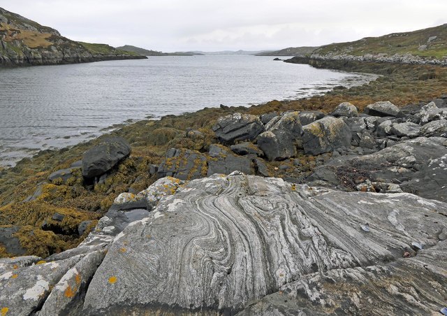
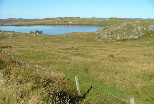
Druim a' Chruidh is a prominent headland located in Ross-shire, Scotland. Situated on the country's stunning coastline, this coastal feature offers breathtaking panoramic views of the surrounding landscape. The headland juts out into the sea, forming a distinct point that is easily visible from both land and water.

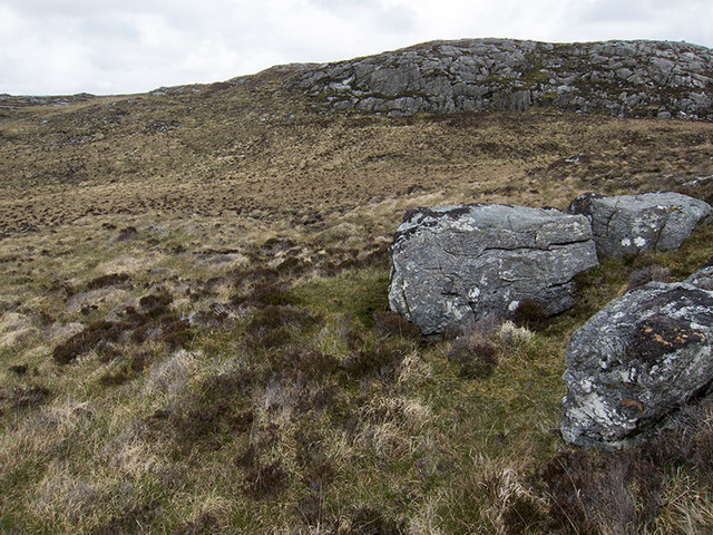
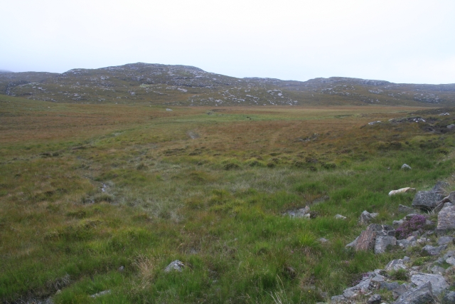
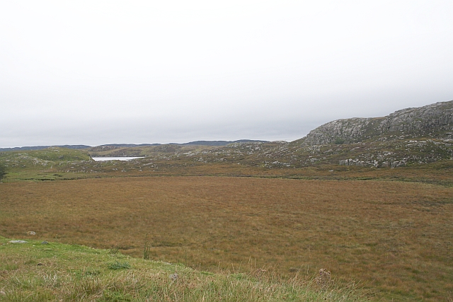
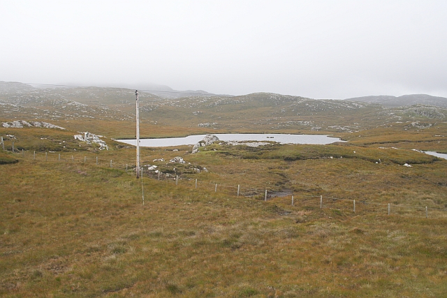
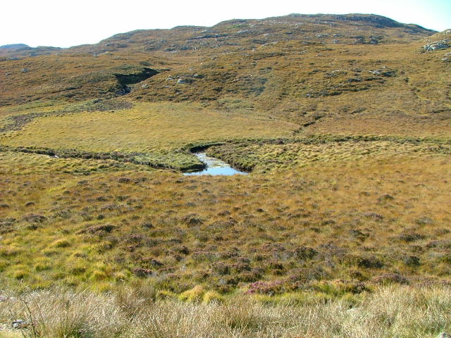
The rocky cliffs of Druim a' Chruidh rise majestically from the crashing waves below, creating a dramatic and picturesque scene. The headland is characterized by its rugged terrain, with craggy cliffs and scattered boulders adding to its charm. The coastal vegetation that blankets the headland includes hardy grasses, heather, and wildflowers, adding a splash of color to the otherwise rugged landscape.

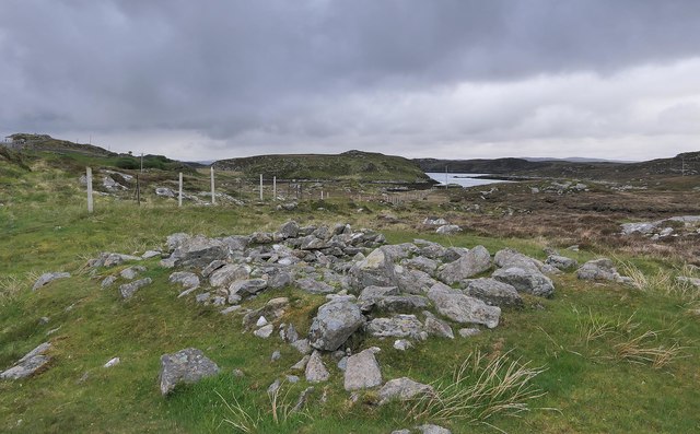
Druim a' Chruidh is a popular destination for nature enthusiasts and outdoor adventurers. The headland offers fantastic opportunities for hiking and exploring, with several walking trails crisscrossing the area. Visitors can enjoy a leisurely stroll along the cliff edge, taking in the stunning views of the sea and surrounding coastal scenery.

The headland is also a haven for birdwatchers, as it provides an ideal habitat for various seabird species. Peregrine falcons, gannets, and fulmars can often be spotted soaring above the headland, while colonies of guillemots and razorbills nest on the cliff ledges.

In summary, Druim a' Chruidh is a striking headland located on the Ross-shire coast. With its rugged cliffs, panoramic views, and diverse wildlife, it offers a truly captivating experience for those who venture to this beautiful Scottish coastal feature.

If you have any feedback on the listing, please let us know in the comments section below.

Druim a' Chruidh Images

Images are sourced within 2km of 58.186796/-6.7835924 or Grid Reference NB1831. Thanks to Geograph Open Source API. All images are credited.

Crulivig: postbox № HS2 91 This postbox stands on the opposite side of the road to <a href="https://www.geograph.org.uk/photo/3286743">NB1733 : Crulivig: the telephone box</a>. It is emptied each morning except Sunday at a quarter to nine.
Crulivig: postbox № HS2 91
This postbox stands on the opposite side of the road to NB1733 : Crulivig: the telephone box. It is emptied each morning except Sunday at a quarter to nine.
Boggy and rocky Often in this type of country, getting up onto a bit of high ground reveals a lochan or just a little pool to add a bit of interest. Not here. The high ground is on the lower slopes of Beinn Sgarastaigh, but with a summit height of 98 m, and difficult navigation through peat hags, no one is likely to get excited about it.
Boggy and rocky
Often in this type of country, getting up onto a bit of high ground reveals a lochan or just a little pool to add a bit of interest. Not here. The high ground is on the lower slopes of Beinn Sgarastaigh, but with a summit height of 98 m, and difficult navigation through peat hags, no one is likely to get excited about it.
Abandoned croft house near Lundal
Low cloud over Great Bernera A thin bank of cloud over the sea. Looking northeast from the B8059 near Lundale.
Low cloud over Great Bernera
A thin bank of cloud over the sea. Looking northeast from the B8059 near Lundale.
Rough pasture near Lundale Looking east towards Callanish, across Loch Ròg.
Rough pasture near Lundale
Looking east towards Callanish, across Loch Ròg.
Beinn Scarastaigh from near Lundale A large rocky hill about 1km to the southeast,
Beinn Scarastaigh from near Lundale
A large rocky hill about 1km to the southeast,
Tòb Lundale, Isle of Lewis Tòb Lundale is an inlet on Loch Ròg.  Tòb is a Gaelic word for bay or cove.
Tòb Lundale, Isle of Lewis
Tòb Lundale is an inlet on Loch Ròg. Tòb is a Gaelic word for bay or cove.
Building remains, Lundal, Isle of Lewis Looking towards the head of Tòb Lundale, an inlet on Loch Ròg.
Building remains, Lundal, Isle of Lewis
Looking towards the head of Tòb Lundale, an inlet on Loch Ròg.
Loch Ròg  Looking northwest from Linsiadar/Linshader, across a multiplicity of en-suite stock watering facilities.
Loch Ròg
Looking northwest from Linsiadar/Linshader, across a multiplicity of en-suite stock watering facilities.
Linsiadar The last house in this small community with a branch of Loch Roag in the distance.
Linsiadar
The last house in this small community with a branch of Loch Roag in the distance.
End of the road at Tobhtaral Two houses at the end of the road in the SE corner of Great Bernera island.
End of the road at Tobhtaral
Two houses at the end of the road in the SE corner of Great Bernera island.
Rubh'an Tairbh Taken from the kink in the field boundary with the famous Callanish Stones behind me. Looking over the heather to the narrow water of Loch Rog and Eilean Chearstaigh beyond.
Rubh'an Tairbh
Taken from the kink in the field boundary with the famous Callanish Stones behind me. Looking over the heather to the narrow water of Loch Rog and Eilean Chearstaigh beyond.
Bratanais Mor A pair of islands in Loch Rog with the hill Beinn Scarastaigh beyond.
Bratanais Mor
A pair of islands in Loch Rog with the hill Beinn Scarastaigh beyond.
Peat Bogs at the Source of the Lundale River The various streams form the river Lundale which flows north to Tob Lundale and into Loch Rog. Beyond the valley is the hill of Cnoc Mhi Neil.
Peat Bogs at the Source of the Lundale River
The various streams form the river Lundale which flows north to Tob Lundale and into Loch Rog. Beyond the valley is the hill of Cnoc Mhi Neil.
Druim a Chruidh The flat peat bog hides the small Lundale river and several tributaries which flow into Tob Lundale.
Druim a Chruidh
The flat peat bog hides the small Lundale river and several tributaries which flow into Tob Lundale.
Loch Aird A small inland loch that drains into Loch na Faing.
Loch Aird
A small inland loch that drains into Loch na Faing.
Lundale River Beneath Cleite na Cloich Ard.
Lundale River
Beneath Cleite na Cloich Ard.
Grazing Land by the Road to Bearnaraigh (Great Bernera) Looking towards Loch Barraglom and Bearnaraigh.
Grazing Land by the Road to Bearnaraigh (Great Bernera)
Looking towards Loch Barraglom and Bearnaraigh.
Show me another place!

Druim a' Chruidh is located at Grid Ref: NB1831 (Lat: 58.186796, Lng: -6.7835924)

Unitary Authority: Na h-Eileanan an Iar

Police Authority: Highlands and Islands

What 3 Words

///materials.homing.help. Near Carloway, Na h-Eileanan Siar

Related Wikis

Eilean Chearstaidh

Eilean Kearstay (Scottish Gaelic: Eilean Chearstaigh) is an uninhabited island in Loch Roag in the Outer Hebrides of Scotland. It lies south east of Great...

Callanish Stones

The Callanish Stones (or "Callanish I": Scottish Gaelic: Clachan Chalanais or Tursachan Chalanais) are an arrangement of standing stones placed in a cruciform...

Callanish

Callanish (Scottish Gaelic: Calanais) is a village (township) on the west side of the Isle of Lewis, in the Outer Hebrides (Western Isles), Scotland. Callanish...

Ceabhaigh

Ceabhaigh is a small island in an arm of Loch Ròg on the west coast of Lewis in the Outer Hebrides of Scotland. It is about 25 hectares (62 acres) in extent...

Nearby Amenities

Located within 500m of 58.186796,-6.7835924
Power: pole
Lat/Long: 58.1893368/-6.7776158
Power: pole
Lat/Long: 58.1893606/-6.7789452
Power: pole
Lat/Long: 58.1893509/-6.7801783
Power: pole
Lat/Long: 58.1893947/-6.7816788
Power: pole
Lat/Long: 58.1894355/-6.7833753
Power: pole
Lat/Long: 58.1894521/-6.7850778
Power: pole
Lat/Long: 58.1894762/-6.7858693
Power: pole
Lat/Long: 58.1895061/-6.7866803
Power: pole
Lat/Long: 58.1895696/-6.7874014
Power: pole
Lat/Long: 58.1897187/-6.7887356
Power: pole
Lat/Long: 58.189813/-6.7896577
Power: pole
Lat/Long: 58.1881592/-6.7889749
Power: pole
Lat/Long: 58.1885992/-6.7889271
Power: pole
Lat/Long: 58.1889727/-6.7888752
Power: pole
Lat/Long: 58.189401/-6.788812
Power: pole
Lat/Long: 58.1899574/-6.7881841
Power: pole
Lat/Long: 58.1901982/-6.7875732
Power: pole
Lat/Long: 58.1905208/-6.7867755
Power: pole
Lat/Long: 58.1907443/-6.7862212
Power: pole
Lat/Long: 58.1909881/-6.7856082
Noexit: yes
Lat/Long: 58.1851507/-6.787163
Passing Place
Lat/Long: 58.1865257/-6.7883705
Passing Place
Lat/Long: 58.187233/-6.789087
Passing Place
Lat/Long: 58.1888668/-6.790608
Passing Place
Lat/Long: 58.1904588/-6.7879435
Passing Place
Lat/Long: 58.1899509/-6.7894179
The data included in this document is from www.openstreetmap.org. The data is made available under ODbL.

Have you been to Druim a' Chruidh?

Leave your review of Druim a' Chruidh below (or comments, questions and feedback).