Friesland Rock

Coastal Feature, Headland, Point in Argyllshire

Scotland

Friesland Rock

Bogha Claidheamh A rocky islet off Eilean Dubh on the south coast of the Isle of Coll. On the horizon can be seen two of the Treshnish Islands - Lunga <a href="https://www.geograph.org.uk/gridref/NM2741">NM2741</a> to the left and Bac Mor (better known as Dutchman's Cap) <a href="https://www.geograph.org.uk/gridref/NM2438">NM2438</a>.
Bogha Claidheamh Credit: Oliver Dixon

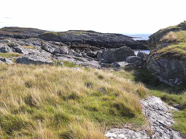
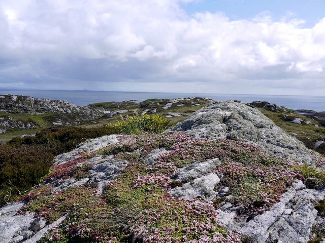
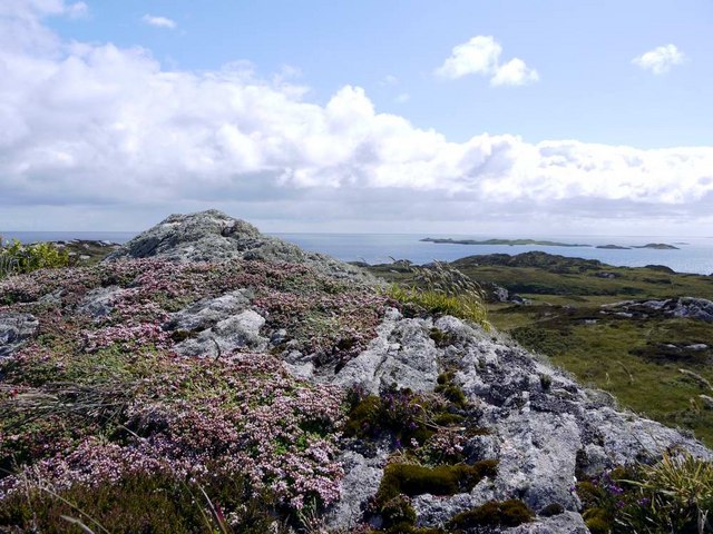
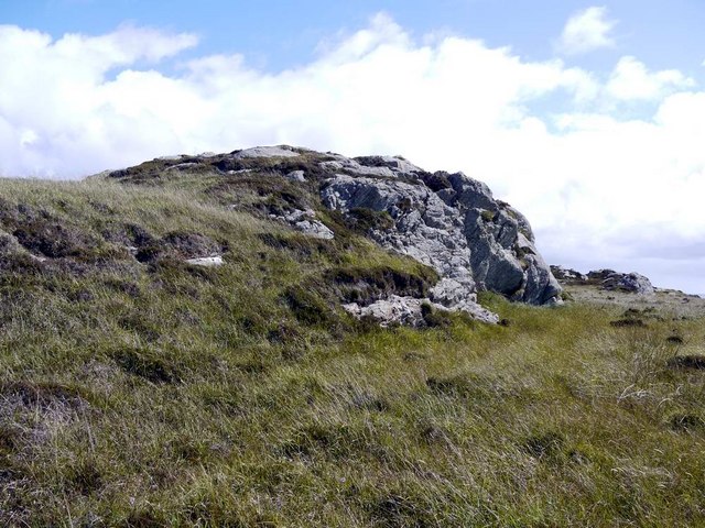
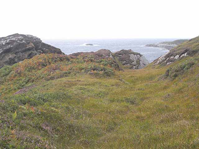
Friesland Rock is a prominent coastal feature located in Argyllshire, Scotland. It is classified as a headland point due to its distinctive shape and geographical characteristics. This rocky outcrop extends into the North Atlantic Ocean, forming a natural dividing point between two bays, creating a visually striking landmark in the region.

The rock is composed of a variety of sedimentary and igneous rocks, including sandstone and basalt, which have been shaped by erosion and weathering over thousands of years. Its jagged and rugged appearance adds to its allure, attracting nature enthusiasts and photographers alike.

Friesland Rock is known for its rich biodiversity and serves as a haven for various species of marine life. The surrounding waters are teeming with a diverse range of fish, crustaceans, and other marine organisms. This makes it a popular destination for anglers and divers who are drawn to its underwater beauty.

The headland point also offers breathtaking panoramic views of the surrounding coastline and is a popular spot for hikers and nature lovers. The rugged terrain and dramatic cliffs provide a challenging yet rewarding experience for those seeking outdoor adventures.

Friesland Rock is an important historical and cultural site as well. It has been the subject of numerous local legends and folklore, adding an air of mystique to its already captivating presence.

Overall, Friesland Rock is a remarkable coastal feature in Argyllshire, offering a unique blend of natural beauty, biodiversity, and cultural significance.

If you have any feedback on the listing, please let us know in the comments section below.

Friesland Rock Images

Images are sourced within 2km of 56.579528/-6.5853106 or Grid Reference NM1852. Thanks to Geograph Open Source API. All images are credited.

Bogha Claidheamh A rocky islet off Eilean Dubh on the south coast of the Isle of Coll. On the horizon can be seen two of the Treshnish Islands - Lunga <a href="https://www.geograph.org.uk/gridref/NM2741">NM2741</a> to the left and Bac Mor (better known as Dutchman's Cap) <a href="https://www.geograph.org.uk/gridref/NM2438">NM2438</a>.
Bogha Claidheamh
A rocky islet off Eilean Dubh on the south coast of the Isle of Coll. On the horizon can be seen two of the Treshnish Islands - Lunga NM2741 to the left and Bac Mor (better known as Dutchman's Cap) NM2438.
Eilean Dubh Looking south across the tidal island of Eilean Dubh off the south coast of the Isle of Coll.
Eilean Dubh
Looking south across the tidal island of Eilean Dubh off the south coast of the Isle of Coll.
Looking south from Ceann Fasachd Looking due south, and the next bit of land is Islay.
Looking south from Ceann Fasachd
Looking due south, and the next bit of land is Islay.
Looking south-west from Ceann Fasachd The island of Soa and outlying skerries in the distance.
Looking south-west from Ceann Fasachd
The island of Soa and outlying skerries in the distance.
Small rock outcrop on Ceann Fasachd
Rocks on east side of Eilean Maol Mòr
Rocks on the west side of Eilean Maol Mòr
Coll moorland near Gortan The roofs of Gortan can just be seen above rocks in the mid distance.  The hills of Mull, with Ben More, over the sea.
Coll moorland near Gortan
The roofs of Gortan can just be seen above rocks in the mid distance. The hills of Mull, with Ben More, over the sea.
Coll moorland Looking down to Loch Gortan.
Coll moorland
Looking down to Loch Gortan.
Headland on the west side of Loch Gortan A jumble of rocky outcrops, heather, bracken and boggy hollows. The islet is Bogha Dearg.
Headland on the west side of Loch Gortan
A jumble of rocky outcrops, heather, bracken and boggy hollows. The islet is Bogha Dearg.
Wreck at Loch Gortan Details about this wreck seem to be sketchy. The ship was called the "Harmony" and  is dated between the 18th and 20th centuries - a broad margin of error.
Wreck at Loch Gortan
Details about this wreck seem to be sketchy. The ship was called the "Harmony" and is dated between the 18th and 20th centuries - a broad margin of error.
Path on the Friesland Farm Nature Reserve Much of the Friesland Farm Nature Reserve on the south side of the Isle of Coll is completely out-of-bounds during the summer months. White stones and posts mark the  line of a rough path which skirts the edge of the closed area and which is open throughout the year. The house on the skyline is Acha <a href="https://www.geograph.org.uk/gridref/NM1854">NM1854</a>.
Path on the Friesland Farm Nature Reserve
Much of the Friesland Farm Nature Reserve on the south side of the Isle of Coll is completely out-of-bounds during the summer months. White stones and posts mark the line of a rough path which skirts the edge of the closed area and which is open throughout the year. The house on the skyline is Acha NM1854.
West side of Port na h-Eathar A secluded bay on the south side of the Isle of Coll, seen just after low water.
West side of Port na h-Eathar
A secluded bay on the south side of the Isle of Coll, seen just after low water.
Mouth of Loch Gortan Looking across the mouth of the sea loch on the south coast of the Isle of Coll. The low island in the middle distance is Eilean Maol Mor <a href="https://www.geograph.org.uk/gridref/NM1852">NM1852</a>.
Mouth of Loch Gortan
Looking across the mouth of the sea loch on the south coast of the Isle of Coll. The low island in the middle distance is Eilean Maol Mor NM1852.
Rocky slopes of Ceann Fasachd Looking towards the headland of Rubha Fasachd <a href="https://www.geograph.org.uk/gridref/NM1652">NM1652</a>.
Rocky slopes of Ceann Fasachd
Looking towards the headland of Rubha Fasachd NM1652.
Gortan Buildings are apparently used, but probably not inhabited, by the Friesland Farm Nature Reserve. A quad bike is approaching.
Gortan
Buildings are apparently used, but probably not inhabited, by the Friesland Farm Nature Reserve. A quad bike is approaching.
Approaching the ford over the Allt a'Mhuilinn at Gortan A quad bike approaches the ford just above the point where the stream enters Loch Gortan. See <a href="https://www.geograph.org.uk/photo/1449177">NM1753 : Gortan</a>.
Approaching the ford over the Allt a'Mhuilinn at Gortan
A quad bike approaches the ford just above the point where the stream enters Loch Gortan. See NM1753 : Gortan.
Making a splash The quad bike (<a href="https://www.geograph.org.uk/photo/1449185">NM1753 : Approaching the ford over the Allt a'Mhuilinn at Gortan</a>) enters the ford over the Allt a'Mhuillin just above the point where the stream flows into Loch Gortan.
Making a splash
The quad bike (NM1753 : Approaching the ford over the Allt a'Mhuilinn at Gortan) enters the ford over the Allt a'Mhuillin just above the point where the stream flows into Loch Gortan.
Show me another place!

Friesland Rock is located at Grid Ref: NM1852 (Lat: 56.579528, Lng: -6.5853106)

Unitary Authority: Argyll and Bute

Police Authority: Argyll and West Dunbartonshire

What 3 Words

///spinning.stiletto.sunbeam. Near Arinagour, Argyll & Bute

Related Wikis

Dùn an Achaidh

Dùn an Achaidh, sometimes Anglicised as Dun Acha, is a dun located near the village of Acha on the Inner Hebridean island of Coll. It is considered the...

Acha, Coll

Acha (Gaelic: An t-Achadh, tranlsating to "The Field") is a small hamlet on the Scottish island of Coll. == References == == See also == Dùn an Achaidh...

Breachacha Castle

Breachacha Castle (also spelled Breacachadh) is either of two structures on the shore of Loch Breachacha, on the Inner Hebridean island of Coll, Scotland...

Breachacha crannog

The Breachacha crannog is a crannog located near Loch Breachacha, on the Inner Hebridean island of Coll. The crannog is recognised in the United Kingdom...

Nearby Amenities

Located within 500m of 56.579528,-6.5853106
Natural: rock
Source: OS7
Tidal: yes
Lat/Long: 56.5835137/-6.5886638
Natural: rock
Source: OS7
Tidal: yes
Lat/Long: 56.5796898/-6.585224
The data included in this document is from www.openstreetmap.org. The data is made available under ODbL.

Have you been to Friesland Rock?

Leave your review of Friesland Rock below (or comments, questions and feedback).