Dubh Sgeir
Coastal Feature, Headland, Point in Ross-shire
Scotland
Dubh Sgeir

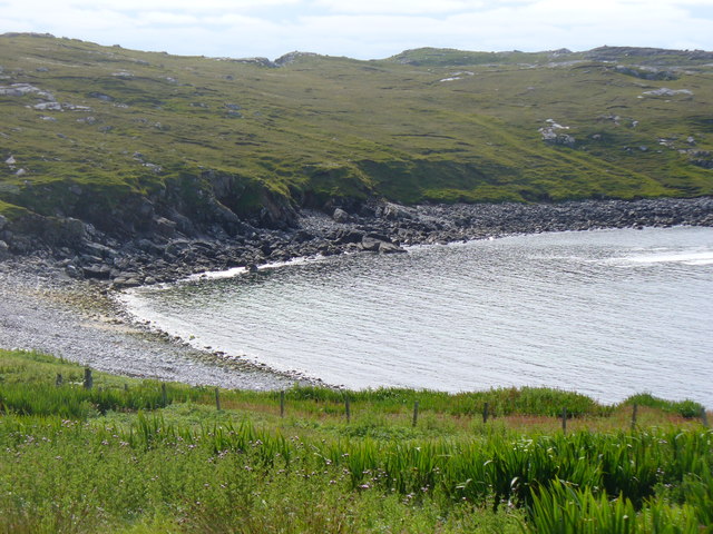
Dubh Sgeir is a prominent coastal feature located in Ross-shire, Scotland. It is a headland or point that juts out into the sea, offering breathtaking views of the surrounding landscape and the ocean.
Situated in the northern part of Ross-shire, Dubh Sgeir is known for its rugged and dramatic cliffs, which rise steeply from the water. The headland is primarily composed of ancient rock formations, including sandstone and shale, which have been shaped by centuries of erosion by the elements.
The name "Dubh Sgeir" translates to "black skerry" in Gaelic, referring to the dark-colored rocks that are characteristic of the area. These rocks are a result of volcanic activity that occurred millions of years ago.
The headland is a popular destination for nature enthusiasts, hikers, and photographers due to its striking beauty and diverse wildlife. Visitors can explore the coastal trails that wind around the headland, offering stunning panoramic views of the surrounding coastline and the open sea. The area is home to a variety of bird species, including seabirds such as puffins, gannets, and guillemots.
Dubh Sgeir is also notable for its rich maritime history. The headland has witnessed numerous shipwrecks over the years, adding to its allure and mystique. It serves as a reminder of the treacherous waters that sailors once navigated along this coastline.
Overall, Dubh Sgeir is a captivating coastal feature in Ross-shire, offering a unique blend of natural beauty, wildlife, and historical significance.
If you have any feedback on the listing, please let us know in the comments section below.
Dubh Sgeir Images
Images are sourced within 2km of 58.293113/-6.8261314 or Grid Reference NB1743. Thanks to Geograph Open Source API. All images are credited.


Dubh Sgeir is located at Grid Ref: NB1743 (Lat: 58.293113, Lng: -6.8261314)
Unitary Authority: Na h-Eileanan an Iar
Police Authority: Highlands and Islands
What 3 Words
///cards.glassware.utter. Near Carloway, Na h-Eileanan Siar
Related Wikis

Garenin
Garenin (Scottish Gaelic: Na Gearrannan) is a crofting township on the west coast of the Isle of Lewis in the Outer Hebrides of Scotland. Garenin is in...

Borrowston, Lewis
Borrowston (Scottish Gaelic: Borghastan), with a population of about 50, is a crofting township situated on the Isle of Lewis, on the Outer Hebrides of...

Dun Carloway
Dun Carloway (Scottish Gaelic: Dùn Chàrlabhaigh) is a broch situated in the district of Carloway, on the west coast of the Isle of Lewis, Scotland (grid...

Campaigh
Campaigh or Campay is a steep and rocky islet in outer Loch Ròg, Lewis, Scotland that lies north of Cealasaigh and Little Bernera. A huge natural arch...

Cealasaigh
Cealasaigh or Kealasay is an islet in outer Loch Ròg, Lewis, Scotland that lies north of Traigh Mhór on Little Bernera and south of Campaigh. To the west...

Carloway
Carloway (Scottish Gaelic: Càrlabhagh [ˈkʰaːɾɫ̪ə.ɤː]) is a crofting township and a district on the west coast of the Isle of Lewis, in the Outer Hebrides...

Little Bernera
Little Bernera (Scottish Gaelic: Beàrnaraigh Beag) is a small island situated off the west coast of the Isle of Lewis in the Outer Hebrides.Little Bernera...
Siadar Wave Power Station
The Siadar Wave Power Station (also known as Siadar Wave Energy Project or SWEP) was a proposed 4 MW wave farm 400 metres (1,300 ft) off the shore of Siadar...
Have you been to Dubh Sgeir?
Leave your review of Dubh Sgeir below (or comments, questions and feedback).